What's New Archive
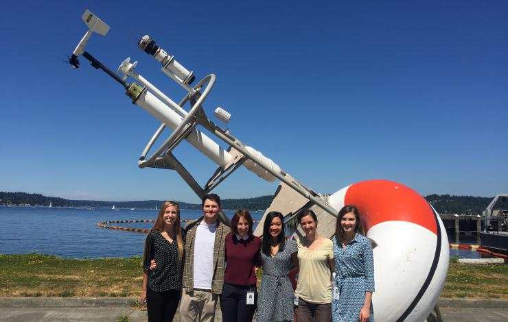
On Wednesday, January 4, 2018, the Council on Library and Information Resources (CLIR) and the Andrew W. Mellon Foundation publicly announced that 14 projects have been selected for the 2017 Digitizing Hidden Special Collections and Archives awards. One of the funded projects, Seas of Knowledge: Digitization and Retrospective Analysis of the Historical Logbooks of the United States Navy, is led by Kevin Wood, research scientist with the University of Washington Joint Institute for the Study of the Atmosphere and Ocean and NOAA PMEL. This new grant will allow these scientists to learn more about past climate from the records of long-gone mariners. The project will digitize the logbooks, muster rolls and related materials from U.S. naval vessels, focusing on the period from 1861 to 1879. Access to historical data is essential for understanding both past and current events, especially in the ocean domain where important geospatial, environmental, and social/cultural data are found only in manuscript formats inaccessible to computers.
After making digital images of the logbooks housed at the National Archives, the project will recover ships’ positions, weather records, oceanographic data and other historical information through the Old Weather citizen-science program that trains volunteers to transcribe the logs’ handwritten entries. So far volunteers have transcribed more than 3 million new-to-science weather records, and more than 1 million of those have been quality-checked and added into global climate databases. This historic weather and climate data helps scientists better understand modern climate change patterns and improve prediction. The new effort seeks to fill a gap in the data of past weather and ocean conditions.
The project will also digitize the National Archives’ related collection of muster rolls that shows the names of all the enlisted sailors on board. When combined with logbooks that list the names of officers, this will provide historians and family researchers an online database of unprecedented detail and a window into day-to-day life during this period in history, Wood said. The grant also will support an educational effort that will allow the public to explore the information uncovered in the ships’ logbooks through an interactive exhibit.
Other investigators on the project are Mark Mollan at the National Archives and Records Administration, Patrick Madden at the National Archives Foundation and, Gilbert Compo at the Cooperative Institute for Research in Environmental Studies at the University of Colorado and NOAA’s Earth System Research Laboratory.
This is the third group of projects to win a Digitizing Hidden Special Collections and Archives award, which is supported by The Andrew W. Mellon Foundation. The program supports the creation of digital representations of unique content of high scholarly significance that will be discoverable and usable as elements of a coherent, national collection.
Read the full story here written by Hannah Hickey, science writer for the University of Washington, on the latest development in the Old Weather project.
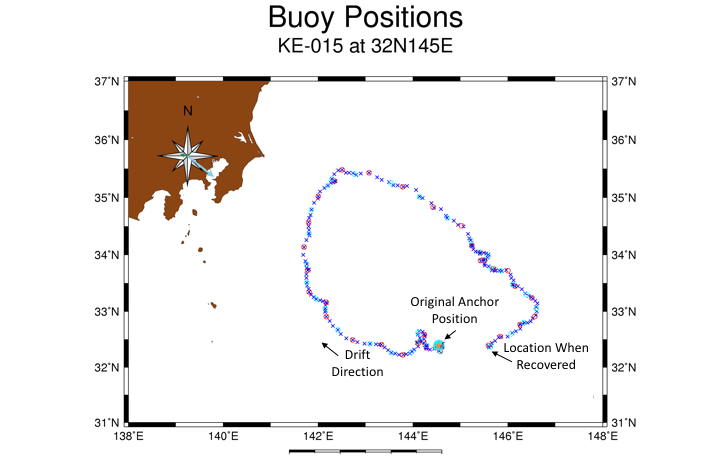
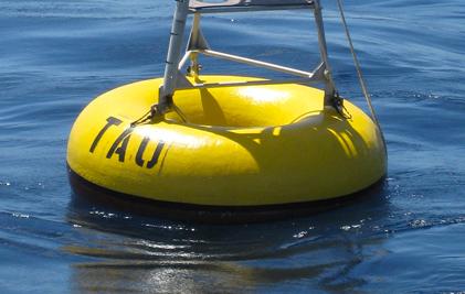
GPS positions from the PMEL KEO mooring during the period when it was adrift show the clockwise motion, which brought the buoy almost back to its anchor location before being rescued.
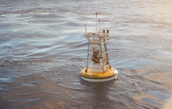
Patrick Berk servicing an Ocean Climate Station. Photo credit: Nathan Anderson
On October 19, 2017, a surface mooring at the Kuroshio Extension Observatory (KEO) maintained by NOAA’s Pacific Marine Environmental Laboratory (PMEL) broke from its anchor and went adrift. Though it drifted in the North Pacific for two full months before being rescued, the buoy stayed in the Kuroshio Extension’s recirculation gyre, and had nearly made its way back to the original anchor location to meet the rescue ship.
The KEO station is located off the coast of Japan. NOAA has maintained a surface mooring there since 2004, and Japan Agency for Marine-Earth Science and Technology (JAMSTEC) has maintained a subsurface sediment trap at KEO since 2014. The KEO surface mooring carries a suite of instrumentation to monitor air-sea exchanges of heat, moisture, momentum (wind stress), and carbon dioxide; surface ocean acidification; and upper ocean temperature, salinity and currents. The combined data sets from both moorings enable computation of the physical and biological pumps of the carbon cycle in this key region of the North Pacific. As such, the site has become a focal point for international climate research.
Researchers are now looking with interest at the data set recorded during the time when the buoy was drifting. The path taken by the buoy is interesting in itself, as it outlines the anti-cyclonic flowing recirculation gyre south of the Kuroshio Extension. Because the mooring still carried subsurface instruments down to 425 meters, the drifting mooring observations can be used to study the air-sea interactions along the entire recirculation gyre.
The drifting buoy was rescued and redeployed by PMEL technicians aboard the JAMSTEC ship Yokosuka at the end of December 2017. Now that it has been redeployed, the KEO mooring will continue to provide high quality measurements for research. In January 2018, it will be at the center of an international science expedition studying upper ocean heat and carbon exchanges. The mission includes researchers from University of Tokyo, JAMSTEC, Monterey Bay Aquarium Research Institute, and North Carolina State University.
Thanks to the joint efforts of PMEL and JAMSTEC, the NOAA KEO mooring is back where it belongs, continuing to be a central part of the research in this region.
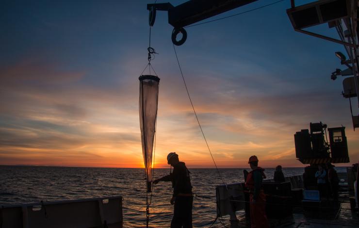
Deploying a vertical net during the 2016 West Coast Acidification Cruise on the NOAA Ship Ronald H. Brown. Photo Credit: Meghan Shea (NOAA Hollings Scholar)
Washington State has experienced some of the earliest, direct impacts of ocean acidification. In order to address these impacts, Governor Chris Gregoire convened an Ocean Acidification Blue Ribbon Panel, the first of its kind in the nation. In 2012, the panel produced a science-based action plan to tackle ocean acidification in Washington State.
Today, the first update to the 2012 report has been released by the Marine Resources Advisory Council (MRAC), a Washington state governor’s appointed board based on recommendations from the Blue Ribbon Panel. This addendum is a companion report that expands upon the 2012 work and describes the progress that’s been made over the past five years, recommends new focal areas and provides a renewed commitment to tackle the issue through a number of research, education and climate mitigation and adaptation solutions.
In the five years since the Blue Ribbon Panel’s report, there have been significant scientific advances and progress made on the 42 recommended actions.
Some research highlights and actions taken include:
- Atmospheric CO2 in the Puget Sound area is increasing faster than along Washington’s coast and faster than the global average. Southern Hood Canal shows the highest surface seawater values of pCO2 in Washington coastal waters.
- Several local species from pteropods to Dungeness crab are showing sensitivity to ocean acidification, suggesting impacts to the entire marine web including salmon and whales.
- Impacts may be more severe in nearshore coastal waters than in offshore open ocean waters, because corrosive conditions are closer to the surface in nearshore coastal waters and in Puget Sound.
- Increasing awareness and literacy through the creation of ocean acidification K-12 curricula.
Washington State continues to be a leader in taking action on ocean acidification. The MRAC brings together federal and state, scientists, educators, industry and tribes to better understand the sources and effects of ocean acidification and provide recommendations for science based management actions.
Eleven NOAA and Washington Sea Grant scientists from the National Ocean Service, National Marine Fisheries Service and the Office of Oceanic and Atmospheric Research served on the Blue Ribbon “Refresh” Panel and contributed to the report including PMEL’s Simone Alin, Richard Feely, and Cathy Cosca. Richard Feely also served as one of the editors along with Jan Newton and Terrie Klinger at the University of Washington. NOAA’s Ocean Acidification Program Director, Libby Jewett, currently serves on the MRAC.
The full report can be found at www.OAinWA.org. Read the news release here.
The 2017 Arctic Report Card was released today, December 12, at the American Geophysical Union’s Fall Meeting. The NOAA-led Arctic Report Card, now in its 12th year, delivers the latest in peer-reviewed, actionable environmental information on this important region, which is warming at twice the rate of anywhere on Earth. PMEL’s Dr. James Overland is one of four editors of the report card which brings together the work of 85 scientists from 12 countries to provide the latest information on multiple measures of Arctic environmental change such as sea ice, temperature, and permafrost.
In 2017, average annual air temperature was the second highest on record after 2016 with a temperature of 2.9 degrees Fahrenheit (1.6 Celsius) above the average for 1981 to 2010. While 2017 saw fewer records shattered than in 2016, the Arctic shows no sign of returning to the reliably frozen region it was decades ago. The current observed rate of sea ice decline and warming temperatures are higher than at any other time in the last 1,500 years, and likely longer than that. This year’s maximum winter sea ice area, measured each March, was the lowest ever observed, while this year’s minimum area, measured each September, was eighth-lowest on record. Sea ice is also getting thinner each year, with year-old ice comprising 79 percent of coverage, and multi-year ice just 21 percent compared to 45 percent in 1985.
You can watch the recorded press conference here which was led by RDML Tim Gallaudet, Ph.D., USN Ret. Assistant Secretary of Commerce for Oceans and Atmosphere and Acting Under Secretary of Commerce for Oceans and Atmosphere.
Read the NOAA Press Release here and the complete 2017 Arctic Report Card here.
NOAA’s Ernest F. Hollings Undergraduate Scholarship (Hollings) and the Education Partnership Program with Minority Serving Institutions (EPP/MSI) Undergraduate Scholarship Program are now accepting applications through January 31.
The Hollings Scholarship and EPP/MSI program recognize outstanding undergraduate students studying in fields that support NOAA’s mission. The scholarships provide funds for two years of undergraduate study to rising junior undergraduate students majoring in Science, Technology, Engineering and Mathematics (STEM) fields such as biological, social, and physical sciences, mathematics, engineering, computer and information sciences, and teacher education.
Student scholars also receive one (Hollings) or two (EPP) paid summer internship opportunities at NOAA facilities across the US. The internship provides hands-on, practical experience in NOAA-related science, research, technology, policy, management, and education activities. Each summer, PMEL hosts several undergraduate students in our Seattle, WA and Newport, OR locations. Past research projects at PMEL have included work on ocean acidification, hydrothermal vents, acoustics, arctic aerosols, and ocean heat content.
These opportunities are designed to prepare students for careers as environmental scientists and educators, and to increase public environmental and ocean literacy and stewardship of the ocean and atmosphere.
Applications are due Wednesday, January 31st, 2018, at 11:59 PM EST and are accepted through an online system. For more information, visit the NOAA Education website.
Other student opportunities with PMEL can be found here including the National Science Foundation Research Experience for Undergraduate (NSF-REU) program and the University of Washington’s JISAO summer internship program.

Dr. Richard Feely of NOAA's Pacific Marine Environmental Laboratory has been named a Fellow of the American Association for the Advancement of Science (AAAS). Election as a AAAS Fellow is an honor bestowed upon AAAS members by their peers. This year 396 members have been awarded this honor by AAAS because of their scientifically or socially distinguished efforts to advance science or its applications.
As part of the Section on Atmospheric & Hydrospheric Sciences, Dr. Feely was elected as an AAAS Fellow for leading the scientific examination of the acidification of oceans and shifting public policy to address this environmental issue.
Dr. Feely has been with PMEL for over 43 years and currently is a senior scientist and project leader of the Ocean Carbon group. He is an active member on many national and international committees and serves as a mentor to graduate students and post-doctoral fellows. He has authored more than 290 scientific research publications. He’s logged over 1,000 days at sea on more than 50 scientific expeditions, most recently as part of the West Coast Ocean Acidification cruise in 2016.
Read the full announcement in the AAAS News and Notes section of the journal Science.
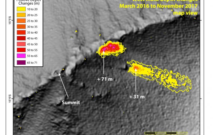
Two large volcanic cones and associated deposits near the volcano's summit. Red-pink areas are the thickest depth changes between bathymetric surveys in 2016-2017. Graphic by Susan Merle.
November 10 - December 18: Nine PMEL scientists from the Earth-Ocean Interactions (EOI) Program are studying the submarine volcanoes in the southwest Pacific Ocean aboard the Schmidt Ocean Institute's R/V Falkor on an expedition being led by Dr. Ken Rubin of the University of Hawaii. Major support for the expedition is from NOAA’s Ocean Exploration and Research Program.
The Falkor and the science team are in the Northeast Lau Basin off of Tonga, a region known to have a very high density of submarine volcanoes. It is estimated that there are 30 discrete volcanoes in a 50 X 50 km area. During the two-part cruise, they will be using the Autonomous Underwater Vehicle (AUV) Sentry to generate high resolution bathymetric maps of the area and then later explore these areas with the Remotely Operated Vehicle (ROV) SuBastain.
In 2008 at West Mata seamount, water column data showed strong evidence of an active eruption which was later confirmed with an ROV response cruise in 2009. West Mata represents an extraordinary opportunity to learn about the interactions between the earth and the deep ocean that can have important impacts on ocean geochemistry and marine ecosystems. And with West Mata’s frequent activity, there is always a chance that they will be lucky enough to catch it erupting again.
The team is already finding evidence for two new eruption sites at West Mata seamount since March 2016, in addition to 5 other recent eruption sites between 2009-2016. This makes West Mata one of the most active submarine volcanoes known on the planet.
Follow along with the cruise logs, read more about the expedition, and meet the science crew at Schmidt Ocean Institute’s web site: Underwater Fire: Studying the Submarine Volcanoes of Tonga
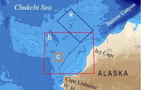
Study area and reference zones for freeze onset (a), Sea Surface Temperature (SST) (b), and ALAMO deployment area (c). AXBT and radiometer SST data were collected over the region between Bering Strait and the northern shelf break. Reference area (a) was selected because of the availability of oceanographic moorings and ship-based CTD data along the PMEL Icy Cape and Distributed Biological Observatory lines that will be available for data validation and other future research.
PMEL is initiating an experimental sea ice fall freeze-up outlook for northern Alaskan waters. The 2017 freeze onset on the Chukchi Sea continental shelf northwest of Icy Cape will begin near the end of November to the first week of December. This is approximately 36 days later than the long-term observed mean (1981-2016).
PMEL researchers with the Arctic Heat Open Science Experiment Based used observations from Air-Launched Autonomous Micro-Observer (ALAMO) floats, deployed in the summers of 2016 and 2017, Airborne EXpendable BathyThermograph (AXBT) arrays deployed in the region that measure ocean temperature as a function of depth from aircraft, and satellite data to project when sea ice freeze up will occur in the Chukchi Sea in 2017.
Float data reveal in real time the presence of ocean heat not detectable by satellite, and provide continuous monitoring of transport, water column stability, and cooling rate. This information is not otherwise available from other observing systems.
Read more about the rationale and data used here. For more information and data, visit the Arctic Heat website: https://www.pmel.noaa.gov/arctic-heat/.
In a new study published in Science, NOAA and NASA scientists used space-borne observations of carbon dioxide (CO2) from NASA’s Orbiting Carbon Observatory-2 satellite, or OCO-2, to characterize the tropical atmospheric CO2 response to the strong El Niño event of 2015-2016. The El Niño provided NASA and NOAA an unprecedented opportunity to test the effectiveness of this new observation tool. OCO-2 is NASA’s first satellite designed to measure atmospheric carbon dioxide with the precision, resolution, and coverage necessary to quantify regional carbon sources and sinks.
Observations of carbon dioxide concentrations over the tropical Pacific from the satellite were validated by data from NOAA’s Tropical Pacific Observing System of buoys, which directly measure carbon dioxide concentrations at the surface of the ocean. Both observing systems showed that in the early months of the El Niño, during the spring of 2015, outgassing of carbon dioxide over the tropical Pacific Ocean significantly declined by 26 to 54 percent.“This response is consistent with what we expect from a theoretical understanding, and comparable to what the NOAA data suggests,” said Richard Feely, senior scientist at NOAA’s Pacific Marine Environmental Laboratory, who is a co-author on the paper.
This research is part of a series of studies to better understand the growth of carbon dioxide concentrations in the global atmosphere using the new NASA satellite. The studies show how various regions contribute to those emissions or serve as sinks, absorbing carbon dioxide emissions at different times.
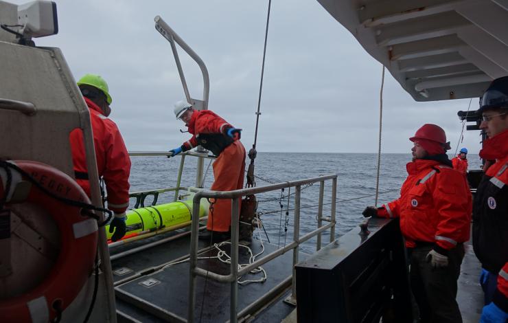
Oculus Coastal Glider being recovered by the crew of the NOAA Ship Oscar Dyson.
After 60 days in the Bering Sea, the Oculus Coastal Glider was successfully recovered by crew of the NOAA Ship Oscar Dyson on September 26, 2017. The glider successfully navigated 242.8 nautical miles, completed 3612 dives, and sampled salinity, temperature, dissolved oxygen, sunlight, and fluorescence at a frequency of approximately 3 dives per hour. The glider was tested in a region with a long history of shipboard and mooring observations that provide context for the Oculus glider's observations. Oculus glider measurements reveal detailed information in a known, important biogeographical transition that divides the ecosystems of the northern and southern Bering Sea shelf near St. Matthew Island. Measurements show unexpected ocean mixing in the water column near the island that may be due to internal waves. Data, sensor, and platform analysis is ongoing. Incorporating this higher resolution sampling into the Bering Sea observing network will improve our understanding of how these features affect the ecosystem.
The Oculus is a coastal glider engineered to work in the highly stratified, shallow depths of the Arctic. By using a rapid buoyancy system, the glider can change buoyancy states 20 times faster and achieve speeds three times faster than legacy gliders - allowing for a more efficient and adaptive Arctic survey, but transferable to a variety of markets.
This was the second field test for the Oculus coastal gliders. The first field test occurred early May 2017, also in the Bering Sea, with 387 dives completed near the M2 mooring site. For the second field test, the glider was deployed from the US Coast Gaurd Cutter Healy during the 2017 Arctic Shield mission.
The Oculus was developed at PMEL in partnership with the University of Washington's Joint Institute for the Study of the Atmosphere and Ocean and the University of Washington Seaglider Fabrication Lab.