Mission
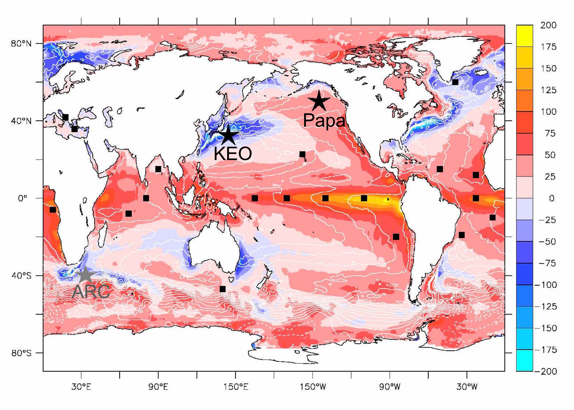
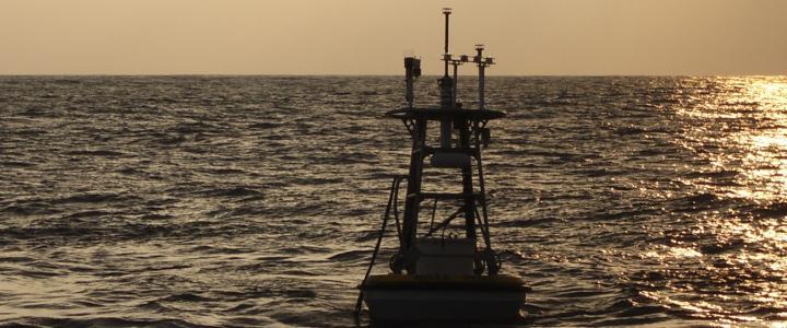
OCS mooring sites (stars) shown on a map of net surface heat flux (W/m2). Other air-sea flux OceanSITES stations are indicated by black squares.
The mission of the Ocean Climate Stations Project (OCS) is to make meteorological and oceanic measurements from autonomous platforms. These reference time series and innovative measurements are used to improve satellite products and forecast models, and improve our understanding of air-sea interactions, and their role within the climate system.
With more than 70% of the Earth covered by oceans, global weather and climate are strongly affected by exchanges of heat and moisture between the ocean and the air. Improved understanding of the climate system will help society adapt to climate variations and changes. Improved, more physically realistic forecast models will help reduce society's vulnerability to weather and climate extremes, preparing a weather-ready nation.
The OCS program encourages broad use of the data and welcomes collaboration. Visit our data pages, and contact us to learn more.
What's New

Patrick Berk (left) and Nathan Anderson (right) create a snow mascot for the 2024 Papa cruise. Joined by Matias Gradilla and Elizabeth McGeorge, the team endured cold weather and brisk winds (Photo Credit: Elizabeth McGeorge).
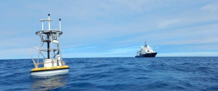
On April 8th, 2024, four scientists from PMEL and CICOES/UW flew to Kodiak, AK to board the NOAA ship OSCAR DYSON on a trip to Station Papa (50°N 145°W) for the annual Ocean Climate Stations (OCS) mooring turnaround. The OCS mooring provides critical oceanographic and meteorological observations useful to modelers, satellite validation and marine heatwave researchers, the National Weather Service, and other users in the science community.
Despite encountering a mix of wintry precipitation in port, positive attitudes kept the team functioning while building and testing the buoy on a frigid (20°F) deck. Crew members assisted with various logistics, including operating the forklift and cranes. At one point, an impromptu snow mascot even joined the scene!
... more