What's New Archive
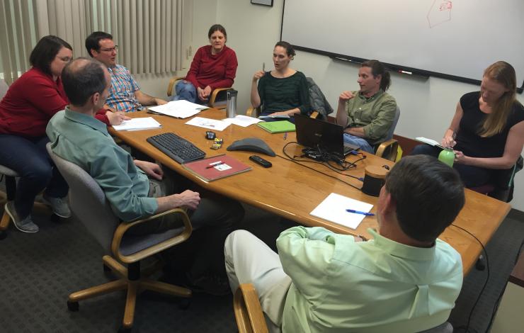
Engineers and scientists of the 2016 Saildrone Team discussing the first phases of the summer mission in the Bering Sea.
Congratulations to all involved with the 2016 Saildrone missions on receiving the Department of Commence Bronze Award and to Susie Snyder for receiving the NOAA Distinguished Career Award.
NOAA’s PMEL and Alaska Fisheries Science Center were awarded the Bronze Medal for “strengthening NMSF-OAR collaborations through the pioneering use of a Saildrone for next-generation ecosystem surveys in the Bering Sea”.
In 2016, the team successfully conducted the first ecosystem study using two Saildrones. The mission combined both physical and biological oceanography to seek out new ways to supplement traditional vessel-based research. The Saildrones each traveled almost 3,000 nautical miles in the 101 day mission testing innovative technologies, including a specially developed echo sounder and a modified whale acoustic hydrophone. Collectively, the oceanographic, meteorological, and fisheries measurements provided unique and groundbreaking insights to understanding the economically and culturally important ecosystem in the Bering Sea.
This was a collaborative mission between the NOAA’s Pacific Marine Environmental Lab, NOAA’s Alaska Fisheries Science Center, UW Joint Institute for the Study of the Atmosphere and Ocean, Saildrone Inc., Simrad AS/Kongsberg Maritime, Greeneridge Sciences Inc, and Wildlife Computers. Read more about the 2016 mission here.
The DOC Bronze Award is the highest honor award granted by the Under Secretary of Commerce for Oceans and Atmosphere, which recognizes superior performance characterized by outstanding or significant contributions, which have increased the efficiency and effectiveness of NOAA.
Susie Snyder was also awarded The Distinguished Career Award for her “continued efforts in improving budgetary policies and procedures relating to memorandum of agreements and reimbursable funds throughout 30 years of service to NOAA”. This award honors contributions on a sustained basis — a body of work — rather than a single, defined accomplishment. This award also recognizes significant accomplishments across all NOAA program areas and functions that have resulted in long- term benefits to the bureau’s mission and strategic goals.
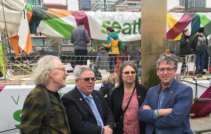
Video above from Clipper Round the World on the research. Image from left to right: Peter Knutson, Fisherman and Owner of Loki Fish Company, PMEL's Richard Feely, UW researcher Jan Newton, Port of Seattle Commissioner Fred Felleman in front of the Visit Seattle racing yacht at a recent press event.
The Clipper Round the World Race has partnered with the Port of Seattle, University of Washington, NOAA, Visit Seattle and Sunburst Sensors to undertake pioneering scientific research into the global impacts of ocean acidification. This research will contribute to a world-wide database and be used to raise public awareness on this issue.
The Visit Seattle, one of the Clipper Race’s eleven identical 70 foot ocean racing yachts, has been fitted with a new Sunburst Sensors underway pH sensor. Sunburst Sensors is the recent winner of a $2 million XPRIZE ocean health award and will test the new pH sensor as the vessel sails the 6,000 nautical mile seventh leg of the race along the US Coast.
Port of Seattle Commissioner, Fred Felleman, who initiated the effort, spoke at a recent press event about the importance of monitoring the waters around the North American coast, saying: “Pacific Northwest waters are particularly vulnerable to ocean acidification - impacting numerous species of ecological and economic importance, from plankton to pollock, oysters to orcas. It also impacts tenants at Fishermen’s Terminal who are an essential part of Seattle’s cultural fabric and economic diversity.
This collaboration with the Clipper Round the World Yacht Race is testing new equipment that could eventually expand the reach of current monitoring efforts and provides a spectacular platform to take this important message to a global audience.
The University of Washington and NOAA PMEL will help to evaluate the data that is obtained during the cruise. One major impact of ocean acidification is the inhibition of calcifying organisms to form their shells. These impacts are not limited to oysters and mussels but also include small planktonic organisms, known as pteropods which are food for herring, salmon, pollock and other fish species of ecological and economic importance.
Read more about the collaboration here: https://www.clipperroundtheworld.com/news/article/clipper-race-collaborates-on-pioneering-us-ocean-research
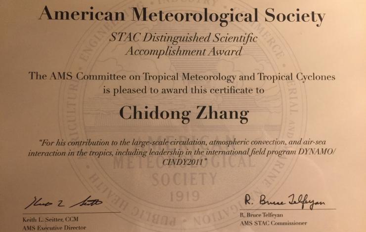
Chidong Zhang recently received the first Distinguished Scientific Accomplishment Award from the American Meteorological Society (AMS) Committee on Tropical Meteorology and Tropical Cyclones "for his contribution to the large-scale circulation, atmospheric convection, and air-sea interaction in the tropics, including leadership in the international field program DYNAMO/CINDY2011". The award was presented at the AMS 33rd Conference on Hurricanes and Tropical Meteorology in Florida.
The Dynamics of the Madden-Julian Oscillation (DYNAMO) project in 2011-2012 brought together an international group of scientists for six months to observe the beginning of the Madden Julian Oscillation (MJO) in the equatorial Indian Ocean. Chidong Zhang was the project lead while he was a professor at the University of Miami.
The MJO is weather phenomenon that starts over the equatorial Indian Ocean and has global climate and weather impacts. In the United States, MJO can influence the development of hurricanes, enhance rainfall on the West Coast in the form of atmospheric rivers, and modulate the North American monsoon, an important source of water in the western US. The results of DYNAMO will help researchers better understand and forecast weather and climate features that develop in the Indian Ocean.
The Scientific and Technological Activities Commission (STAC) Distinguished Scientific/Technological Accomplishment Award recognizes an individual who has made significant contributions to the discipline and is well recognized within the discipline as being a science/technological leader. The STAC is composed of Committees and Boards, which in the aggregate are made up of hundreds of volunteers primarily from the membership of the Society. STAC helps to advance science and technology by promoting the open exchange of ideas, strengthening our disciplinary communities, enhancing collaboration and dialog among these communities, embracing diversity, celebrating and fostering excellence, and cultivating the next generation of scientists and leaders.
Congratulations Chidong!
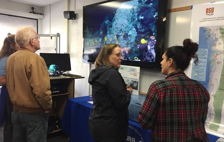
EOI scientists talk about their work at hydrothermal vents.
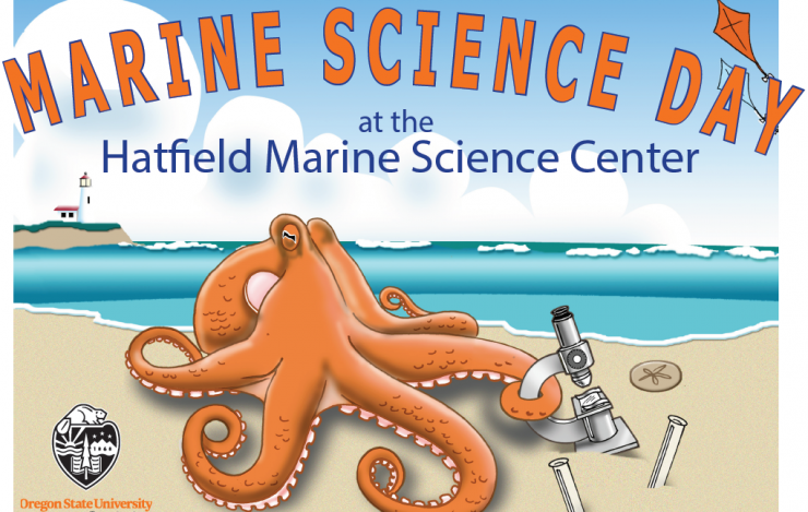
Join PMEL at Marine Science Day THIS SATURDAY, April 14, at the Hatfield Marine Science Center, in Newport, OR. Join tours, meet scientists, and get a behind-the-scenes look at the research, education, and outreach in marine sciences that makes this marine laboratory unique in the Pacific Northwest. Admission is FREE and open to the public. There will be interactive research exhibits that will feature emerging ocean observing technologies, bioacoustics of whales, video of volcanoes and deep ocean vents, and a new video on the emerging issue of ocean acidification. Activities for children and families can be found throughout the event.
PMEL will have two booths highlighting the work done at underwater volcanoes around the world and locally at Axial Seamount and ocean noise. You'll be able to view videos from recent expeditions and listen to various recorded sounds.
More information can be found here: https://hmsc.oregonstate.edu/marinescienceday
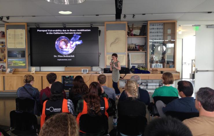
Nina Bednarsek captivates the audience at the Exploratorium during the West Coast Ocean Acidification Cruise in 2016. She is sharing her recent findings about the plight of pteropods. Photo: Meg Chadsey, Sea Grant
Dr. Nina Bednarsek has been awarded the biennial SeaDoc Society's’ Salish Sea Science Prize for her groundbreaking work on the impacts of ocean acidification on pteropods, planktonic marine snails, as well as enhancing policy and regulatory processes along the US West Coast. Her novel research is filling gaps needed to catalyze management actions that will mitigate the harmful effects of ocean acidification on marine ecosystems. Dr. Bednarsek was an NRC postdoctoral research fellow with PMEL from 2012 - 2015 where she worked with Carbon Program. She has authored or co-authored 12 papers and contributed to major state and national reports on ocean acidification.
Dr. Bednarsek’s research with PMEL has found that the highest impacts on pteropods from ocean acidification is observed in the Salish Sea. Her results show that live pteropod shells undergo dissolution at aragonite saturation state values <1, which is commonly found in subsurface Salish Sea waters and along the Washington coast during the upwelling season. With collaborators, she developed a new set of ocean acidification indices that could be used by coastal States and the US Environmental Protection Agency to address water quality issues related to ocean acidification.
After her postdoc, she continued her research and policy work at the University of Washington before joining the Southern California Coastal Water Research Project where she collaborates with scientists from PMEL, University of Washington Ocean Acidification Center, and other local and state institutions, including the Washington State Marine Resources Council, on her research on ocean acidification in the Salish Sea and California Current System.
The SeaDoc Society is a science-based marine conservation program that is focused on people and science healing the sea. It funds and conducts marine science and uses science to improve management and conservation in the Salish Sea. It is a program of the Karen C. Drayer Wildlife Health Center, a center of excellence at the UC Davis School of Veterinary Medicine. Read the full announcement on the SeaDoc Society website here: http://www.seadocsociety.org/salish-sea-science-prize/.
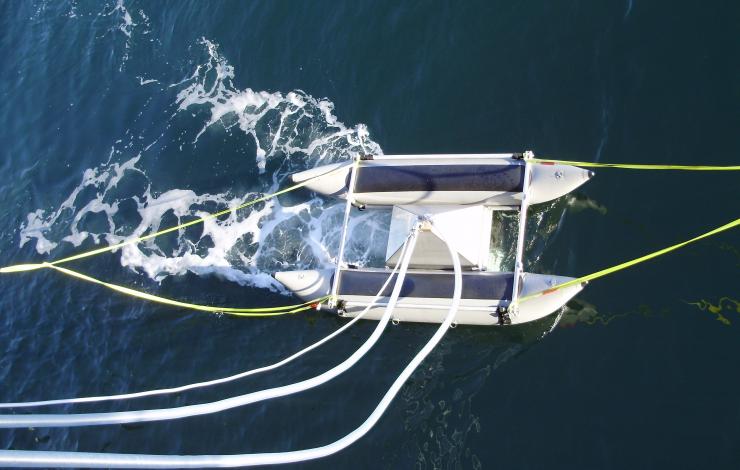
Sea Sweep seawater sampling during the Western Atlantic Climate Study in 2014.
March 20 - April 13: PMEL's Atmospheric Chemistry Group is currently participating in the fourth and final NAAMES (North Atlantic Aerosol and Marine Ecosystem Study) cruise aboard the Woods Hole Oceanographer Institution R/V Atlantis. NAAMES is a five-year NASA funded study consisting of four, combined ship and aircraft campaigns that are each aligned to a specific event in the annual plankton lifecycle to assess how changes in plankton production and species composition affect aerosols and clouds and their implications for climate. The North Atlantic is home to the world' largest plankton bloom which stretches from North America across the Atlantic to Europe. Plankton form the base of the marine food web and can impact the productivity of fisheries and serve as an important carbon sink for atmospheric greenhouse gases. NAAMES is an interdisciplinary investigation resolving key processes controlling marine ecosystems and aerosols that are essential to our understanding of Earth system function and future change. The study aims to make ship- and aircraft-based measurements that, when combined with satellite and ocean sensor data, will help clarify the annual cycles of ocean plankton and their relationship with atmospheric aerosols.
PMEL scientists, Lucia Upchurch and Derek Coffman, are onboard the R/V Atlantis measuring properties of freshly emitted sea spray aerosol using Sea Sweep and quantifying the number production flux of sea spray aerosol with a Marine Aerosol Reference Tank (MART). The parallel airborne and shipboard observations will provide the crucial link between local-scale processes and properties quantified at the basin-scale through satellite remote sensing. Through integration of ship, airborne, modeling, and sustained satellite and autonomous sensor approaches, predictions of ocean ecosystem and aerosol changes in a future warmer ocean will be improved. As such, NAAMES will directly address NOAA’s strategic long-term climate goal of improving our scientific understanding of the changing climate and related impacts.
PMEL's Atmospheric Chemistry Group is dedicated to international field campaigns and long term measurements to determine the impact of atmospheric aerosol particles on climate and air quality. Learn more about the group here and the cruise here.
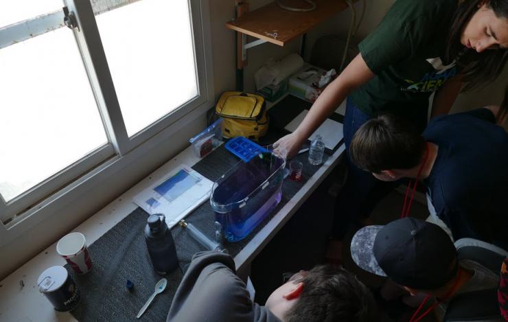
Students learning about water density and ocean circulation at NOAA Science Camp July 2017.
Online Registration for the 2018 NOAA Science Camp is now open! NOAA Science Camp is held at the NOAA Campus in Seattle, WA. Middle and high school students will have a chance to participate in hands-on science activities and learn more about the diverse range of opportunities and research conducted by NOAA scientists. Three programs are offered: Middle School Science Camp, High School Junior Leadership Program and a Remotely Operated Vehicle Mini Session. The camps will run at various times from July 9-25.
PMEL scientists (NOAA and JISAO) lead activities relating to engineering and oceanography, including how scientists conduct their research when they go to sea, how scientists work with engineers to solve complex marine questions, how currents and trace chemicals move throughout the ocean, and even how buoys help predict large-scale climate events such as Tsunamis.
The middle school camp offers two, one-week sessions from July 9-13 and July 16-20, 2018. The Junior Leadership Program is a two-week program (July 9-20) and is open to students entering grades 9-12 in the fall of 2018. Applications are due on April 15, 2018, and require two written references (for new participants).
NOAA Science Camp has partnered again with Atlantis STEAM to provide an exciting addition to the normal camp. In the three-day mini-session, campers will get to design, build, and drive their own Remotely Operated Vehicles (ROVs).
Learn more on the Washington Sea Grant site and register for NOAA Science Camp here.
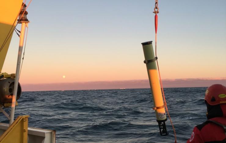
A hydrophone being lowered into the water with the moonrise in the distance in February 2017. Photo Credit: Lauren Roche (CIMRS/PMEL)
The PMEL Acoustics Program is back in the Ross Sea in Antarctica replacing six hydrophones that record icequakes, iceberg tremors and other naturals sounds near the Drygalski and Nansen Ice Shelves. The data collected from these hydrophones over the last four years will allow the Acoustics program to characterize the soundscape of the Terra Nova Bay polynya and to assess ice flow dynamics, as well as marine mammal presence/distribution in the newly formed Antarctic Marine Protected Area.
Ice shelves are permanent floating sheets of ice that connect to a landmass and are mostly found around the coast of Antarctica. They also slow the rate of ice flow from glaciers and ice streams coming into the ocean from the interior of the land. If an ice shelf collapses, then the glaciers flow more quickly out to the ocean and can accelerate sea level rise. Sea shelves can also calve, or split apart, as seen when two iceberg broke away from the Nansen ice shelf in April 2016 due to the largest low pressure storm system in more than a year that ultimately caused the icebergs to break free of the Nansen shelf.
The PMEL Acoustics Program has been collaborating with the Korea Polar Research Institute (KOPRI) for several years on multiple projects in Antarctica.
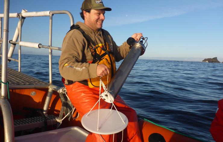
Joe Haxel ready to deploy the drifting hydrophone off the coast of Oregon. Photo credit: OSU/GEMM Lab.
At the Ocean Sciences Meeting this week, Dr. Joe Haxel with Oregon State University's Cooperative Institute for Marine Resources Studies and PMEL's Acoustic Program presented findings from acoustic recordings from a series of drifting hydrophone deployments off of the Oregon coast from May-October 2016. The hydrophone recorded loud sounds characteristic of snapping shrimp, which are typically found in warm, shallow subtropical waters all over the world, but are undocumented in the colder coastal waters off the coast of the Pacific Northwest, until now. Analysis of the recordings provide estimates of the number of snapping shrimp along the central and southern Oregon coasts and their activity levels.
In addition to discovering the presence of snapping shrimp, the researchers found eastern Pacific gray whales were often foraging near the rocky reefs the shrimp inhabit. Gray whales don't eat snapping shrimp, but they do eat other types of prey usually found near the rocky reefs, in particular mysids. Joe Haxel and his colleagues suspect the loud snaps and crackling din of the snapping shrimp could be an acoustic cue to direct whales to areas of the ocean where their typical food might be plentiful.
The discovery is part of a larger effort by researchers to better understand the acoustic environment of Pacific Northwest coastal waters. By deploying the hydrophones, they hope to characterize the volume and types of sounds animals hear in Pacific Northwest waters. The new research shows snapping shrimp are an important contributor to the coastal soundscape, Haxel said.
Read the press release from AGU here.
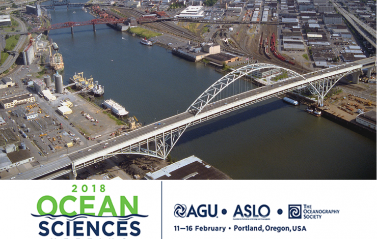
Image of the Willamette River in Portland, OR where the Ocean Sciences Meeting will take place.
More than 50 PMEL scientists, including scientists from NOAA, University of Washington's Joint Institute for the Study of the Ocean and Atmosphere (JISAO), Oregon State University's Cooperative Institute for Marine Resources Studies (CIMRS) and the National Research Council, will present a talk or share a poster on their research at the 2018 Ocean Sciences Meeting in Portland, Oregon February 12-16, 2018. PMEL research groups that will be present at the conference are: Acoustics, Arctic, Earth-Ocean Interactions, EcoFOCI, Engineering, Global Tropical Moored Buoy Array, Innovative Technology for Arctic Exploration, Large Scale Ocean Physics, Ocean Carbon, Ocean Climate Stations, Pacific Western Boundary Currents, Science Data Integration Group, Thermal Modeling and Analysis Project
28 talks will present research on ocean carbon, ocean acidification, ocean observing systems, Arctic research including the Distributed Biological Observatory and Arctic Marine Pulses (AMP), ENSO, MJO, hydrothermal vents, Saildrone research, air-sea interactions, SOCCOM, and ocean mixing. 26 posters will be up during the poster sessions and highlight research in the Arctic, hydrothermal vents, acoustics, methane bubbles and hydrates, Saildrone, Oculus Coastal Glider, ocean carbon, deep ocean temperatures, glider research in the Solomon Sea, and ocean acidification and hyopxia.
PMEL staff will also be chairing sessions and workshops on:
- El Nino-Southern Oscillation (ENSO) Diversity, Predictability, and Impacts
- Western Pacific and Indonesian Sea Circulation and Its Environmental and Climatic Impacts
- New Platform and Sensor Technologies: Advancing Research, Readiness, and Transitioning for Sustained Ocean Observing of Essential Ocean Variables
- Methane from the Subsurface Through the Bio-, Hydro-, and Atmosphere: Advances in Natural Hydrate Systems and Methane Seeps in Marine Ecosystems
- Cascadia Margin methane seep and hydrates to share results and coordinate future work
The 2018 Ocean Sciences Meeting is co-sponsored by the American Geophysical Union (AGU), the Association for the Sciences of Limnology and Oceanography (ASLO), and The Oceanography Society (TOS). The meeting is an important venue for scientific exchange across broad marine science disciplines. Sessions will include all aspects of oceanography, especially multidisciplinary topics, as well as presentations that reflect new and emerging research on the global ocean and society, including science education, outreach, and public policy