

What's New

Photos: Nick Delich (NOAA PMEL)
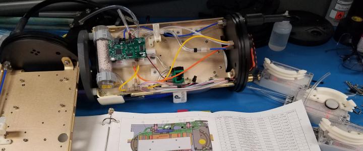
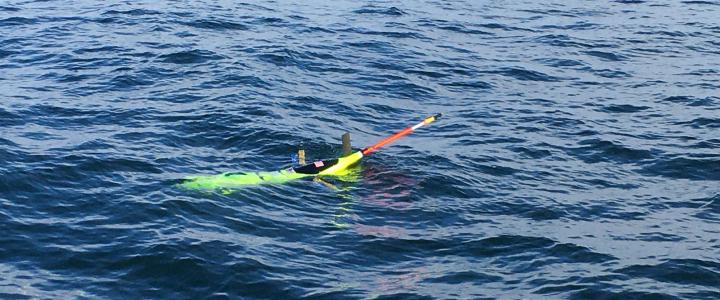
In May 2026, three members of PMEL's Engineering team (Scott Stalin, Nick Delich, and Courtney Avioli) were aboard 404 Marine's Michael UHL. Their destination? The Harvest platform—a retired oil and gas rig ~10 miles off the California coast near Point Conception. NASA JPL has used this platform for 30 years as a calibration/validation ("cal/val") site.
While there, our team deployed one SWOT/GNSS buoy (SWOT = Surface Water and Ocean Topography, GNSS = Global Navigation Satellite System), recovered another, and repaired a third on location. Two humpback whales (a mom and her baby) kindly decided to drop in on our team for a photo op with one of our buoys.
The work performed by our Engineering team at Harvest sustains PMEL's ongoing collaboration with NASA JPL for SWOT satellite cal/val using in-situ sea surface height measurements from our GNSS buoys.
As of today, PMEL has 5 GNSS buoys in the water: two are at the Harvest site and three more are off... more
In the News
It’s bright yellow, solar-powered and self-propelled. It can stay at sea for months, collecting data with a wide variety of off-the-... more
On a windy day in October 2013, a small team of engineers and boatbuilders watched the first wind-powered ocean drone disappear over the... more
Feature Publication
A recent study published in Frontiers in Marine Science identified navigational challenges and opportunities for Arctic study using saildrones. Researchers from NOAA and other affiliates were among those carrying out the mission, where they took five saildrones to the US Arctic to test their remote navigation... more