What's New Archive
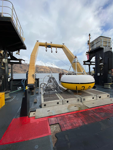
FOCI mooring ready for deployment in the Bering Sea aboard the NOAA Ship Oscar Dyson. The M2 surface mooring that has been deployed each spring in the southeastern Bering Sea for over 25 years. This critical mooring provides year-round measurements of temperature, salinity, nitrite, chlorophyll, and currents in this highly productive area. For the last 10 years, partial pressure in CO2 (pCO2) and pH measurements have also been taken at M2.
An annual survey is underway to provide baseline fisheries and oceanographic data to support sustainable management of living resources in the Bering Sea and the rapidly changing US Arctic ecosystem. These surveys provide key data in understanding and monitoring events such as sea-ice loss and the cold pool and how these are impacting the Arctic ecosystem.
This spring mooring cruise brings together scientists from NOAA’s PMEL and Alaska Fisheries Science Center, University of Washington, US Fish and Wildlife, and the University of Alaska. While aboard the NOAA Ship Oscar Dyson, the scientists will service a biophysical mooring array in the Bering Sea, collect conductivity, temperature, depth (CTD) profiles, zooplankton and ichthyoplankton samples and conduct special projects related to harmful algal blooms and zooplankton machine learning. Results from these observations and experiments will help describe important ecosystem linkages among climate, plankton, fishes, birds and mammals.
EcoFOCI will be field testing and using several technologies this summer, including pop-up floats, a remote access sampler and a new shallow-water glider. These technologies aim to enhance shipboard and mooring research with more data collection in a fine scale region.
NOAA’s EcoFOCI program is leading 5 research cruises this March to October in the Alaska region.
Find blog updates on the NOAA Alaska Fisheries Science Center webpage: https://www.fisheries.noaa.gov/region/alaska#science
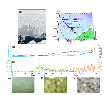
During the first Chukchi deployment, floats resurfaced under a sheet of floating ice (ice floe), monitored and tracked the ice region for almost two months and detected an under-ice algae bloom (Stabeno et. al, 2020). The bottom row shows the captured images with no bloom and/or algae.
After spending 8 months under water and ice, two of NOAA’s three Arctic-deployed pop-up floats have successfully surfaced in the Chukchi Sea and are transmitting data on temperature, pressure, photosynthetic active radiation (PAR), and chlorophyll fluorescence. These data are from measurements taken while the float is anchored to the seafloor, while it rises through the water column, and while it is trapped under the ice at the water-ice boundary.
The two floats were initially deployed in the fall of 2020 by the scientists and crew of NOAA Ship Oscar Dyson. These are part of the 4th cohort of deployments since 2017, and the second cohort deployed in the Chukchi Sea. The first float to surface has transmitted data from the four months it spent on the seafloor, just over a month of data from when it was trapped under ice, and about half of the photos it took while under ice. The second float has transmitted about five months of data from the seafloor, just over four months of data from under the ice along with the under-ice photos it captured, and 7 days of open ocean sea surface temperature.
Pop-up floats provide an inexpensive method to explore a unique micro-ecosystem under floating ice. The floats collect ocean health data to help researchers better understand the rapidly changing Arctic ecosystem. They collect data during the ice-covered winter and spring months, a time during which it isn’t possible for researchers to penetrate the ice from above to study the water underneath. The water column data they collect on their rise up from seafloor to surface is essential for researchers to monitor ongoing ecosystem changes in the Arctic, such as watching for harmful algal blooms and documenting biodiversity in the environment. The floats can also help researchers measure the extent of the cold pool, an area of cold water about 30 meters deep that results from melting Arctic ice from the previous season.
NOAA PMEL began development of these floats in 2015. The float is an orange sphere equipped with sensors to measure temperature, pressure, and other ocean conditions as well as cameras to capture under ice imagery. It is deployed during the ice-free summer months and anchors to the seafloor measuring bottom-ocean conditions. It stays here collecting measurements throughout the winter and early spring. It then rises up through the water column at a pre-programmed time, in this case early March to mid-April, capturing data at various depths to create a profile of the water column. The floats are then trapped under ice when it reaches the surface, and will continue collecting data and images of conditions at the water-ice boundary. When the ice melts in mid-May and early June, the floats can emerge fully from the ice to reach the surface and begin transmitting their stored data, while continuing to monitor sea surface temperature.
Read more about the 2020 pop-up deployments in Arctic Today and on the ITAE website.
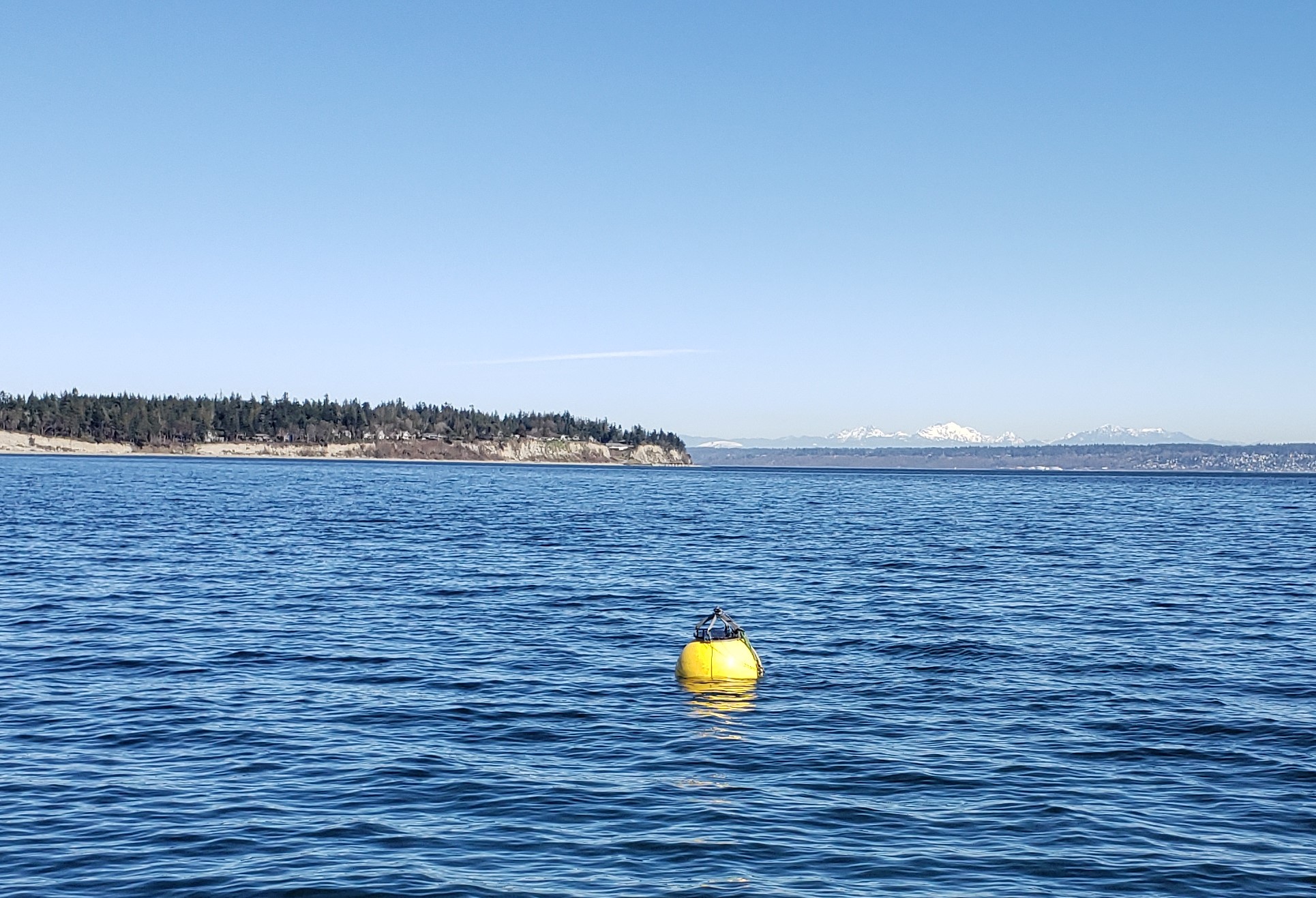
Flotation Controllable Ocean Mooring (FCOM) system resurfacing during testing in Puget Sound.
After 8 months of sitting on the seafloor, PMEL’s latest engineering development, the Flotation Controllable Ocean Mooring (FCOM) system successfully resurfaced in July. Over the last two years, PMEL has been developing a profiling mooring for use in Arctic regions that submerges when ice arrives in the fall and refloats in the spring after ice retreat. The FCOM system has a surface float that is anchored to the ocean floor, and includes a Prawler that moves up and down the mooring line collecting profiles of temperature, salinity, chlorophyll, and dissolved oxygen. This innovation will provide real-time information of the full water column during the entire open water (sea ice free) season.
The Chukchi Sea is an ice-driven system. Collecting data during the spring and fall is crucial for monitoring ecosystem production and generating ice forecasts. Data collection during spring and fall is difficult as there are few vessels in the region during those times, and moorings must be placed near the seafloor to avoid ice keels which prevents real time data return on the status of the full water column. Prior to FCOMs, surface floats could only sample for a short period because deployment and recovery were dependent upon the tight scheduling of research vessels. This mooring addresses these long-standing science gaps.
The mooring was originally deployed from the R/V Ocean Starr in spring of 2019 in the Chukchi Sea with pre-programmed dates to sink and resurface. It sank in October 2019, resurfaced in July 2020 and will be recovered in September. The next version of FCOM will be outfitted with a hydrophone and ice-detection algorithms so that it can resurface after ice retreats without having a pre-programmed date. Ultimately, the FCOM with a Prawler is intended to be integrated into NOAA’s Arctic observing system.
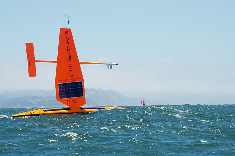
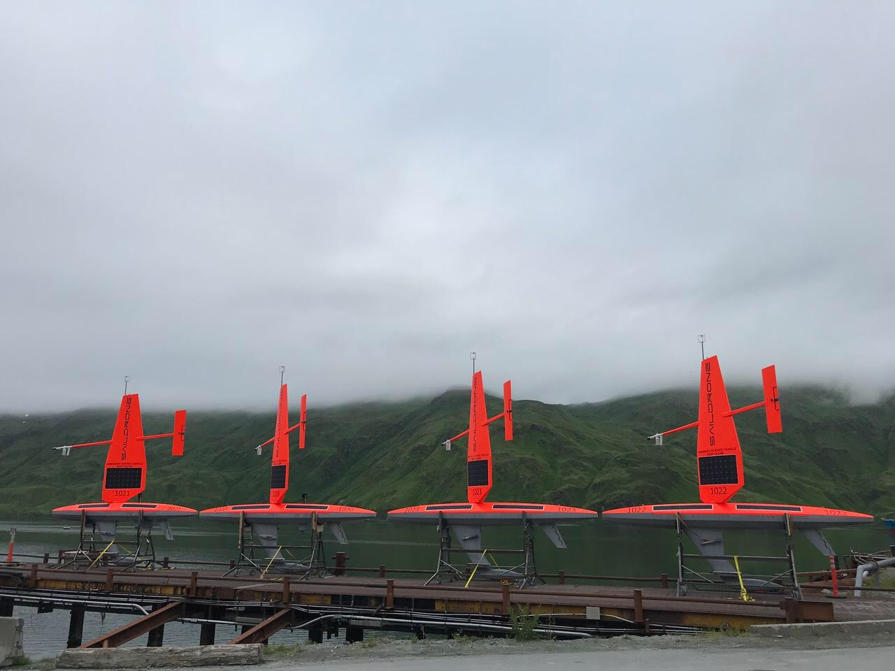
Two saildrones in the Pacific Ocean just west of the Golden Gate Bridge at the start of their journey. Photo Credit: Saildrone, Inc.
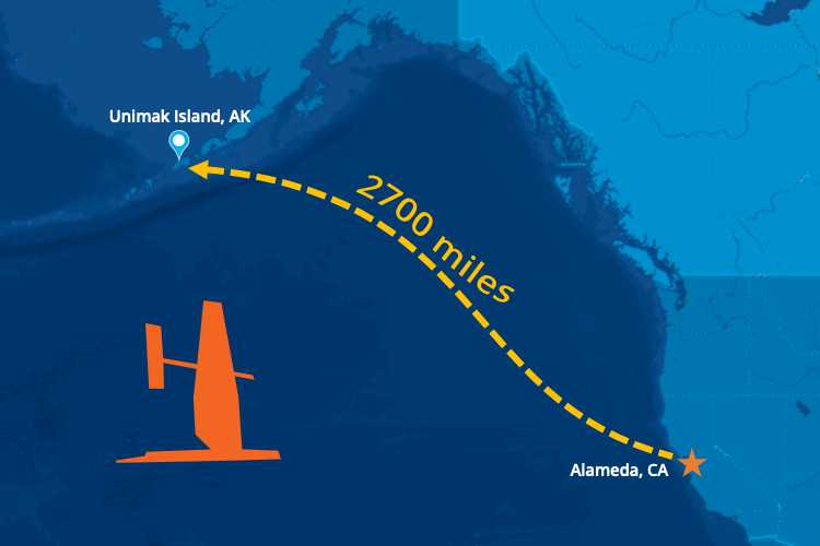
Three saildrones left Alameda, California in May and have arrived at Unimak Pass in Alaska’s remote Aleutian Islands to collect valuable abundance data to support sustainable management of the largest commercial fishery in the United States.
Three saildrones left Alameda, California in May and have arrived at Unimak Pass in Alaska’s remote Aleutian Islands. The ocean drones have sailed nearly 2,700 miles at a walking pace, about 2.5 miles per hour (2 knots), which is just about the distance from Seattle to Miami. Once they navigate through the pass, the saildrones will enter the Bering Sea. This is where they will conduct a two month-long acoustic survey of walleye pollock to collect some critically needed data to support management of the nation’s largest commercial fishery for Alaska pollock. They are expected to reach their first survey station in about a week and will cover roughly the same area normally covered by standard research vessels.
The data the drones collect will help to fill in the gap for fisheries stock assessment scientists who monitor the changes in pollock populations to advise fisheries management. The sonar measurements made by the ocean drones will provide valuable insights on pollock abundance and distribution in 2020.
The mission is led by NOAA's Alaska Fisheries Science Center with scientists at the Pacific Marine Environmental Laboratory processing the oceanographic and meteorological data in real time. Data will be made available to weather forecasts center worldwide via the World Meteorological Organization's Global Telecommunication System (GTS) so that these observations can be incorporated into weather predictions. PMEL, AFSC and Saildrone have collaborated on several missions in the Arctic since 2015 to develop the vehicle’s capabilities and refine the sensors.
The US Arctic and Bering Sea are big, remote, and harsh environments. PMEL's Innovative Technology for Arctic Exploration program and Engineering Development Division have been developing autonomous technologies and tools to collect critical data to better understand changes in the oceans and its impact on food security, sea ice forecasts, weather and climate.
Drones and gliders are not designed for ice edge and can offer a new perspective on Arctic science, exploring new areas of the Arctic Ocean. One critical area of study is the melting edge of the seasonal ice pack. The timing and speed of annual ice retreat is changing each year, and could have a big impact on ecosystems and global weather patterns. PMEL is pushing the envelope to further develop gliders and drones to advance the science near the ice edge to explore how it moves and changes.
Check out the video on our YouTube Channel to learn more about NOAA PMEL’s autonomous observing technology in the Arctic: https://youtu.be/A_
41 scientists from PMEL, including scientists from NOAA's cooperative institutes at the University of Washington's Joint Institute for the Study of the Ocean and Atmosphere (JISAO) and Oregon State University's Cooperative Institute for Marine Resources Studies (CIMRS), the National Research Council, graduate and undergraduate students are heading to the Ocean Sciences Meeting in San Diego to share their current research. Talks and posters cover a range of topics include saildrone research, ocean observing systems, marine heatwaves, Arctic, acoustics, Deep Argo, genetics and genomics, El Nino, hydrothermal vents, methane, nutrients, technologies, ocean carbon and data management.
The 2020 Oceans Science Meeting is the flagship conference for the ocean sciences and the larger ocean-connected community. As we approach the UN Decade of Ocean Science for Sustainable Development, beginning in 2021, it is increasingly important to gather as a scientific community to raise awareness of the truly global dimension of the ocean, address environmental challenges, and set forth on a path towards a resilient planet. The meeting is co-sponsored by the American Geophysical Union (AGU), the Association for the Sciences of Limnology and Oceanography (ASLO), and The Oceanography Society (TOS).
PMEL research groups that will be present at the conference are: Acoustics, Arctic including Innovative Technology for Arctic Exploration, Climate-Weather Interface, Earth-Ocean Interactions, EcoFOCI, Engineering, Genetics and Genomics, Global Tropical Moored Buoy Array, , Large Scale Ocean Physics, Ocean Carbon, Ocean Climate Stations, Pacific Western Boundary Currents, and Science Data Integration Group.
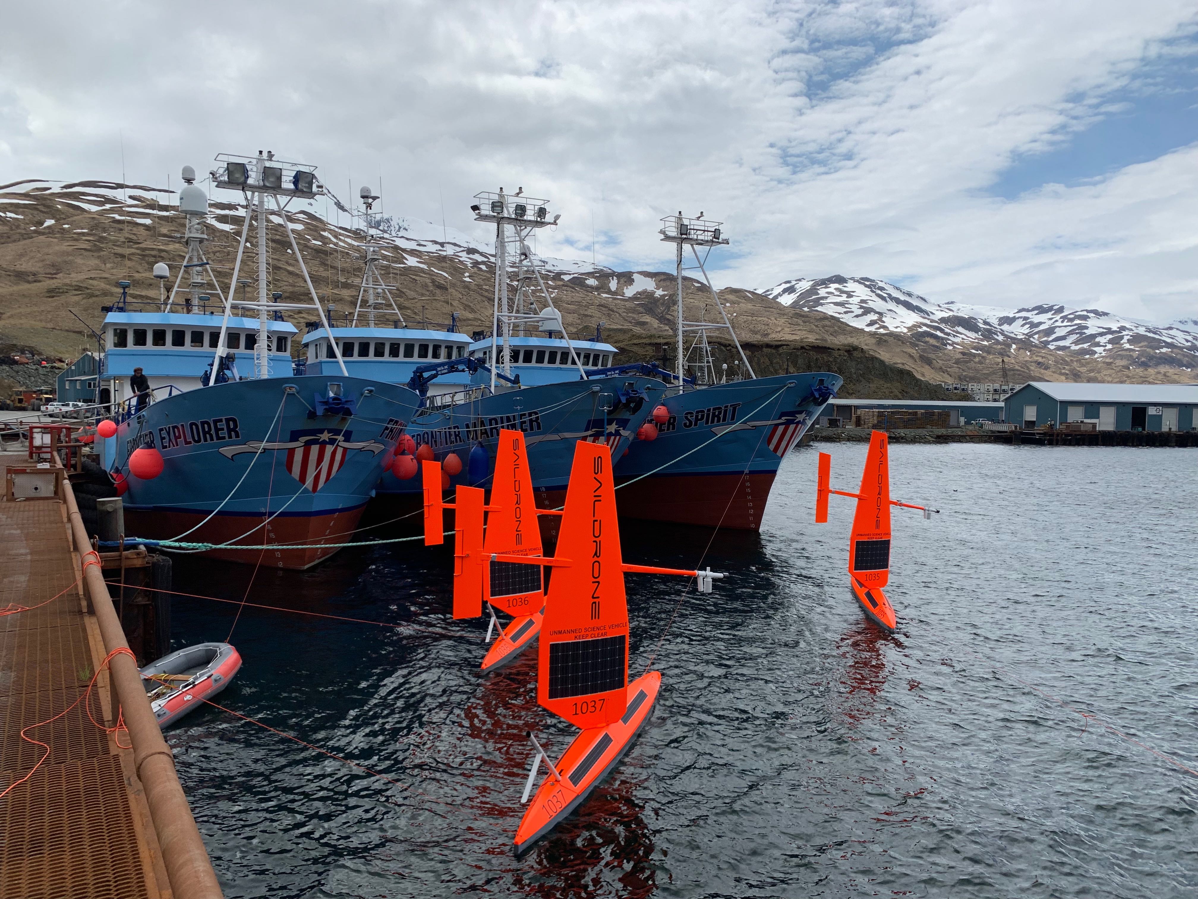
Three of six saildrones getting ready for deployment from Dutch Harbor, AK, on the 2019 Arctic mission. Photo Credit: Saildrone, Inc.
On May 16, six saildrones loaded with scientific instruments and cameras launched from a dock in Alaska's Dutch Harbor to monitor ongoing changes to the U.S. Arctic ecosystem food-chain, ice movement, and large-scale climate and weather systems.
This is the first year NOAA and NASA scientists will be working together to use the drones to survey as close to the Arctic ice edge as possible. Measurements collected this summer in the Arctic will not only be used to improve NOAA and NASA satellite ocean temperature measurements, they will also be available to global weather agencies for operational use.
While most of the saildrones will be pursuing the ice edge for the duration of the three-month mission, two other simultaneous projects will also tackle some big questions on how this cutting-edge technology can be used to collect critical observations. NOAA PMEL scientists will continue to study how the Chukchi Sea is absorbing carbon dioxide to help improve weather and climate forecasting as well as our understanding of ongoing changes in the Pacific-Arctic ecosystem. The Bering Sea is home to the largest walleye pollock fishery and the declining population of northern fur seal which primarily feed on pollock. During the summer, NOAA Fisheries scientists will use the saildrone combined with traditional at-sea tracking techniques and video cameras to get a seals-eye view during fur seal feeding trips and measure walleye pollock abundance and distribution. Read more about the work done by NOAA's Alaska Fisheries Science Center.
This is a joint NOAA mission along with the Earth & Space Research, the University of Washington's Joint Institute for the Study of Ocean and Atmosphere and the Applied Physics Lab, and Saildrone, Inc.
Saildrones have traveled about 45,000 nautical miles on Arctic missions since 2015. Follow along with drones as they collect data on fish, fur seals, changes in the Arctic ecosystem and more on the mission blog.
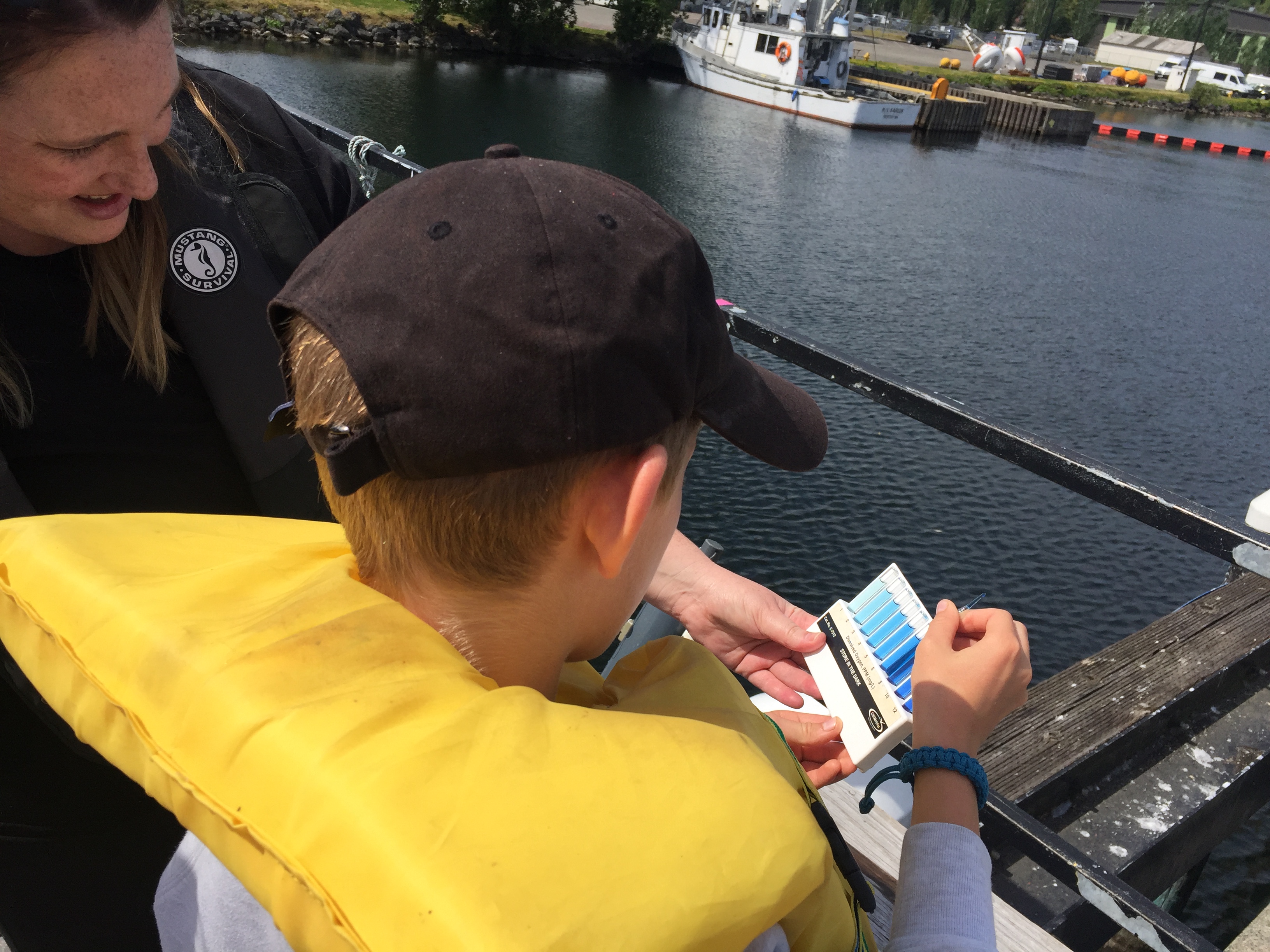
Student analyzing a water sample for dissolved oxygen levels.
NOAA and Washington Sea Grant are embarking on the sixteenth year of NOAA Science Camp in Seattle, WA. The camp offers two, one-week middle school camps, a two-week junior leadership program for high school students, and a three-day remotely operated vehicle (ROV) mini session. PMEL volunteers interact with approximately 90 middle school and high school students through hands on learning activities to simulate some of the oceanographic work done at PMEL.
As part of NOAA Science Camp, PMEL helps middle school campers learn more about ocean circulation, density, plankton, dissolved oxygen, data collection, water quality and ecosystem health. Campers get to try out collecting data using a Niskin bottle, plankton net tow, Secchi disk, Van Veen Grab, and a glass syringe for dissolved gas analysis. After each station, students walk away excited about what they've collected. Later in the week, middle school campers are presented with a science mystery to solve. They visit several NOAA offices to find out more about various aspect of the scenario and then apply what they learned to test their hypotheses. Campers present their findings and conclusions on the last day of camp each week and are evaluated by a scientist representative of each office.
PMEL engineers and technicians met with the junior leaders to share expertise on buoy design and development as the high school students developed and deployed through own buoys in Lake Washington.
More than 10 NOAA offices participate in the event and have their scientists and staff interact directly with camp participants to demonstrate how NOAA research addresses environmental issues on both local and international scales.
Four saildrones ready for deployment in Dutch Harbor, Alaska. to conduct ocean acidification and fisheries research in the Arctic Ocean. Photo credit; Saildrone, Inc.
Over the last week, Saildrone Inc. and NOAA have launched the first batch of saildrones in Alaska and the Washington coast to enhance our understanding of fisheries, ocean acidification and climate science.
Four of these saildrones launched from Dutch Harbor, Alaska this past weekend and will make their way northward, surveying more than 20,000 miles through Bering Strait and into the Arctic Ocean to measure atmospheric and surface ocean conditions, carbon dioxide in the ocean, and the abundance of Arctic cod. Arctic cod is a key component of the Arctic marine ecosystem as a food source for seabirds, ringed seals, narwhals, belugas and other fish. These two missions will gather measurements to identify ongoing changes to the Arctic ecosystem and how changes may affect the food-chain as well as large-scale climate and weather systems.
Last year was the first time the drones journeyed through the Bering Strait into the Arctic with a newly adapted system to measure carbon dioxide concentrations. Jessica Cross, NOAA Oceanographer at PMEL, continues to use saildrones to study how the Arctic Ocean is absorbing carbon dioxide to help improve weather and climate forecasting and our understanding of ocean acidification in these critical ecosystem areas.
Alex De Robertis, NOAA Fisheries Biologist with Alaska Fisheries Science Center, is mapping fish with sound to determine the amount and distribution of Arctic cod. Two drones will survey the same remote locations as previous ship-based surveys in hopes of demystifying the story of Arctic cod as temperatures and ice cover change in the Arctic. “We are trying to unravel the puzzle of what happens to the young Arctic cod that are so abundant in the summer on the Chukchi shelf,” says De Robertis. “There are many young-of the year Arctic cod in this area, but comparatively few adults. They either move to other areas or don’t survive the winter. What is their fate?”
These two missions will continue to further demonstrate the operation of these platforms at high-latitudes through the first fully autonomous acoustic fish survey and field tests of an updated carbon dioxide system that was re-designed to address challenges observed during the 2017 mission.
NOAA and Saildrone, Inc. are embarking on the fifth year of collaboration and novel data collection using saildrones to better understand how changes in the ocean are affecting weather, climate, fisheries and marine mammals.
Read more about all the NOAA Saildrone missions this summer here: http://www.noaa.gov/stories/flotilla-of-saildrones-deploy-to-artic-and-pacific-for-earth-science-missions
Follow along with the Arctic missions on this blog: https://www.pmel.noaa.gov/itae/follow-saildrone-2018
Read more about the West Coast Fisheries survey here: https://swfsc.noaa.gov/news.aspx?ParentMenuId=39&id=23090
Learn more about what we did in previous Alaska surveys:
PMEL Follow the Saildrone 2017
NOAA Fisheries video on 2017 mission
2017 Fur Seal Blog by Carey Kuhn
NOAA Saildrone Research 2016 – Live YouTube Broadcast Recording
2016 Press release and Press Conference
Tracking Technology: the Science of Finding Whales: Video interview with Jessica Crance
2016 Fur Seal Blog by Carey Kuhn
Engineers and scientists of the 2016 Saildrone Team discussing the first phases of the summer mission in the Bering Sea.
Congratulations to all involved with the 2016 Saildrone missions on receiving the Department of Commence Bronze Award and to Susie Snyder for receiving the NOAA Distinguished Career Award.
NOAA’s PMEL and Alaska Fisheries Science Center were awarded the Bronze Medal for “strengthening NMSF-OAR collaborations through the pioneering use of a Saildrone for next-generation ecosystem surveys in the Bering Sea”.
In 2016, the team successfully conducted the first ecosystem study using two Saildrones. The mission combined both physical and biological oceanography to seek out new ways to supplement traditional vessel-based research. The Saildrones each traveled almost 3,000 nautical miles in the 101 day mission testing innovative technologies, including a specially developed echo sounder and a modified whale acoustic hydrophone. Collectively, the oceanographic, meteorological, and fisheries measurements provided unique and groundbreaking insights to understanding the economically and culturally important ecosystem in the Bering Sea.
This was a collaborative mission between the NOAA’s Pacific Marine Environmental Lab, NOAA’s Alaska Fisheries Science Center, UW Joint Institute for the Study of the Atmosphere and Ocean, Saildrone Inc., Simrad AS/Kongsberg Maritime, Greeneridge Sciences Inc, and Wildlife Computers. Read more about the 2016 mission here.
The DOC Bronze Award is the highest honor award granted by the Under Secretary of Commerce for Oceans and Atmosphere, which recognizes superior performance characterized by outstanding or significant contributions, which have increased the efficiency and effectiveness of NOAA.
Susie Snyder was also awarded The Distinguished Career Award for her “continued efforts in improving budgetary policies and procedures relating to memorandum of agreements and reimbursable funds throughout 30 years of service to NOAA”. This award honors contributions on a sustained basis — a body of work — rather than a single, defined accomplishment. This award also recognizes significant accomplishments across all NOAA program areas and functions that have resulted in long- term benefits to the bureau’s mission and strategic goals.