TPOS Uncrewed Surface Vehicles
Overview
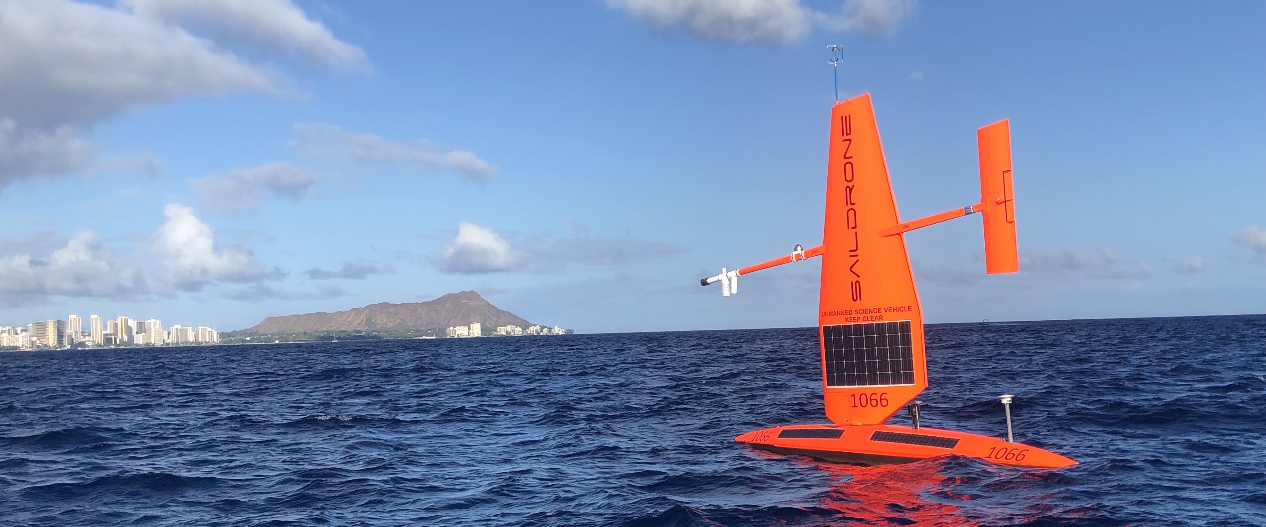
Uncrewed surface vehicles (USVs) are semi-autonomous vehicles which are used to collect high-resolution oceanographic and atmospheric data over large-scale distances. The Saildrone is an example of a USV which is currently being tested by the OCS group for integration into the Tropical Pacific Observing System (TPOS). Through these missions, we have tested their readiness level and have developed adaptive sampling strategies for:
- Providing physical and biogeochemical air-sea interaction data in the Tropical Pacific, with near-realtime data for operational meteorological and ocean data centers
- Resolving fast mesoscale air-sea interaction processes (such as atmospheric cold pools associated with convective downdrafts) through a "mobile mesonet" cluster of drones
- Resolving abrupt fronts and their impact on air-sea interactions
- Observing highly variable equatorial upwelling
- Performing interoperability experiments with TPOS surface moorings
- Incorporating biological measurements critical to fisheries management (e.g. biomass distribution) into the multidisciplinary observing capabilities of the USV
This work has been supported by NOAA/OMAO/UxSOC and NOAA/OAR/GOMO.
For additional photos, please check our Saildrone Gallery.
Various data delivery options exist on our Data Access webpage, and realtime data from past and current missions can be accessed via a newly developed Plotly Dashboard.
OCS TPOS Saildrone Blogs
TPOS 2024 - Mission 7 (October 30, 2024 - February 4, 2025)
TPOS 2023 - Mission 6 (June 22, 2023 - November 5, 2023)
TPOS 2022 - Mission 5 (June 22, 2022 - September 26, 2022)
TPOS 2021 - Mission 4 (July 23, 2021 - February 17, 2022)
TPOS 2019 - Mission 3 (June 8, 2019 - December 8, 2019)
TPOS 2018 - Mission 2 (October 3, 2018 - February 2019)
TPOS 2017 - Mission 1 (September 1, 2017 - May 18, 2018)
Technical Development
PMEL began a partnership with Saildrone, Inc. in 2014, under a Cooperative Research and Development Agreement. The partnership aimed to develop the unmanned surface vehicles to collect high quality oceanic and atmospheric observations.
In addition to the vehicles themselves, Saildrone, Inc. provides engineering expertise in vehicle design, software, electronics, and operations. PMEL provides engineering expertise on sensors, sensor sampling schemes, telemetry protocols, and access to calibration equipment and facilities.

Vehicles being assembled at Saildrone, Inc. (Photo credit Saildrone, Inc.)
The OCS group has been working together with PMEL engineers and Saildrone, Inc. since mid-2016. The OCS goal was to install sensors on the drones with equivalent or better quality than those currently used on Tropical Atmosphere and Ocean (TAO) buoys for air-sea flux measurements. New additions made to the Saildrones also included a 300-kHz Acoustic Doppler Current Profiler (ADCP) for upper ocean current measurements, and a suite of biogeochemical sensors. OCS and Saildrone, Inc. co-developed the real-time motion correction algorithms for high frequency 3-dimensional wind and ADCP current measurements.
These technological developments significantly improved the data quality and led to the acceptance of Saildrone USVs as the observing platforms of air-sea interaction even under extreme conditions, such as hurricanes.
Refer to the Technical Notes page and Zhang et al. (2019, 2023) for documentation of the OCS / Saildrone development efforts.

5th generation Saildrone ascending a wave.

Saildrone sensor suite as of November 2017 (Click to enlarge)