OCS Saildrone Mission - TPOS 2022
This 90-day mission is supported by NOAA OMAO and Saildrone, Inc.
Mission Overview
Mission Dates: June 22, 2022 - September 26, 2022
TPOS Mission 5 launched June 22, 2022, with two Saildrone uncrewed surface vehicles (USVs) SD1033 and SD1052 initially departing San Francisco Bay, CA in early May 2022 as part of a multinational effort to enhance the Tropical Pacific Observing System (TPOS). The pair, starting near 10°N, 125°W, surveyed the TAO moored buoy array along 125°W to observe the air-sea interaction processes and CO2 fluxes associated with the predicted rare 3rd consecutive La Niña, the Tropical Instability Waves and high frequency eddy and frontal variability between the Equatorial Cold Tongue and the Intertropical Convergence Zone. This 90-day mission was funded by NOAA OMAO.
Want more up-to-date information? You are in luck! Follow the drones on their 2022 TPOS journey and access real-time data on the PMEL Saildrone dashboard.
Mission Blog
Lessons Learned from TPOS 2022
June 5, 2023
The TPOS 2022 Saildrone mission officially completed on September 26, 2022, with SD1033 positioned near 5°N, 131.5°W and SD1052 positioned near 0°N, 133.75°W. Since the drones were located in the field far from land, it took several months for each drone to complete its long journey home to California. While SD1033 returned to port on January 6, 2023, SD1052 only recently returned to port on May 13, 2023, lasting 281 and 407 days at sea, respectively. Per the previous post, SD1052 experienced degrading performance and was the slower of the two drones, but at the end of the mission it was also positioned further south (by a whole 5°!) and thus had more distance to travel home. Surprisingly, SD1052 was the only drone to briefly cross the strong meridional temperature front separating the warm sub-tropical waters from the cold, upwelled water along the Equator. Unfortunately, the timing of the crossing occurred with only seven days remaining in the mission, reflecting the navigational difficulties posed by low-wind, high-ocean current conditions in the eastern equatorial tropical Pacific study region. As a refresher, the USVs from the TPOS missions are of the Saildrone Explorer series class, meaning that there is no motor available for navigation, so the drones depend strongly on wind power.
While the equatorial study region did not go according to plan, the TPOS 2022 Saildrone mission provided important lessons and insights for the recently launched TPOS 2023 Saildrone mission to the central tropical Pacific. Rather than fighting the currents, which the drones have struggled with over the years, the navigation team is planning routes that will anticipate the westward drifting currents and prevent the drones from overshooting their target region of 0°, 155°W to 0°, 170°W. Likewise, in the second half of the mission, the drones will transit north along 170°W to ride the North Equatorial Counter Current back to the east. As we press forward with each new mission, we continue to learn how to best optimize this novel technology to "fill in the gaps" and enhance the existing observational network across the tropical Pacific.
Go with the Flow
August 29, 2022
With approximately one month remaining in the TPOS 2022 Mission to the eastern tropical Pacific, the two drones have made impressive strides as they continue to sample the air-sea environment across the region. During their first month, the drones successfully completed two buoy intercomparisons against the Tropical Atmosphere Ocean (TAO) array moorings located at 8°N, 125°W and 5°N, 125°W. These intercomparisons involve the drones circling around a buoy for 12 - 24 hours in order to evaluate the sensors on both types of observing platforms and ensure that we are collecting climate-quality measurements.
In the second month of the mission, as the drones traveled south toward the equatorial study region, they once again encountered strong ocean currents associated with the westward expanding equatorial Cold Tongue and tropical instability wave (TIW) activity. As in previous missions, strong ocean currents coupled with weaker winds pose navigational difficulties for the drones, as the vehicles are not motorized and instead rely on environmental conditions for sailing. Using past lessons learned, the drones were directed to use the currents to their advantage, sailing clockwise around a TIW crest to enter more favorable conditions for reaching the study region. While sailing this clockwise trajectory, the drones successfully crossed a weak sea surface temperature (SST) front associated with a convergence zone on the backside of the TIW crest, maintaining a zonally-oriented east-west formation as they collected observations.
Unfortunately, given degradation in the sailing performance of drone 1052, the drones will likely become separated for the remainder of the mission as they continue south across a region of powerful westward-flowing ocean currents. Nevertheless, the drones will continue in an attempt to cross the strong meridional SST front separating the warm sub-tropical waters from the cold, upwelled water along the Equator, yielding important information on the air-sea interface.
The Sun Rises on TPOS 2022
July 6, 2022

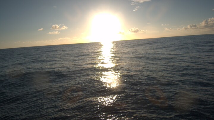
Photo taken on SD1033 en route to the 8°N, 125°W TAO buoy in the eastern tropical Pacific Ocean. Photo credit: Saildrone, Inc.
The day after the (boreal) summer solstice, Saildrone USVs SD1033 and SD1052 began their mission in the middle of the eastern tropical Pacific Ocean, having launched from Alameda, CA about one month prior. As in previous missions, the drones are fully equipped with oceanic, atmospheric, and biogeochemical sensors to collect climate-quality air-sea measurements over data sparse regions of the tropical ocean, with the overarching goal to address gaps in the current Tropical Pacific Observing System array. As we enter into the fifth TPOS Saildrone mission to the eastern tropical Pacific, we continue to explore the feasability of USVs as observing platforms within different regimes, such as the low-wind environment of the ITCZ (i.e., "the doldrums"), the low-wind, high-ocean current environment of the equatorial Pacific Cold Tongue, and the warm, biologically-active waters of the tropical Pacific Ocean.
This blog page is maintained by Samantha Wills.


