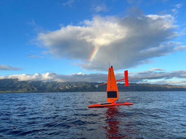
SD 1079 deploys in Hawai'i with a rainbow seen in the background. Courtesy Saildrone, Inc..
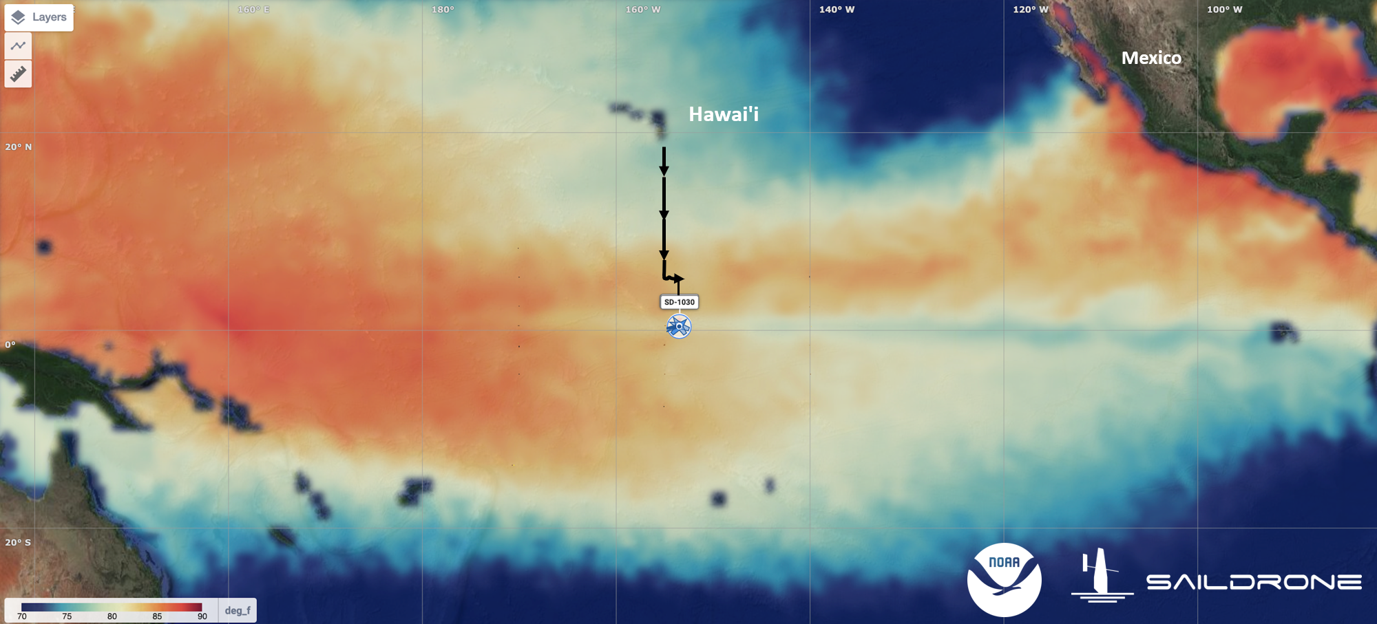
The three Saildrone, Inc. uncrewed surface vehicles were launched from Hawai‘i and currently are at the equator in the central Pacific observing the developing El Niño. Sea Surface Temperature (SST) warmer than 90°F is shown in dark red. SST cooler than 70°F is shown in dark blue. This image was generated within the Saildrone, Inc. mission portal using the SST analysis from the HYCOM ocean prediction system. Click to enlarge map.
The 120-day Tropical Pacific Observing System (TPOS) 2023 Saildrone Mission officially began on June 22, 2023, just after the official start of what experts suggest may be a strong El Niño. The three Saildrone, Inc. Explorer-class Uncrewed Surface Vehicles (USVs), launched from Honolulu, Hawai‘i, are now at the equator in the central Pacific (~155°W), about 1,300 miles south of the Hawaiian Islands. An El Niño state occurs when above-average equatorial sea surface temperatures are present throughout the central and eastern tropical Pacific, leading to a weakening or even reversal of the trade winds near the equator and anomalous weather patterns across the world.
Each USV is outfitted with a suite of sensors to monitor wind stress, air-sea exchanges of heat and carbon dioxide, and surface seawater temperature, salinity, and biogeochemistry. In addition, two of the drones will profile ocean currents to about 100 m depth, while the third will profile the distribution of organisms on a range of trophic levels down to 1,000 m depth.
Overall, this sixth TPOS mission uses Saildrone, Inc. USV for: (a) observing the air-sea interactions, including potential equatorial upwelling, associated with the evolving El Niño system, (b) observing the relaxation of carbon dioxide outgassing from the Tropical Pacific often associated with El Niño events, and (c) supplementing ship-based acoustic fish surveys to assess the distribution of organisms in the water column.
This TPOS mission marks a new collaboration between the NOAA Pacific Marine Environmental Laboratory TPOS team and Dr. Réka Domokos of NOAA Pacific Islands Fisheries Science Center. The Science Center produces science to support the conservation and management of the fisheries and many marine resources in the Pacific Islands Region. “The addition of the acoustic echosounder will allow us to explore the value and feasibility of using long-range USVs to assess the effects of the physical environment on biomass and distribution of organisms within the remote Pacific Islands Regions during a collaborative effort,” said Dr. Domokos. Ultimately, the goal for this new collaboration is to better connect the life cycle with the energy, water, and carbon cycles, thereby improving ecosystem forecasts within Earth system models.
This 120-day mission is supported by NOAA Uncrewed Systems Operations Center and NOAA Uncrewed Systems Research Transition Office. The TPOS mission brings together academic, industry, and international partners with NOAA partners from Research, the Weather Service, Marine and Aviation Operations, and now Fisheries line offices. It highlights NOAA’s efforts to increase innovative applications of uncrewed systems technologies through purchasing data using public-private partnerships and collaboration with academia.
To follow the progress of our mission, visit our blog: https://www.pmel.noaa.gov/ocs/ocs-saildrone-mission-blog-tpos-2023-mission