What's New Archive
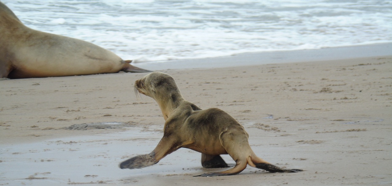
Sea lion pups were just one of the many types of wildlife to suffer when a large marine heatwave that became known as "The Blob" took hold in the Pacific Ocean off the West Coast. Credit: NMFS
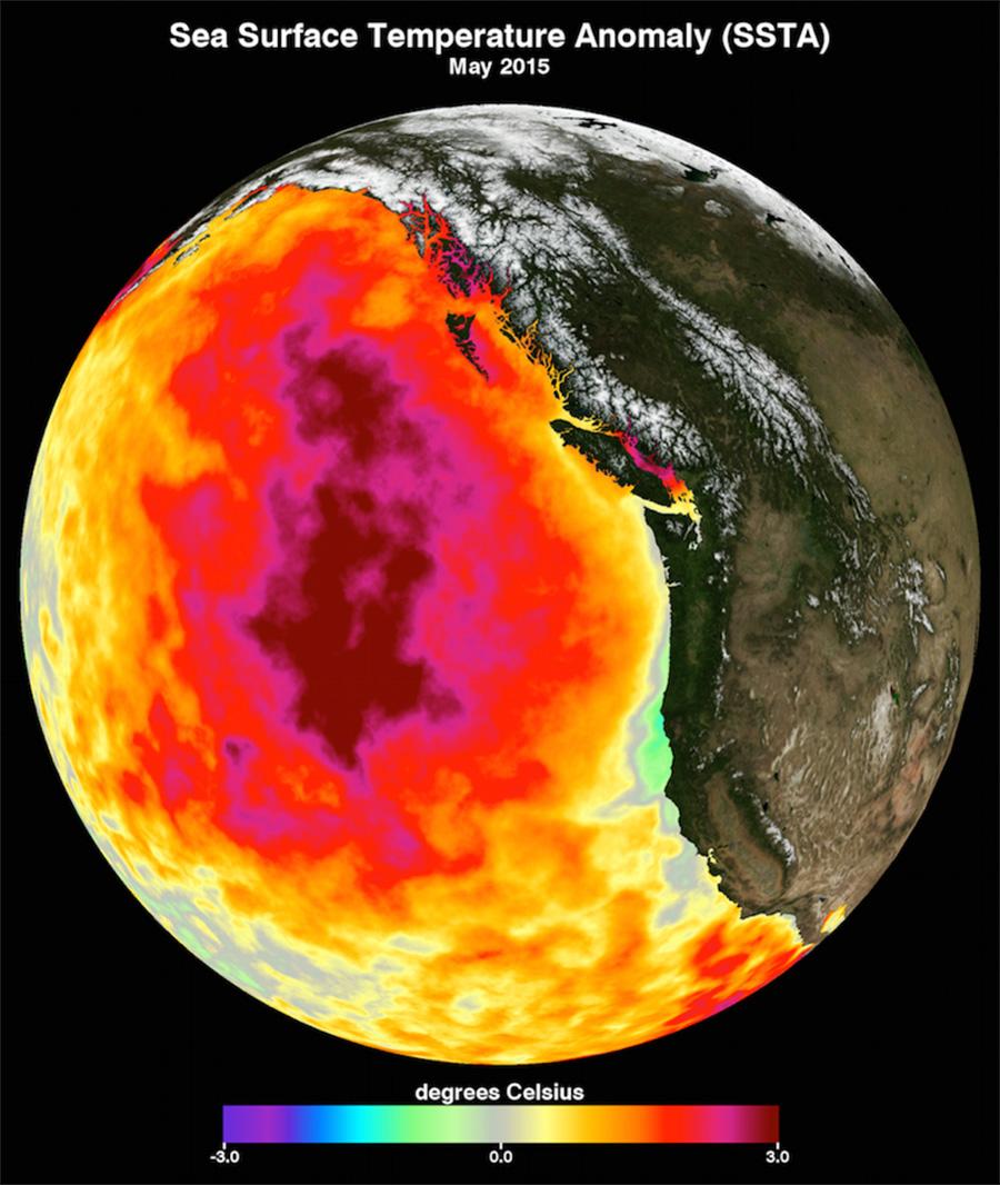
This data image shows the monthly average sea surface temperature for May 2015, the peak of the marine heat wave dubbed The Blob. Credit: NASA Physical Oceanography Distributed Active Archive Center
The North Pacific has warmed significantly faster than any other ocean basin on Earth since 2013, enduring two major marine heat waves in five years that had devastating effects on marine mammals, seabirds, as well as fisheries and the communities that rely on them.
Oceanographers are asking "What’s going on in the North Pacific?"
"How long will sea surface temperatures continue to increase at the rate they have?" asked Michael McPhaden, senior scientist at NOAA's Pacific Marine Environmental Laboratory. "And what will the consequences be? Understanding the underlying physical processes better and developing ways to skillfully forecast the future evolution of this trend are really important."
In a new paper published in Nature Climate Change, McPhaden and a team of researchers from NOAA's Climate Prediction Center and National Centers for Environmental Information describe one of the processes driving the North Pacific's trajectory into uncharted waters.
Rising greenhouse gas concentrations in the atmosphere, they said, are driving more heat into the ocean's surface layer. This creates a greater temperature differential with deeper water and less turbulent mixing with colder water at depth, which causes the surface mixed layer to become thinner. Heat entering the ocean becomes trapped in this shallower layer, which further accelerates surface warming.
This dynamic also creates a negative feedback, albeit not nearly enough to counter the warming trend. Warmer surface water evaporates more quickly, transferring heat back to the atmosphere and reducing the rate at which sea surface temperatures would otherwise rise.
The increase in global ocean temperature during the last few decades has been well documented. Sea surface temperatures increased during the 20th century and continue to rise. Sea surface temperature has been consistently higher during the past three decades than at any other time since reliable observations began in 1880. The year 2023 was the warmest ever recorded.
Record high sea surface temperatures in 2023 were accompanied by marine heatwaves around the globe, including in much of the North Atlantic Ocean, parts of the Mediterranean Sea, Gulf of Mexico and the Caribbean Sea, Indian Ocean and North Pacific Ocean.
McPhaden noted that previous research has demonstrated that in most parts of the global ocean, the surface mixed layer is getting thinner due to global warming. "We can see evidence of this in other basins," he said. "so there must be something else going on to distinguish the North Pacific."
How much of this accelerated warming results from processes internal to the North Pacific as opposed to remote forcing from higher or lower latitudes, or from other ocean basins, is an open question, he said.
"Whatever the ultimate causes, this temperature rise can’t continue forever at the current rate," said McPhaden. "What will the North Pacific look like 10-20 years from now? The rate of warming may slow down or plateau, but in either case we will need an improved decadal forecast system to help us prepare for that future."
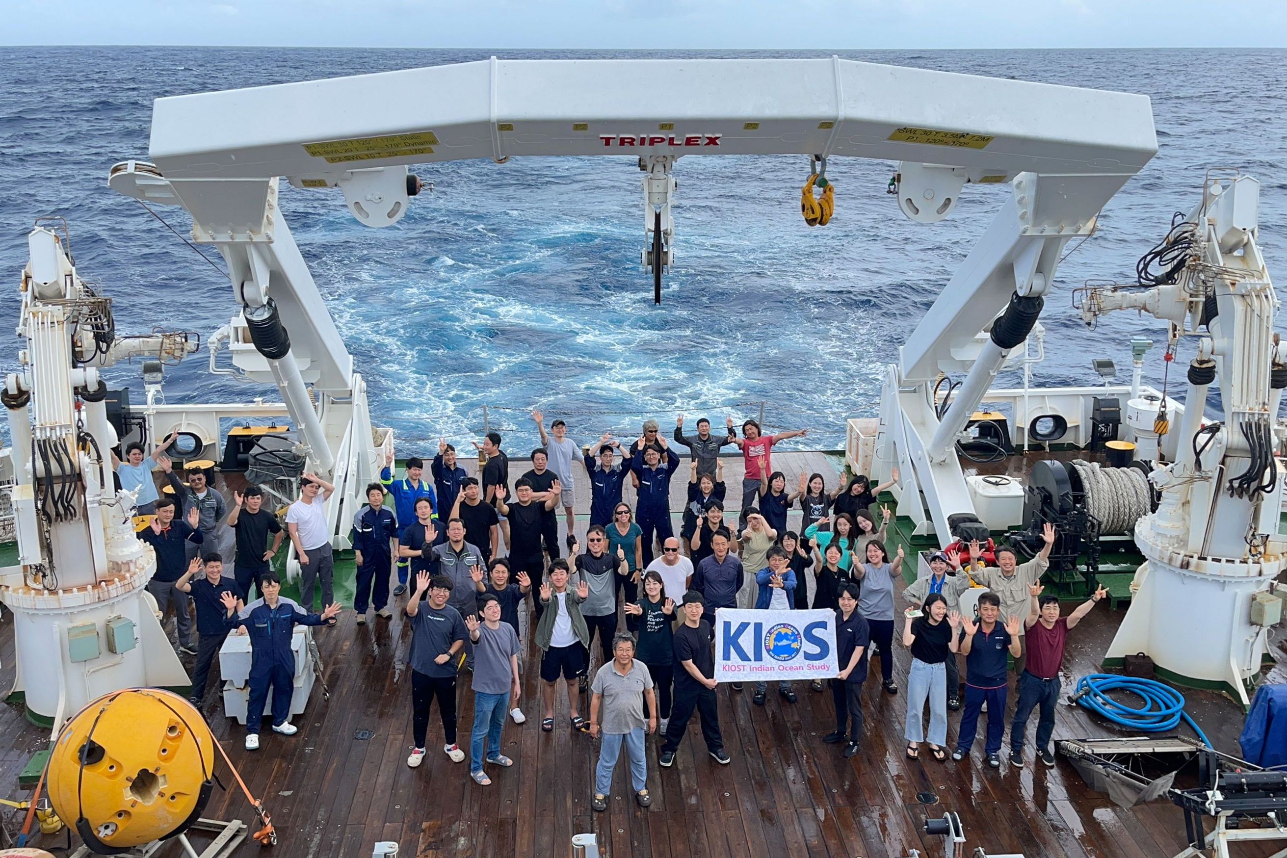
Group photo of RAMA/KUDOS/KIOS research cruise participants aboard the R/V ISABU in June 2023. Photo Credit: Chang-yeol Lee (Korean Educational Broadcasting System)
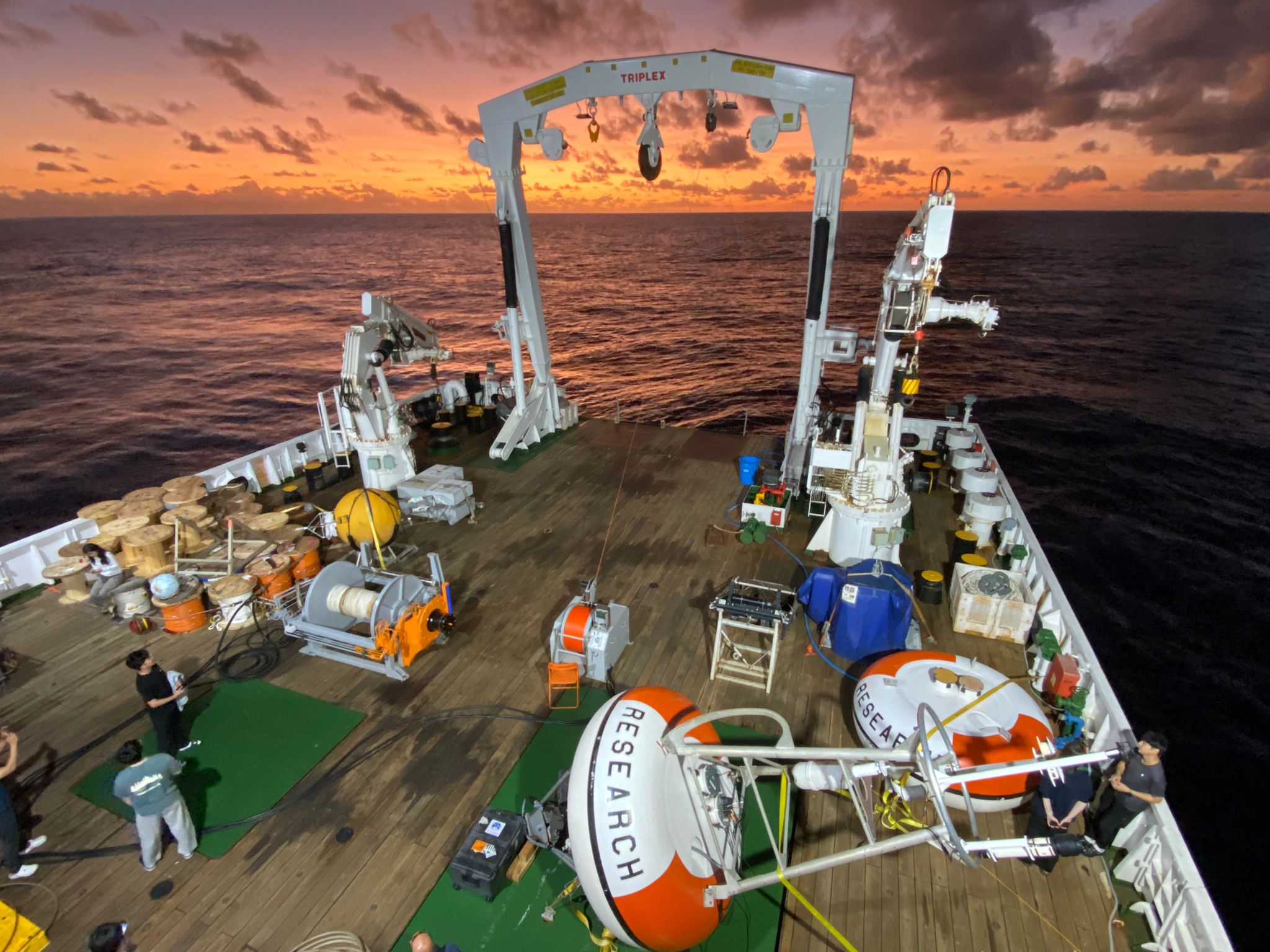
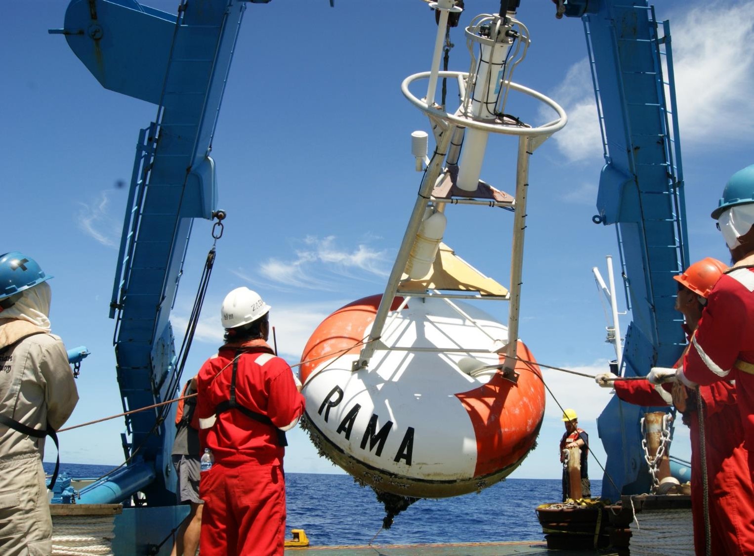
RAMA moorings staged on the aft deck of the R/V ISABU in preparation for deployment. Photo Credit: Tara Clemente (UW CICOES/NOAA PMEL)
May 15 – June 11, 2023: The Korea Institute of Ocean Science and Technology (KIOST) recently hosted NOAA’s Pacific Marine Environmental Laboratory (PMEL) on a research cruise aboard the KIOST ship R/V ISABU to maintain moorings as part of the multi-national Research Moored Array for African-Asian-Australian Monsoon Analysis and Prediction (RAMA).
One third of the world population depends on monsoon driven rainfall for agricultural production. RAMA provides crucial data in the traditionally data sparse Indian Ocean to better improve our understanding of the Indian Ocean’s role in the monsoons and support monsoon predictions.
PMEL staff Tara Clemente and Mike Strick participated on the research cruise and led the RAMA moored buoy operations. The team successfully deployed three RAMA moored buoys at 12°S 65°E, 8°S 65°E, and 4°S 65°E and deployed one subsurface ADCP mooring at 8°S 65°E. In addition to the moored buoy objectives, PMEL staff deployed eight (8) Lagrangian drifter buoys in support of the NOAA’s Global Drifter Program (GDP).
The three moored buoy sites deployed along 65°E are newly established mooring sites relocated from previously occupied mooring sites along 67°E. The new locations for these RAMA moorings are intended to better coordinate the joint Korea-U.S. Indian Ocean Scientific (KUDOS) Research Program and the KIOST Indian Ocean Study (KIOS) in the Seychelles-Chagos Thermocline Ridge region. An area around 8°S, 65°E has been established as the “RAMA K study site” and KIOST will be relocating additional subsurface moorings to this location in 2024.
Another notable event during this cruise was the recovery of the mooring from 8°S, 67°E that had gone adrift on 18 September 2022. The ISABU was able to intercept the drifting buoy and safely recover the buoy, sensors, and high-resolution data on board.
NOAA PMEL is grateful for the partnership with KIOST and wishes to commend the crew of the ISABU and the participating scientists for a successful RAMA/KUDOS/KIOS cruise.
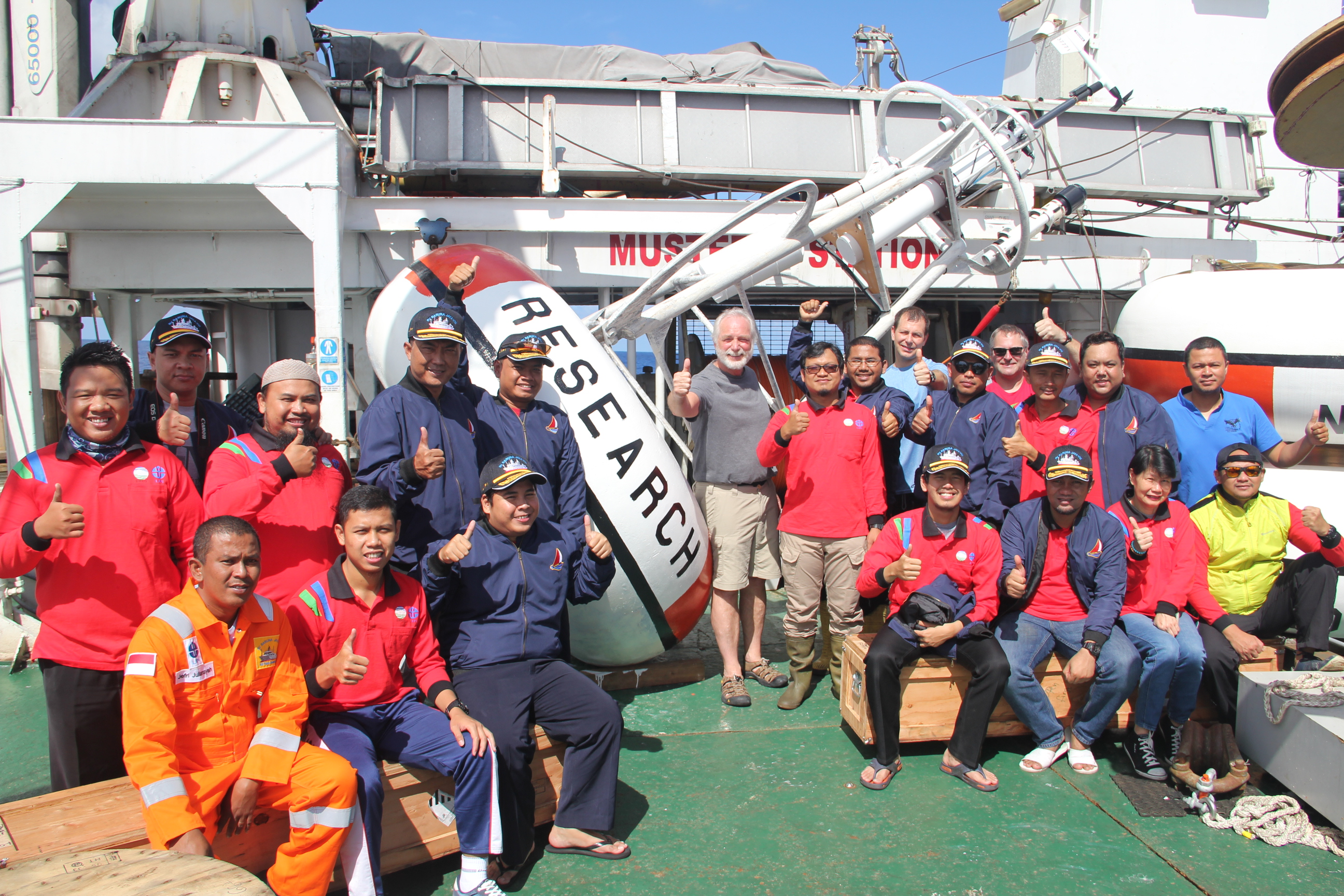
Indonesia BMKG and NOAA scientists participating on a joint RAMA cruise (February - March 2017) in the Indian Ocean aboard the Indonesian Research Vessel Baruna Jaya-VIII.
On July 29, 2022, representatives from NOAA and the Indonesian Meteorology, Climatology, and Geophysical Agency (BMKG; Badan Meteorologi, Klimatologi, dan Geofisika) signed an updated Memorandum of Understanding (MOU) that extends the partnership agreement between NOAA and BMKG for five more years. This renewed MOU marks 17 years of successful long-term partnership that was first established in 2005 and later formalized with the signing of the first MOU in 2012.
This bilateral partnership leverages mutually beneficial resources that strengthen our combined capabilities in ocean and atmospheric observations for improved weather and climate prediction. Some of the highlights of this partnership include delivery of improved information for regional climate decision support services, PhD opportunities in the US for Indonesian students, training and capacity building opportunities for Indonesian scientists at NOAA's Climate Prediction Center (CPC) International Climate Desk, jointly conducted RAMA related field work on Indonesian research vessels in the Eastern Indian Ocean, and annual BMKG-NOAA Partnership Science Workshops.
PMEL provides all the equipment, instrumentation, technical capacity building, and data services for moorings deployed in RAMA. PMEL also provides support for PhD students, participates in the annual partnership workshops, and participates on the annual joint BMKG-NOAA RAMA cruises aboard the Indonesian research vessels to deploy up to five RAMA moorings per year.
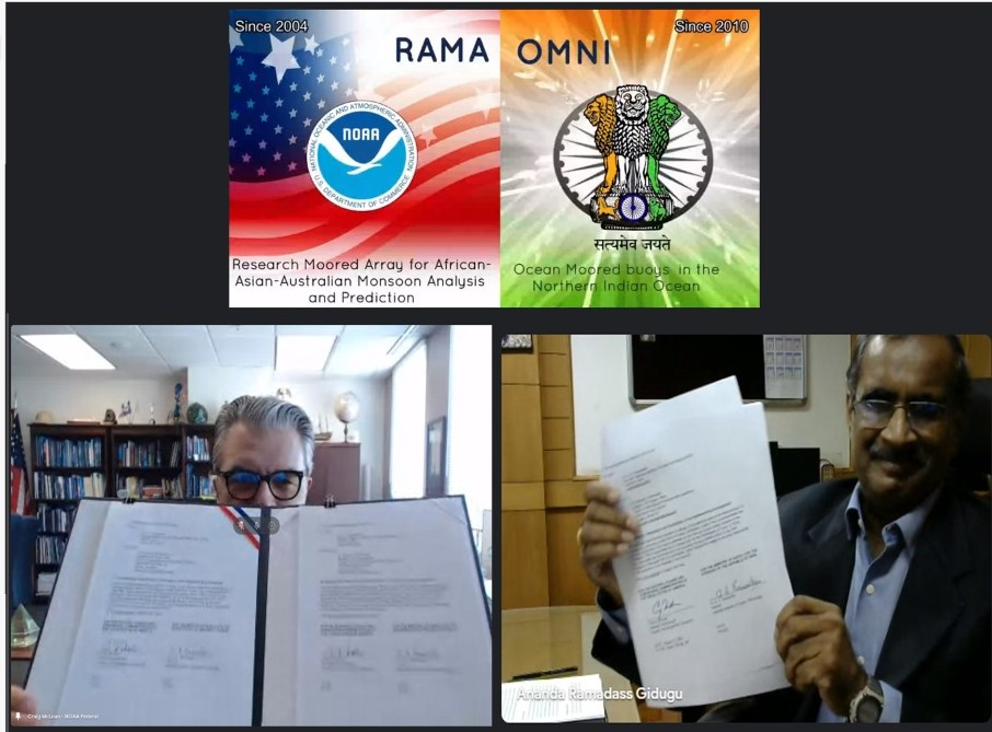
Craig McLean and G. A. Ramadass hold up their signed partnership agreement pages during the virtual ceremony on August 9, 2021.
On August 9, 2021, representatives from NOAA and the Ministry of Earth Sciences (MoES) of India signed an updated partnership agreement that marks more than 12 years of partnership between these nations in the name of ocean and atmospheric observations for improved weather and climate prediction. The virtual signing ceremony included a live demonstration of a new joint oceanographic data portal that makes data from the RAMA-OMNI moored buoy array in the Indian Ocean publicly available for the benefit of global science, forecasting, and disaster preparedness.
“The Indian Ocean is where the monsoon patterns arise that will impact the agriculture and the economic activity of India. But it’s the same basin as well where weather begins that affects North America,” said Craig McLean, NOAA Assistant Administrator for Oceanic and Atmospheric Research. “Our weather in the Americas, the farmlands and what we declare as the production belt of wheat and other crops in the United States - our Midwest - it’s told in advance by understanding what is happening in the Indian Ocean.”
The Research Moored Array for African-Asian-Australian Monsoon Analysis and Prediction (RAMA) was designed to study the Indian Ocean’s role in monsoons, improve monsoon forecasts, and to better study the historically data-sparse Indian Ocean. The first RAMA buoys were deployed by NOAA PMEL in 2004, with the most recent moorings deployed in the Arabian Sea in 2019. MoES has extended operational support to the RAMA array since the earliest deployments. RAMA buoys collect data on a range of atmospheric and oceanic variables, including ocean temperature, salinity, currents, wind, sea level air pressure and humidity. Data collected within RAMA has been extensively used globally and in collaborations between NOAA and MoES scientists to understand the thermohaline structure in the Bay of Bengal, and to validate satellite products and ocean-climate-weather models.
The Ocean Moored Buoys in the Northern Indian Ocean (OMNI) array was initially deployed in 2012, and MoES announced in 2018 that data from the open ocean elements of the OMNI array would be open access and shared freely among researchers to help improve the accuracy of forecasts.
The renewed partnership and joint data portal will significantly benefit the U.S., Indian, and global community working in ocean and climate science, forecasting, and disaster preparedness, especially as we enter the UN Decade of Ocean Science for Sustainable Development and look for new ways to address the climate crisis.
Story modified from NOAA’s Global Ocean Monitoring and Observing Program.

Tara Clemente has recently joined NOAA/PMEL and the University of Washington Cooperative Institute for Climate, Ocean, and Ecosystem Studies (CICOES) as the new Field Operations Manager for the Global Tropical Moored Buoy Array (GTMBA) project. She brings extensive experience in marine operations and oceanographic field program planning. Tara holds an M.Sc. degree in Biological Oceanography from the University of Hawai'i at Manoa (UH). Prior to joining PMEL Tara lived and worked in Honolulu, Hawaii for 21 years. At UH, Tara worked as the Program Operations Manager for the Hawaii Ocean Time series (HOT) and The Simons Collaboration on Ocean Processes and Ecology (SCOPE) programs, two collaborative oceanographic field programs investigating the temporal and spatial variability of the hydrography, chemistry and biology of the North Pacific Subtropical Gyre. She was also the Lab Manager for the Center for Microbial Oceanography Research and Education, C-MORE Hale, a state-of-the-art, LEED platinum facility that supports the comprehensive research of the biological and ecological diversity of marine micro-organisms. To date Tara has participated on over ninety research cruises with the HOT program and dozens of other research cruises between Hawaii, Alaska, California, American Samoa, Rapa Nui and Antarctica, totaling 1500+ days at sea.
41 scientists from PMEL, including scientists from NOAA's cooperative institutes at the University of Washington's Joint Institute for the Study of the Ocean and Atmosphere (JISAO) and Oregon State University's Cooperative Institute for Marine Resources Studies (CIMRS), the National Research Council, graduate and undergraduate students are heading to the Ocean Sciences Meeting in San Diego to share their current research. Talks and posters cover a range of topics include saildrone research, ocean observing systems, marine heatwaves, Arctic, acoustics, Deep Argo, genetics and genomics, El Nino, hydrothermal vents, methane, nutrients, technologies, ocean carbon and data management.
The 2020 Oceans Science Meeting is the flagship conference for the ocean sciences and the larger ocean-connected community. As we approach the UN Decade of Ocean Science for Sustainable Development, beginning in 2021, it is increasingly important to gather as a scientific community to raise awareness of the truly global dimension of the ocean, address environmental challenges, and set forth on a path towards a resilient planet. The meeting is co-sponsored by the American Geophysical Union (AGU), the Association for the Sciences of Limnology and Oceanography (ASLO), and The Oceanography Society (TOS).
PMEL research groups that will be present at the conference are: Acoustics, Arctic including Innovative Technology for Arctic Exploration, Climate-Weather Interface, Earth-Ocean Interactions, EcoFOCI, Engineering, Genetics and Genomics, Global Tropical Moored Buoy Array, , Large Scale Ocean Physics, Ocean Carbon, Ocean Climate Stations, Pacific Western Boundary Currents, and Science Data Integration Group.
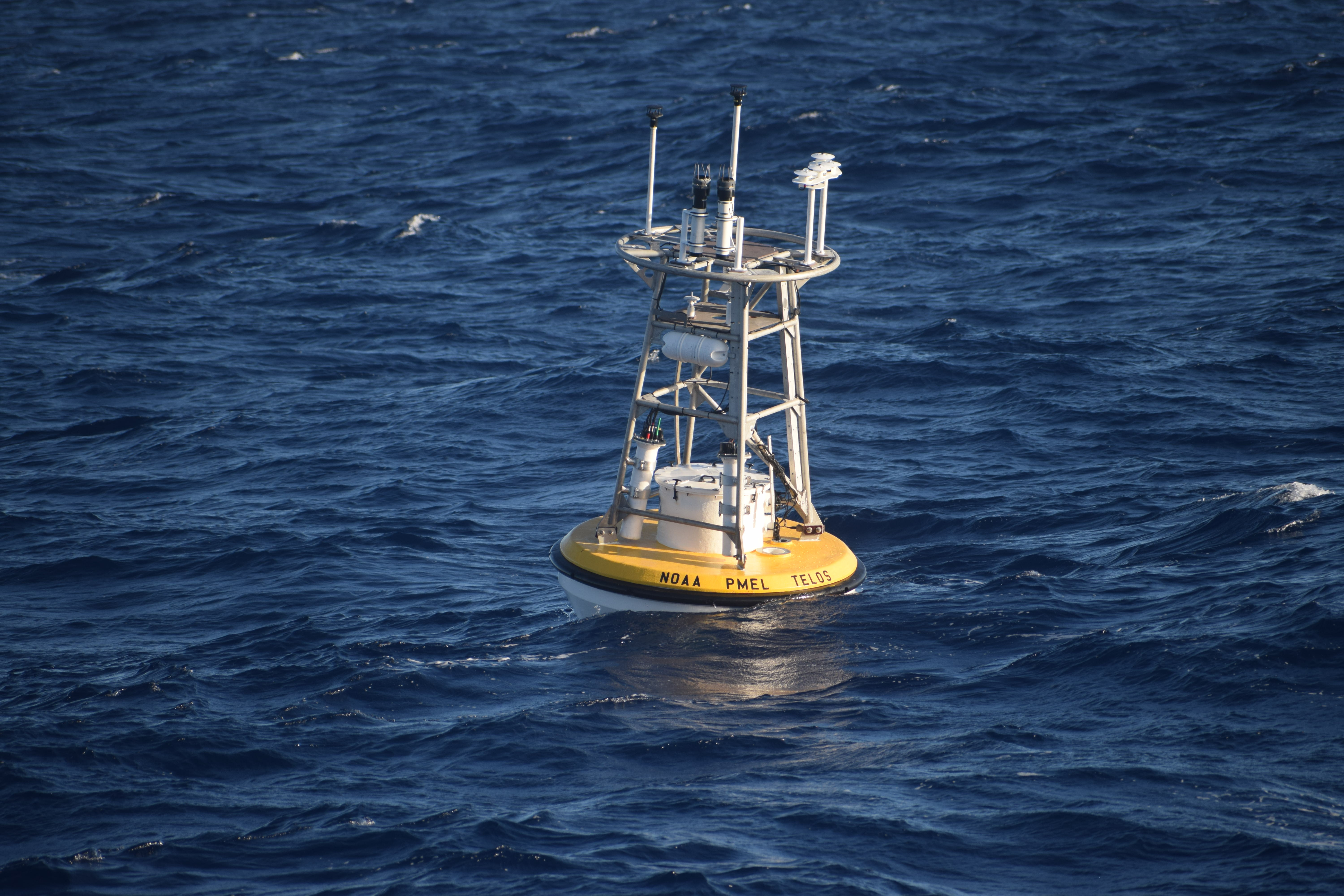
The TELOS protoype mooring interfaces with multiple sensors on the mooring line collecting, storing and transmitting the data in real-time.
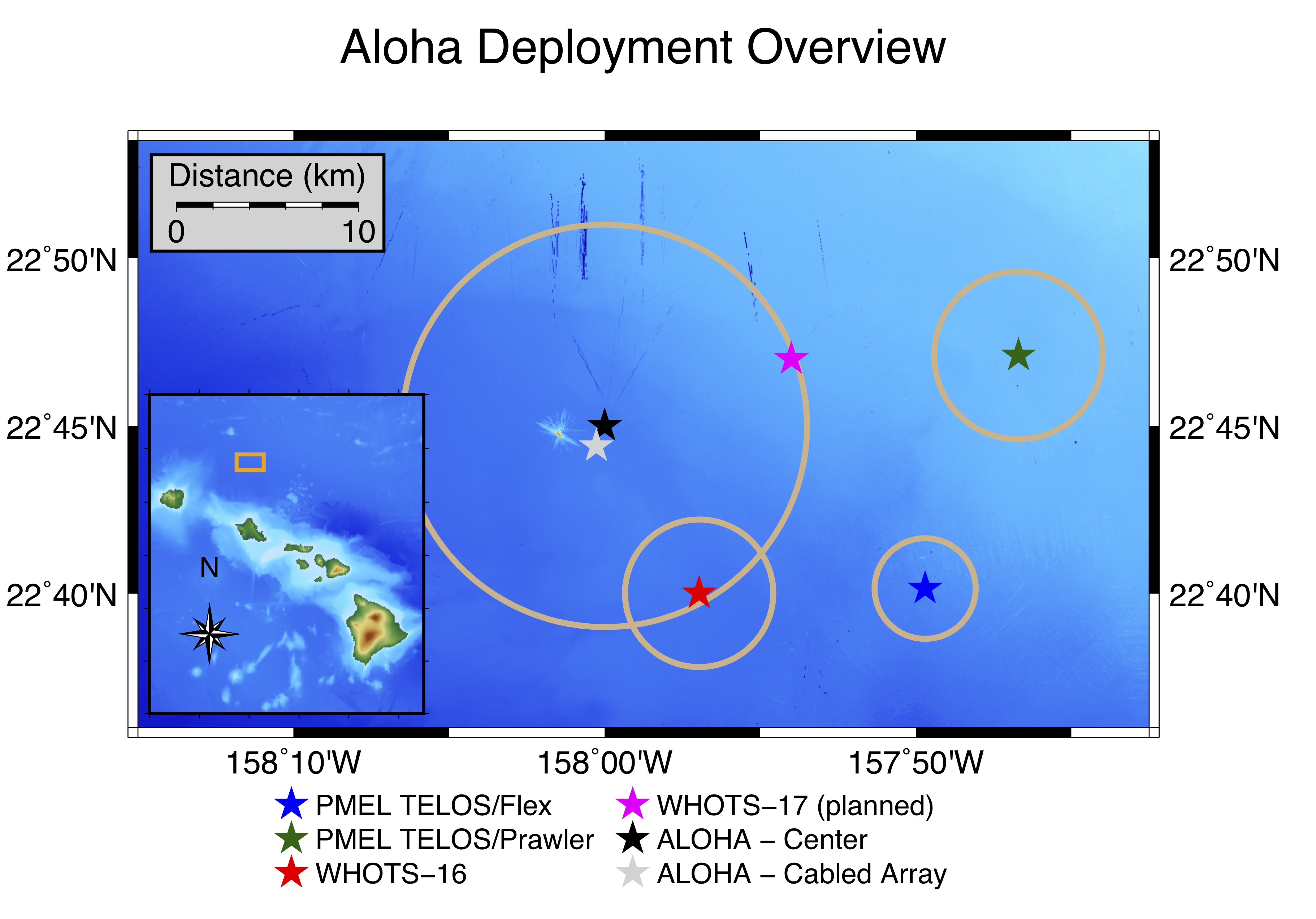
Map of two PMEL prototype TELOS moorings deployed east of Station ALOHA (blue and green stars).
On November 20, 2019, a team of PMEL scientists, engineers, and technicians successfully deployed two deep water oceanographic moorings off the coast of Hawaii to test PMEL’s newest data acquisition system, known as TELOS (Telemetry, Electronics & Logging of Oceanographic Sensors). The “brain” behind oceanographic data collection, TELOS interfaces with the atmospheric and oceanic sensors aboard the moorings -- collecting, storing, and transmitting measured data in real-time via satellite telemetry.
Station ALOHA, located 90 miles north of Oahu, is a well-established hub of ocean research. The site contains a cabled array seafloor observatory, a Woods Hole Oceanographic Institution surface mooring (WHOTS), long-range profilers, autonomous gliders, and other equipment. With the abundance of ocean observations on site, frequent ship visits, and ease of access from a US port to ocean depths greater than 4,500 meters (nearly 3 miles), the site offers an ideal testbed to evaluate the new TELOS technology.
The two deployments near Station ALOHA represent the first-ever open-ocean moorings with TELOS. One mooring contains a standard set of 13 line-mounted temperature/salinity instruments at depths ranging from 1 meter to 500 meters, two current meters, and a full suite of six meteorological instruments similar to the instrumentation on well-established Global Tropical Moored Buoy Array and Ocean Climate Stations moorings. A backup data acquisition system with a duplicate suite of six meteorological instruments is deployed on this mooring for comparison to an established control system. The second mooring also includes the standard set of 6 meteorological instruments and features a PMEL subsurface Prawler device that crawls up and down the mooring line, transmitting upper-ocean temperature/salinity profile data and potentially replacing the need for multiple in-line instruments. Both moorings will be evaluated over the 1-year deployment period to compare the data acquisition systems, using measurements from both moorings as well as the WHOTS mooring for additional comparison. TELOS has already demonstrated the capability to collect, process, and return higher volumes of real-time data than previous data acquisition systems, with the additional capacity for integrating new instrumentation.
So far, the mission has been a success. High-resolution real-time data are transmitted to PMEL via satellite, and scientists are developing visualization tools and analyzing data quality. The full data payload will be downloaded from the moorings in late 2020, testing the ability to survive a yearlong deployment at sea. If successful, TELOS will be scaled up for implementation across the PMEL mooring networks, transforming the future of oceanographic data collection.
Buoys part of the Research Moored Array for African-Asian-Australian Monsoon Analysis and Prediction (RAMA) are designed to study the Indian Ocean’s role in the monsoons.
Rainfall declines may affect U.S. West Coast and parts of the East Coast
New research by NOAA and a visiting scientist from India shows that warming of the Indo-Pacific Ocean is altering rainfall patterns from the tropics to the United States, contributing to declines in rainfall on the United States west and east coasts.
In a study published this week in the journal Nature, researchers report a doubling in the size of a warm pool of water spanning the western Pacific and eastern Indian Ocean in recent years. This Indo-Pacific warm pool in what is already the warmest part of the global ocean is expanding each year by an area the size of California.
The expansion is changing a key weather and climate feature called the Madden Julian Oscillation, which is characterized by a band of rain clouds that move over the tropical ocean from the Seychelles off Africa toward India and into the Pacific Ocean, influencing everything from monsoons in India to heat waves and flooding in the United States.
Warming ocean driving change in key climate pattern
The changes in the behavior of the MJO have brought a decline in rainfall to the central Pacific, the west and east coasts of the United States, north India, east Africa and the Yangtze basin in China. These same changes are causing an increase in rainfall over northern Australia, the Amazon basin, southwest Africa and Southeast Asia, researchers conclude.
“NOAA is part of coordinated international efforts to extend the range of accurate weather forecasts out to lead times of two to four weeks and the MJO is one of the most important keys to the success of this enterprise,” said Michael McPhaden, a senior scientist at NOAA’s Pacific Marine Environmental Lab and co-author of the study. “Our research provides a critical benchmark for determining which computer models to trust for extended range weather forecasting, based on their ability to simulate the observed behavior of the MJO in changing the climate.”
Though the entire Indo-Pacific Ocean has warmed, the warmest waters are over the west Pacific, creating a temperature contrast that drives moisture from the Indian Ocean to the west, enhancing cloud formation. This has changed the life cycle of the MJO. The length of time these clouds linger over the Indian Ocean has shrunk by four days from an average of 19 to 15 days. Over the west Pacific, the clouds now reside five more days. It is this change in the residence of MJO-driven clouds that is altering weather patterns around the globe, researchers found.
“Climate model simulations indicate that continued warming of the Indo-Pacific Ocean is highly likely, which may further intensify these changes in global rainfall patterns,” said Roxy Mathew Koll, lead author of the study with the Indian Institute of Tropical Meteorology who worked with McPhaden while visiting PMEL for the last year. “This means that we need to enhance our ocean observational arrays to monitor these changes accurately, and update our climate models to skillfully predict the challenges presented by a warming world.”
The study is part of a collaboration between NOAA and India’s Ministry of Earth Sciences, facilitated by the National Academy of Sciences with funding from NOAA’s Climate Program Office Climate Variability and Predictability Program. In addition to McPhaden, Chidong Zhang, also of NOAA PMEL, is a co-author of the research.
Originally posted on NOAA Research on November 27, 2019.

RAMA—The Research Moored Array for African-Asian-Australian Monsoon Analysis and Prediction— was established in 2004 to address fundamental questions related to the ocean’s role in monsoon dynamics. RAMA is the moored buoy component of the Indian Ocean Observing System (IndOOS), which is a coordinated system of sustained ocean based observing systems in the Indian Ocean designed to complement the constellation of earth observing satellites. IndOOS is in the final stages of a comprehensive, community-based decadal review, the goal of which is to update the observing system design based on new knowledge gained, new technologies that can be brought to bear, and practical lessons learned since inception more than 10 years ago. As part of this review, several recommendations have been made specific to RAMA, including a reconfiguration of the array to reduce its size from 46 to a more manageable 33 moorings. The updated array, referred to as RAMA-2.0, is more robust, capable, and cost-effective for meeting its scientific objectives. The full scope of the IndOOS decadal review, inducing all recommendations, can be found here.
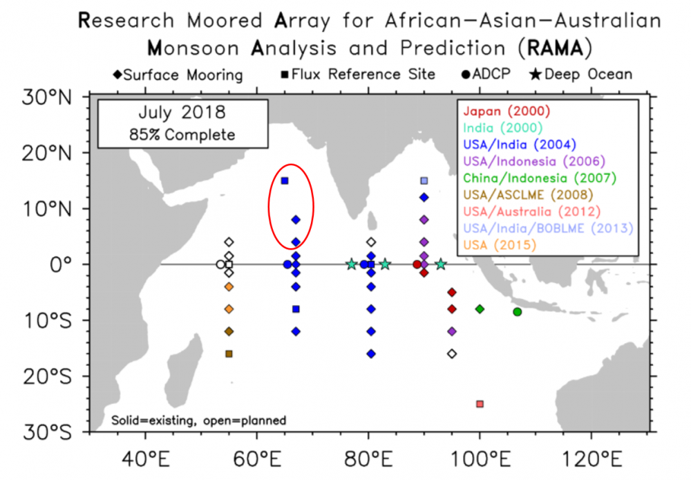
Current RAMA Array Map as of July 2018. The red circle indictes the three new RAMA sites established.
The recent Research Moored Array for African-Asian-Australian Monsoon Analysis and Prediction (RAMA) cruise aboard the NOAA Ship Ronald H. Brown, which departed Goa, India on June 14, established three new RAMA sites in the Arabian Sea along 65E and 67E. The cruise also maintained five existing RAMA moorings along 67E and finished on July 19 in Darwin, Australia.
RAMA was designed to study the Indian Ocean’s role in the monsoons. One third of the world population depends on monsoon driven rainfall for agricultural production, so improving our understanding and ability to predict the monsoons has been a longstanding objective of the international scientific community.
RAMA, the newest tropical moored buoy array (the other two being in the Pacific and Atlantic Oceans), was initiated in the traditionally data sparse Indian Ocean in 2004 via multi-national partnerships led by NOAA/PMEL. The new moorings bring RAMA to near completion and will help NOAA and other weather forecast centers around the world continue to improve monsoon predictions.