What's New Archive
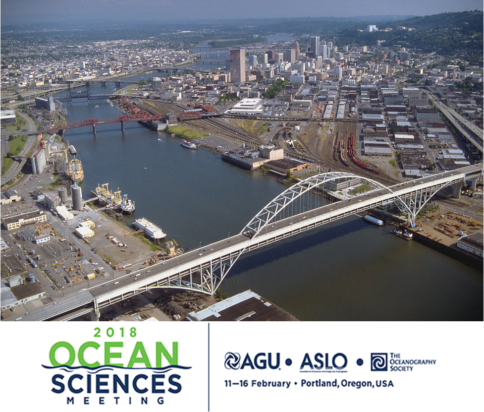
Image of the Willamette River in Portland, OR where the Ocean Sciences Meeting will take place.
More than 50 PMEL scientists, including scientists from NOAA, University of Washington's Joint Institute for the Study of the Ocean and Atmosphere (JISAO), Oregon State University's Cooperative Institute for Marine Resources Studies (CIMRS) and the National Research Council, will present a talk or share a poster on their research at the 2018 Ocean Sciences Meeting in Portland, Oregon February 12-16, 2018. PMEL research groups that will be present at the conference are: Acoustics, Arctic, Earth-Ocean Interactions, EcoFOCI, Engineering, Global Tropical Moored Buoy Array, Innovative Technology for Arctic Exploration, Large Scale Ocean Physics, Ocean Carbon, Ocean Climate Stations, Pacific Western Boundary Currents, Science Data Integration Group, Thermal Modeling and Analysis Project
28 talks will present research on ocean carbon, ocean acidification, ocean observing systems, Arctic research including the Distributed Biological Observatory and Arctic Marine Pulses (AMP), ENSO, MJO, hydrothermal vents, Saildrone research, air-sea interactions, SOCCOM, and ocean mixing. 26 posters will be up during the poster sessions and highlight research in the Arctic, hydrothermal vents, acoustics, methane bubbles and hydrates, Saildrone, Oculus Coastal Glider, ocean carbon, deep ocean temperatures, glider research in the Solomon Sea, and ocean acidification and hyopxia.
PMEL staff will also be chairing sessions and workshops on:
- El Nino-Southern Oscillation (ENSO) Diversity, Predictability, and Impacts
- Western Pacific and Indonesian Sea Circulation and Its Environmental and Climatic Impacts
- New Platform and Sensor Technologies: Advancing Research, Readiness, and Transitioning for Sustained Ocean Observing of Essential Ocean Variables
- Methane from the Subsurface Through the Bio-, Hydro-, and Atmosphere: Advances in Natural Hydrate Systems and Methane Seeps in Marine Ecosystems
- Cascadia Margin methane seep and hydrates to share results and coordinate future work
The 2018 Ocean Sciences Meeting is co-sponsored by the American Geophysical Union (AGU), the Association for the Sciences of Limnology and Oceanography (ASLO), and The Oceanography Society (TOS). The meeting is an important venue for scientific exchange across broad marine science disciplines. Sessions will include all aspects of oceanography, especially multidisciplinary topics, as well as presentations that reflect new and emerging research on the global ocean and society, including science education, outreach, and public policy
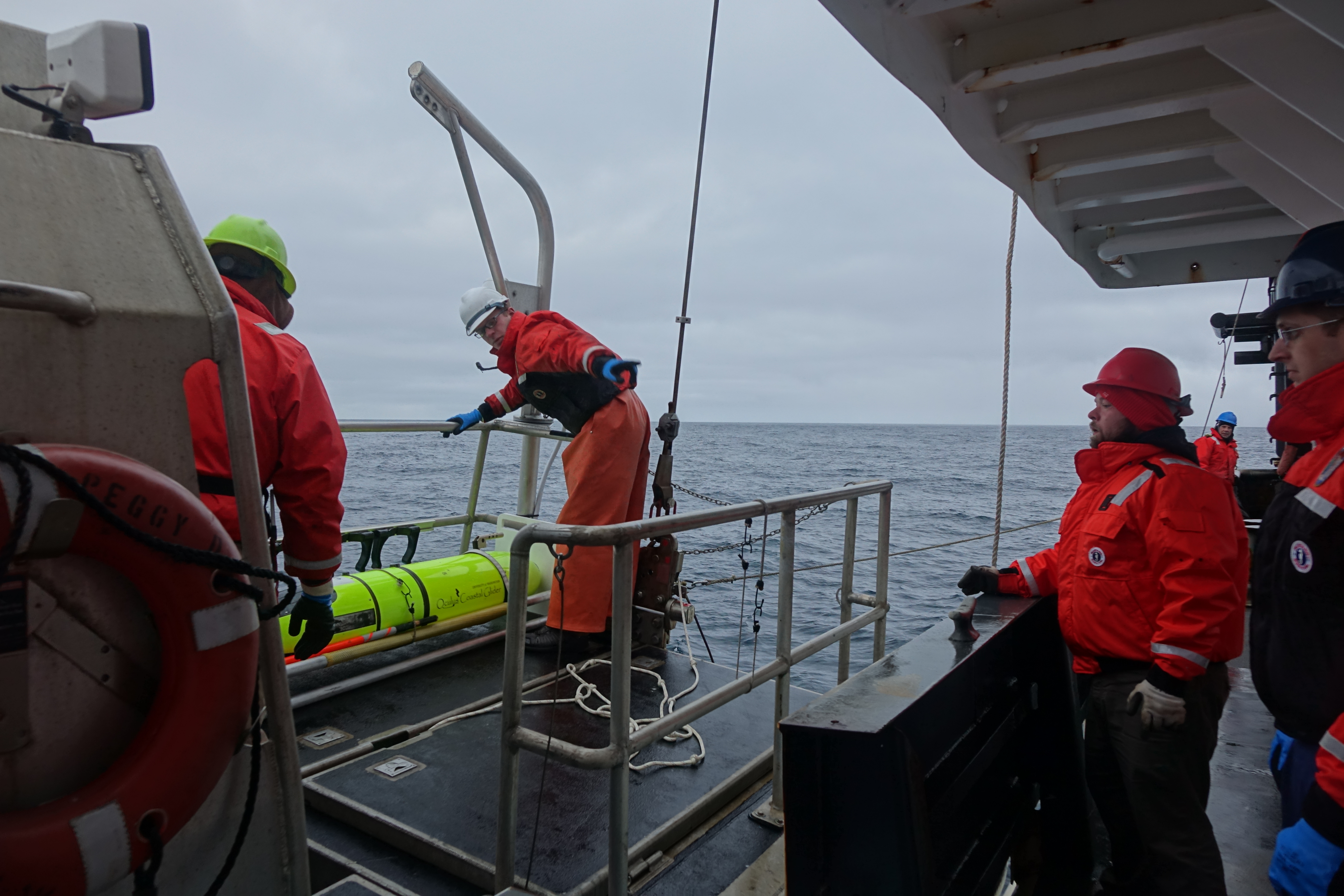
Oculus Coastal Glider being recovered by the crew of the NOAA Ship Oscar Dyson.
After 60 days in the Bering Sea, the Oculus Coastal Glider was successfully recovered by crew of the NOAA Ship Oscar Dyson on September 26, 2017. The glider successfully navigated 242.8 nautical miles, completed 3612 dives, and sampled salinity, temperature, dissolved oxygen, sunlight, and fluorescence at a frequency of approximately 3 dives per hour. The glider was tested in a region with a long history of shipboard and mooring observations that provide context for the Oculus glider's observations. Oculus glider measurements reveal detailed information in a known, important biogeographical transition that divides the ecosystems of the northern and southern Bering Sea shelf near St. Matthew Island. Measurements show unexpected ocean mixing in the water column near the island that may be due to internal waves. Data, sensor, and platform analysis is ongoing. Incorporating this higher resolution sampling into the Bering Sea observing network will improve our understanding of how these features affect the ecosystem.
The Oculus is a coastal glider engineered to work in the highly stratified, shallow depths of the Arctic. By using a rapid buoyancy system, the glider can change buoyancy states 20 times faster and achieve speeds three times faster than legacy gliders - allowing for a more efficient and adaptive Arctic survey, but transferable to a variety of markets.
This was the second field test for the Oculus coastal gliders. The first field test occurred early May 2017, also in the Bering Sea, with 387 dives completed near the M2 mooring site. For the second field test, the glider was deployed from the US Coast Gaurd Cutter Healy during the 2017 Arctic Shield mission.
The Oculus was developed at PMEL in partnership with the University of Washington's Joint Institute for the Study of the Atmosphere and Ocean and the University of Washington Seaglider Fabrication Lab.
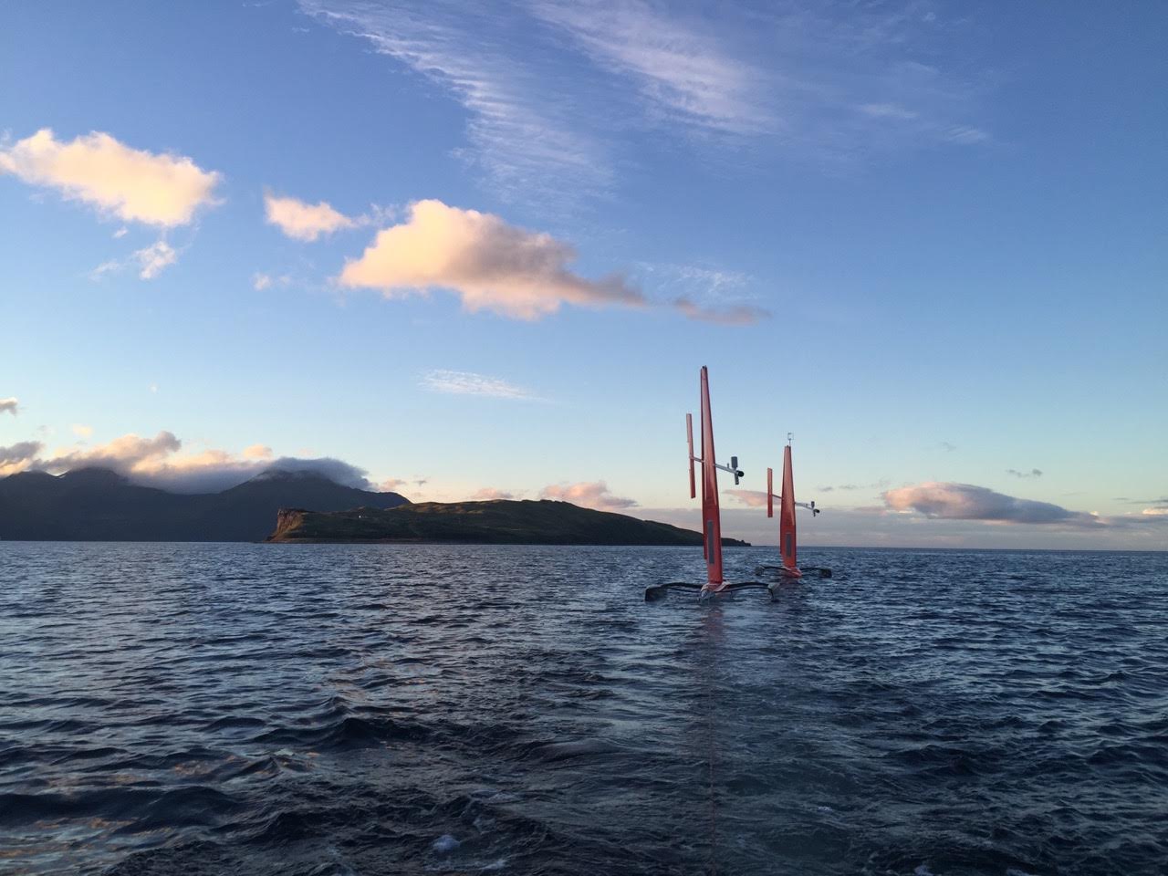
Two Saildrones headed to the tropical Pacific Ocean to enhance the Tropical Pacific Observing System
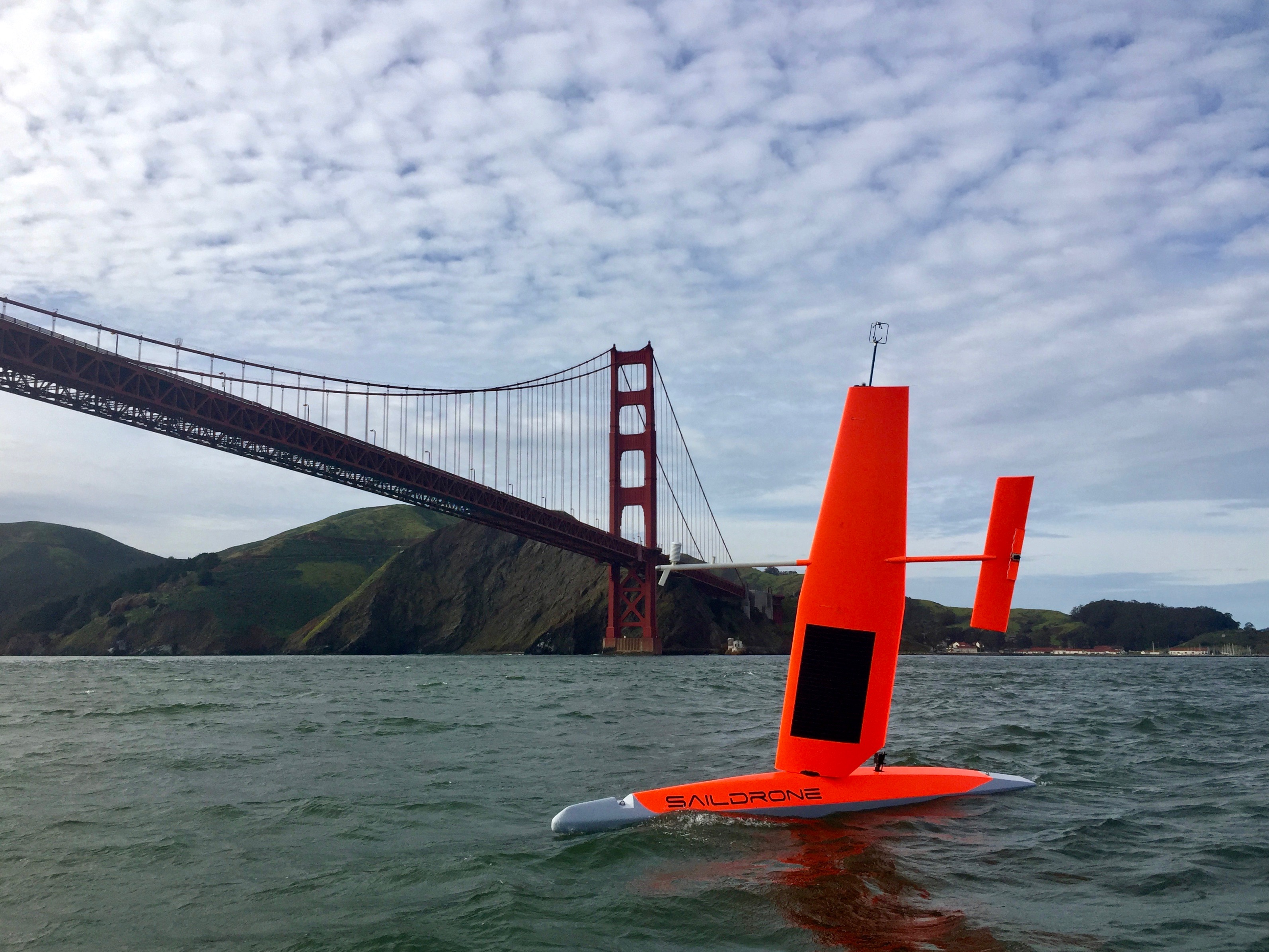
A saildrone as it passes the Golden Gate Bridge in San Francisco, CA. Photo Credit: Saildrone, Inc.
On September 1, two saildrones launched from the Saildrone Inc. dock in Alameda, CA to begin their six-month, 8,000-nautical-mile, round-trip mission to the equator to improve the Tropical Pacific Observing System (TPOS). These saildrones are a component of a broader effort to rethink the Tropical Pacific Observing System (TPOS) that supports sub-seasonal to seasonal forecasting for the US. TPOS provides real-time data used by the US and partner nations to forecast weather and climate, including El Nino. The mission will be testing if this new, enhanced tool can collect a variety of measurements at a quality that matches research ships and proven mooring technology, Tropical Atmosphere Ocean (TAO) array. If this is the case, they may become a powerful tool to provide key observations for weather forecasts.
The saildrones are headed to the California Current Ecosystem (CCE) for a short test before taking part in a larger field study with NASA at the NASA SPURS study site in the eastern Tropical Pacific. The saildrones will perform an intercomparison with the Woods Hole Oceanographic Institution’s (WHOI) buoy and collect observational date in the study site. The saildrones will also do a calibration exercise with a research ship to ensure the accuracy and quality of the measurements that are being collected. This is particularly important to scientists when testing new sensors and technologies. Then the saildrones will travel south to the equator to do intercomparisons with the TAO moorings before heading back to Alameda, CA.
If the mission is successful, the improved data collection can help improve forecasts for El Nino’s and other weather phenomena that develop in the tropical Pacific and strongly impact North American weather patterns.
Read more about the Saildrone missions in the Arctic and the Tropical Pacific here.
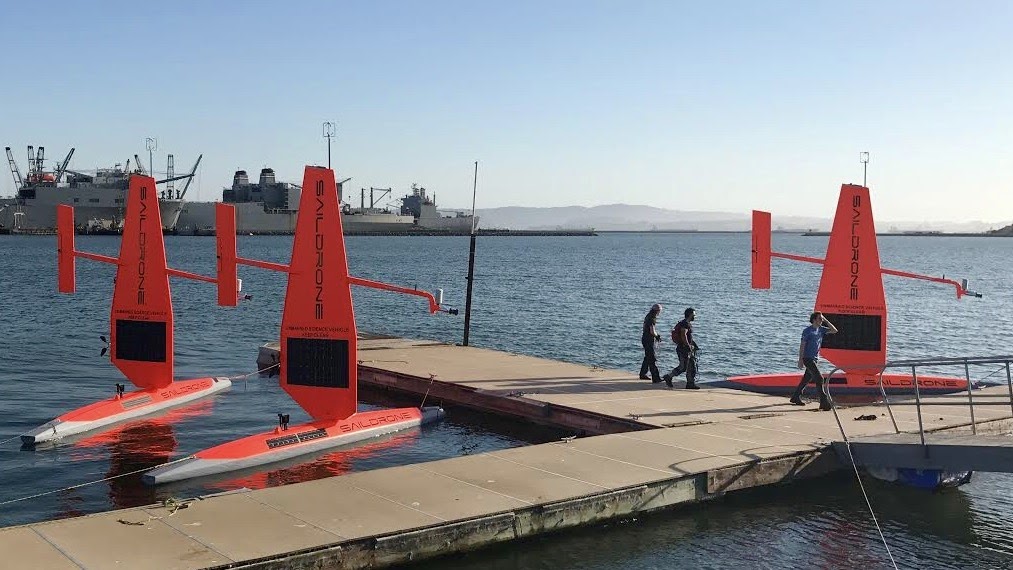
The fleet of saildrones pictured here are being prepared for a summer and fall of science from the Bering Sea to the Arctic to the far reaches of the tropical Pacific Ocean. Credit: Saildrone Inc.
Over the next four months, NOAA scientists will launch unmanned ocean vehicles, called Saildrones, from the Arctic to the tropical Pacific Ocean to help better understand how changes in the ocean are affecting weather, climate, fisheries and marine mammals. The wind and solar-powered research vehicles that resemble a sailboat will travel thousands of miles across the ocean, reaching some areas never before surveyed with such specialized technology.
Earlier this week, PMEL scientists and Saildrone, Inc. sent off three saildrones from Dutch Harbor, Alaska. For the first time, two saildrones will sail north through the Bering Strait into the Arctic Ocean to study how the Arctic Ocean is absorbing carbon dioxide. A third unmanned vehicle will survey more than 3,100 nautical miles in the Bering Sea for walleye pollock, Northern fur seals that prey on them and the elusive North Pacific right whale. This work will build on research conducted during 2016, including a study of fur seal feeding rates. NOAA Fisheries Alaska Fisheries Science Center scientists will also attach video cameras to fur seals to record feeding and verify the species and sizes of fish that fur seals are eating.
In September, scientists will launch two more unmanned systems from Alameda, Calif., on a six-month, 8,000-nautical-mile, round-trip mission to the equator to improve the Tropical Pacific Observing System (TPOS). TPOS provides real-time data used by the U.S. and partner nations to forecast weather and climate, including El Nino. The unmanned sailing vehicles will take part in a larger field study with NASA, and visit mooring sites along the array of observing buoys.
Read the release on NOAA Research here and follow along with the Innovative Technology for Arctic Exploration's Blog for the Bering and Chukchi Seas missions.
May 16-June 2: The second summer field season for the Arctic Heat Open Science Experiment began with its first flight out of Kotzebue, Alaska. The research team, including Kevin Wood, are flying aboard a specially-outfitted NOAA Twin Otter aircraft to launch traditional atmospheric and oceanographic probes as well as the experimental Air-Launched Autonomous Micro-Observer (ALAMO) floats into the Chukchi Sea. After last year's field missions, two ALAMO floats made it through the winter and are currently profiling every 5 days. Check out the raw data for float 9085 and float 9076.
Arctic Heat is an open science experiment, publishing data generated by the project to further NOAA Science Missions with real-time data to facilitate timely observations for use in weather and sea-ice forecasts, to make data readily accessible for model and reanalysis assimilation, and to support ongoing research activities across disciplines.
Arctic Heat is a joint effort of NOAA Pacific Marine Environmental Laboratory (PMEL) Arctic Research, the Innovative Technology for Arctic Exploration (ITAE) program, the ALAMO development group at the Woods Hole Oceanographic Institution (WHOI), and the Joint Institute for the Study of the Atmosphere and Ocean (JISAO) at the University of Washington.
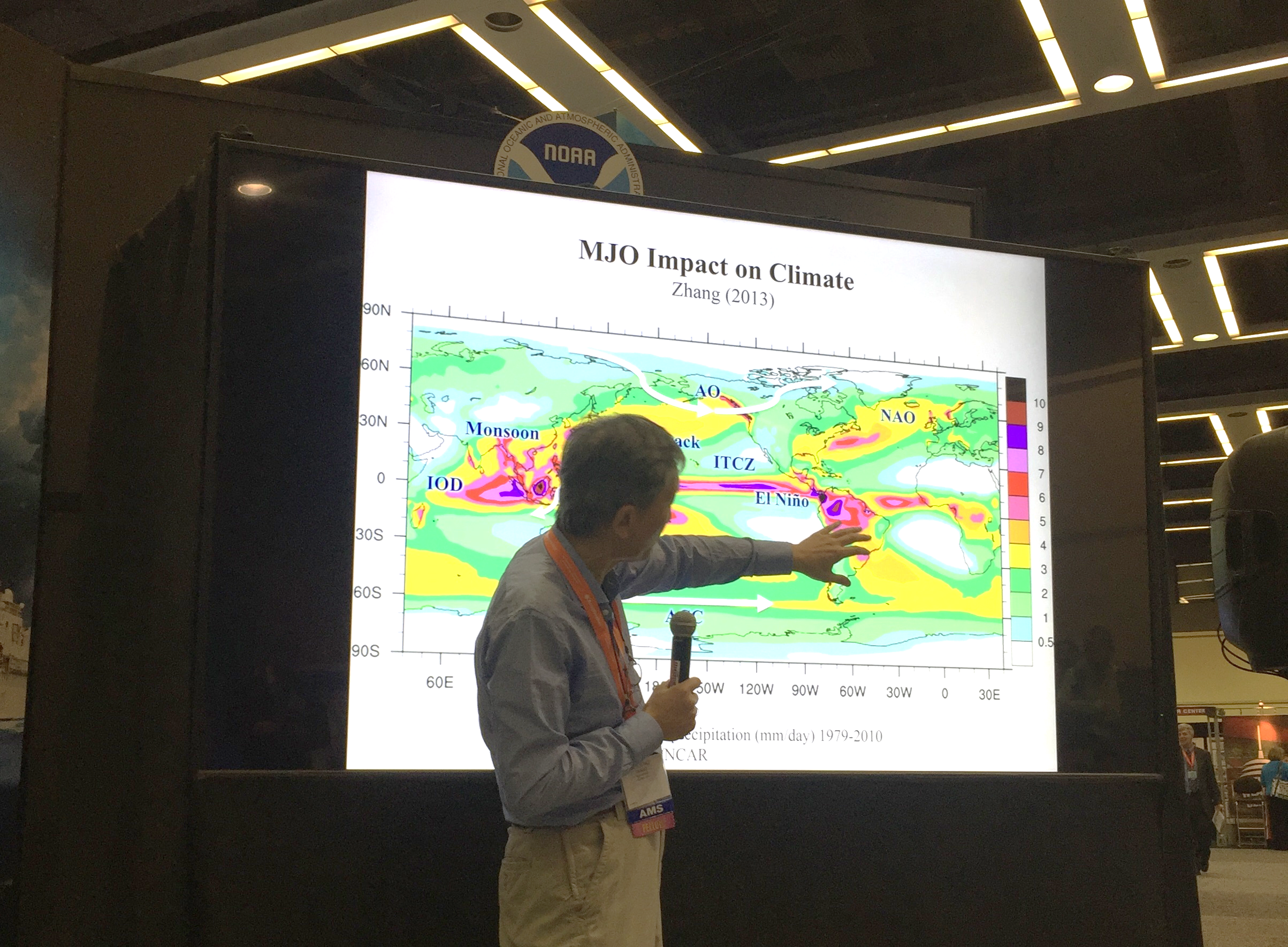
Dr. Chidong Zhang gave a talk at the NOAA Booth during AMS about his research on the Madden Julian Oscillation.
Last week, PMEL scientists attended the American Meteorological Society (AMS)’s Annual Meeting in Seattle, WA and the Alaska Marine Science Symposium (AMSS) in Anchorage, AK. Presentations covered research in the Bering Sea, data management and access, El Nino, sea ice, the Earth's energy imbalance, innovative technologies, and recent warming in the Pacific and others.
At AMSS, the Ecosystems and Fisheries-Oceanography Coordinated Investigations (EcoFOCI) group had multiple presentations and posters on the Bering Sea including topics on the recent marine heat wave in Alaska, linking annual oceanographic processes to contiguous ecological domains in the pacific Arctic, fish distributions, ecology, Saildrone and oceanography.
A wider range of topics were covered at AMS and included invited talks from Nick Bond, Chidong Zhang and Kevin Wood. Dr. Zhang spoke about the Dynamics of the Madden-Julian Oscillation; Kevin Wood presented the Old Weather Project using historical U.S. ship logbooks to collect and analyze historical climate data; and Nick Bond discussed the recent warming in the NE Pacific. The annual meeting is the world’s largest yearly gathering for the weather, water, and climate community and brings together atmospheric scientists, professionals, students, educators and research’s from around the world. AMS is the nation’s premier scientific and professional organization promoting and disseminating information about the atmospheric, oceanic, hydrologic sciences.
Learn more about all our different research themes and groups here.
The saildrones as they make their way to Dutch Harbor, AK for recovery. Photo Credit: Saildrone, Inc.
On September 3, after three months of collecting data in the Bering Sea, the two Saildrones have been safely recovered. The Saildrones each traveled almost 3000 nautical miles in 101 days. After arriving in Dutch Harbor, AK, the Saildrones were packed into a container and shipped to their home base in San Francisco, CA. Data from the tested technologies for fish and marine mammal acoustics are expected mid-September with preliminary analysis completed around the New Year.
This was a collaborative mission between the Pacific Marine Environmental Lab, Alaska Fisheries Science Center, Saildrone, Inc., Simrad AS/Kongsberg Maritime, Greeneridge Sciences, Inc, and Wildlife Computers.
Continue to follow the Saildrone on the Innovative Technology for Arctic Exploration page to learn more about upcoming events and preliminary results in the weeks and months to come.
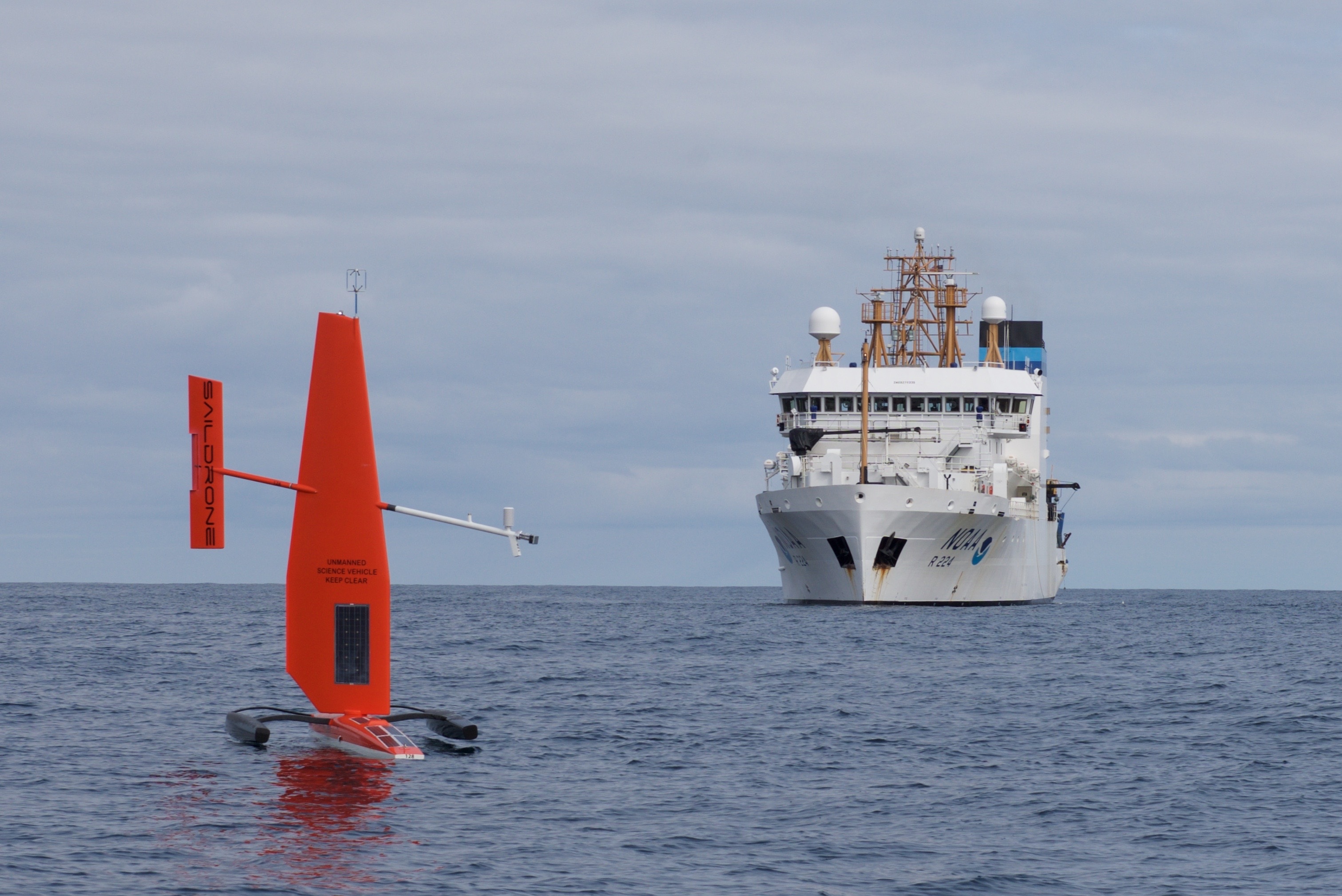
The Saildrone with NOAA ship Oscar Dyson in the background. Photo credit: Mark Frydrych
In April, PMEL and JISAO scientists and engineers teamed up with Saildrone, Inc. to test two Saildrones in the harsh environment of the Bering Sea for the first time. The unmanned instruments sailed from Dutch Harbor, AK on April 22. They have traveled over 2,000 miles each since then, taking over 40 million measurements as they sail north following the ice retreat. With the Arctic environment changing rapidly, the success of these vehicles couldn’t come at a better time. The measurements taken across the eastern Bering Sea have the potential to provide a comprehensive picture of the changes that occur in the late spring environment when the ice is retreating.
Read more about this research on the NOAA Research page and the Innovative Technology for Arctic Exploration site.
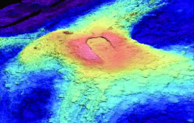
3D image of Axial Seamount bathymetry
PMEL’s Earth-Ocean Interactions program led by Oregon State University Cooperative Institute for Marine Resources Studies scientist, Dr. Bill Chadwick, has just launched a new blog aimed at analyzing and forecasting when the next eruption at Axial Seamount might occur. Axial Seamount is the most active submarine volcano in the NE Pacific. Located on the Juan de Fuca Ridge off the coast of Oregon, it was chosen as the site of the world's first underwater volcano observatory called NeMO and is now a node on the new Ocean Observatories Initiative (OOI) cabled observatory. Axial erupted most recently in 1998 and 2011.
Scientists from PMEL, Oregon State University, and University of North Carolina at Wilmington will be monitoring Axial closely. Watch the blog for forecast updates.

Wave Glider in Prince William Sound. Credit: Wiley Evans.
Led by Dr. Jeremy Mathis, PMEL teamed up with the University of Alaska and the Alaska Ocean Observing System this summer and early fall to use new unmanned tools to study how melting glaciers in Alaska’s Prince William Sound may be intensifying ocean acidification in the sound and on the Gulf of Alaska continental shelf. PMEL engineers outfitted two Carbon Wave Gliders and one underwater Slocum glider with sensors to help better understand the unique processes of glacial melt water and how they change the chemistry of the water column in Prince William Sound.
To read more about this project please visit the NOAA Research News website.