
KEODriftPlot.png
Image
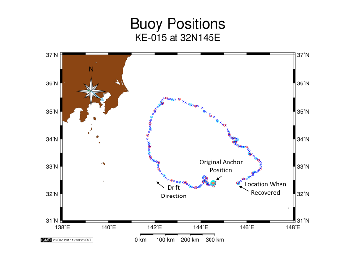
GPS positions from the PMEL KEO mooring during the period when it was adrift show the clockwise motion, which brought the buoy almost back to its anchor location before being rescued.
Official websites use .gov
A .gov website belongs to an official government organization in the United States.
Secure .gov websites use HTTPS
A lock (
) or https:// means you’ve safely connected to the .gov website. Share sensitive information only on official, secure websites.
GPS positions from the PMEL KEO mooring during the period when it was adrift show the clockwise motion, which brought the buoy almost back to its anchor location before being rescued.