
featured_image_horizontal.png
Image
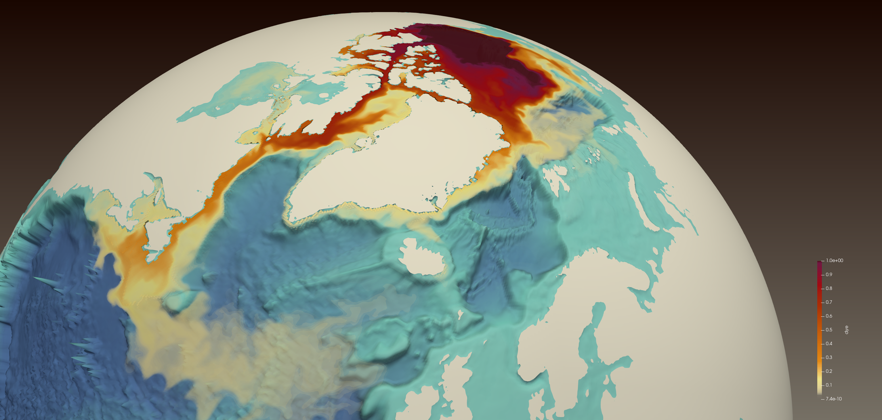
A simulated red dye tracer released from the Beaufort Gyre in the Arctic Ocean (center top) shows freshwater transport through the Canadian Arctic Archipelago, along Baffin Island to the western Labrador Sea, off the coast of Newfoundland and Labrador, where it reduces surface salinity. At the lower left is Newfoundland (triangular land mass) surrounded by orange for fresher water, with Canada’s Gulf of St. Lawrence above colored yellow. Credit: Francesca Samsel and Greg Abram (LANL)