
|
|
||
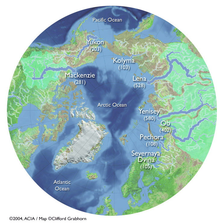
Land - Rivers - ACIA map of Arctic river basins |
||
|
Roads | Permafrost | Tundra | Rivers | Ducks | Caribou Go back to Rivers Arctic river basin map from the Arctic Climate Impact Assessment Report.. Click to see a larger image. The thickness of the blue lines represents the relative river discharge, with the thickest lines indicating the rivers with the largest volume. The numbers on the map are the discharge in cubic kilometers per year.
|
||
| About | http://www.pmel.noaa.gov/arctic-zone/detect oar.pmel.arctic.webmaster@noaa.gov DOC | NOAA | PMEL | Arctic Zone | Arctic Change Detection Privacy Policy | Disclaimer |