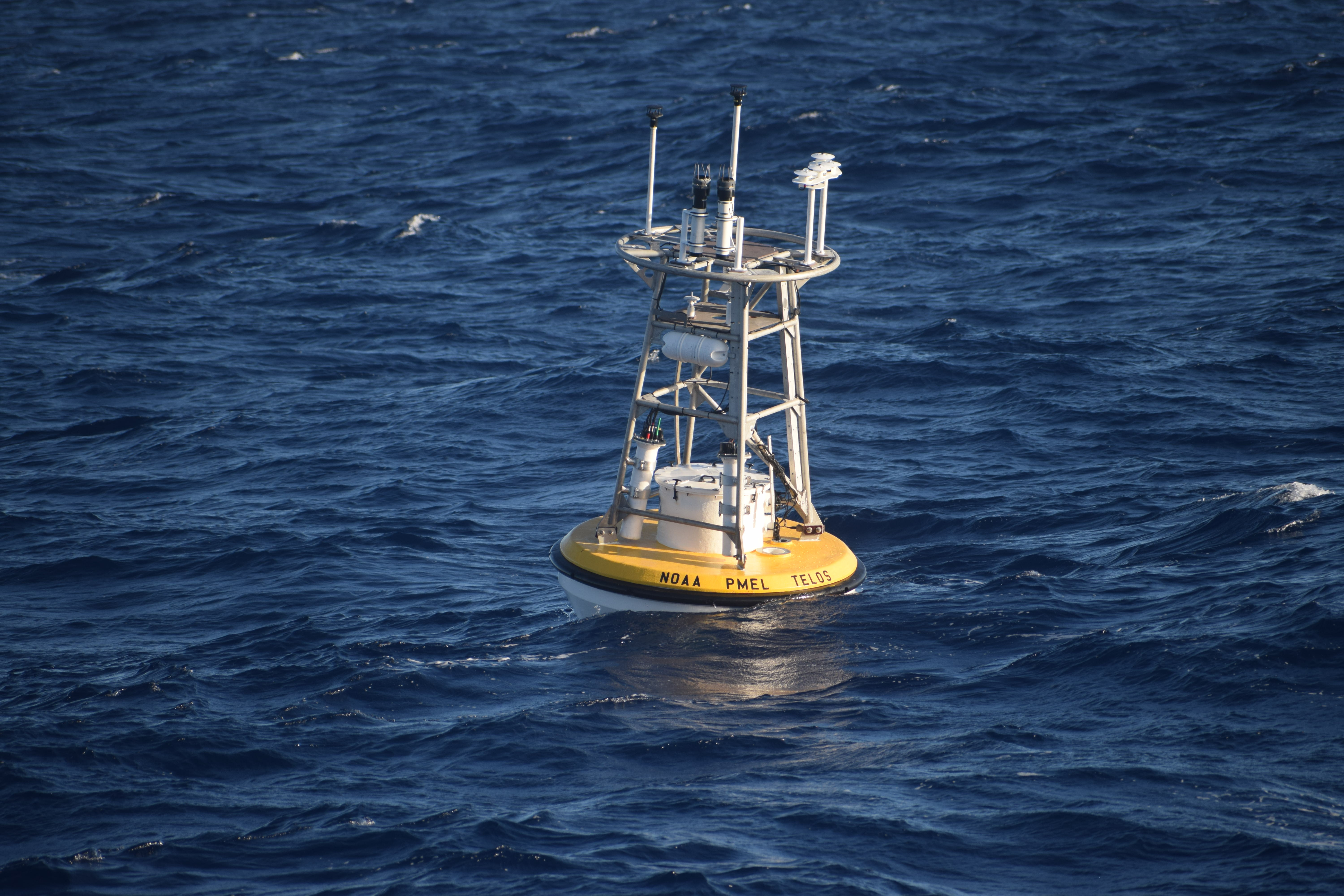
The TELOS protoype mooring interfaces with multiple sensors on the mooring line collecting, storing and transmitting the data in real-time.
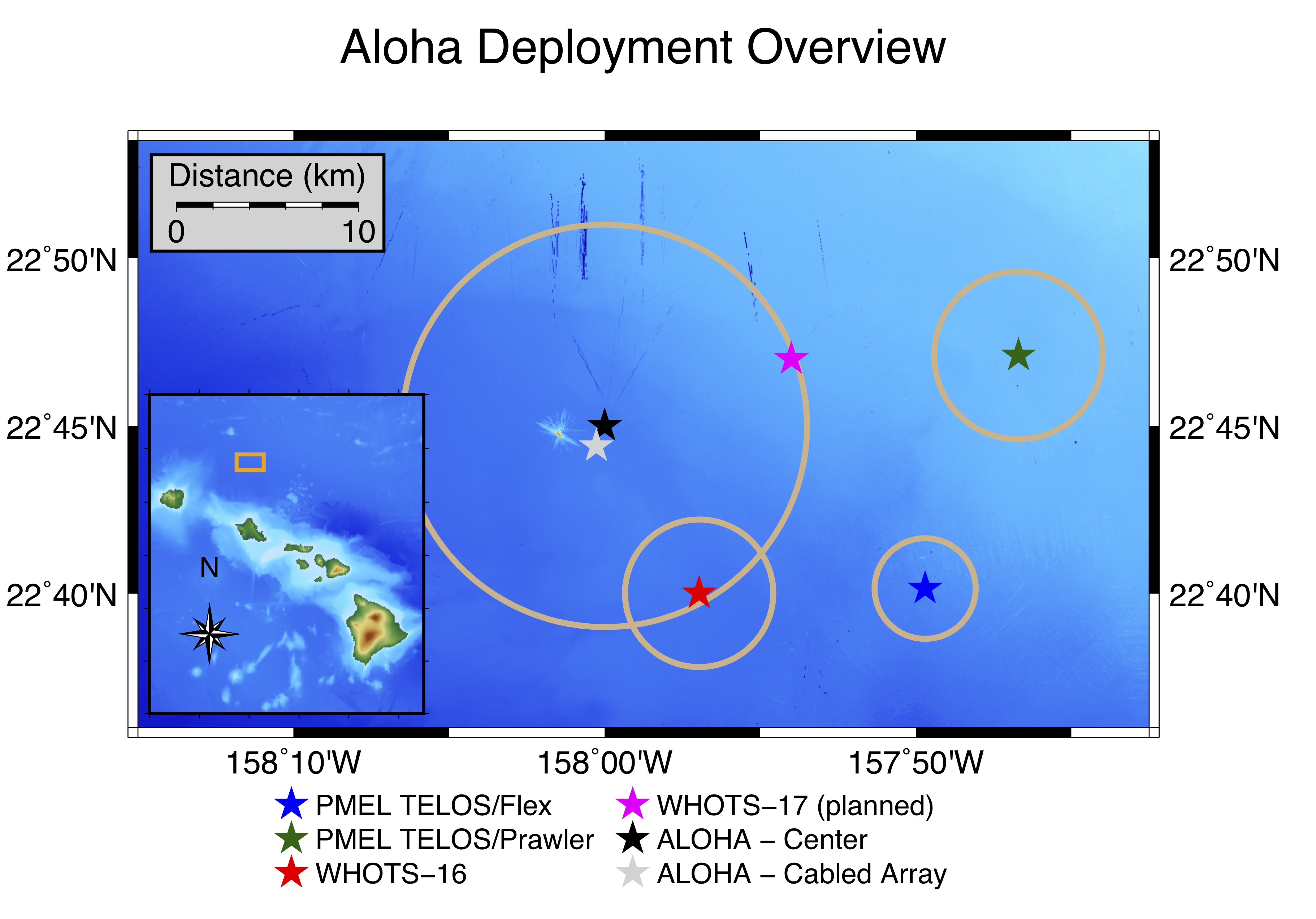
Map of two PMEL prototype TELOS moorings deployed east of Station ALOHA (blue and green stars).
On November 20, 2019, a team of PMEL scientists, engineers, and technicians successfully deployed two deep water oceanographic moorings off the coast of Hawaii to test PMEL’s newest data acquisition system, known as TELOS (Telemetry, Electronics & Logging of Oceanographic Sensors). The “brain” behind oceanographic data collection, TELOS interfaces with the atmospheric and oceanic sensors aboard the moorings -- collecting, storing, and transmitting measured data in real-time via satellite telemetry.
Station ALOHA, located 90 miles north of Oahu, is a well-established hub of ocean research. The site contains a cabled array seafloor observatory, a Woods Hole Oceanographic Institution surface mooring (WHOTS), long-range profilers, autonomous gliders, and other equipment. With the abundance of ocean observations on site, frequent ship visits, and ease of access from a US port to ocean depths greater than 4,500 meters (nearly 3 miles), the site offers an ideal testbed to evaluate the new TELOS technology.
The two deployments near Station ALOHA represent the first-ever open-ocean moorings with TELOS. One mooring contains a standard set of 13 line-mounted temperature/salinity instruments at depths ranging from 1 meter to 500 meters, two current meters, and a full suite of six meteorological instruments similar to the instrumentation on well-established Global Tropical Moored Buoy Array and Ocean Climate Stations moorings. A backup data acquisition system with a duplicate suite of six meteorological instruments is deployed on this mooring for comparison to an established control system. The second mooring also includes the standard set of 6 meteorological instruments and features a PMEL subsurface Prawler device that crawls up and down the mooring line, transmitting upper-ocean temperature/salinity profile data and potentially replacing the need for multiple in-line instruments. Both moorings will be evaluated over the 1-year deployment period to compare the data acquisition systems, using measurements from both moorings as well as the WHOTS mooring for additional comparison. TELOS has already demonstrated the capability to collect, process, and return higher volumes of real-time data than previous data acquisition systems, with the additional capacity for integrating new instrumentation.
So far, the mission has been a success. High-resolution real-time data are transmitted to PMEL via satellite, and scientists are developing visualization tools and analyzing data quality. The full data payload will be downloaded from the moorings in late 2020, testing the ability to survive a yearlong deployment at sea. If successful, TELOS will be scaled up for implementation across the PMEL mooring networks, transforming the future of oceanographic data collection.