Arctic Change NOAA
A near-realtime Arctic Change Indicator website

HOME
NEWS
OVERVIEW
TABLE OF INDICATORS
CLIMATE
Arctic Oscillation
Surface Temps
Stratospheric Temps
Clouds
Ocean
GLOBAL
Global Temperatures City Temps
Ocean Overturning
LAND
Roads
Permafrost
Tundra
Rivers
Waterfowl
Caribou
MARINE ECOSYSTEM
Overview
Bering Sea
Barents Sea
Greenland
ICE
Sea Ice
North Pole
Glaciers
Snow Cover
HUMAN
Socio-economic
Shishmaref
Marine Access
Canadian Marine
Roads

Land - Rivers

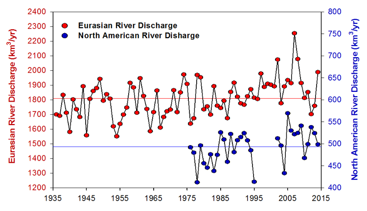
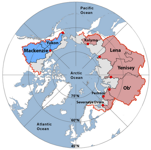
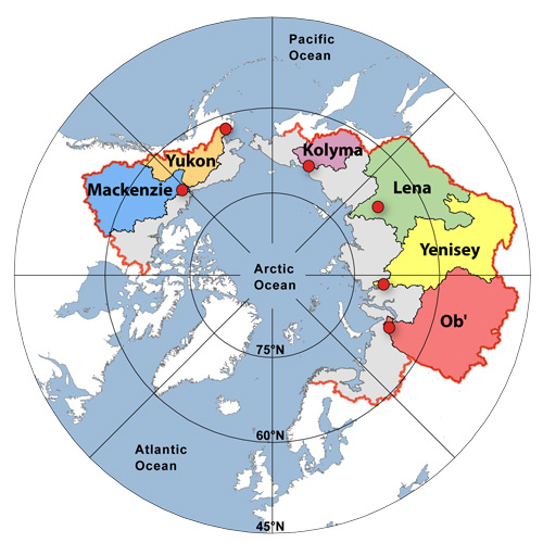
Roads | Permafrost | Tundra | Rivers | Waterfowl | Caribou

See the River Discharge section of the annually updated Arctic Report Card

The Arctic Ocean receives a large amount of fresh water from river runoff relative to its area, compared to other oceans. There are five major rivers that flow into the Arctic, the Mackenzie and Yukon in North America, and the three largest in Asia, the Ob, Yenisey and Lena Rivers.

From the 2015 Arctic Report Card:

Annual discharge of Lena, Ob and Yenisey Rivers
 

Long-term records of annual discharge for Eurasian and North American Arctic rivers. The Eurasian rivers are the Severnaya Dvina, Pechora, Ob', Yenisey, Lena, and Kolyma. The North American rivers are the Yukon and Mackenzie. Note the different scales for the Eurasian and North American river discharge; discharge from the former is 3-4 times greater than it is from the latter. The horizontal lines show long-term mean discharge values for the Eurasian (1,809 km3 y-1) and North American (493 km3 y-1) rivers

Arctic river basins
 

Map showing the watersheds of the eight rivers featured in this report. Together they cover 70% of the 16.8 x 10⁶ km2 pan-Arctic watershed. The red dots show the location of the discharge monitoring stations and the red line shows the boundary of the pan-Arctic watershed.


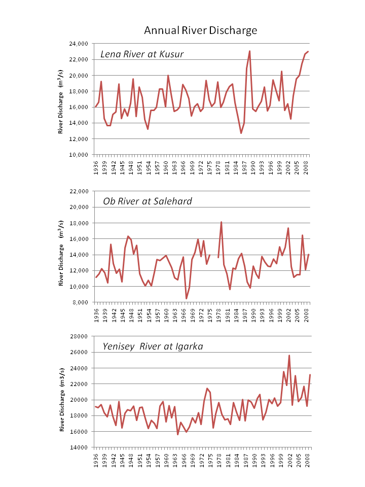
The Ob and Yenisey Rivers show an increase since the 1980s. Discharge from the six largest Asian rivers increased by 7% from 1936 to 1999. [Peterson, et. al., 2002, Science].

Annual discharge of Lena, Ob and Yenisey Rivers
 

Annual discharge of Lena, Ob and Yenisey Rivers. Data from the ArcticRIMS database and R-ArcticNET database. Click for larger image.

Arctic river basins
 

Arctic river basins map from the Arctic Great Rivers Observatory. Click to see larger image. Also available is an alternate map of river basins from the Arctic Climate Impact Assessment Report.


Find more information (references and websites):