Buoy Launched in the Chukchi Sea
Today, the NOAA team led by Noah Lawrence Slavas, deployed a series of environmental buoys.
This article was originally published on the USCG Healy Website
10 July 2015 - Approximately 70 miles northwest of Icy Cape, the NOAA Buoy and wave gliders were launched. Heavy fog was present most of the day, limiting visibility to approximately 0.5 miles. Air temperature ranged from 38 - 49 and the water temperature was a balmy 42 F.
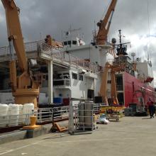
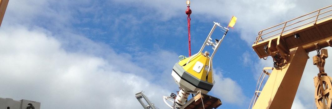
Today, the NOAA team led by Noah Lawrence Slavas, the CGC HEALY crew, and the Coast Guard R&D Center (RDC) test director Jason Story deployed a series of environmental buoys. The purpose of these buoys is to evaluate innovative sensors and techniques to increase NOAA’s observational capabilities as well as to obtain baseline environmental information in the Arctic. The first deployment was a moored 1.5m wide octagonal surface buoy. The buoy has a central instrument well that houses a data logger and alkaline battery packs, an integrated ~1m bridle that holds subsurface scientific instruments, and a bolt-on 2m tower with meteorological instruments. The team is leaving this buoy in the water for three to four months to collect data. The buoy will be recovered by another Coast Guard vessel in the fall before ice re-occupies the mooring site.
In a box-shaped pattern approximately 20 miles around this buoy, the team deployed a series of additional sensors. This included three drifter buoys, like the ones deployed on 8 July, to collect environmental data in the immediate proximity of the moored buoy. The team also conducted Conductivity, Temperature, and Depth (CTD) castings at nine locations to include the initial buoy deployment site. These castings provide a vertical profile of the fundamental ocean properties, and the multiple castings are necessary to determine any variations in the boundary conditions around the moored buoy.
The team also deployed two wave gliders, which are autonomous wave-powered surface vessels with various ecosystem monitoring instruments. The vehicles are controlled via RF and satellite communications and are generally programmed to run track lines between waypoints. One of the wave gliders will provide a broader perspective around the area of the moored buoy while the other will focus specifically on measuring regional carbon processes, which has implications on ocean acidification. The wave gliders will remain deployed in the region for several months.
Tomorrow, the team enters the ice! They will deploy and evaluate multiple air, surface, and subsurface technologies.