Ecosystems Fisheries-Oceanography Coordinated Investigations
Photos pertaining to FOCI studies in Alaskan waters.
NOAA logo

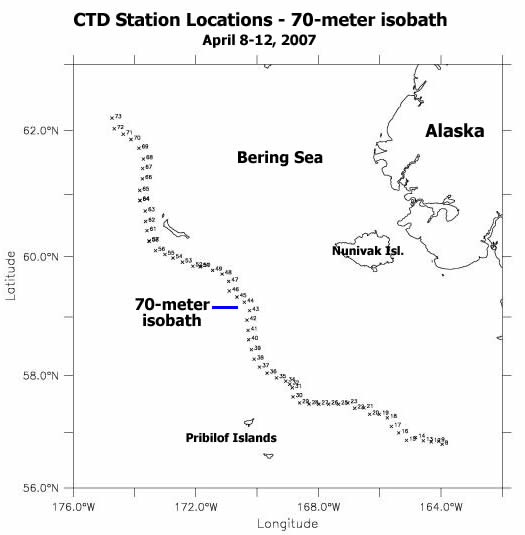
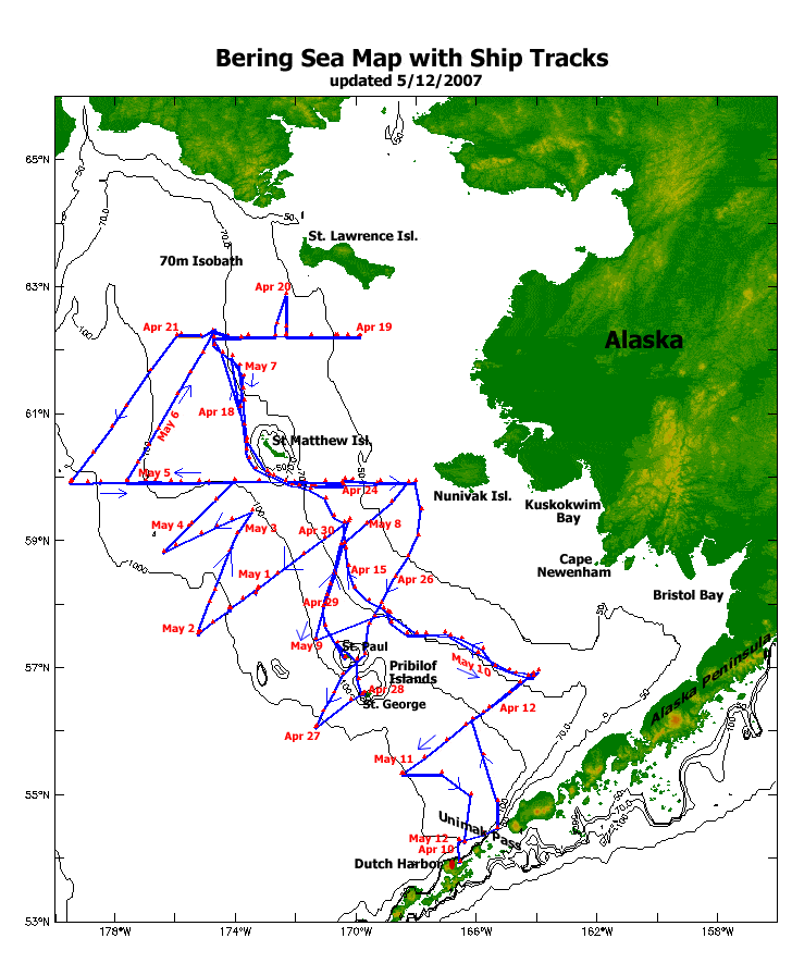
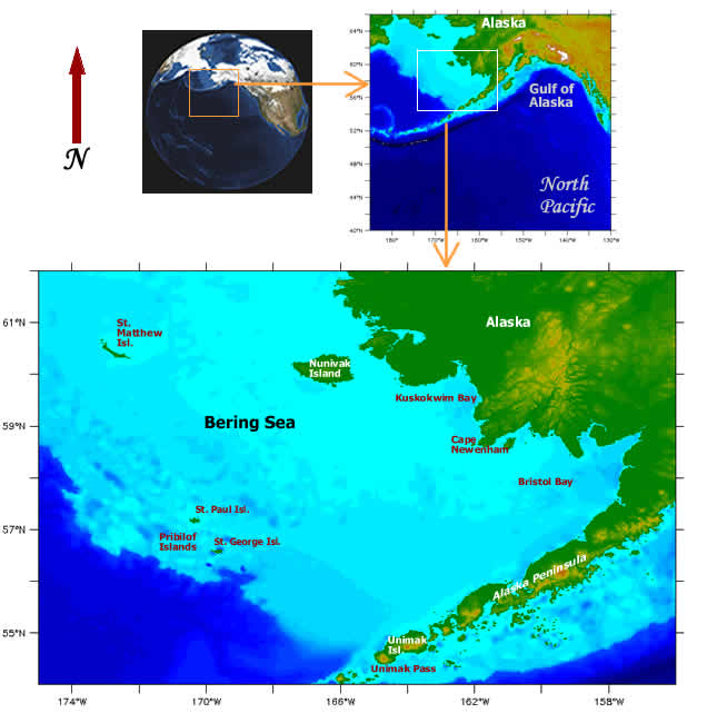
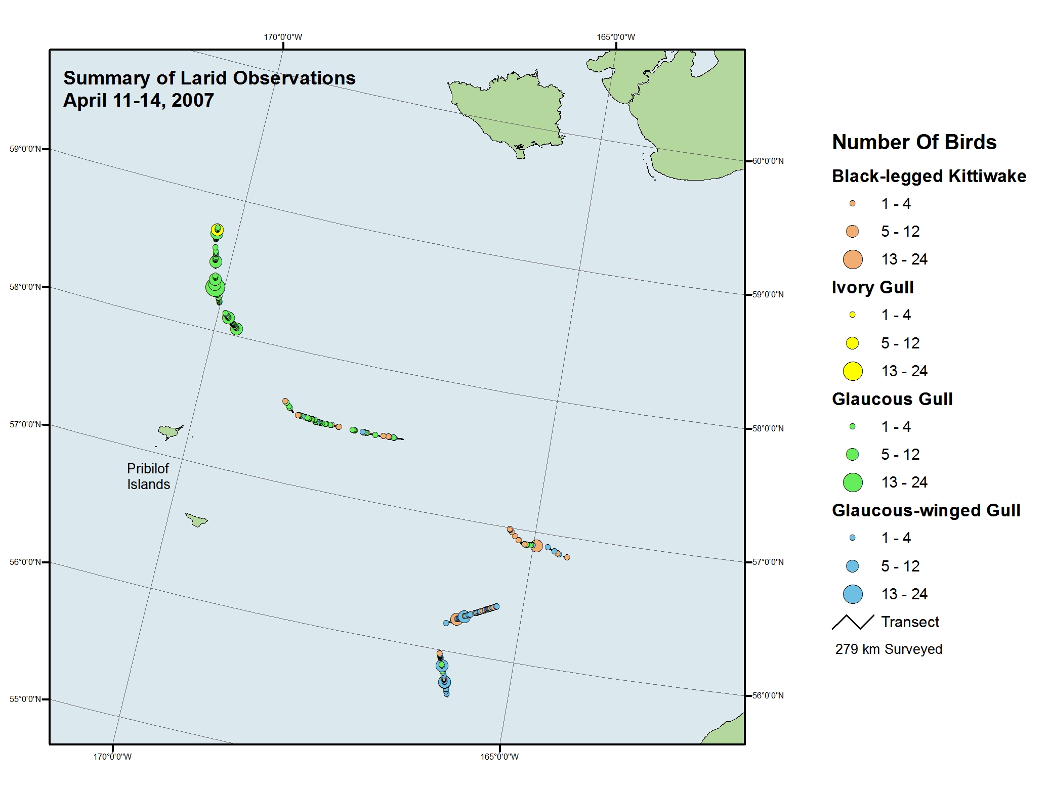
Bering Sea Ice Expedition
Maps

Maps and nautical charts, are an important part of ocean navigation and exploration.
Here are a few map resources:


Map showing CTD station locations along the 70-meter isobath in the Bering Sea. Data were collected at these stations April 8-12, 2007 Ship Tracks from USCGC Healy: where we have been on this Expedition. This map of the Bering Sea indicates place names and shows dates of travel.

     
Maps of the Bering Sea, location in the North Pacific and on our globe. The larger Bering Sea map (click for larger image) shows places.      
NOAA - National Oceanic and Atmospheric Administration