WHAT'S NEW:
BACKGROUND:
Mission
Project Description
Cruise Plans:
Participants
Technology (ROV, ships, etc.)
Future Plans
Results:
1998 NeMO Cruise
Axial 1998 "Eruption"
Cruise Plan R/V Wecoma
Investigation of hydrothermal activity at Axial Volcano, Juan de Fuca Ridge
Cruise Dates: June 16-29, 1999
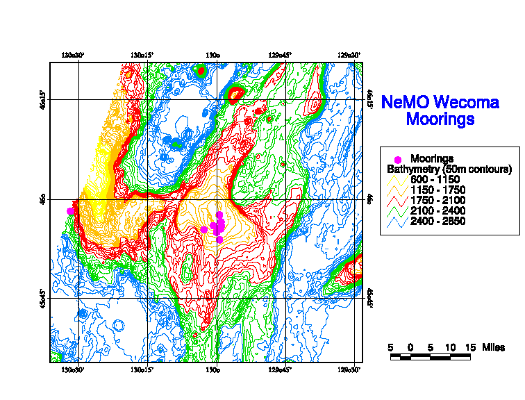
Purpose: Wecoma Cruise (W9906B) is a physical and chemical oceanographic cruise that will support a variety of investigations utilizing towed and vertical CTD/rosette casts, mooring deployments and recoveries, and chemical sampling. This cruise is a continuation of the NOAA/VENTS New Millennium Project (NeMO) to establish a seafloor observatory at the summit of Axial Volcano.
Itinerary: The itinerary for this leg is to proceed from Seattle to the general area of Axial Volcano, 46o N, 130o W, for CTD operations and current meter mooring deployments. Work at Axial Volcano will require approximately 8 days. The ship will then proceed to the vicinity of the Cleft segment, 45o N, 130o 20' W, for CTD tows and casts. The ship will return to Newport, Oregon, from the Cleft segment. Location of the CTD operations will depend on the hydrothermal conditions and cannot be predicted in advance; final positions for CTD casts and tows will be provided by the Chief Scientist during the cruise.
Sampling Plan: The CTD rosette is equipped with a CTD, transmissometer, nephelometer, altimeter, pinger, and Niskin bottles. Tows shall be run at a speed of one to two knots using a PMEL Sea Bird CTD and rosette sampler (with the above instrumentation) attached to the 0.322 inch diameter conducting cable on the trawl winch led over the stern A-frame. During tows the sensor/sampling package will be lowered and raised in a continuous sequence to vertically sample within the bottom several hundred meters of the water column. The vertical position of the sensor will be determined by pressure-depth-altimeter and the horizontal position will be registered to GPS coordinates.
CTD casts will be made in depths ranging from 1,500 meters to over 2,500 meters and all casts will go to within five to ten meters of the bottom. The CTD will be lowered at a speed of 30 meters/minute for the first 200 meters and then at 60 meters/minute and retrieved at 60 meters/minute unless otherwise specified by the chief scientist or a designated watchstander. The ship will maneuver to hold station during all CTD casts.
Mooring Description: All moorings are subsurface, anchored to the bottom with either railroad wheel(s) or heavy chain. They are held taut vertically by Benthos glass spheres in plastic hard hats. Acoustic releases are attached just above the anchor. Current meters are connected into the line at shackled junctions and MTRs are attached by panduits that have been threaded through the Yalex mooring line.
For more information:
Credits/Contacts
oar.pmel.vents.webmaster@noaa.gov