What's New
Click image to see full graphic (Source: NOAA Climate.gov)
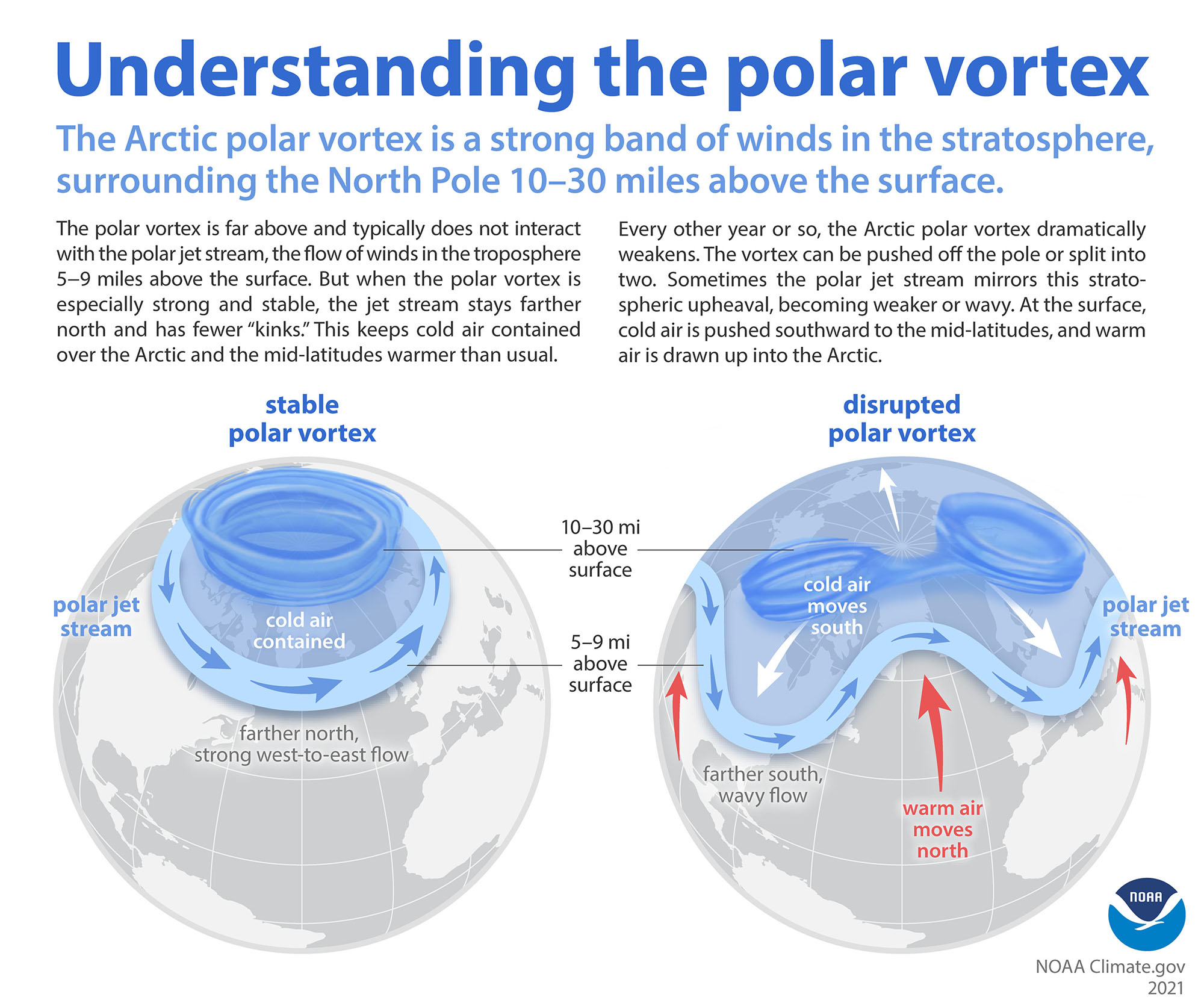
Despite rapid Arctic warming, plan for more frigid spells
New research on the Arctic confirms that even as the Arctic is warming faster than the rest of the world, cold-air outbreaks from the polar region will continue across the Northern Hemisphere in the coming decades.
The big challenge now is to better understand what triggers these cold-air outbreak events and how to improve their predictability.
Much of the previous research has shown how a weakening of the ... more
In the News
A controversial geoengineering proposal suggests that brightening clouds off South America could weaken a burgeoning El Niño, but major technical and ethical... more
Scientists are still untangling the complex relationship between El Niño and human-driven warming, but their confluence has major implications for extreme weather and... more
The biggest episodes of the past have altered the course of human events, according to researchers. An emerging one is drawing historic comparisons.
Featured Publication

Oxygen (a) and heat (b) content (0-500 meters) from models and data products, the Niño 3.4 index (c), and regression of the oxygen content and the Niño 3.4 index using GOBAI-O2 (d) and the high-resolution (e) and low-resolution (f) CESM models.
El Niño and La Niña phases in the tropical Pacific Ocean are the major drivers of interannual variability in the region. This includes the oxygen (O2) content of upper ocean waters, with El Niño resulting in higher O2 in the eastern tropical Pacific due to a deepening of the thermocline and reduced upwelling of O2-poor deepwater and lower O2 in the west due to a large-scale shallowing of the thermocline; La Niña phases display the opposite pattern... more