WHAT'S NEW:
Deepsea Image Galleries on Multimedia page
(posted 9/15/98)
Eruption Confirmed!
New lava (rumbleometer stuck in flow) SE rift zone
(posted 9/1/98)
BACKGROUND:
Technology (ROV, ships, etc.)
Other 1998 Axial cruise reports
EXPEDITION:
Science Objectives
Calendar
Today's Science News
Participant Perspective
Teacher Logbook
EDUCATION:
Curriculum
Teacher Observations
Questions/Answers from sea
MULTIMEDIA:
(video clips, animations, sounds)
Science News
August 24, 25, 26, 27, 28(not available), 29, 30, 31, 01, 02, 03, 04, 05, 06, 07, 08, 09, 10 11 (not available), 12, 13, 14, 15, 16 17 (not available), 18 19 (not available), 20
September 20, 1998
Chief Scientist Final Report
It's been a few days since we're back on dry land, but I'm still
"unwinding" from the very intense and exciting experience of the
NeMO98 expedition. The last few days of the cruise was rather
stressful because of the very marginal weather conditions. ROPOS
could not dive for about 36 hours because of a large swell and
high winds, and did not return to the water until about 12 hours
 from the deadline for beginning our voyage back to
Victoria,
British Columbia to end the expedition.
from the deadline for beginning our voyage back to
Victoria,
British Columbia to end the expedition.
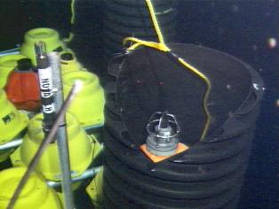
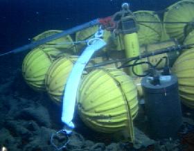
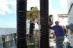
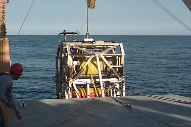
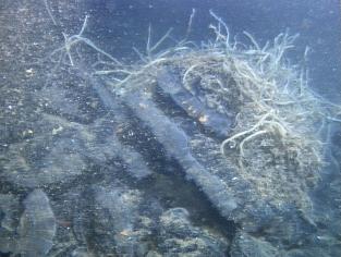
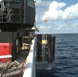
But what a dive (Dive 480) it was! We were able to return the
refurbished extensometer instruments (photo right: extensometer
being pulled from elevator for redeployment) to the seafloor at
high points where they could "talk" to one another over the next
year. The elevator which carried the instruments to the seafloor
was recovered and the RON BROWN then towed the ROPOS down to a
vent site called CASM at the northernmost part of the ccaldera.
This site is at the interesection of the north rift zone of Axial
with the northern wall of the caldera
(SEE MAP). Hydrothermal
systems tend to form at places where there are intersections of
faults or other structures such as the volcanic rift zones because
the rock is more fractured and forms pathways for the fluids. The
CASM site was first discovered in 1983 by a group of Canadian
(
several of whom were participants in the NeMO98 cruise) and U.S.
Scientists using the Canadian PISCES IV submersible (now
decommissioned) and had not been visited by a submersible or ROV
for about a decade. CASM" is an acronym for "Canadian American
Seamount" (Expedition). The site had changed considerably since
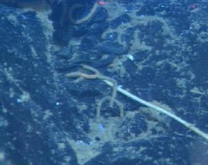
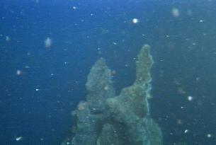
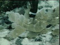
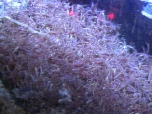 the 1980s. One spectacular vent was found lying on a crack in the
wall of the fissure just south of its intersection with the
caldera wall. This site was unique in that it had a dense colony
of the "palm" worms gracefully waving in the currents
(photo left:
field of palm worms at CASM site). These polychaete worms
are usually solitary or in small groups; and its not clear why
they would form such a dense colony at this site. Another
surprise was the presence of a new high temperature chimney within
the large fissure. Chimneys had been seen just outside the
fissure, but these had ceased venting high temperature fluids.
the 1980s. One spectacular vent was found lying on a crack in the
wall of the fissure just south of its intersection with the
caldera wall. This site was unique in that it had a dense colony
of the "palm" worms gracefully waving in the currents
(photo left:
field of palm worms at CASM site). These polychaete worms
are usually solitary or in small groups; and its not clear why
they would form such a dense colony at this site. Another
surprise was the presence of a new high temperature chimney within
the large fissure. Chimneys had been seen just outside the
fissure, but these had ceased venting high temperature fluids.
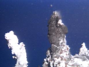
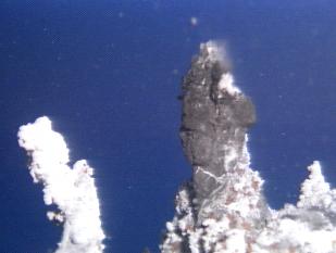
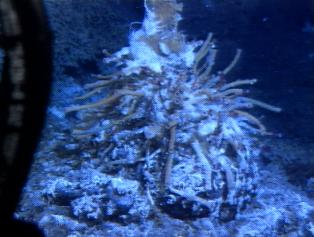 The new chimney had flow coming from small spires (photo right:
spire with tube worms) and intense lower temperature venting
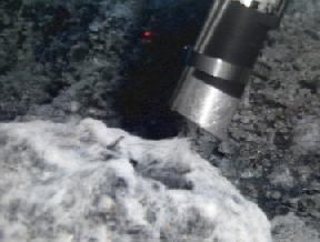
around its base. With some difficulty, a high temperature probe
was placed in one of the vent orifices and left for the year. Two
biologic samples, several scans with the SUAVE, and sulfide sample
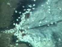
was taken here. The vent also was emitting what appeared to be
bubbles similar to those reported on earlier from the Mushroom
vent at ASHES (photo below left)
Samples of this fluid taken with the gas sampler should
The new chimney had flow coming from small spires (photo right:
spire with tube worms) and intense lower temperature venting
around its base. With some difficulty, a high temperature probe
was placed in one of the vent orifices and left for the year. Two
biologic samples, several scans with the SUAVE, and sulfide sample
was taken here. The vent also was emitting what appeared to be
bubbles similar to those reported on earlier from the Mushroom
vent at ASHES (photo below left)
Samples of this fluid taken with the gas sampler should
 shed some light on the origin and composition of these bubbles.
During the last week of the expedition (Dives 477 and 478), we
also were able to complete our goals on the new eruption site. A
time-lapse camera (experiment of
Verena Tunnicliffe) was placed
next to the Marker 33 site which will take pictures at 30 hour
intervals over the next year. The camera in conjunction with a
long-term Osmosampler
(photo below right: Osmosampler at marker 33)
 and temperature probe, will record the evolution of the chemical
and biologic systems associated with the eruption-related
hydrothermal system. An attempt at freeing the Rumbleometer from
the grip of the lava flow was, unfortunately, unsuccessful (photo below left).
Perhaps a more elaborate recovery effort
and temperature probe, will record the evolution of the chemical
and biologic systems associated with the eruption-related
hydrothermal system. An attempt at freeing the Rumbleometer from
the grip of the lava flow was, unfortunately, unsuccessful (photo below left).
Perhaps a more elaborate recovery effort
 using the power of the surface vessel may be attempted next year.
We also saw the first definitive site where tubeworms had been contacted and fried by the new lava (photo below left) on the eastern contact of the lava flow. Several dead clam shells near the contact suggest that it may have gotten too hot for them also.
NeMO 98 was an outstanding scientific success. On the last day of
the voyage, we all gathered together to discuss the results. A
feeling that everyone had was that the scientific success of the
expedition was primarily because of interaction between the
geologists, chemists, and biologists made possible because of the
 ability of the ROV to bring us all to the seafloor at the same
time.
ability of the ROV to bring us all to the seafloor at the same
time.
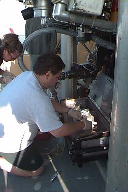
Our success was due not only to the extensive preparation by the scientific party, but to many others both at sea and on land who worked to ensure that the platform was prepared and run efficiently. This includes the seagoing staff of the RON BROWN, the engineers on shore who made sure the ship systems were prepared for the ROPOS, our funding sponsors ( VENTS Program, Sea Grant, the West Coast National Undersea Research Center, and the Canadian National Sciences and Engineering Research Council). The preparation and maintainence of this web page at sea was done through the hard work of Susan Merle and Gene Williamson and on shore by Andra Bobbitt. Mike Goodrich and Vicki Osis at the Hatfield Marine Science Center worked to ensure that the information was disseminated to the public and to the educational community at large. Gene and Mike were both volunteers, so a special thanks to them for their efforts.
We plan to continue this site with updates on the latest research results and plans for the next field season. We hope that's its been as much of a learning experience for all of you out there as it has been for us!
Sincerely,
Bob Embley
Chief Scientist, the NeMO98 Expedition
September 18, 1998
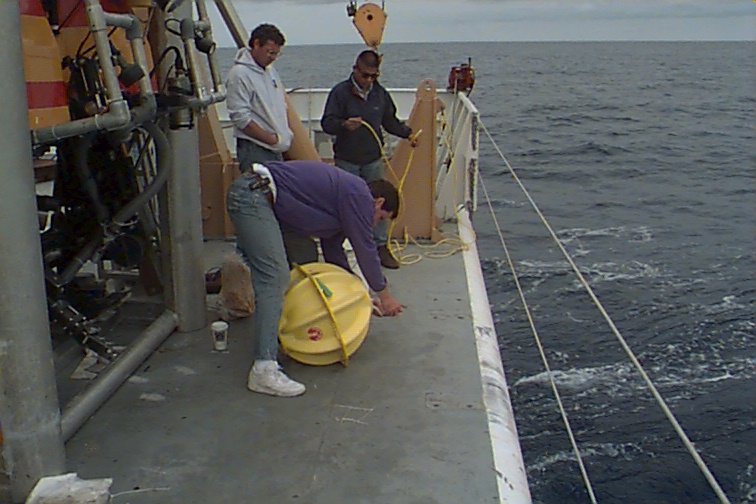
After 43 hours downtime due to weather, ROPOS is back in the water. During the
time we were unable to dive with ROPOS other operations took place. One
CTD
cast was made, and five
rockcores were successfully completed. We're back in
the water now. Expect a cruise report from the chief scientist tomorrow.
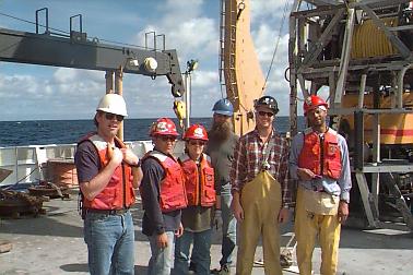
Photo shows the
ship's deck crew;
responsibilities include small boat operations and all gear going in & out of the water. (photo: NOAA Vents G. Williamson)
September 16, 1998
Daily Science Report - Sep 16
ship's location = 45 55.9N/130 00.8W
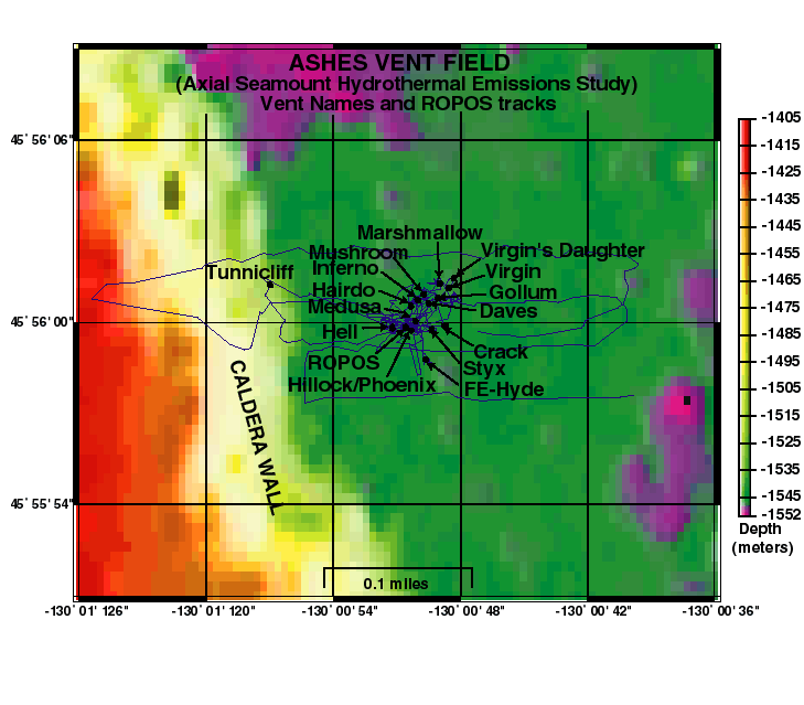
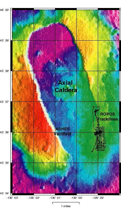
ROPOS is currently back at the ASHES vent field (map left) on dive 479. The first part of the dive consisted of fluid sampling of high-temperature vent fluids (up to 293 deg C) at black smoker chimneys with names like "Hell", "Inferno", and "Virgin Mound". This was followed by biological sampling with the slurp sampler. We will also be finishing our Imagenex sonar survey of the vent field on this dive.
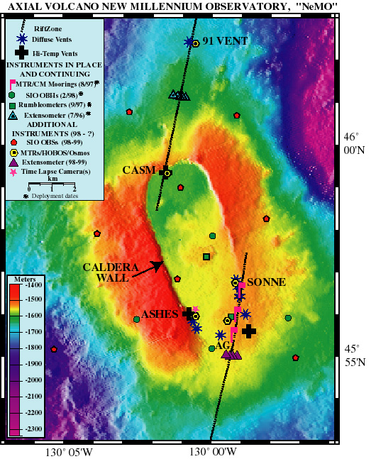
On the next dive we plan to redeploy the acoustic extensometer instruments on the north rift zone with the elevator mooring, and then complete our Imagenex sonar survey there. If time and weather permit, we may then visit a high- temperature vent site on the north edge of Axial caldera called CASM. CASM was the first vent site discovered on the Juan de Fuca Ridge, back in 1983 (15 years ago!).
September 15, 1998
Daily Science Report - Sep 15
ship's location = 45 56.0N/129 58.9W
ROPOS dive 478 returned to the upper south rift to deploy a
time-lapse
camera at the marker 33 vent, which will document changes at the site
over the next year. The rest of the dive consisted of coordinated SUAVE
chemical and biological sampling.
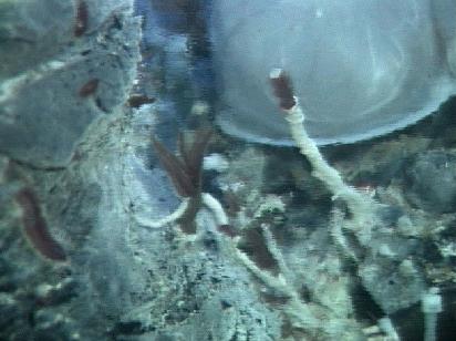
 Tube worms were sampled from brand
new colonies (photo right shows "baby" tubeworms) on the new lava as well as pre-existing colonies on the
surrounding older lavas. The distribution of new animal communities at
vents on the new lava flow has been an intriguing aspect of the cruise.
Each vent seems to have a distinct assemblage of animals, and the
biologists are developing ideas about why this might be. Since new
colonies get started by the large numbers of drifting larvae, why don't
all the new vents get about the same number and kinds of species? Is
the biology of each vent dependent on the specific chemistry of the vent
fluids, or does the first arrival stake out a site and keep other species away?
Tube worms were sampled from brand
new colonies (photo right shows "baby" tubeworms) on the new lava as well as pre-existing colonies on the
surrounding older lavas. The distribution of new animal communities at
vents on the new lava flow has been an intriguing aspect of the cruise.
Each vent seems to have a distinct assemblage of animals, and the
biologists are developing ideas about why this might be. Since new
colonies get started by the large numbers of drifting larvae, why don't
all the new vents get about the same number and kinds of species? Is
the biology of each vent dependent on the specific chemistry of the vent
fluids, or does the first arrival stake out a site and keep other species away?
After the dive we recovered two of the three transponders that that we will no longer be using on the south rift zone.
September 14, 1998
Daily Science Report - Sep 14
ship's location = 45 56.0N/129 58.9W
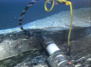
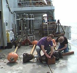
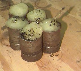
ROPOS underwent some maintenance work for much of today. The tether that goes between ROPOS and its cage needed to be re-terminated (a process in which a new end is cut in the tether and it is rewired into ROPOS) and a host of other minor problems were corrected. After dinner ROPOS descended for dive 477 and the first task was phase 2 of the rumbleometer recovery. This involved attaching a line from the cage to the rumbleometer and pulling the cage up until either the rumbleometer came off the seafloor, or the line broke. If the instrument came off the seafloor and let go of its anchor, then it would be buoyant and immediately start rising toward the surface. To prevent it from slamming into the cage, we had attached a line and weights to it a few days ago during dive 474. Ideally it would be floating above the bottom attached to that "anchor" line after we pulled it out of the new lava flow. Then the cage could drop the "pull" line and ROPOS could cut the "anchor" line and let it float up to the surface to be recovered by the ship.
Unfortunately that didn't happen. The "pull" line we attached today had a "weak link" in it that would break if the cage pulled with over 2200 pounds of force (so that we wouldn't risk being anchored to the seafloor if anything went wrong). After only a few minutes of pulling up with the cage the weak link broke. When ROPOS went back down to the bottom, the rumbleometer had not budged, even though we had pulled with 3-4 times its weight with its anchor attached (about 600 pounds in water). That thing is really stuck! There were a lot of disappointed faces in the ROPOS control room after this latest rescue attempt. We now have to consider other more complicated options and whether or not we could fit such an operation into the rapidly diminishing time we have out here.
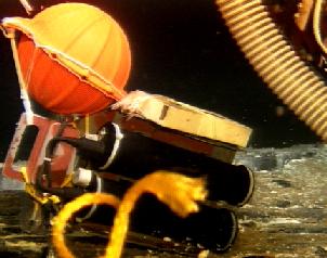 In the meantime, ROPOS has moved onto other tasks in dive 477, including
recovering
a short-term OSMO sampler, deploying a long-term OSMO sampler, and recovering
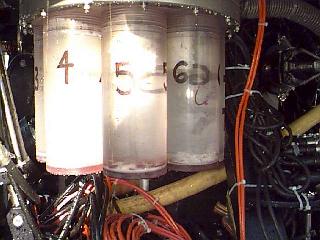
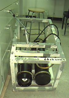
bacterial traps. The OSMO samplers are ingeneous devices (see photo left)
designed to collect small
volumes of vent fluid continuously over a long period of time, so that a time
series of
samples is obtained, even after ROPOS is long-gone (most fluid sampling is only
done
when an ROV or sub is at a specific site). These long-term samplers will stay
out for a
year and then will be recovered for chemical analysis.
In the meantime, ROPOS has moved onto other tasks in dive 477, including
recovering
a short-term OSMO sampler, deploying a long-term OSMO sampler, and recovering
bacterial traps. The OSMO samplers are ingeneous devices (see photo left)
designed to collect small
volumes of vent fluid continuously over a long period of time, so that a time
series of
samples is obtained, even after ROPOS is long-gone (most fluid sampling is only
done
when an ROV or sub is at a specific site). These long-term samplers will stay
out for a
year and then will be recovered for chemical analysis.
Chief Scientist's Weekly Reports
September 13, 1998
Daily Science Report - Sep 13
ship's location = 45 56.9N/129 59.0W
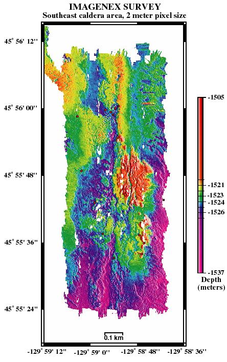
The last 3 ROPOS dives (474, 475, 476) were devoted to mapping the northern extent of the 1998 lava flow on Axial's upper south rift zone. It was originally intended to be just one dive but ROPOS had to come up early twice due to vehicle problems before the mapping was completed. In addition to the geologic traverses on the bottom and collecting Imagenex sonar data (map on left) above the bottom, we re-visited the stuck rumbleometer, retrieved bacterial traps, collected additional samples of the bacterial mats on the new lava, and tube worms on and off the new lava. Also a long term osmotic fluid sampler was deployed at "Milky" vent where it will stay down until next summer.
The extensometer instruments that we recovered several dives ago, do not appear to have seen any movement across Axial's north rift zone associated with the January 1998 eruption. This is perhaps not surprising since most of the earthquakes in January occurred within Axial's caldera and along its south rift zone. Four of the five instruments worked well (one failed) and will be redeployed for another year deployment in a few days.
September 12, 1998
CHIEF SCIENTISTS WEEKLY REPORT
This week has gone by very fast, and, in the view of the NeMO98 science party,
has been a watershed in terms of scientific return with a remote vehicle. The
ability to interactively explore and sample the site of a recent deep-sea
eruption over several weeks is presenting new opportunities on a dive by dive
basis. All of us realize that the window of opportunity is limited and that we
have to make as much as we can out of each trip to the seafloor. The system
will no doubt undergo considerable change before the NeMO 99 expedition, and
every effort is being made to deploy all the monitoring instruments and to take
as many key samples as is possible.
The dive last night capped off another exciting week. We began with the successful implementation of the first stage of a plan to recover the Rumbleometer that is now stuck in the lava flow. The ROPOS team carried a line and weight to the seafloor near the instrument and attached the line to the top of the instrument (see photo right). On a future dive, an attempt will be made to pull the instrument free of the seafloor with a line between the ROPOS "cage" and the instrument. Careful observations in the vicinity of the Rumbleometer suggests that the lava is about 6 to 8 feet thick so it's somewhat of a mystery why the instrument wasn't completely buried! ROPOS also transited over the site of the current meter mooring that never returned after being called back on Leg I of NeMO98. This site was also covered with new lava, and it's now pretty certain that the mooring was damaged and/or released by the lava flow.
A remnant from a visit to Axial caldera in 1996 or 1997 also provided a "smoking
rope" to the lava story. As was described here in reports from the first part
of the expedition, the position of ROPOS on the seafloor is tracked with the aid
of undersea sonar "beacons" called "Transponders". After the transponders we
used here in both 1996 and 1997 were released (and recovered on the surface),
 the thin nylon line linking the floating transponder to the weight on the
seafloor fell back to the seafloor. After locating this line draped on older
lava (we knew its position from a dive with ALVIN in July), it was followed back
to the contact where a close-up photo (photo left) clearly shows it
disappearing beneath the lava! It doesn't get much better than that!
the thin nylon line linking the floating transponder to the weight on the
seafloor fell back to the seafloor. After locating this line draped on older
lava (we knew its position from a dive with ALVIN in July), it was followed back
to the contact where a close-up photo (photo left) clearly shows it
disappearing beneath the lava! It doesn't get much better than that!
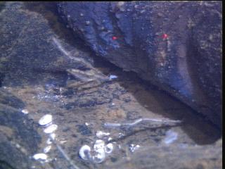
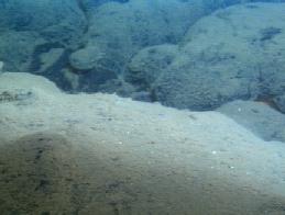
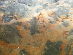
One of the most interesting characteristics of the new lava is a nearly
ubiquitous coating of what appears to be a brown to tan fluffy "mat" on its
surface. Without close examination, this coating (photo below right) makes the
lavas appear much older, so there was some initial confusion about distribution
 of new lavas. The primary goals of last night's dive were to map the
distribution of the new lava, and to collect samples of the basalt and the
various types of material coating its surface. On one of our tracks, we also
happened across a site that the biologists have been hoping to find since the
beginning of the dives. Growing around small holes in the lava where warm vent
fluid was emerging were pockets of tiny tubeworms, (photo below left)
representing the first stage in the recruitment of these ubiquitous vent fauna.
The sample taken at that site will probably be one of the most important
biological samples taken during NeMO98.
of new lavas. The primary goals of last night's dive were to map the
distribution of the new lava, and to collect samples of the basalt and the
various types of material coating its surface. On one of our tracks, we also
happened across a site that the biologists have been hoping to find since the
beginning of the dives. Growing around small holes in the lava where warm vent
fluid was emerging were pockets of tiny tubeworms, (photo below left)
representing the first stage in the recruitment of these ubiquitous vent fauna.
The sample taken at that site will probably be one of the most important
biological samples taken during NeMO98.
One of the most important developments during the past week was the success of the Vent Fluid Sampler. The success of this system over two long dives has provided much need samples for the NeMO98 chemistry and microbiology programs.
We also successfully recovered the "Extensometers" on the north rift and are now in a position to re-deploy them for another year on a later dive. Four of the instruments recorded data over more than a year and we are looking forward to seeing any sign of seafloor "stretching" during the 1998 event.
The dives at the ASHES vent field were very successful and provided our first
intensive look at this site on the opposite side of the caldera from the
eruption area. In contrast to the east side of the caldera, this site is
characterized by intense high-temperature venting (up to about 345 deg C!). The
ASHES vents are fed by fluid that has probably been in contact with the magma
source that probably lies about 1 mile beneath the caldera. The "fault" nearby
provides a zone of crushed rock wherein hot fluids can rise very fast without
mixing with cold seawater and exit the seafloor retaining their high
 temperature. The unique characteristic of ASHES is that it resides at a depth
where boiling occurs well within the range of hydrothermal fluids. Gas breaks
out of the fluid at about 348 deg C and very gassy fluids have been recovered
from this site as long ago as 1986. However, the bubbling vents seen by the
ROPOS video (photo right) were an unexpected surprise. The jury is
still out on how much ASHES was affected by the 1998 eruption and earthquakes.
temperature. The unique characteristic of ASHES is that it resides at a depth
where boiling occurs well within the range of hydrothermal fluids. Gas breaks
out of the fluid at about 348 deg C and very gassy fluids have been recovered
from this site as long ago as 1986. However, the bubbling vents seen by the
ROPOS video (photo right) were an unexpected surprise. The jury is
still out on how much ASHES was affected by the 1998 eruption and earthquakes.
Only one more week in this expedition and much is yet to be accomplished. In particular we have a full schedule of deployments for our year-long monitoring systems and recoveries for experiments placed earlier during this expedition. Measurements made with a time-lapse camera, a chemical sampling system (Osmosampler), and numerous temperature probes will be our only link between the NeMO98 and the NeMO99 expeditions. (Stay tuned in 1999!)
The ROPOS is almost ready to go back in the water. Goodbye for now.
Bob Embley Chief Scientist of the NeMO98 Expedition
September 10, 1998
Daily Science Report - Sep 10
ship's location = 45 56.7N/129 59.1W
ROPOS is back on Axial's upper south rift zone this morning (where we now know it erupted in January) for dive 473. The main goal of the dive is fluid sampling from the vents that were located on earlier dives (with names like Oxide, Milky, Easy, The Pit, Supersnow, Marker 33, Cloudy, Marker 108, Circ, and Castle (photo at right)). This is the first dive we've made to the rift zone with the fluid sampler, which is now working well. The slurp sampler (see below perspective for photo of slurp sampler) is also on board for biological sampling. The next dive will be devoted to geologic mapping of the extent of the new lava flow.
A little ROPOS trivia that highlights the payload capability of this ROV: During our dives at Axial, ROPOS has been carrying about 250 pounds of science equipment (including all our samplers and sonars and cameras). Impressive, huh? We scientists are always thinking of new gadgets to take down to the seafloor, so it helps to have a hefty vehicle like ROPOS.
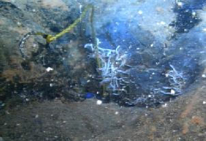
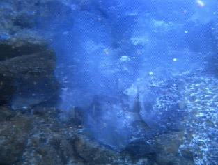
 A few dives ago, on dive 469 while ROPOS was at a vent named
Mushroom in the
ASHES vent field, we saw distinct bubbles rising up from the chimney.
(see photo at left) The
bubbles
formed and grew on the lip of the chimney and periodically released and floated
upward
every few seconds. This is quite remarkable considering the tremendous
pressure,
which is about 2200 pounds per square inch at this water depth (1540 meters).
This
was surprising since none of us has ever seen this before at this depth. We
still don't
know what was forming the bubbles, but we should be able to tell once our
samples
are analyzed. Our view at this point is that it is probably not steam (from
boiling of
the hot vent fluid), because the vent fluid at Mushroom is well below the
boiling point
at this depth (100 degrees C vs. 348 degrees C), and because steam bubbles would
quickly condense and collapse as they cooled, whereas the bubbles we saw rose up
at
least several meters above the vent. The other possibility is that it is a gas
being released from the vent fluid, like methane, hydrogen, or CO2 (or some
combination). In fact, we know that the sample taken here did have a remarkable
amount of gas in it. The intriguing thing is that it would take a lot of gas
production to make so much that it all would not stay dissolved in seawater.
Where is it coming from? And why does it show up here and not elsewhere? And
why is this the first time we have seen this here?
A few dives ago, on dive 469 while ROPOS was at a vent named
Mushroom in the
ASHES vent field, we saw distinct bubbles rising up from the chimney.
(see photo at left) The
bubbles
formed and grew on the lip of the chimney and periodically released and floated
upward
every few seconds. This is quite remarkable considering the tremendous
pressure,
which is about 2200 pounds per square inch at this water depth (1540 meters).
This
was surprising since none of us has ever seen this before at this depth. We
still don't
know what was forming the bubbles, but we should be able to tell once our
samples
are analyzed. Our view at this point is that it is probably not steam (from
boiling of
the hot vent fluid), because the vent fluid at Mushroom is well below the
boiling point
at this depth (100 degrees C vs. 348 degrees C), and because steam bubbles would
quickly condense and collapse as they cooled, whereas the bubbles we saw rose up
at
least several meters above the vent. The other possibility is that it is a gas
being released from the vent fluid, like methane, hydrogen, or CO2 (or some
combination). In fact, we know that the sample taken here did have a remarkable
amount of gas in it. The intriguing thing is that it would take a lot of gas
production to make so much that it all would not stay dissolved in seawater.
Where is it coming from? And why does it show up here and not elsewhere? And
why is this the first time we have seen this here?
September 9, 1998
Daily Science Report - Sep 9
ship's location = 45 51.1N/130 02.3W
Today we had two relatively short ROPOS dives, both at ASHES, and both focused on biological and microbiological sampling. Unfortunately both dives were also terminated early due to equipment problems. The first, dive 471, was terminated after 6 hours because the slurp sampler in-take tube got inadvertently melted when it was held too close to a hot vent. The second, dive 472, was terminated after 7 hours due to problems with the color video camera and the ROPOS telemetry system. While repairs are underway we will be rockcoring until ROPOS is ready to dive again, hopefully around midnight. This time ROPOS will be going back to the upper south rift zone.
September 8, 1998
Daily Science Report - Sep 8
ship's location = 45 56.0N/130 00.8W
ROPOS dive 469 to the ASHES vent field came back with the fluid sampler full of samples, after 14 hours on the bottom. This was the first full dive with the fluid sampler and everyone was happy to see it working well. Some of the fluid samples will be used to analyze the chemical composition of the vent fluids and some will be used for microbiolgical studies.
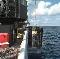
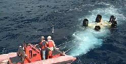
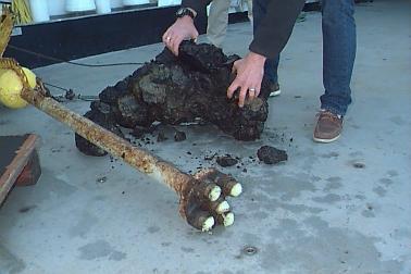
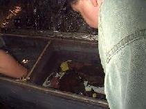
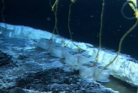
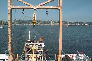
Series of photos showing the recovery of the
extensometer being recovered from 2 years on seafloor. The instruments had to be manually released by ROPOS and brought to the surface using an elevator.
Ship's crew launched a boat to bring the package to the ship and then hoisted it aboard using the ship's crane. Scientist responsible for the extensometer,
Bill Chadwick, stands by the recovered instruments.
|
|
This morning we tried to release the anchor from the elevator mooring with the extensometer instruments in it (that we loaded up on ROPOS dive 467) by sending an acoustic command from the ship, but it refused to come back to the surface. We were forced to send ROPOS down after it, since it also can be mechanically released by ROPOS. This became dive 470 and lasted all of 30 minutes on the bottom, and then ROPOS returned to the surface. Within about 45 minutes the elevator surfaced right next to the ship and the whole thing was hoisted on board. When every you put anything over the side and drop it into the ocean, you never know if it will come back, so it was a good feeling to see the extensometer instruments come back on board. We are now in the process of downloading the data that they have collected over the last 2 years. Preparations are underway for the next dive at ASHES.
Our first 10 dives with ROPOS have amounted to 147 hours of bottom time, or an average of ROPOS has been a work horse!
September 7, 1998
Daily Science Report - Sep 7
ship's location = 45 56.0N/130 00.9W
The 25 knot winds we had yesterday subsided in the afternoon and so we cut short our SeaBeam survey and ROPOS was back in the water by evening for dive 468 at the ASHES vent field. The main aim of the dive was to test out the newly repaired fluid sampler (see Partipant Perspective for today) and do coordinated sampling with the SUAVE chemical analyzer at diffuse (low-temperature) vent sites. The fluid sampler worked well, but the sampling arm was damaged, so the dive was ended after only 4 hours to make repairs. Additional rockcores were collected between dives, and now ROPOS is back at ASHES to continue water sampling on dive 469. We will also be collected some Imagenex and digital camera data at ASHES.
September 6, 1998
Daily Science Report - Sep 6
ship's location = 45 42.5N/130 21.5W
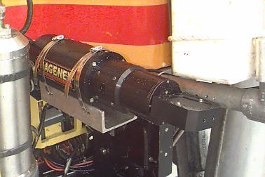
|
Imagenex instrument mounted on the ROPOS ROV |
We've had extraordinarily good weather so far during this cruise, but since mid-day yesterday the winds have been up around 25 knots and the seas have built up so that it is presently too rough to launch ROPOS safely. So after some additional rockcores, we will now be collecting SeaBeam sonar data until the weather settles down. SeaBeam is a sonar system that is mounted on the hull of the ship and collects bathymetric data in a swath about 2.5 miles wide as the ship drives around. This is the same basic idea as the Imagenex sonar, but the Imagenex is used very close to the bottom to get very high-resolution data over a small area, whereas SeaBeam is collected from a surface ship, and gets lower-resolution data but over a much larger area. The two systems are used to make different kinds of seafloor maps. The maps that you've probably seen elsewhere on this web site of the summit of Axial Seamount were made from previously collected SeaBeam data. Today we will be going west of Axial to an area that has never been surveyed before to extend our bathymetric coverage of this section of the Juan de Fuca Ridge.
September 5, 1998
Daily Science Report - Sep 5
ship's location = 46 01.2N/130 01.5W
ROPOS dive 466 to the
ASHES vent field lasted 18 hours and successfully
collected
water samples and coordinated biological samples and chemical scans with the
SUAVE
chemical analyzer. One small bush of tubeworms that measured about a foot
across was
estimated to contain over 150,000 individual animals from at least 25 species,
including
the tubeworms themselves and smaller animals that live among the tubeworms, such
as
palm worms, limpets, snails, copepods, ostracods, and scaleworms. After the
dive,
more CTD's and rockcores were collected.
The highlight of the day was an airdrop delivery at mid-day by a C-141 airplane from McChord Air Force Base in Tacoma, Washington. The item delivered was a key component to VENTS fluid sampler (see photos below in the Teacher's log) which had failed during the first few days of the cruise before it could even be used. Since these fluids samples are such an important part of the story we are investigating, the Air Force was willing to help us out and use the opportunity as a training mission. Many thanks to them!
Early this morning ROPOS descended for dive 467, this time on the north rift zone of Axial to recover an array of instruments that had been deployed on the bottom for 2 years. The instruments are called "acoustic extensometers" and are designed to measure seafloor spreading. We found all the instruments and will recover them with an "elevator mooring" either today or in a few days, depending on the weather. We will then download the data from the instruments, replace the batteries and re-deploy them again on a later dive. We're also collecting Imagenex sonar data at the site and hope to visit a known vent site later in the dive.
September 4, 1998
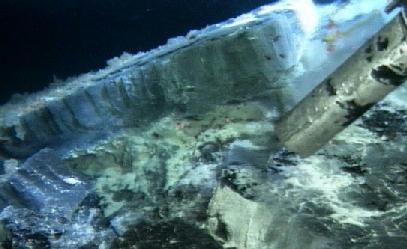
Daily Science Report - Sep 4
ship's location = 45 56.0N/130 00.8W (directly over ASHES vent field)
The ROPOS dive that started yesterday (dive 465) to investigate the possible
eruption site
3 miles south of Axial's caldera (at 45 52.0/130 00) lasted 5 hours and was a
great success.
We suspected that lava had erupted at this site in January because a bathymetric
re-survey
(collected by scientists from the
Monterey Bay Aquarium Research Institute) in
May had shown up to
25 m of depth change on the
south rift zone (link shows bathymetry difference on right maps). But you never
know
until you get down to the bottom and look. But when ROPOS got to the bottom,
 it quickly found a thick pile of
new "pillow-lava", a kind of underwater
lava flow that forms big round or tubular "pillows". This new flow had
extensive evidence
of having had warm water flowing through it as it cooled, including extensive
staining and
fluffy,
orange bacterial mats deposited on it (like we've seen up in the caldera
on other dives),
but it seems to have all stopped by now because we saw no warm water actively
venting.
Finding the lava flow and mapping its extent was very satisfying because it was
*exactly*
were we thought it was, and confirms the accuracy of our methods for remotely
detecting
the locations of seafloor eruptions.
The interval between dives again included CTDs and rockcores, and this time was
notable
because during one rockcore (which usually only samples a few grams of rock
during each
core)
it quickly found a thick pile of
new "pillow-lava", a kind of underwater
lava flow that forms big round or tubular "pillows". This new flow had
extensive evidence
of having had warm water flowing through it as it cooled, including extensive
staining and
fluffy,
orange bacterial mats deposited on it (like we've seen up in the caldera
on other dives),
but it seems to have all stopped by now because we saw no warm water actively
venting.
Finding the lava flow and mapping its extent was very satisfying because it was
*exactly*
were we thought it was, and confirms the accuracy of our methods for remotely
detecting
the locations of seafloor eruptions.
The interval between dives again included CTDs and rockcores, and this time was
notable
because during one rockcore (which usually only samples a few grams of rock
during each
core)
 a huge rock came up to the surface with the corer, wrapped up in the wire
that the
corer is lowered on! What a spectacular sample!
a huge rock came up to the surface with the corer, wrapped up in the wire
that the
corer is lowered on! What a spectacular sample!
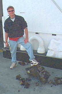
ROPOS is now back on the bottom again (dive 466), this time at the ASHES vent field, which is near the SW caldera wall. This will be our first dive of many at ASHES - up until now all our dives have been in the SE part of the caldera on the upper south rift zone where lava was erupted in January (though we will be returning for more dives there as well). ASHES has many high-temperature "smoker" chimneys in addition to extensive areas of more diffuse venting and vent animal colonies. Water and biological sampling are scheduled.
September 3, 1998
September 3, 1998 ROPOS came back on deck this evening after 16 hours on the bottom during dive 464. The dive recovered water and bacteria from the slurp samples, tube worm samples, sulfide samples from Castle vent, and bacterial traps that were deployed on earlier dives.
 The recovery of the ROV is always an exciting time on the ship because almost
everyone
is out on the fantail of the ship waiting for the cage and vehicle to get
secured so that
they can go and see what treasures ROPOS has brought back to the surface. There
is always a lot of activity on deck as individual investigators get their
samples and start
working with them in the lab.
The recovery of the ROV is always an exciting time on the ship because almost
everyone
is out on the fantail of the ship waiting for the cage and vehicle to get
secured so that
they can go and see what treasures ROPOS has brought back to the surface. There
is always a lot of activity on deck as individual investigators get their
samples and start
working with them in the lab.
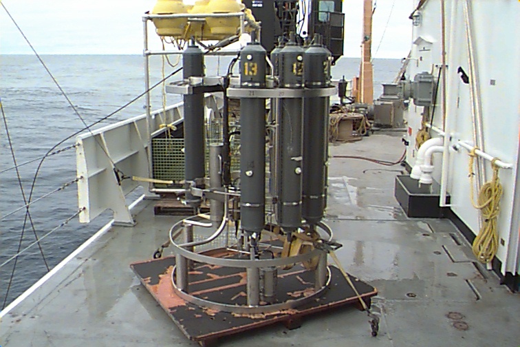
After 9 hours of CTD's (photo of CTD instrument) and rock cores (photo of rockcore sample), ROPOS is now on it's way down to the bottom again, this time about 3 miles south of all our previous dives - a location of the south rift zone where a bathymetric resurvey collected in May showed depth changes (maps show areas of bathymetry difference) up to 25 meters from earlier surveys. We think there is more new lava there and we're going down to find out for sure. We'll let you know...
September 2, 1998
Daily Science Update - early September 2
current location = 45 56.4'N/129 58.9'W
|
Photo taken within the new lava flow showing hydrothermal fluid seeping from cracks within the lava. This type of vent is called a "diffuse" vent. Bacteria and particulates emitted from the fluid coats the lava as fine sediment. (photo: ROPOS NeMO 1998) |
Each ROPOS dive gets a number and our first dive at Axial was dive 460. Our fourth dive (463) was ended early after 16 hours on the bottom because the vehicle developed tether problems. The problem was quickly corrected and ROPOS is now on the bottom again (continuing where we left off) conducting dive 464.
The long duration of the dives is a logistical challenge to the science party. On the
one hand
when ROPOS is down on the bottom and working, no one wants to bring it back up.
There are many objectives we are trying to do on each dive and it is always
tempting
to add more once we are down there because we are always bumping into
fascinating
new sites. But on the other hand, no one person can stay up for that many hours
(even though many of us try!). There are data and samples to process from the
previous dives, plus planning for future dives, in addition to directing and
efficiently
collecting information during the current dive. It is a real challenge. At any
one time
there are about 8-12 people in the ROV control room (3 ROPOS pilots, 1
navigator,
1 video watchstander, 1 datalogging watch stander, 1 watch leader, and then
other
investigators who are directly involved in what ROPOS is going at the time).
Sleep
patterns for most of us have become very irregular, because ROPOS is determining
when we have to be up and we just catch sleep in between those times.
Every day we have a meeting to share results, and coordinate our plans for the next dive day. Today's dive will include tube worm, bacterial, and sulfide sampling. Recent highlights include finding a patch of tube worms that barely survived the eruption because they are located right on the edge of the new lava flow (photo above). A lobe of new lava came right up against the worm patch and they were happily bathing in the warm water coming up around the lava lobe. This seems amazing that anything could survive being almost overrun with lava, but on the edge of the flow it is very thin (10-20 cm) and once the lava quickly cools in the 2 degree C water the lava crust becomes a very good insulator, keeping most of the 1100 degree C heat away from its surroundings. We have found no new colonies of tube worms on the new lava itself.
September 1, 1998
Daily Science Update - early early early on September 1
Our current location = 45 55.6'N/129 58.8'W
Our first week has been a busy one. ROPOS is now on the bottom in its fourth dive at Axial. The vehicle has been working terrifically. Our first dive on Aug 28, totalling 25 hours of bottom time, was mainly a reconnaisance dive on the upper south rift zone to take a look around and locate markers that the submarine Alvin had deployed in mid-July at several vent sites. We found several additional vent sites (including some "snow-blower" vents, that spew out bacterial floc) and put markers at the best ones where we will want to return to take water and biological samples on other dives. We also collected data with two of our mapping tools, the Imagenex scanning sonar and the down-looking digital camera.
On the second dive on Aug 30, which totalled 28 hours on the bottom, we
collected
biological and basalt samples with the bio-box on the front of ROPOS and
deployed
bacterial traps.
(see teacher's logbook for a picture of the traps) We also found the missing
"rumbleometer" (the instrument
package
that had been deployed at Axial since the summer of 1997 but did not release
when it was supposed to in early August).
 Mid-way through the dive we located
a sulfide chimney (formed by mineral deposits around a high-temperature "smoker"
vent) that had previously been photographed by a camera tow in 1996 (so we know
it
was pre-existing before the 1998 eruption). The chimney is actively venting hot
water,
has lots of tube worms growing around it and is interesting because it is the
first
smoker vent found on the south rift zone. We named this chimney "castle" vent
because it is fantastically shaped - narrow near the bottom and very broad near
the
top with many individual spires on the top.
Mid-way through the dive we located
a sulfide chimney (formed by mineral deposits around a high-temperature "smoker"
vent) that had previously been photographed by a camera tow in 1996 (so we know
it
was pre-existing before the 1998 eruption). The chimney is actively venting hot
water,
has lots of tube worms growing around it and is interesting because it is the
first
smoker vent found on the south rift zone. We named this chimney "castle" vent
because it is fantastically shaped - narrow near the bottom and very broad near
the
top with many individual spires on the top.
ROPOS's third dive was relatively
 short
(Aug 31, 7 hours) because it was specifically configured for and focused on
water and
biological sampling with the
"slurp" sampler at only a few vent sites and
deploying
additional bacterial traps. Each dive we change around some of the sampling and
instrumentation on ROPOS depending on the specific objectives of the dive.
short
(Aug 31, 7 hours) because it was specifically configured for and focused on
water and
biological sampling with the
"slurp" sampler at only a few vent sites and
deploying
additional bacterial traps. Each dive we change around some of the sampling and
instrumentation on ROPOS depending on the specific objectives of the dive.
After a 5 hour turn around, ROPOS decended for it's fourth dive, which we are currently conducting. This one will probably be another long one including more Imagenex sonar surveying, and additional slurp (vent water and/or bacterial mats) and biological samples. We hope to get some samples of the castle chimney too near the end of the dive. All of our first 4 dives have been on the upper south rift zone within an area about 3 km north-south and 1 km east-west. In between ROPOS dives we have been doing CTD casts for biological and chemical samples of the hydrothermal plumes above the seafloor, and rockcoring - which obtains samples of the basalt on the seafloor for later chemical analysis.
We now are convinced that we see new (1998) lava on the seafloor where we have been diving. It took us a while to be convinced because the new lava does not look "pristine" (black, shiny, and without any sediment) the way other new flows have looked at other eruption sites we have visited in the last few years. Instead it is covered almost everywhere with an orange, slimey-looking deposit that appears to be derived from bacterial growth directly on the new lava as it cools. This is the first time we have seen this kind of coating on a new flow and we're still trying to figure it out (we've taken samples of it to examine). We're convinced it is new because if we wipe off the slime, the lava is shiny and black underneath, it is still venting warm water in many places with bacterial mats growing around the vents. We've seen many very well-defined "contacts" between older lavas and the new lavas and the change is striking, from lava with sediment and deep-sea animals colonized on it, to the orange coated new flows devoid of any animals (it takes months to years for deep-sea animals to colonize new flows). By mapping out these contacts with ROPOS we will be able to make a map of the extent of the new lava flow. So far we haven't covered much ground yet, but over the next 3 weeks we'll be piecing together that picture.
The biology really helps doing geologic mapping in this case. On the first dive we were looking for a large field of tube worms that had been visited with ROPOS last summer, but we couldn't find it. Now we are convinced that it is completely covered with new lava and obliterated without a trace! There are still tube worms in other areas on the older lavas that have not been covered up (in case you are wondering how we have tube worm samples!). The "missing" rumbleometer may even be a data point on our geologic map, because it may be surrounded by new lava, instead of collapsed into older shelly lava, as we first thought. We're still not sure of this, but that may explain why it did not release when it was supposed to! Should make for a great data-set if we can recover it later.
How extensive is this new lava flow? Where exactly did it erupt out of? How far down the rift zone did the eruption extend? How does the pattern of earthquakes relate to the eruption sites? These are all questions we hope to answer in the next 3 weeks.
August 31, 1998
Scientists were very busy turning the ROV over for a dive today and have given a summary of the day's events on tomorrow's science summary.
Teacher's log is still to come (stay tuned).
ROPOS coming back onto the Ron Brown deck (photo:S.Merle NOAA Vents)
Rocks heavily coated with bacteria photographed on ROPOS Dive #3 (photo: ROPOS NeMO 1998)
Scientist Craig Moyer recovering bacteria samples from the "BioBox" on ROPOS after a dive (photo: S.Merle NOAA Vents)
Science summary for August 30
Scientists have filed this brief report:
The second ROPOS dive is now in progress, the first of which was over 24 hours long. We have been concentrating our efforts in the southeast section of the caldera. Between dives a CTD cast was made and 5 rock cores were taken. A detailed scientific report of ROPOS dive #2 will be posted tomorrow. Dive #2 has been on the bottom over 12 hours. Activities include mapping, bio-sampling, 2 gas-tight water samples taken and deployed a marker (#33). Stay Tuned.
Susan Merle, NOAA Vents Program
Apparently the ship is very busy taking photographs of an biologically abundant area on Dive #2. They are in the process of dive #2 which is occurring on the eastern caldera wall of Axial Volcano. Examining the Axial map indicates they could be in the Axial Gardens or Sonne Vent fields on the eastern side which is a known area of hydrothermal vents and biology.
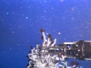
The following is a collage of images sent from ROPOS, taken on Dive #2 (exact species identifications not available yet):
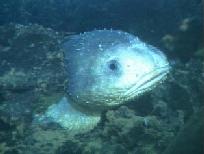
"Bag creature"
|
"Lump Fish"
|
Snails
|
Worms & Snails

|
Biology collection box
|
Non-smoking chimney spire
|
Science summary for Aug 28-29
Science Report-- Some Impressions after the first two ROPOS dives in Axial Caldera
Bob Embley
Chief Scientist
Tubeworms at eastern caldera wall of Axial Volcano (photo: ROPOS NeMO 1998)
This afternoon the NeMO program began its second long ROPOS dive on the eastern side of the caldera. The first dive discovered several very vigorous diffuse vents along a northwest trending fracture system. The venting fluids varied in character from very milky to clear with temperatures up to almost 40 C. Large areas were covered with white bacterial mats which also were observed covering the insides of cavities of the porous lavas. Close examination with the excellent color camera on ROPOS revealed large bacterial flocs frequently breaking off from within these shallow subsurface cavities and being carried off by bottom currents. The most vigorous venting seen to date on the eastern side is coming from a series of pits which are gushing warm fluid filled with floc. Measurements with the PMEL chemical scanner by scientists Gary Massoth and Stacey Maenner have revealed very high levels of hydrogen sulfide in these fluids.
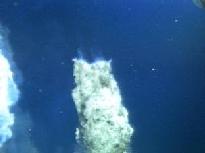
Bill Chadwick and the NeMO navigation team successfully homed in on the missing "rumbleometer" on Saturday afternoon using acoustic ranging. ROPOS found the instrument partly embedded in a pile of loose cindery lava which apparently blocked the release hook from fully deploying. An attempt may be made later in the expedition to release the instrument by attaching a line from it to the ROPOS cage because it may very well may hold some key data that will help us understand better what the environment of the seafloor was like in the vicinity of the massive outpouring of hot water following the subseafloor magma injection.
A major question that has arisen from observations made during the first two dives is "where have all the tubeworms gone?" (see above photo taken on second dive of tubeworms at a different location). Photographs taken by a camera towed near the seafloor from the German research vessel SONNE in 1996 and by a ROPOS dive in 1997 revealed extensive areas of tubeworms along approximately the same track that ROPOS made. Considerable debate was heard in the ROPOS control center in the wee hours of last night. Did the tubeworms get covered with lava? Did an extensive outpouring of hot water clean off prexisting colonies of these animals during the January/February earthquake swarms, leaving a pristine surface to be recolonized?
Bob
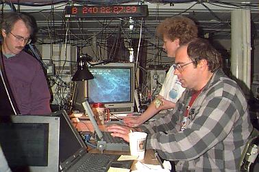 Main ROPOS laboratory (a wiring nightmare!). Computer screen in background
has live ROPOS video shot. Pictured are scientists Lee Evans & Dave Butterfield
(NOAA Vents), Verena Tunnicliffe (U. Victoria) photo: S.Merle NOAA
Main ROPOS laboratory (a wiring nightmare!). Computer screen in background
has live ROPOS video shot. Pictured are scientists Lee Evans & Dave Butterfield
(NOAA Vents), Verena Tunnicliffe (U. Victoria) photo: S.Merle NOAA
Science summary for mid-day Aug 26 to mid-day Aug 27
Once the ship gets to a dive site, (and even before all of us have our "sea legs") one of the first task is usually to deploy "acoustic transponders" so that we can locate the ROV underwater. This is an important first step in our work because, while the ship can know where it is at all times from satellite positioning, those satellite signals cannot penetrate through water. So we must keep track of ROPOS underwater with sound.
Transponders are acoustic beacons that "ping" underwater at different frequencies. We first drop them from the ship, then located them precisely, and once that is done we can locate anything else underwater relative to those transponders. This process takes about a day. For example, we deployed and precisely located 11 transponders in 3 separate locations over the last 20 hours. During a dive, the ROV pings to all the transponders and they ping back to it and the round trip travel times tell us how far the ROV is from each of the transponders with an accuracy of 1-2 meters (3-6 feet). Pretty good considering the ROV is almost a mile underwater!
This precise navigation is critical to many of the things we will be doing during the cruise, such as finding and returning to specific vent sites, locating the samples we take on the bottom, conducting site surveys, and of course placing all our new observations in the context of previous work at Axial. Knowing where you are is something we take for granted on land, because we can *see* our surroundings. But on the bottom of the ocean, it is pitch black, and it is amazingly easy to get lost and disoriented without the help of good navigation. Even with the lights that ROPOS has and the cameras that feed live video up to the ship, we can only see about 15-30 feet in any direction. That would be like exploring the dark side of the moon with a flash light. Everything is always much easier when you know where you are, where you've been, and where you are going at all times. That's why we invest this time at the beginning of these kinds of expeditions.
|
After the calibration, a CTD cast was conducted. Now we're ready to dive! NOAA CTD "rosette" on deck of Brown 8/26/98
|
|

1:45 AM
ROPOS was on the bottom at 11pm (PST), in the SE caldera area. Seeing massive amounts of floc (see video of floc/bacterial mats from CoAxial site 1993) in the water and lots of bacterial mats. The dive is in progress. A more detailed science report about the dive will follow tomorrow.
August 26, 1998

Science activities:
Dropped the transponders (8 of them) and calibrated the transponder nets (3 separate nets: north rift zone, ashes, and south rift zone). (See NeMO map for these areas). Looks like we will be done with the calibration by late morning, then if all goes well we will be ready for our first ROPOS dive. Plans call for SUAVE to be aboard the first dive collecting samples.
August 25, 1998
Departure was delayed until 1500PST due to problems with interfacing scientific instruments with the ROV. Engineers worked up to departure time to resolve difficulties, not all repaired but work will continue while underway to study site. Transit time to site is estimated at ~20 hours.
Engineers working on ROV ROPOS as it sets sail for the NeMO 1998 cruise to Axial Volcano (photo: J.Gendron/NOAA)
August 24, 1998
NOAA ship Ron Brown arrived in Newport, OR at 0800PST. The ship had been scheduled for 1400PST departure but was delayed until tomorrow. A few minor problems with some of the scientific water sampling equipment for the ROV needed repair.
Engineers from NOAA's Pacific Marine Environmental Laboratory met the ship and are working on the gear. Ship is scheduled to depart at 0900PST 8/25/98.
Scientists are busy finding their way around the large ship, stowing their ge ar and meeting each other.