| Seismic Activity - East Pacific Rise at 9 South (July, 1997) | ||||
|
|
||||
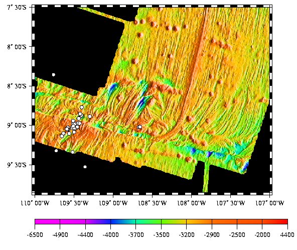 (click to enlarge) Plot of Earthquake Epicenters. Estimated error for the site based on a numerical simulation is 1 minute in latitude and longitude. Mean position is 9 0.75'S, 109 27.42'W. Bathymetry for the region compiled by the RIDGE Multibeam Synthesis Project. |
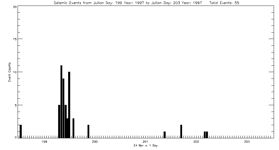
Beginning July 18, 1997, the Autonomous Hydrophone Array deployed by PMEL in the Eastern Equatorial Pacific recorded what appears to be volcanic seismicity from the East Pacific Rise near 9 S and 109W. The activity appears to die down after only 4 days with a total of 55 events located. The character of the seismicity appears volcanic, but the short duration of the event and the location on a fracture zone make the interpretation difficult. The site lies about 45 miles west of an earlier episode of activity at 9 02'S; 108 43'W.
Listing of earthquake epicenters from the EPR at 9 S recorded July, 1997.
|
|||
|
Last
Updated: 01/05/01
Address inquiries to: Robert Dziak - Seismologist - robert.p.dziak@noaa.gov |
||||