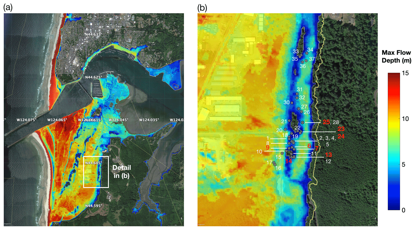
The left panel shows the model of maximum tsunami inundation depth at South Beach for the 1700 CE event and on the right a zoomed-in view of the tsunami inundation depth at Mike Miller State Park. Gray dotted circles show location of trees used in this study on the north side of the stand. Colors on the map show inundation depth from the model, implying 0–10 m of inundation depth at the Mike Miller Park Douglas-fir stand. Green areas are high ground locations that show no inundation. Dziak et al. 2021
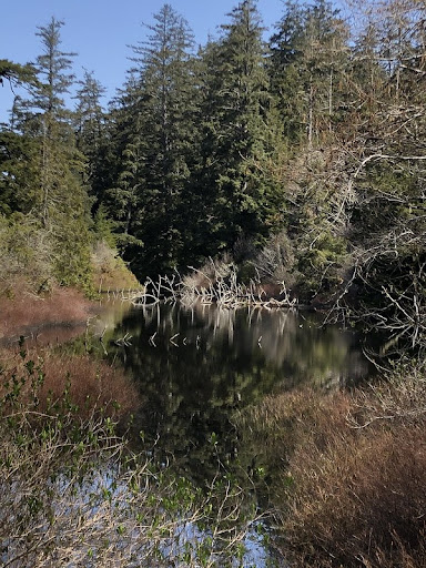
A stand of old growth Douglas-firs near a pond in Mike Miller Park in South Beach, Oregon
Core samples taken from a stand of old growth Douglas-fir trees in the South Beach area just south of Newport showed reduced growth following the 9.0 earthquake and subsequent tsunami that struck the Pacific Northwest in 1700.
The physical evidence from the Douglas-fir tree rings confirms modeling that depicts the reach of the January 1700 quake, which was the last major earthquake to hit the Cascadia Subduction Zone, said Robert Dziak, NOAA PMEL Acoustic Program lead.
“The tsunami appears to be the event that most affected the trees’ growth that year,” said Dziak, whose work includes ocean acoustic studies, signal analysis and tsunami modeling. He also holds a courtesy appointment in Oregon State University’s College of Earth, Ocean, and Atmospheric Sciences. “Getting these little bits of the picture helps us understand what we might expect when the next ‘big one’ hits.”
The findings were published recently in the journal Natural Hazards and Earth System Sciences.
The idea for the study dates back more than a decade; Dziak was aware of past research that had shown evidence of the 1700 quake in trees in Washington, and thought it might be worth seeing if similar evidence existed in Oregon.
The first challenge was finding a stand of old growth Douglas-firs in the tsunami inundation zone. The researchers looked at a few places before locating the stand in Mike Miller Park in South Beach, about two kilometers south of Yaquina Bay and 1.2 kilometers east of the present-day ocean shoreline.
“We’re not sure why this tree stand wasn’t logged over the years, but we’re very fortunate to have a site so close to the coastline that has survived,” said coauthor Bryan Black of the Laboratory of Tree-Ring Research at the University of Arizona, Tucson.
A new and updated tsunami model run by the researchers as part of the study shows that the area could have been inundated by up to 10 meters of water in the 1700 tsunami event, said Dziak.
Once the old growth stand was identified, the researchers collected core samples from about 38 trees using a process that allows them to analyze the tree rings without damaging the overall health of the trees. The majority of the trees dated to around 1670, with one dating to 1650, Dziak said.
They analyzed the growth rates in the rings and compared the growth rates to those of other old-growth Douglas-firs at sites not in the tsunami inundation zone. They found that in 1700 the trees in the tsunami inundation zone showed a significantly reduced growth rate.
Researchers are still working to figure out why the tsunami might have affected the trees’ growth since the trees are relatively far from the shoreline. They suspect it may be a combination of the ground shaking from the earthquake and the inundation of seawater.
“The salty seawater from a tsunami typically drains pretty quickly, but there is a pond area in Mike Miller Park where the seawater likely settled and remained for a longer period of time,” Dziak said.
Black added that the researchers’ next step is to conduct an isotopic analysis on the wood from 1700.
“We will look for signatures consistent with those found in trees that were inundated by the 2011 Tohoku tsunami in Japan,” he said. “If successful, we could develop a powerful new technique to map prehistoric tsunami run-up along the Pacific Northwest coast.”
Yong Wei of the University of Washington Cooperative Institute for Climate, Ocean and Ecosystem Studies and Susan Merle of the Cooperative Institute for Marine Resource Studies at Oregon State University’s Hatfield Marine Science Center are co-authors.
Originally posted on OSU News on August 24, 2021