
NOAA's 2021 Saildrone Observations of Atlantic Hurricanes for Improvement of Intensity Forecasts
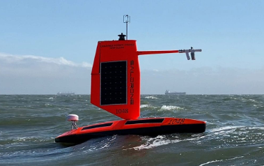
Improving the accuracy and ultimate value of NOAA's operational hurricane forecasts requires more complete real-time knowledge of atmospheric and oceanic conditions and more realistic representation of key physical processes in hurricane forecast models. To meet these needs, a research team from NOAA's Pacific Marine Environmental Laboratory (PMEL) and Atlantic Oceanographic and Meteorological Laboratory (AOML) have successfully deployed five saildrones (see picture below) to observe conditions near the ocean surface during the 2021 Atlantic hurricane season.
Objectives
(1) Measure near-surface atmospheric and upper-ocean parameters to calculate energy and momentum fluxes between the atmosphere and ocean outside and within hurricanes.
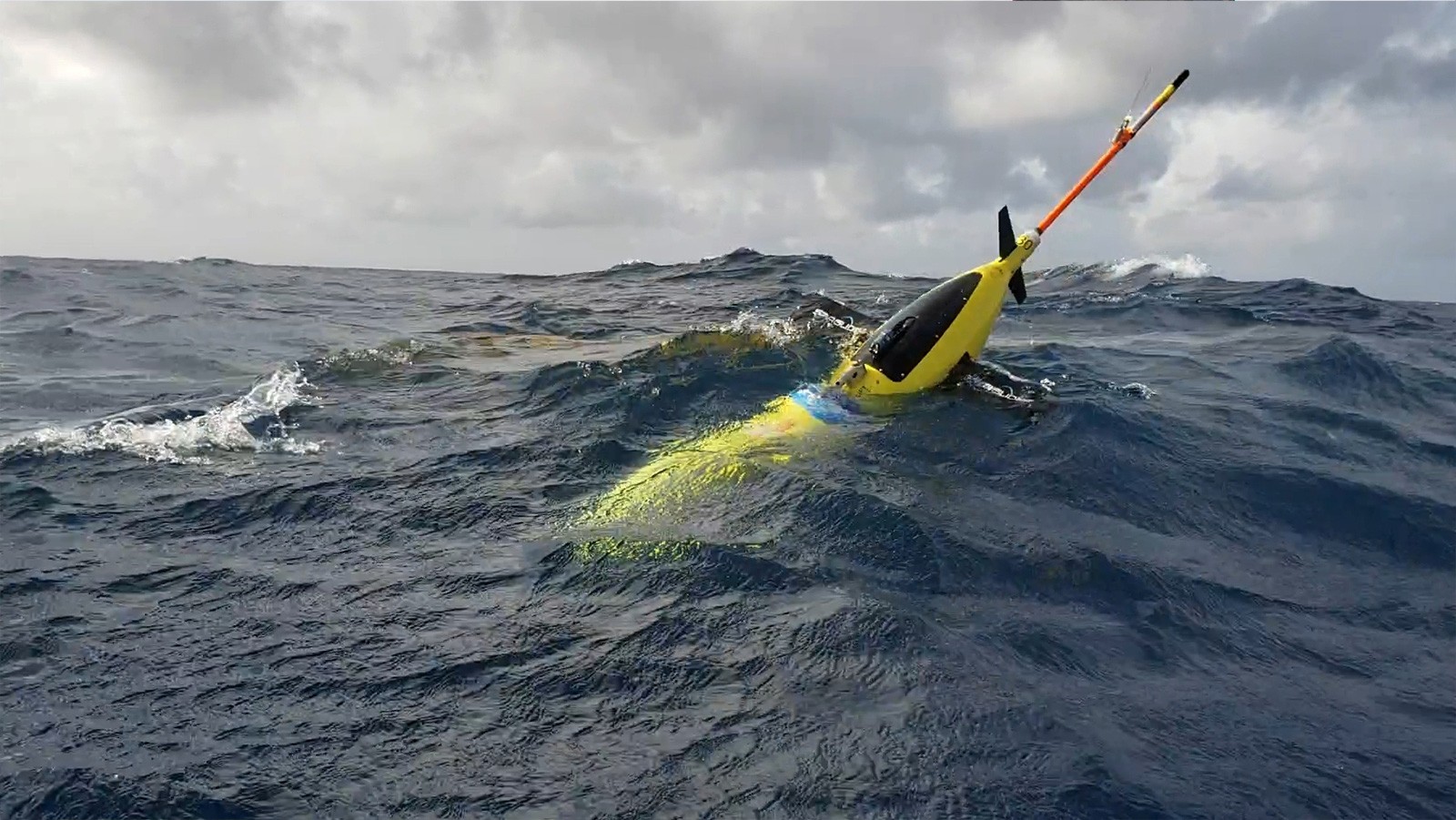
(2) Synchronize the deployments of saildrone and ocean gliders (see picture below) to measure the coupling between the surface atmosphere and upper ocean.
(3) Transmit data in real-time to operational weather prediction centers to improve atmosphere-ocean initial conditions in forecast models.
(4) Apply the observations to understand how air-sea interaction affects hurricane intensity and to advance hurricane prediction models.
Deployments
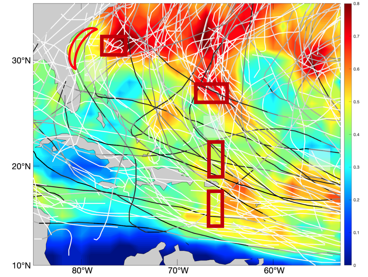
Saildrone observations covered August 1-November 17, 2021 in five areas (highlighted by red boxes in the map below) where chances of hurricane occurrence are high. Observations were sent to worldwide weather prediction centers in real time to assist their operational forecasts. Data are publicly available. This project also involves partnerships with NOAA's Environmental Modeling Center (EMC) of the National Weather Service and the CoastWatch of NOAA's National Environmental Satellite and Data Information Service (NESDIS).
Outcome
One saildrone observed catogroy-5 hurricane Sam. It took a video and measured surface heat fluxes and near-surface oceanic-atmospheric conditions near the eyewall of Sam. Other saildrones observed four tropical storms (Fred, Grace, Henri, Peter). Saildrones and ocean gliders were coordinated to take near-collocated, simultaneous measurement of the upper ocean and the surface oceanic-atmospheric conditions. Comparisons between data from the saildrones and moored buoys were also made the cross-validate the measurement by the two observing platforms. Atmospheric dropsondes and oceanic floats were launched by NOAA and NASA research aircraft near the saildrones, providing addition observations to study interactions between the ocean and atmosphere. Detailed data analysis is underway after the completion of the mission.
NOAA Mission Team:
Gregory Foltz, AOML (Co-Lead)
Chidong Zhang, PMEL (Co-Lead)
Andy Chiodi, PMEL/University of Washington
Calvin Mordy, PMEL/University of Washington
Christian Meinig, PMEL
Dongxiao Zhang, PMEL/University of Washington
Edward (Ned) Cokelet, PMEL
Eugene Burger, PMEL
Francis Bringas, AOML
Gostavo Goni, AOML
Kevin O'Brien, PMEL/University of Washington
Noah Lawrence-Slavas, PMEL
Joaquin Trinanes, AOML/University of Santiago, Spain
Jun Zhang, AOML/University of Miami
Collaborators:
Catherine Edwards, University of Georgia
Shuyi Chen, Edoardo Mazza and Brandon Kerns,
University of Washington
Xingchao Chen, The Penn State University
With support of
Maria Morales Caez, The Penn State University
This mission is supported by NOAA Ocean and Atmospheric Research (OAR) and Office of Marine and Aviation Operations (OMAO) in collaboration with Saildrone, Inc.
Photos & Videos
2021 Saildrone Atlantic Hurricanes Mission (credit: Dr. Gregory Foltz, NOAA/AOML) on PMEL's SmugMug