|
||
| Biophysical Observations aboard Alaska State Ferries | ||
|
|
|
|
The oceanographic
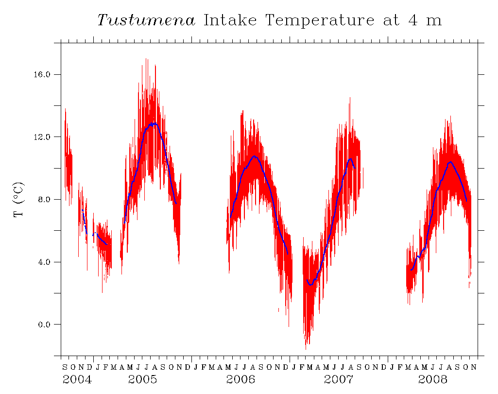
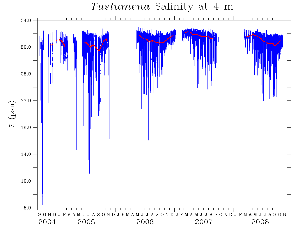
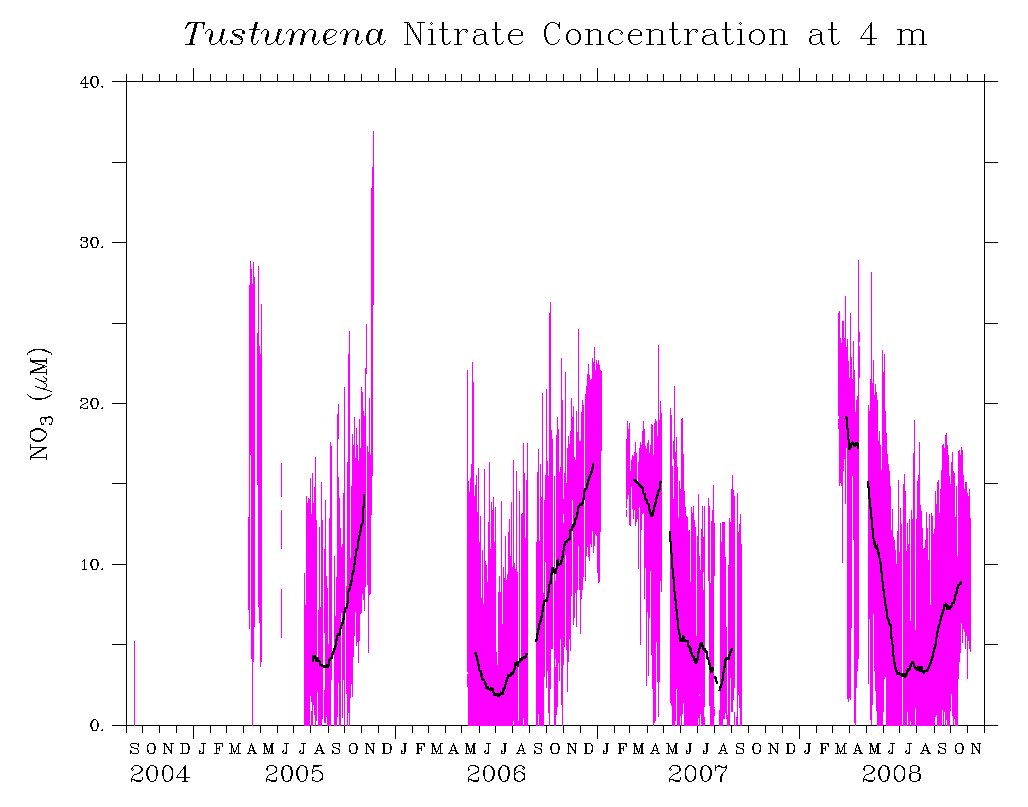
measurement system aboard M/V Tustumena began recording near-surface data (at ~4 meters) on 15 September 2004. Time series data extend from 2004 to September 2008.
DOWNLOAD
|
|
View movies of changing temperature, salinity, chlorophyll, nitrate concentration (NO3), CDOM (Colored Dissolved Organic Matter) concentration and optical attenuation along the ferry route (QuickTime format)
|
| Temperature | Salinity | Chlorophyll | Nitrate | CDOM | Optical Attenuation |
| Movies of Along-Track Data
9/2004-11/2008 (QuickTime) | |||||
|---|---|---|---|---|---|
| Temperature | Salinity | Chlorophyll | Nitrate | CDOM | Optical Attenuation |
| Movies of Along-Track Data including Dutch Harbor
9/2004-11/2008 (QuickTime) | |||||
|---|---|---|---|---|---|
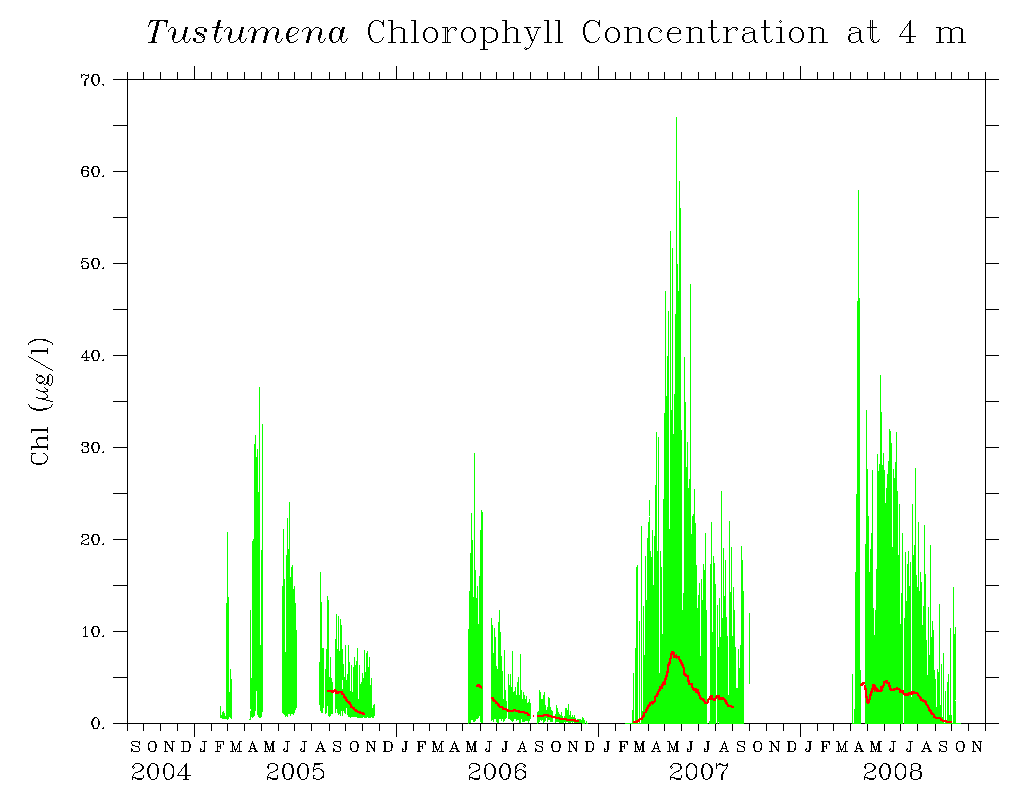
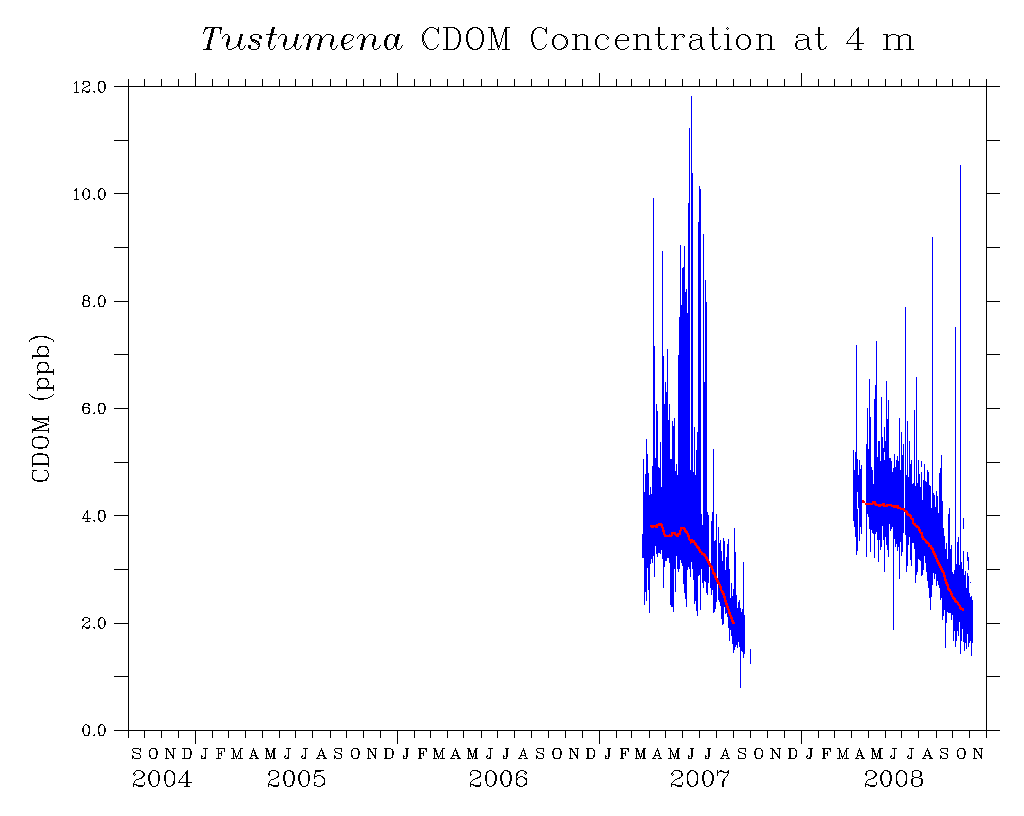
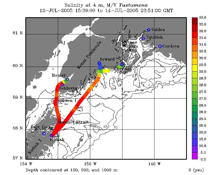
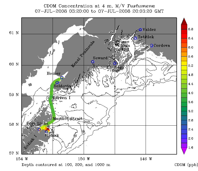
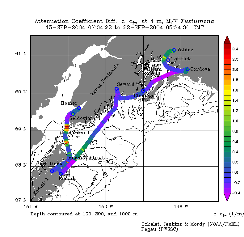
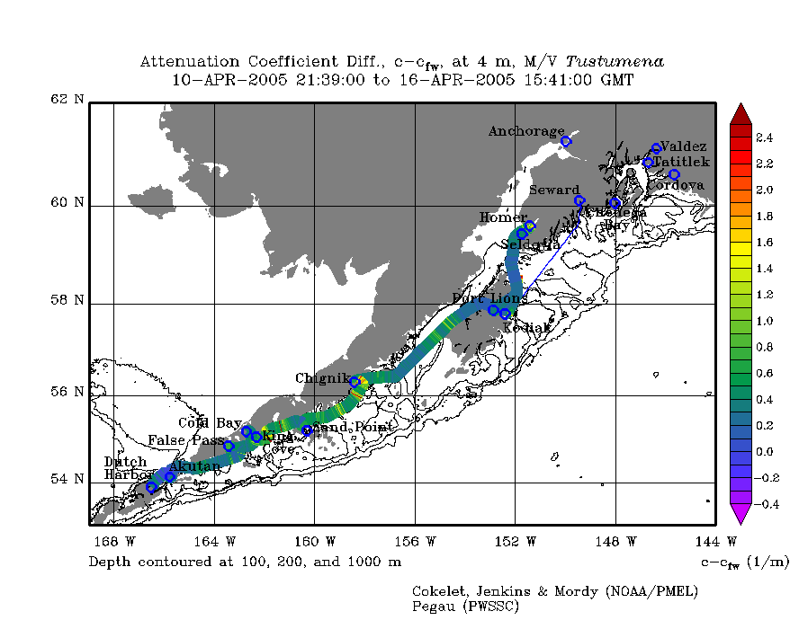
The following near-surface time series were measured along the Alaska Marine Highway's "Southwest Alaska: Prince William Sound to Kodiak Island" ferry route aboard the M/V Tustumena. High-frequency variations are due to spatial differences along the track as the ship moves between confined and open waters. Click an image for a larger view of time series data plots for temperature, salinity, nitrate concentration, chlorophyll, CDOM and attenuation. |
 |
 |
 |
 |
 |
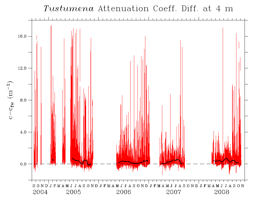 |
| Temperature | Salinity | Nitrate concentration | Chlorophyll | CDOM Conc. | Attenuation Coeff. |
| The following maps show along-track data collected as the ferry moved between ports. | 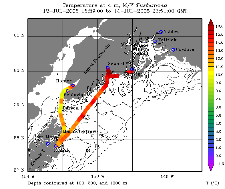 |
 |
 |
 |
| Temperature | Salinity | CDOM Conc. | Attenuation Coeff. |
|
EcoFOCI Project Office |
| last updated 09/01/2010 |

