| Seismic Activity - East Pacific Rise at 22 South (September, 1996) | ||||
|
|
||||
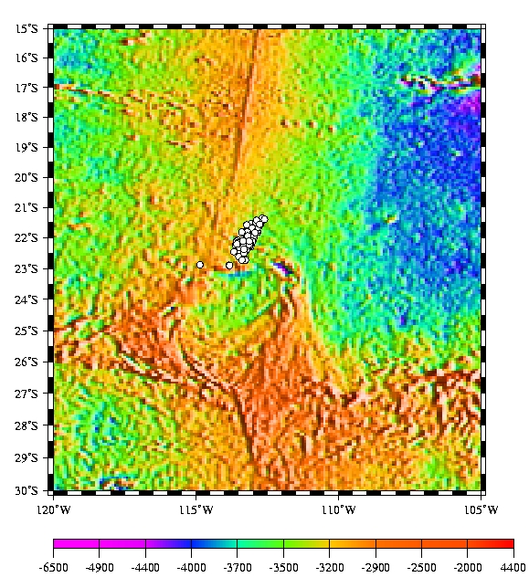 (click to enlarge) Plot of Earthquake Epicenters; Bathymetry is based on satellite altimetry from Smith and Sandwell. Estimated error for the site based on a numerical simulation is 7-minutes in latitude and 5 minutes in longitude. Mean position is 22 10.55'S, 113 10.86' W. |
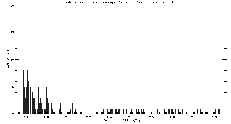
Beginning September 5, 1996, the Autonomous Hydrophone Array deployed by PMEL in the Eastern Equatorial Pacific recorded an episode of seismicity from the East Pacific Rise near 22 S and 113W. The activity continued for 3 days with a total of 165 events located. The location is at the northern edge of the Easter Microplate. The seismicity was originally interpreted to be of volcanic origin, but the presence of a large (Ms = 7.1) thrust mainshock recorded by the global networks indicates the activity to be an aftershock sequence. A discussion has been published by Delouis, Nicolas, Ildefonse, and Philip, 1998, GRL, vol 25, no.9 1443-1446.
Listing of earthquake epicenters from the EPR at 22 S recorded September, 1996.
|
|||
|
Last
Updated: 01/05/01
Address inquiries to: Robert Dziak - Seismologist - robert.p.dziak@noaa.gov |
||||