Maps
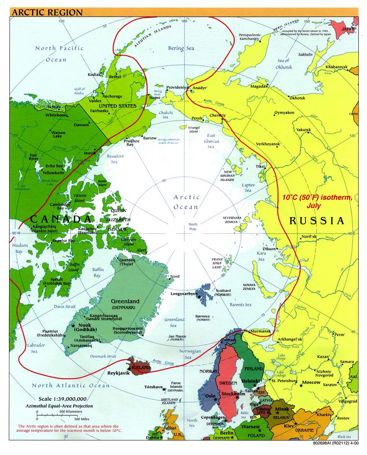
- Arctic Region Reference Map with place names from the UT Perry-Castaneda Library
- Arctic Boundary Maps from the US Arctic Research Commission
- Arctic Environmental Atlas from United Nations Environment Programme
- Collection of Arctic Maps from the University of Texas Perry-Castaneda Library
- View the the globe with topography from the North Pole and other orientations
- Place names in the Arctic Region map from University of Texas
- Bering Sea - Bathymetry, currents, Islands, Habitats
- North Pacific Ocean - Bathymetry, currents, Islands
- International Bathymetric Chart of the Arctic Ocean (IBCAO)
- Arctic National Wildlife Refuge Maps - from US Fish & Wildlife Service - Alaska
- Arctic Maps showing ice, temperature, explorers routes, and more from Athropolis.com
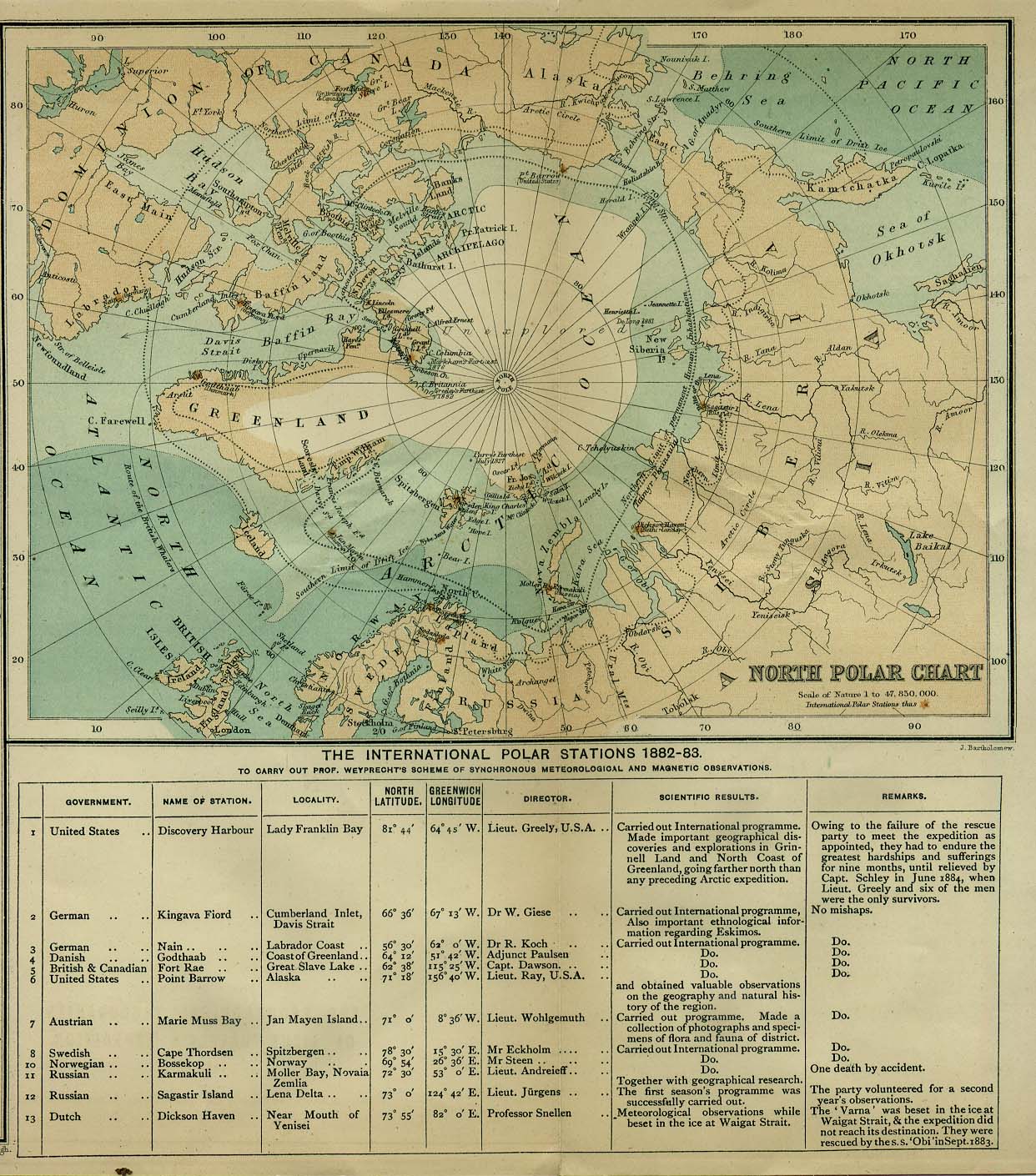
- Historical map of the North Pole (1885) from the UT Perry-Castaneda Library
- Historical maps of Polar regions and oceans from the UT Perry-Castaneda Library
- Alaska maps from alaskais.com
- Canada maps from Natural Resources Canada (topographic maps, snow cover and agriculture maps)
- Aboriginal Map Gallery from the Aboriginal Mapping Network (Gitxsan and Ahousaht First Nations and Ecotrust Canada)
- Suomi - Finland clickable map from Finnish Ministry of Education
- Norway map from Infoplease.com
- Circumpolar Arctic vegetation map - from CAFF