|
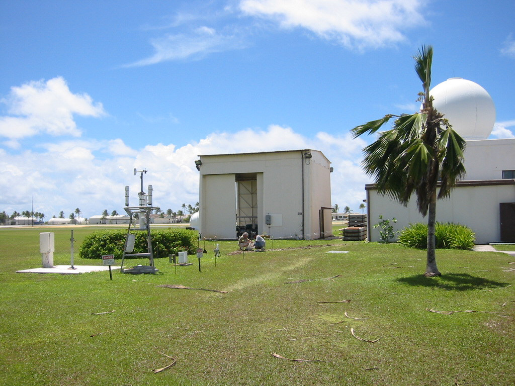
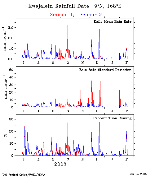
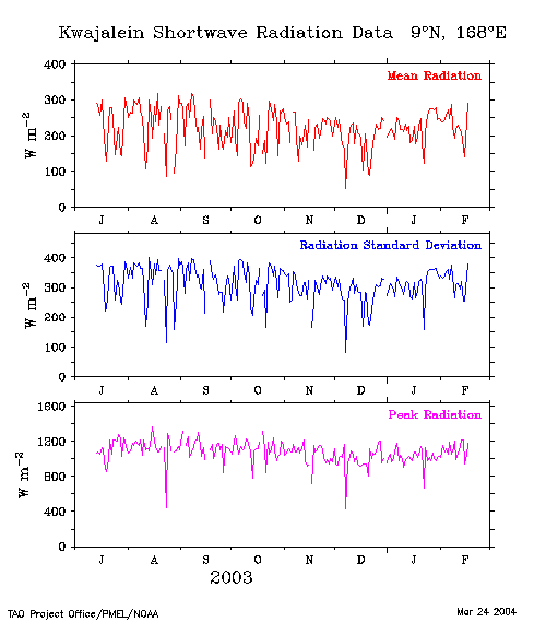
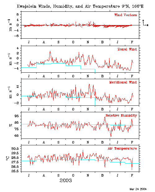
The data displayed below are from a TAO meteorological
station on Kwajalein Island, Republic of the Marshall
Islands, at 8° 43'N, 167° 44'E. They are part of a
precipitation gauge performance evaluation in collaboration
with the University of Washington's Department of Atmospheric
Science, and Aeromet, Inc. The TAO sensors and instrumentation
installed here are functionally equivalent to those deployed on
ATLAS moorings within the TAO Array. Daily mean data are
received daily via satellite. Higher temporal resolution data
are
available in delayed mode.
|