 |
COARE rain information |
|
|||
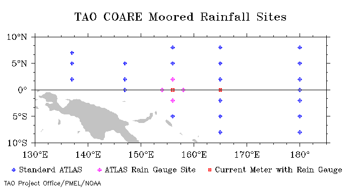
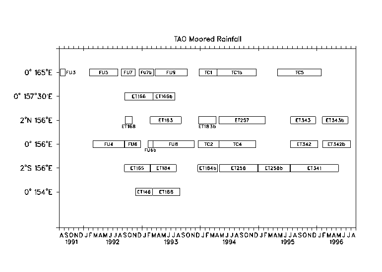
Moored Rainfall Measurements during COARE Please Note: These data are considered experimental and should be used accordingly. Users who find problems with these data or have questions about them should contact paul.freitag at noaa.gov. Difficulties with sensor calibration and performance as well as the effect of environment factors (e.g. wind, buoy motion, shielding by other instrumentation) preclude an absolute estimate of measurement error. Data have been quality controled by eliminating obviously bad data as well as some questionable data. Missing or bad data are flagged with the value -99 . Data quality indices (included with each data record) have been assigned a nominal value of 1. The resultant good data have been organized into one file per site with subsections within a file for each mooring deployment or sensor replacement. Hourly values of the following rainfall statistics are available from a WWW delivery page.
2) mean rainfall rate (mm/hr) 3) rainfall standard deviation during the hour (mm/hr) 4) maximum rainfall rate during the hour (mm/hr) For more detailed information about these rain data see the following publications:
Thiele, O.W., M.J. McPhaden, and D.A. Short, 1995: Optical Rain Gauge Performance: Proceedings of the Second Workshop on Optical Rain Gauge Measurements, held at NASA Goddard Space Flight Center, Greenbelt, Maryland April 21-22, 1994. NASA Conference Publication 3288, 76 pp. Cronin, M. and M. J. McPhaden, 1997: The upper ocean heat balance in the western equatorial Pacific warm pool during September-December 1992. J. Geophys. Res., 102, 8533-8553. If you get any of these data please notify paul.freitag at noaa.gov so that we can inform you of any modifications to the data sets. If these data are used in publications, please acknowledge the TAO Project Office, Dr. Michael J. McPhaden, Director. Also, we would appreciate receiving a preprint and/or reprint of those publications utilizing TAO data for inclusion in the TAO bibliography. These publications should be sent to:
        The TAO Project Office
        NOAA/Pacific Marine Environmental Laboratory
        7600 Sand Point Way NE
        Seattle, WA 98115
Questions regarding data within this archive should be directed to: H. Paul Freitag,
paul.freitag at noaa.gov |
| Home | Project overview | Data display | Data delivery | El Niño & La Niña | Site map |
|
TAO
Project Office |