 |
COARE radiation information |
|
|||
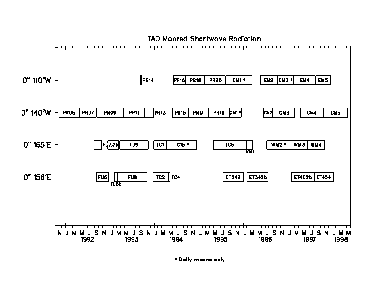
TAO Moored Solar Radiation Measurements Six-minute mean radiation values are recorded from (Eppley Laboratory model PSP) pyranometers at 20-minute intervals. The times indicated are GMT and are the mid-point of the 6-minute averages. These high resolution data are internally recorded and retrieved when the moorings are recovered. Daily averaged values (mean over 24 hours centered at 1200 GMT) are obtained in real time via a satellite link. In some cases these daily mean values are available for periods during which no high resolution data were recovered. Available data have been organized into one file per site with subsections within a file for each mooring deployment or sensor replacement. Both the high resolution and daily mean values are available from a WWW delivery page. Sensors are calibrated by the manufacturer before deployment and, when possible, after recovery. Differences between calibrations averaged 2% over a nominal 6-month deployment. Data presented here have been computed using the pre-deplyment calibrations. Data have been assigned a quality index of 2 if the sensor used was recovered and post-deployment calibrations were available and sensor drift was typical. When sensors were not recovered or damaged, a quality index of 1 is assigned. Unusual cases are assigned a quality index of 9. Details can be obtained by selecting data quality information for that site from the WWW delivery page. For more detailed information about these data see the following publications:
Cronin, M. and M. J. McPhaden, 1997: The upper ocean heat balance in the western equatorial Pacific warm pool during September-December 1992. J. Geophys. Res., 102, 8533-8553. If you get any of these data please notify paul.freitag at noaa.gov so that we can inform you of any modifications to the data sets. If these data are used in publications, please acknowledge the TAO Project Office, Dr. Michael J. McPhaden, Director. Also, we would appreciate receiving a preprint and/or reprint of those publications utilizing TAO data for inclusion in the TAO bibliography. These publications should be sent to:
        The TAO Project Office
        NOAA/Pacific Marine Environmental Laboratory
        7600 Sand Point Way NE
        Seattle, WA 98115
Questions regarding data within this archive should be directed to: H. Paul Freitag,
paul.freitag at noaa.gov |
| Home | Project overview | Data display | Data delivery | El Niño & La Niña | Site map |
|
TAO
Project Office |