Work in progress: Calculation of the heat fluxes in the eastern tropical Pacific
Work in progress:
Calculation of the heat fluxes in the eastern tropical Pacific.
Meghan F. Cronin (NOAA / PMEL), Chris Fairall (NOAA / ETL) and Michael McPhaden (NOAA / PMEL)
This webpage is no longer in use. Please see published results:
Cronin, M.F., C. W. Fairall, and M. J. McPhaden.
An assessment of buoy-derived
and numerical weather prediction surface heat fluxes in the tropical Pacific. J. Geophys. Res., 111, C06038, doi:10.1029/2005JC003324, 200
6.
AMS conference on Air Sea Interaction. Aug 2004
Outline:
- Definition and recipe for computing heat fluxes from moored data in the eastern tropical Pacific.
- Ship & Buoy data. Need for gap filling procedure.
- OK to fill gaps in hourly data with telemetered daily average data?
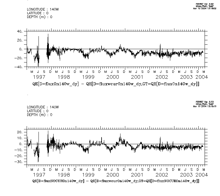
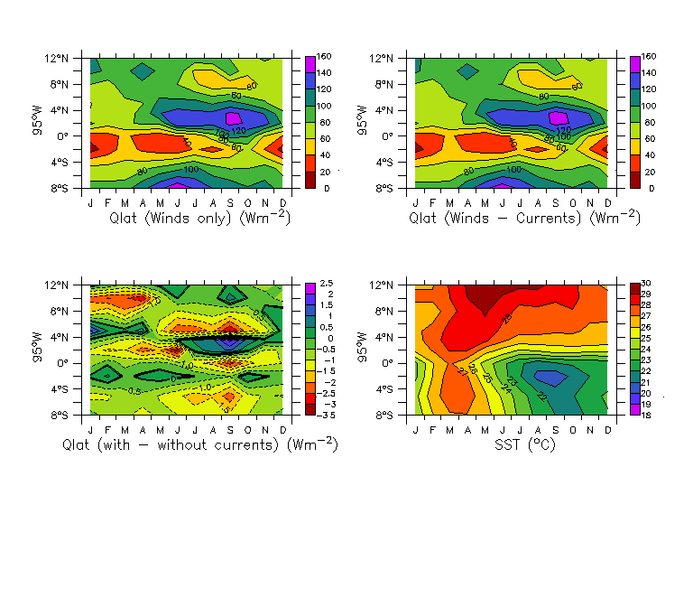
- Should fill currents with OSCAR? or with zeros? Is it necessary to use currents ?
- OK to fill LWR with parameterization?
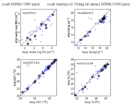
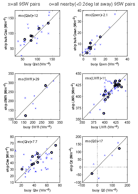
- Comparison of state variables with ship board measurements:
Scatter plots of daily data separated by less than .15-.2deg: State variables
Heat fluxes
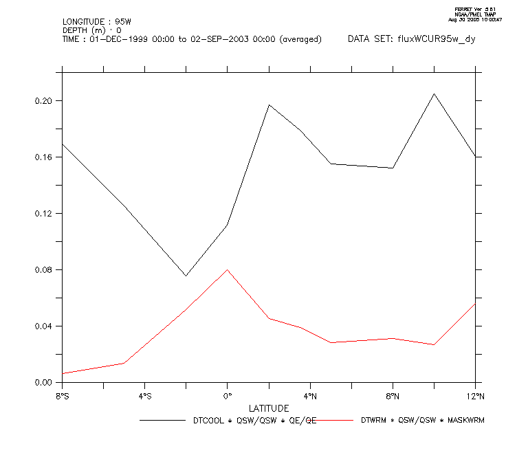
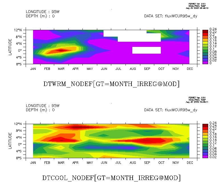
- SST comparison. Is it necessary to do warm layer correction/coolskin?
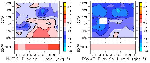
- How well do NCEP1, NCEP2 and ECMWF reproduce the observed QE, QH, SWR, and LWR?
- Why do NCEP and ECMWF fail when they do?
1. Introduction
Importance of ASF.
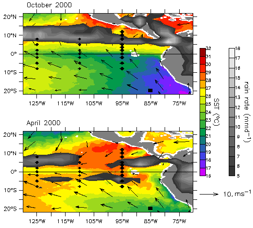
Purpose of EPIC -- Fig. 1.
Purpose of this analysis.
|
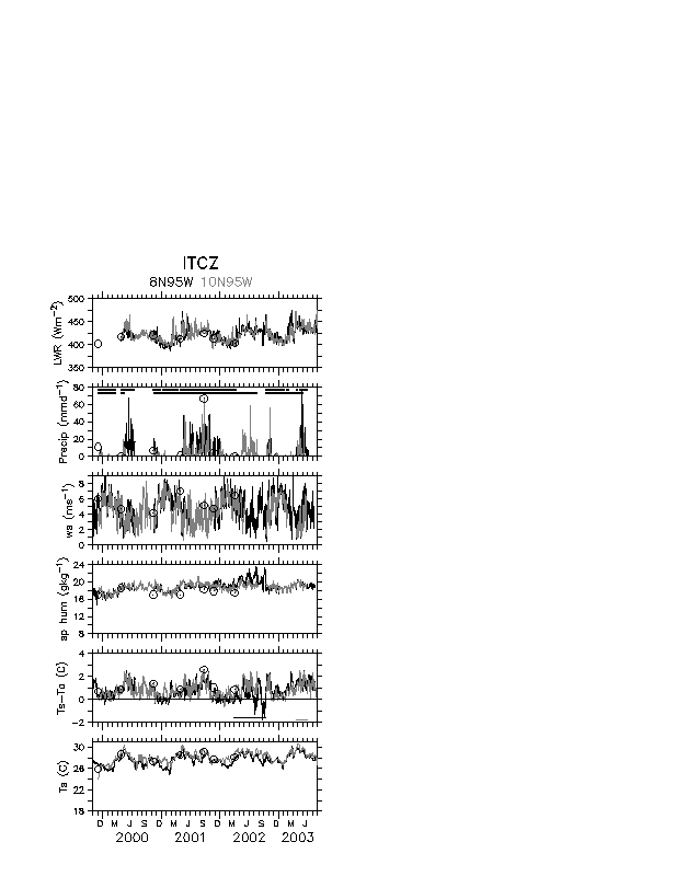
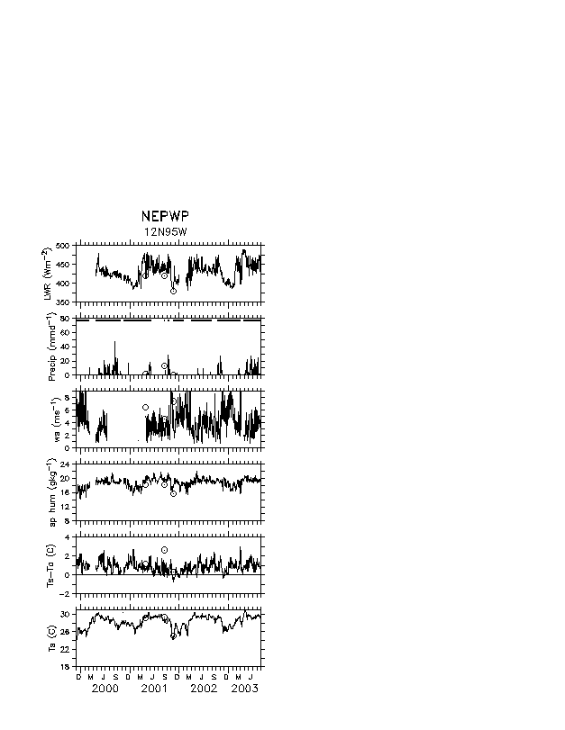
Fig. 1. The EPIC array shown in relation to the April & October 2000 averaged
TMI SST and QuickSCAT wind stress & CMAP rain fields --
95W Moorings cross the ITCZ/Cold Tongue complex. IMET buoy in the stratus
region.
* Note that the deep convection is over the warmest waters. Clouds are
sensitive to SST, but also affect SST. Coupled problem.
* Double ITCZ is observed sometimes in springtime! Southern hemisphere ITCZ over water > 28C.
*Model biases include a persistent double ITCZ, cold tongue that is too cold, and southern hemisphere SST that is too warm.
* Purpose of EPIC. 95W TAO moorings & IMET mooring.
|
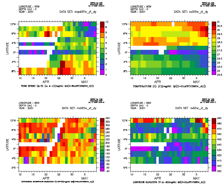
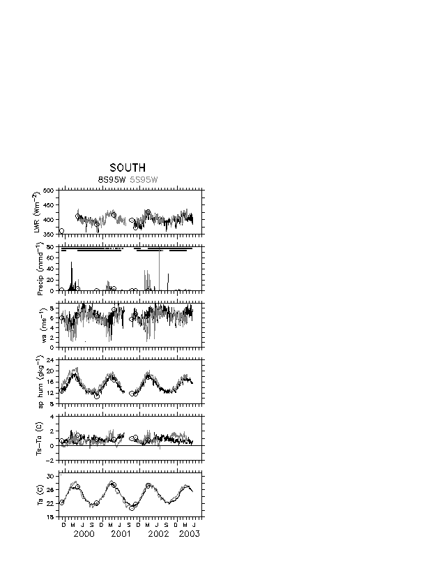
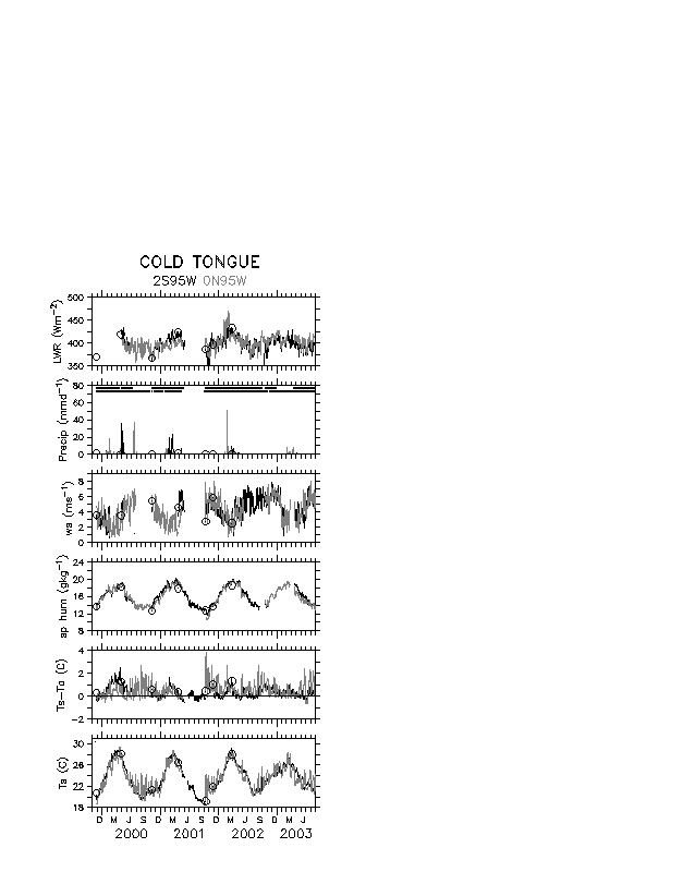
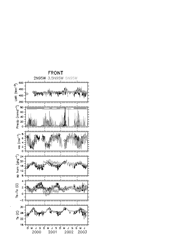
2. Data and Methodology
data description
- Ship Buoy Intercomparison of State Variables
Methodology
- Is it necessary to use daily data?
|
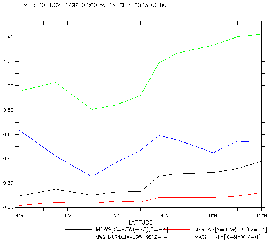
black = mean (scalar - daily-vector-averaged wind speed) -- note that
this is a mean error in the wind speed, and is very weak in SH & over
.1 m/s in ITCZ region.
red = mean((wsc-ws)/wsc) -- mean relative error in wind speed due to
using daily-vector-averaged wind speed instead of scalar wind speed.
green = mean diurnal gustiness (gustiness = sqrt(wsc^2 - ws^2))
blue = mean hourly gustiness modeled by v3.0 flux algorithm.
This shows that the diurnal gustiness is a very serious problem in the ITCZ
region.
|
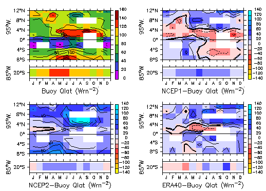
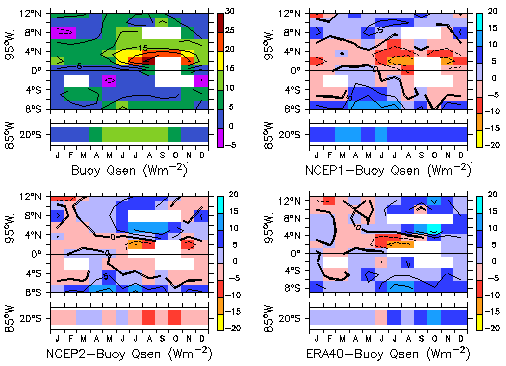
3. Comparison to NWP
Will compare to NCEP2 reanalysis monthly averaged cloud forcing through aug 2003, and ECMWF for monthly averaged cloud forcing through ....
All fields will be shown on original grid, and then will be remapped
onto buoy monthly grid to analyze differences from buoys.
4. Discussion and Conclusions
The end.