|
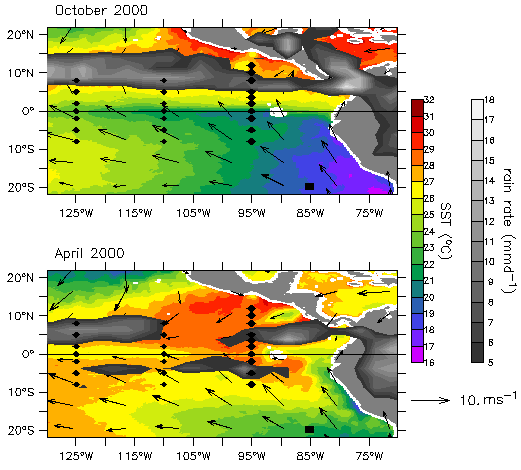
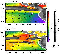
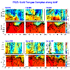
Fig. 1. EPIC mooring array shown in relation to the April 2000 (bottom panel) and October 2000 (upper panel) averaged TMI sea surface temperature,
QuikSCAT wind stress, and TRMM rain fields. Diamonds indicate TAO buoys. Large diamonds indicate EPIC-enhanced TAO buoys. A large square indicates the Woods Hole IMET buoy.
|
|
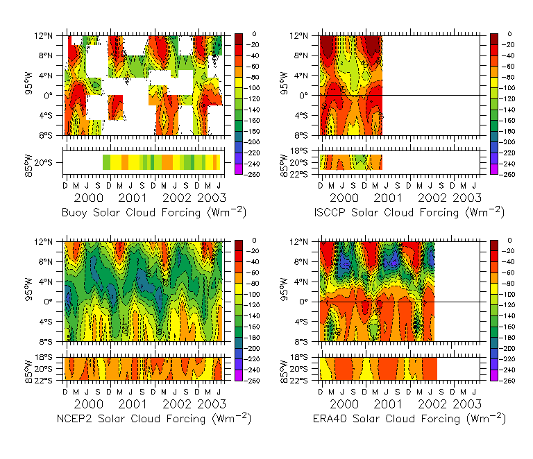
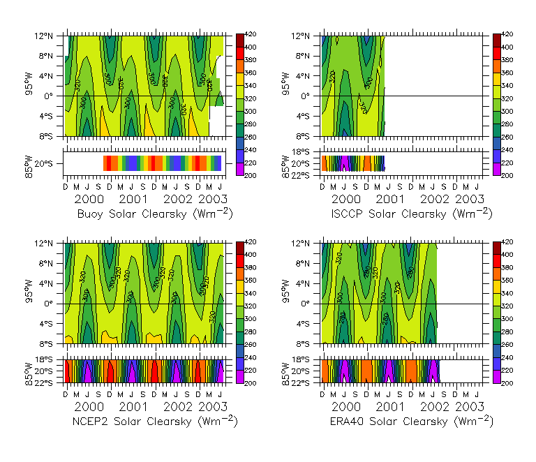
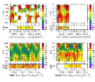
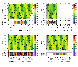
Fig. 2. Monthly-averaged solar cloud forcing at the surface along
95W from 8S to 12N and at 20S, 85W from buoy measurements (upper
left), ISCCP (upper right), NCEP2 reanalysis (lower left), and ECMWF
operational (lower right). Solar cloud forcing is defined by (1) and
has units W/m2.
|
|
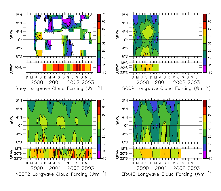
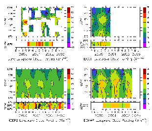
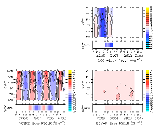
Fig. 3. Same as Fig 2., but for surface longwave cloud forcing
|
|
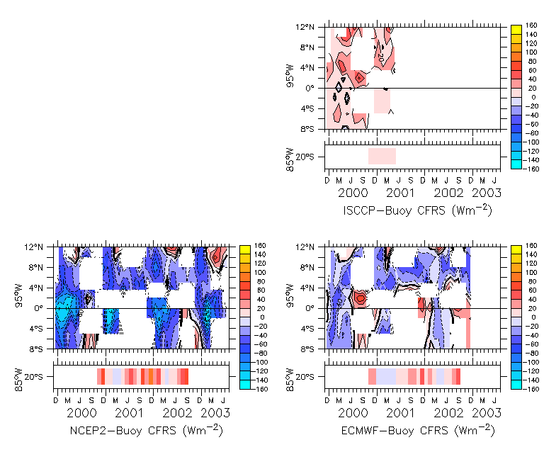
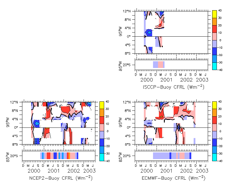
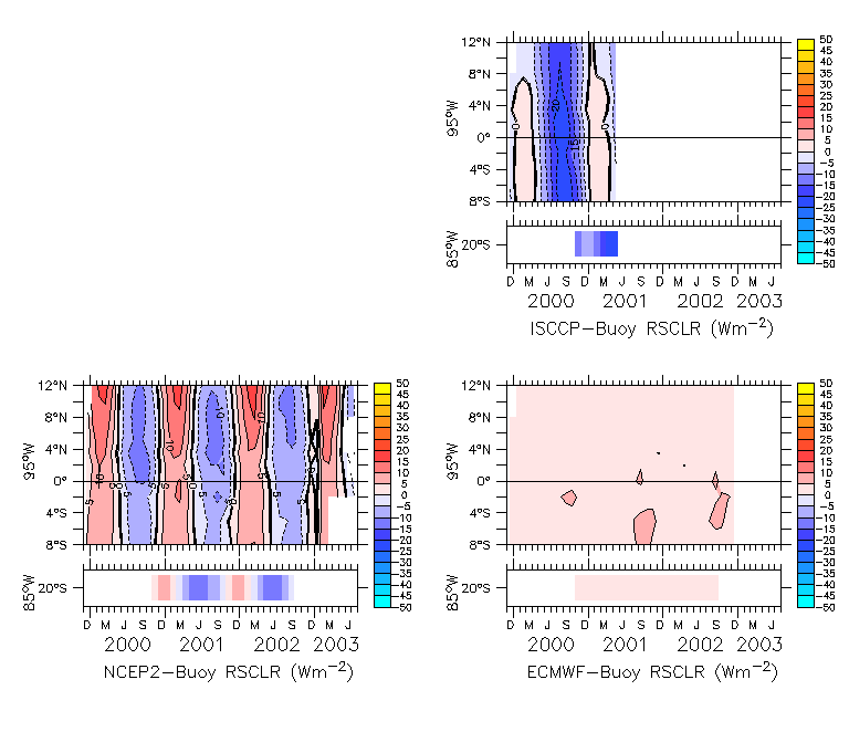
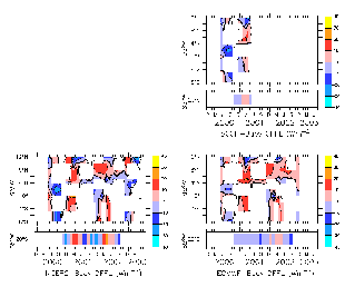
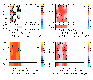
Fig. 4. Monthly-averaged surface solar cloud forcing discrepancy
from buoy fields along 95W from 8S to 12N and at 20S, 85W. Fields
relative to buoys are: ISCCP (upper right), NCEP2 reanalysis (lower
left) and ECMWF operational (lower right).
|
|
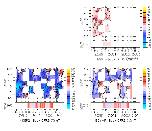
Fig. 5. Same as Fig 4., but for longwave cloud forcing.
|
|
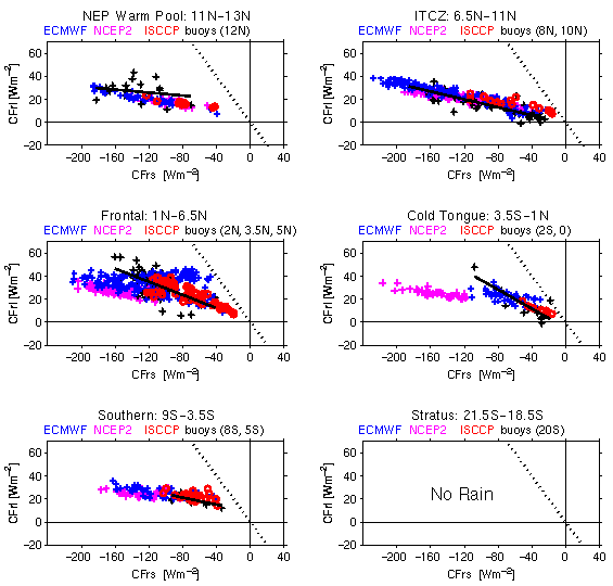
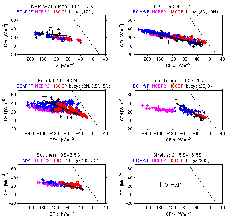
Fig. 6. Scatter plots of monthly-averaged longwave cloud forcing
versus solar cloud forcing for precipitating clouds in six latidunial
bands defined as northeast Pacific warm pool (11N-13N, 95W), ITCZ
(6.5N-11N, 95W), frontal (1N-6.5N, 95w), cold tongue (3.5S-1N, 95W),
southern (9S-3.5S, 95W), and stratus (21.5S-18.5S, 85W). Buoy values
are shown as black + marks, NCEP2 are magenta +, ECMWF are blue +, and
ISCCP are red circles. The negative 1-1 line is indicated by
dashes. The least-squares straight line fit of the buoy cloud forcing
values is shown by a thick black line extending over the range of the
buoy solar cloud forcing. Significant rainfall was determined by TRMM
rainfall within each latitudinal bin.
|
|
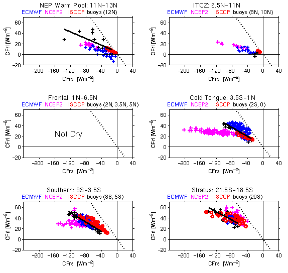
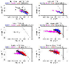
Fig. 7. Same as Fig 6., but for months with no significant rainfall.
|
|
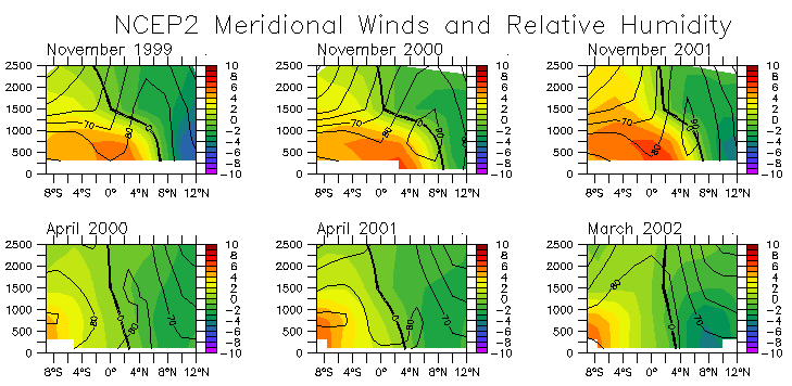
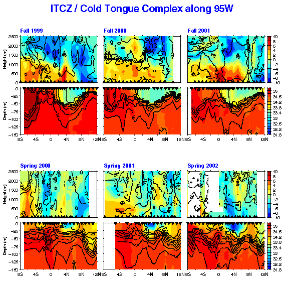
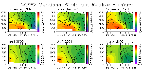
Fig. 8. NCEP2 relative humidity and meridional wind vertical sections along 95W for months when corresponding to TAO tender sounding sections.
|
Fig. 9. Sounding section of relative humidity and meridional winds from 95W TAO tender ship.
|
|
Fig. 10. As in Fig. 2, but for clearsky solar radiation at the surface.
|
|
Fig. 11. As in Fig. 4, but for clearsky solar radiation at the surface.
|
|
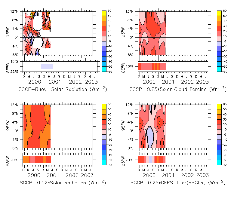
Fig. 12. ISCCP downwelling solar radiation relative to buoy measured
field (upper left) and ad hoc models of this bias: ISCCP downwelling solar
radiation scaled by 0.12 (lower left), ISCCP cloud forcing scaled by 0.25
(upper right), ISCCP cloud forcing scaled by 0.25 with difference between
clearsky solar radiation (lower right). All fields have units W/m2.
|
|