The plot that you show has a range of 0 to 100 on both the horizontal and vertical scales, not the longitude and latitude ranges in Columbia. It sounds as if your dataset has the coordinate data in separate variables. That is, if you open the data, the longitudes and latitudes are in separate 2-D? That might look like this:
yes? use tmp.nc
yes? show data
    currently SET data sets:
   1> ./tmp.nc  (default)
name     title   I         J         K         L         M         N
TMP temperature 1:180     1:173      20       ...       ...       ...
LON longitude   1:180     1:173     ...       ...       ...       ...
LAT longitude   1:180     1:173     ...       ...       ...       ...
In Ferret, datasets such as this are called "curvilinear coordinate" data. To plot this sort of data, you would use a three-argument form of the FILL or SHADE command,
yes? shade/k=1 var, lon, latand perhaps you might limit the region with /HLIMITS and /VLIMITS:
yes? shade/k=1/vlim=-9:18/hlim=-81:-60 var, lon, latand then "go land" will draw the land outlines in the right location.
If the coordinate information is in 1-dimensional variables then you would probably need a DEFINE AXIS command. If that is the case, please write back and show the result of
yes? show data/attributesand somebody will be able to help.
Ansley
On 2/10/2017 1:13 PM, Gijs
Koetsenruijter wrote:
Dear ferret users,
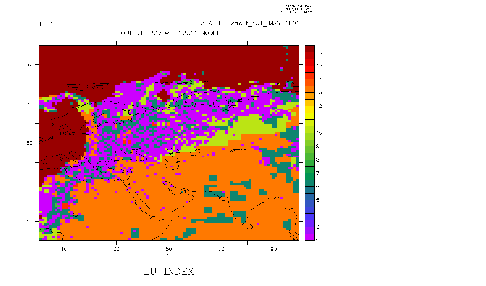
I have a netCDF dataset containing various data like land use, surface height and x and y longtitudes. The are I am interested in is Colombia, with longitudes and lattitudes: 81W:60W and 9S:18N.I would like to make a graphic of a variable (land use in this case) and include a land overlay map. I enclosed a picture to show the problem.
To plot the geographical borders I used the go land script. I can't get the map on the right geographical region and plot for example land use at the same time. No matter what I do it keeps showing central eurasia as soon as I plot my variable. I think it has something to do with the fact that the data is on x/y axes.
How can I make a plot of my data and the geographical borders at the same time?
Thanks in advance,
Gijs