[Thread Prev][Thread Next][Index]
[ferret_users] Remapping curvilinear coordinates to rectilinear coordinates
- To: ferret_users@xxxxxxxx
- Subject: [ferret_users] Remapping curvilinear coordinates to rectilinear coordinates
- From: Szymon Roziewski <szymon.roziewski@xxxxxxxxx>
- Date: Fri, 08 Oct 2010 14:48:23 +0200
- Dkim-signature: v=1; a=rsa-sha256; c=relaxed/relaxed; d=gmail.com; s=gamma; h=domainkey-signature:mime-version:received:received:date:message-id :subject:from:to:content-type; bh=f4G9fmXggjCNJIixCmtoXTu/iiy49GAETthsQK9nWiU=; b=CM2MWHO9LMDGRX4PGMvjiY/yTZsc6GUocKYg00F/RYrVnp97Jj2vpY5LiRxeRJ4TPl 2yf/aK7pS5La0hSeGK3aCAYITPNlM+yULt9HxhSAVUtII8RbBTZIdlzRHPEN8n/mrWoh rBo+m/rVsME/B9aWbv7k0Tui3gvCOJjTvJL3M=
- Domainkey-signature: a=rsa-sha1; c=nofws; d=gmail.com; s=gamma; h=mime-version:date:message-id:subject:from:to:content-type; b=C1Dp2x3uszTck4IqRbiIeHql5w1Jmz8N52ulIFcRtvTsjNNNSAF23fEjVcFmT0uQG5 mjK8NzuvQBIsI81Ya/puhLvgIWyQ4dalY7TR4RCwPKsdbDFgEge//0s4eK1ig50MCgTI BzOJGw704hTCG/3bKxw9vgv6urgE7UNA7MPi4=
- Sender: owner-ferret_users@xxxxxxxx
Hello there,
I have problem with appropriate remapping from curvilinear coordinates to rectilinear coordinates.
The area which is covered with curvilinear coordinates is bigger than I need in rectilinear coordinates (it's a subset of curvilinear grid).
I would like to raise such a question if ferret can do this transformation automaticly i.e. I needn't to care about the curvilinear grid is about bigger area than rectilinear.
Or I need to tell ferret that fact by some computations and findings.
I attach files:
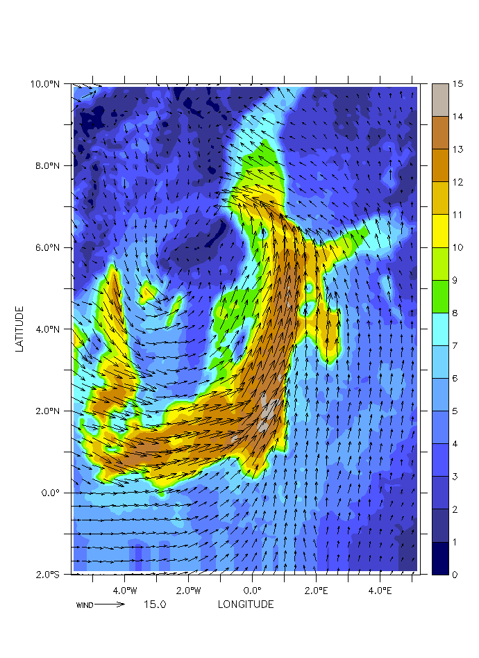
- wind_2010092103_ICM_aspect.gif - this is wind on curvilinear grid it is a bigger area
- wind_2010092103_ICM_remaped_132x145_and_interpolated.gif - this is wind on rectilinear grid it's a smaller area.
As You can see ferret did transformation but in a way I didn't intend. The Baltic Sea area is a little bit translated to the north and the northern part of sea was cut. The picture should wrap all area of Baltic Sea.
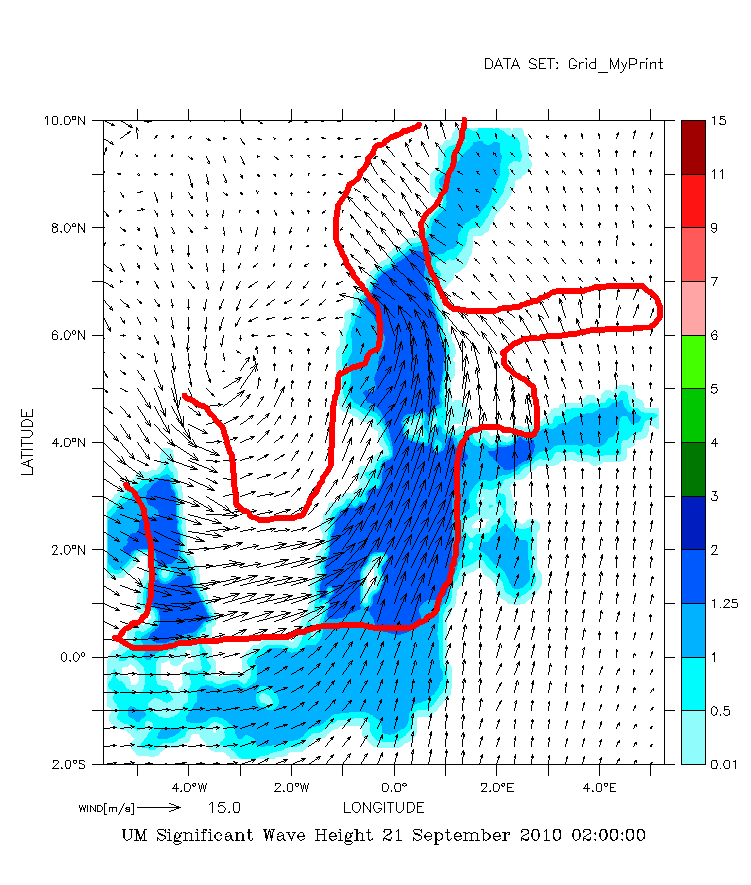
In the picture UM_Significant_Wave_Height_21_September_2010_020000_TMP.gif I marked the area which matches interpolated wind field on Baltic Sea and You can see that it disagrees to significant wave height which occupies properly area. It means that interpolation from curvilinear grid 448x615 to the rectilinear grid 132x145 was done improperly.
I hope I was understood.
Kind regards,
Szymon Roziewski
Attachment:
wind_2010092103_ICM_aspect.gif
Description: GIF image
Attachment:
wind_2010092103_ICM_remaped_132x145_and_interpolated.gif
Description: GIF image
Attachment:
UM_Significant_Wave_Height_21_September_2010_020000_TMP.gif
Description: GIF image
[Thread Prev][Thread Next][Index]
Contact Us
Dept of Commerce /
NOAA /
OAR /
PMEL /
TMAP
Privacy Policy | Disclaimer | Accessibility Statement