To get the colors to balance with the center of the palette zero, you would usually specify /LEVELS=nC where n is the number of levels to be used, and C tells Ferret to center the range of levels, with an equal number of levels below and above 0. I see that you have some specific levels assigned to show the range of your data. You might think of designing your own palette, and use the style of palette called by_value.
An example of this is in the v5.60 release notes, at http://ferret.pmel.noaa.gov/Ferret/Documentation/Release_Notes/v56.html#palettes, which shows the palette topo.spk. This particular palette is designed to show land/sea topography, but you could do something similar with a set of colors to show your data. To find a palette that's in the Ferret distribution, use the Unix command Fpalette, e.g. this will list the location of topo.spk
> Fpalette topo.spk
The topo.spk file is below - note how it associates particular data values with particular colors. If you compare this with a palette like light_centered, you will see how you can make a palette to associate your data levels with the colors you want them to have.
! Palette for ocean/terrestrial elevation.
! *jc* 11/00
! Good levels for US elevation (in meters):
! (-6000,-1000,1000)(-1000,-100,100)(-100,100,10)(100,1000,100)(1000,6000,1000)
RGB_Mapping By_Value
! Val R G B
-8000. 0. 0. 10. ! blue-black
-4000. 0. 0. 50.
-2000. 0. 0. 100. ! blue
-300. 40. 70. 100.
-100. 50. 100. 100.
-50. 40. 80. 70.
-0.1 90. 100. 100. ! light green-blue
0. 0. 20. 00. ! dark green
100. 0. 70. 30. ! light green
300. 90. 100. 0. ! light yellow
1200. 60. 30. 0. ! rust
4000. 90. 90. 100. ! ice blue
5000. 100. 100. 100. ! white
Javeria Ashraf wrote:
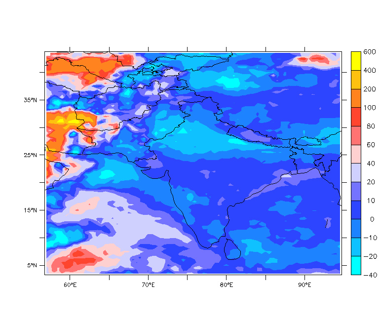
dear allIn the figure attached, the shades of blue color are assigned to both positive and negarive values,I have used pallette=light_centered.Is there any way that values less than zero show shades of different color(e.g Blue),and the values greater than zero show shades of different color(e.g. Red), without changing the levels.Cheers,Javeria.Research Fellow,
Climate Section,
Global Change Impact Studies Centre,Islamabad,Pakistan.
--

~>   ~>   ~>   ~>   ~>   ~>   ~>   ~>   ~>   ~>   ~>

Ansley Manke, NOAA/PMEL   ansley.b.manke@xxxxxxxx
7600 Sand Point Way NE, Seattle WA
Phone 206-526-6246,  FAX 206-526-6744