You do not need to do any conversion. This is a curvilinear data set, with coordinate variables lat and long in degrees, and a data variable D2_aNO3. The units of i and j are not important, they are treated as indices only. You can user Ferret's curvilinear plot commands,
FILL D2_aNO3[L=1], long, lat
or
SHADE D2_aNO3[L=1], long, lat
Specifying any time step, like L=1 if the data depended on more than one time. I don't see that D2_aNO3 depends on depth, but that could be specified in the square brackets if a variable depends on K.
To explore the data set further, try these commands (thanks to Andrew Wittenberg for the idea of a checkerboard variable.):
! show the curvilinear coordinates
yes? fill long
yes? fill lat
! show a variable on the curvilinear grid that alternates colors between each grid cell
yes? let checkerboard = 0*D2_aNO3 + MOD(i+j, 2)
yes? shade checkerboard, long, lat
Ashraf Zakey wrote:
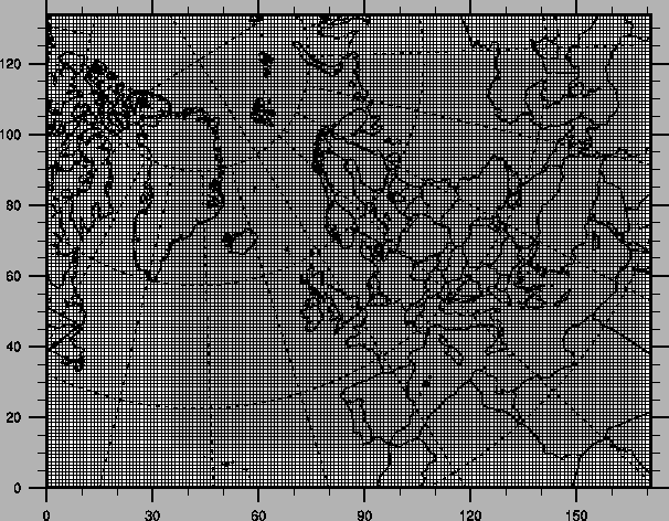
Hi Ansley,

    Thank you for your reply. And I would like to draw
this data on the following domain, please see the
attched figure. I appricate your help.

All the best
Ashraf


The characteristics of my data is:

ncdump -h rv2_2_10_NILU_year.nc

netcdf rv2_2_10_NILU_year {
dimensions:
        i = 101 ;
        j = 51 ;
        k = 20 ;
        time = UNLIMITED ; // (1 currently)
variables:
        float i(i) ;
                i:coord_axis = "x" ;
                i:long_name = "EMEP grid x coordinate";
                i:units = "km" ;
        float i_EMEP(i) ;
                i_EMEP:long_name = "official EMEP grid coordinate i" ;
                i_EMEP:units = "gridcells" ;
        float j(j) ;
                j:coord_axis = "y" ;
                j:long_name = "EMEP grid y coordinate";
                j:units = "km" ;
        float j_EMEP(j) ;
                j_EMEP:long_name = "official EMEP grid coordinate j" ;
                j_EMEP:units = "gridcells" ;
        float lat(j, i) ;
                lat:long_name = "latitude" ;
                lat:units = "degrees" ;
        float long(j, i) ;
                long:long_name = "longitude" ;
                long:units = "degrees" ;
        float k(k) ;
                k:coord_alias = "level" ;
                k:long_name = "vertical eta coordinates" ;
                k:units = "eta_level" ;
                k:positive = "down" ;


float D2_aNO3(time, j, i) ;
                D2_aNO3:long_name = "D2_aNO3" ;
                D2_aNO3:numberofrecords = 1 ;
                D2_aNO3:units = "ugN/m3" ;
                D2_aNO3:class = "ADV" ;
                D2_aNO3:scale_factor = 1. ;
                D2_aNO3:_FillValue = 9.96921e+36f ;
                D2_aNO3:xfelt_ident = 0, 0, 0, 6, 2, 670, 1000, 0, 0, 101, 51, 0, 0, 0, -21, 72, 0, 0, 0, 0;
                D2_aNO3:current_date_first = 2001, 1, 1, 3 ;
                D2_aNO3:current_date_last = 2001, 1, 1, 3 ;

global attributes:
                :Conventions = "GDV" ;
                :model = "ZD_OZONE" ;
                :author_of_run = "Unimod group" ;
                :created_date = "20050905" ;
                :created_hour = "164425.705" ;
                :lastmodified_date = "20050905" ;
                :lastmodified_hour = "164519.940" ;
                :projection = "Stereographic" ;
                :projection_params = "90.0 -32.0 0.933013" ;
                :vert_coord = "vertical coordinates =(p-p(top))/(p(surf)-p(top))" ;
                :period_type = "yearly" ;
                :run_label = "rv2_2_10_NILU_2001" ;


--- Ansley Manke <ansley.b.manke@noaa.gov> wrote:
Hi Ashraf, You asked several questions that all seemed to be related to the same question in working with your data. Did Jaison's answer help you? If you still need more help, could you tell us more about the data you are using and how you set up the stereograpic projection? It sounds as though your variable NO3 is initially on a grid defined in km. If so, then you need to define a new grid in units of degrees, and regrid the data to that grid. If you define the new grid to have its coordinate points at the same locations as the input grid, but in the new units of degrees, then you would use the @ASN regridding transformation to put the data onto the latitude-longitude grid. Are you running the mp_stereographic_north or mp_stereographic_south journal script to create the projection? If so, then you should regrid to the grid defined in degrees first, and then use the projection script. Ansley Ashraf Zakey wrote:Hello everyone, With Netcdf data and Stereographic projection,Iwould like to convert the units of X and Y axis>from (KM) to (Degree) using Ferret to darw theconcentrations of some Air pollutants. I did something such as: let x1=x/111.1 let y1=y/111.1 fill/set NO2,x1,y1 But it donsn't work I appreciate any help Thanks Ashraf ''~`` ( o o )+------------------.oooO--(_)--Oooo.------------------+||| Ashraf Saber Zakey|| Department of Chemistry|| Atmospheric Science group|| Universty of Gothenburg|| SE 412 96 Gothenbrg|| Sweden|| e-mail: zakey@chem.gu.se|| ashraf_saber123@yahoo.com|||| .oooO|| ( ) Oooo.|+---------------------\ (----()--------------------+\_) ) / (_/______________________________________________________Click here to donate to the Hurricane Katrinarelief effort.http://store.yahoo.com/redcross-donate3/''~`` ( o o ) +------------------.oooO--(_)--Oooo.------------------+ | | | Ashraf Saber Zakey | | Department of Chemistry | | Atmospheric Science group | | Universty of Gothenburg | | SE 412 96 Gothenbrg | | Sweden | | e-mail: zakey@chem.gu.se | | ashraf_saber123@yahoo.com | | | | .oooO | | ( ) Oooo. | +---------------------\ (----( )--------------------+ \_) ) / (_/ ______________________________________________________ Click here to donate to the Hurricane Katrina relief effort. http://store.yahoo.com/redcross-donate3/