|
||
| Biophysical Observations aboard Alaska State Ferries |
|
|
|
|
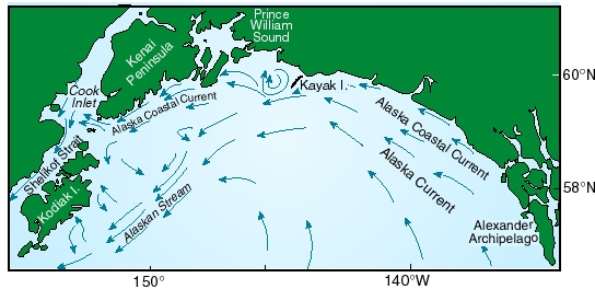
ECOSYSTEM: The productive ecosystem
of the coastal Gulf of Alaska supports some of the nation's largest fisheries
and vast numbers of birds and mammals. Over the continental shelf in depths
less than 200 m, the Alaska Coastal Current (ACC)
|
 |
|
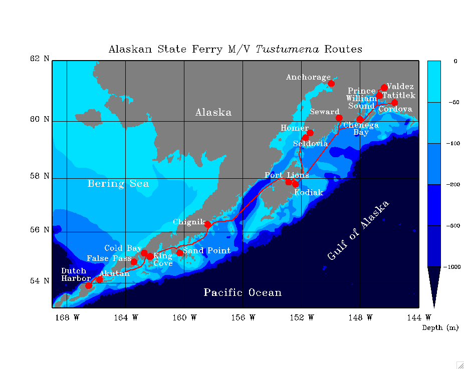
Monitoring at sea is expensive. Operation of a dedicated research vessel can cost upwards of $20,000 per day. An alternative is to use a vessel that regularly plies the waters of interest and outfit it to make scientific measurements. Such a Volunteer Observing Ship (VOS) would operate at no cost to the research agency. The Alaska Marine Highway System (AMHS) operates a fleet of ferries in Alaska. The ferry M/V Tustumena crosses the Alaska Coastal Current between the Kenai Peninsula and Kodiak Island over 280 times per year with less-frequent trips northeast into Prince William Sound and southwest to Dutch Harbor. In FY2004 GEM's top priority was to initiate the process to collect basic physical and biological observations from an Alaskan ferry. Primarily with GEM funding, NOAA's Pacific Marine Environmental Laboratory (PMEL) and the Alaska Department of Fish and Game's Kachemak Bay Research Reserve (ADF&G KBRR) began such a study. AMHS generously allowed GEM to instrument M/V Tustumena. Data were collected from the Ferry between September 2004 and September 2008, amassing a time series data set that is a new view of the coastal waters in the Alaska Coastal Current (ACC). |
RESULTS: Data were collected from the Ferry between September 2004 and September 2008, amassing a time series data set that is a new view of the coastal waters in the Alaska Coastal Current (ACC) |
|
EcoFOCI Project Office |
| last updated 10/09/2012 |