Realtime data from the OSU BPR/Tilt instrument at MARS
Examples of earthquake signals detected by the Nano-BPR sensor:
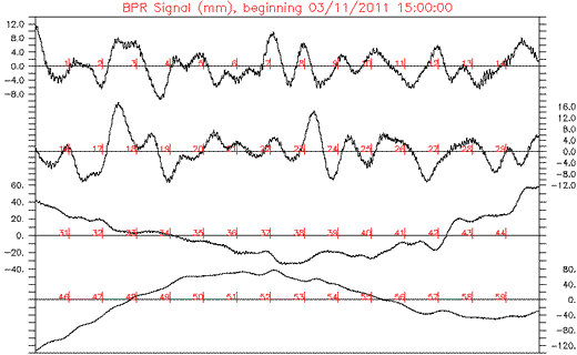
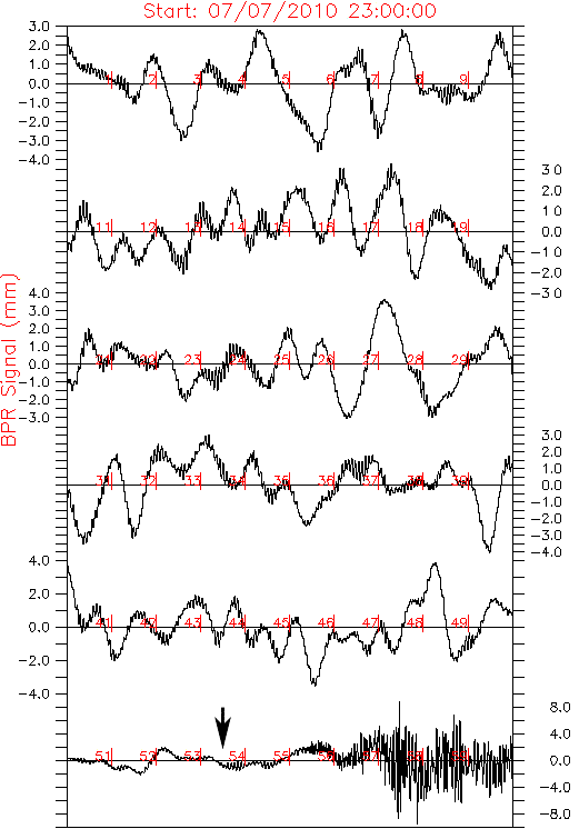
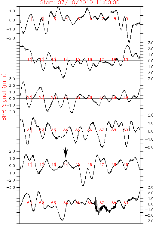
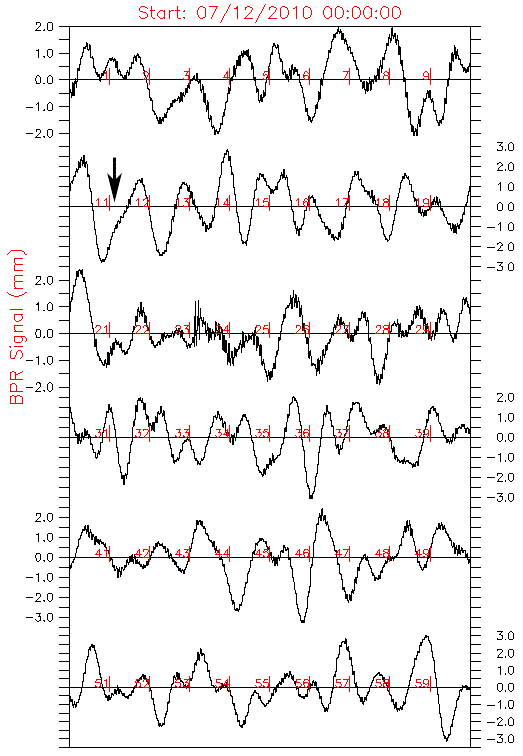
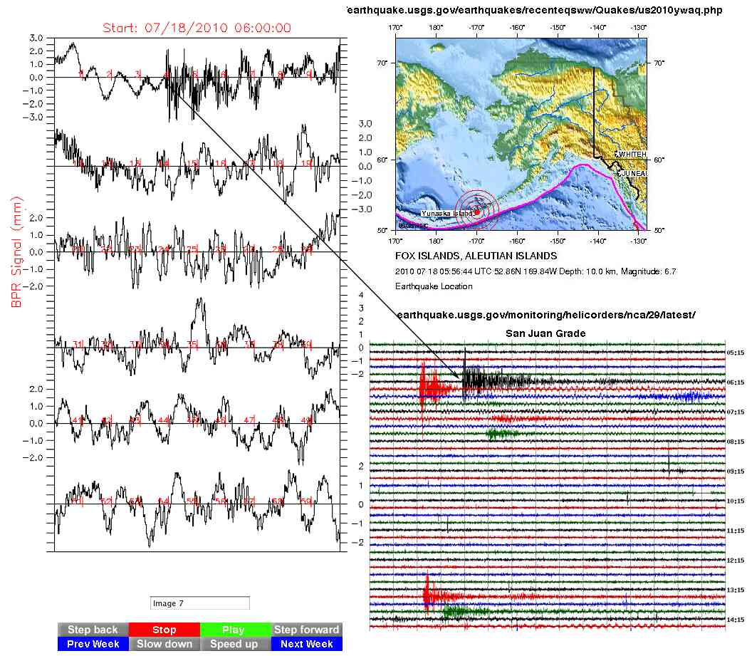
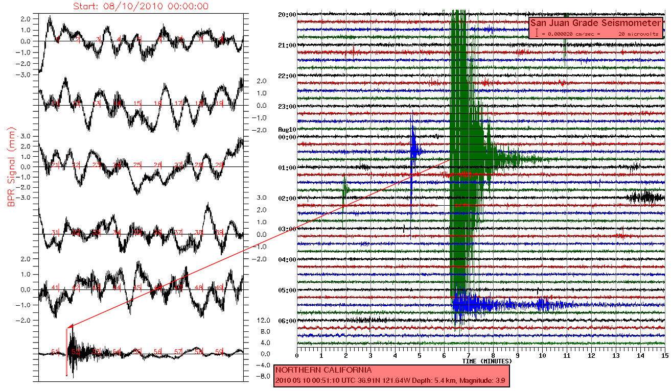
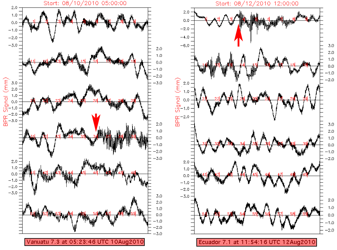
In the plots below, one hour of Nano-BPR data are shown in 10-minute segments on the x-axis with a variable scale in mm on the y-axis. Each 10-minute segment of the Nano-BPR data has been crudely "de-tided" by simply subtracting out the average linear trend for that time interval. The black arrows show the origin time of selected earthquakes and are followed within minutes by vertical ground motion at the MARS site, detected by the Nano-BPR. The earthquakes below are from Honshu Japan, southern California, the Mariana trench, Chile, Alaska and Ecuador and are all magnitude 5.4 - 9.0.
The Japan Honshu recording is different as it shows the tsunami signal arriving in addition to the actual earthquake.
(Return to MARS OSU BPR/Tilt instrument main page)
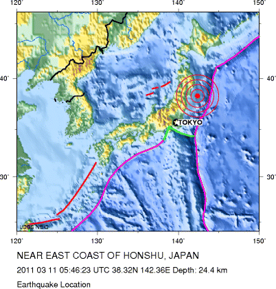
Honshu Japan Mw 9.0, March 2011:
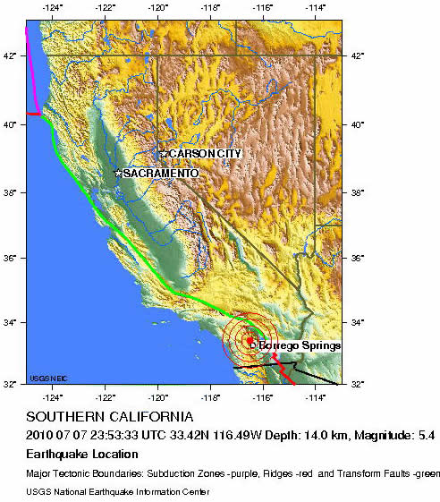
Southern California:
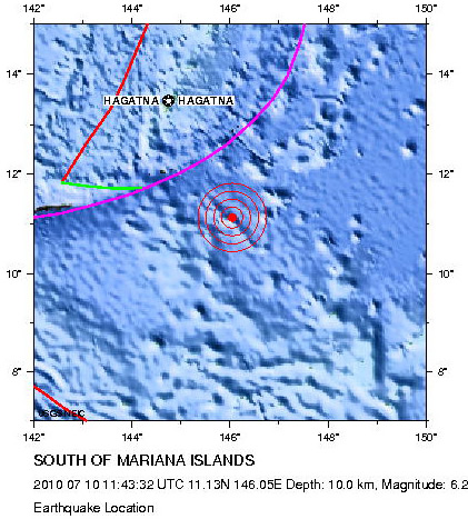
Marianas:
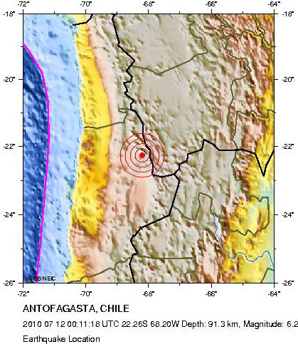
Chile:
Alaska:
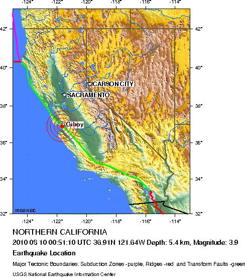
Gilroy, California:
Ecuador:
More information
More information is available at these links: The OSU BPR/Tilt main data page
NSF | MARS | The Ocean Observatories Initiative | NE Pacific Cabled Observatory
Required NSF disclaimer: This material is based upon work supported by the National Science Foundation under Grant No. 0826490. Any opinions, findings, and conclusions or recommendations expressed in this material are those of the author(s) and do not necessarily reflect the views of the National Science Foundation.