US Dept of Commerce / NOAA / OAR / ERL / PMEL HOME

SEBSCC Modeling Results 1998: Regional Tidal Plus Subtidal Results

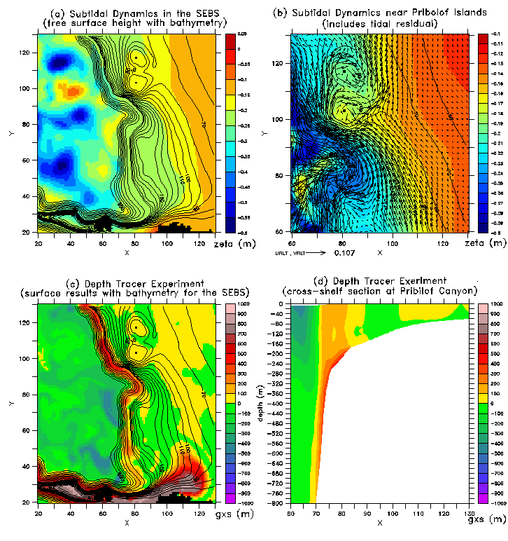
We have completed both idealized runs of the regional model with tidal plus subtidal forcing, and specific simulations of 1997 and 1995 with tides, wind, and heat flux forcing. First, here are some results from an idealized sixty-day spinup run with M2 tides and subtidal forcing (idealized Aleutian North Slope Current and Alaskan Stream) but no wind or heat flux. In this case the model is implemented on a grid with 4 km spacing; the model domain is centered on the southeastern corner of the Bering Sea. The orientation of the y-axis is northwest-southeast in these figures. Model bathymetry is shown as solid lines in (a)-(c); contour interval is 10m for 0-200m and 100m otherwise.


  1. De-tided sea surface height (m, shaded) with bathymetry, after 60 days spinup. The x and y axes are labeled by indices of the model grid.
  2. Closeup of de-tided sea surface height and circulation (m  s-1) in the vicinity of the Pribilof Islands (with St. Paul Island and St. George Island indicated by the small black squares).
  3. Surface values of a "depth tracer variable" (gxs) from a passive tracer experiment, exhibiting cross-isobath mixing and advection. Here we initialized a 3-D scalar field in SCRUM with the value of the local bathymetric depth, i.e.
    g(x,y,z,0) = h(x,y)
    where g is the passive tracer and h is the model bathymetry. We then tracked its evolution over the 60-day spin-up run. As the run proceeds, cross-isobath mixing and advection are indicated by the difference
    gxs(x,y,z,t) = g(x,y,z,t) - h(x,y)
    A positive value of gxs indicates either flow of initially deeper (and typically more nutrient-laden) water parcels into shoal areas, or sub-grid-scale mixing across isobaths.
  4. Cross-shelf profile of the depth tracer variable at Pribilof canyon, exhibiting on-shelf penetration of waters from deeper areas.


Comparison of 1995 and 1997 subtidal results:

Most recently we have completed a model comparison of years 1997 and 1995 through mid-May, driven by realistic (ECMWF 12-hourly) winds, climatological heat flux, five tidal components (M2, K1, S2, N2, O1) from the global model, and subtidal inflows appropriate to those two years. Results from these runs suggest the following: (Click on each image to see it in full size.)

1) There is considerable eddy activity in the basin, which the sea surface height (shaded, in m) of mid-May 1997 exemplifies:


2) There is somewhat more mesoscale eddy activity in the basin during 1995 than during 1997.
Compare the two velocity fields (plotted over bathymetry, shaded, in m) for mid-May 1995 and mid-May 1997:


3) Energetic small-scale horizontal structures (eddies) abound near the shelf break
and along the 100-meter isobath:
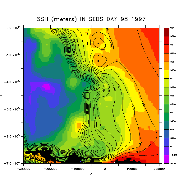
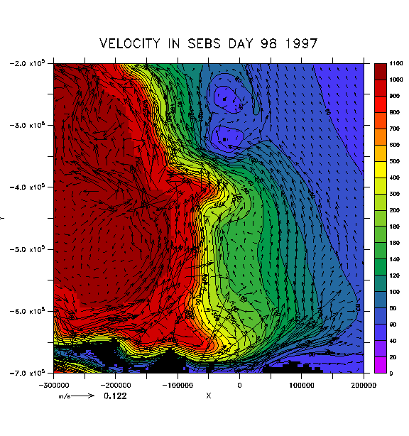
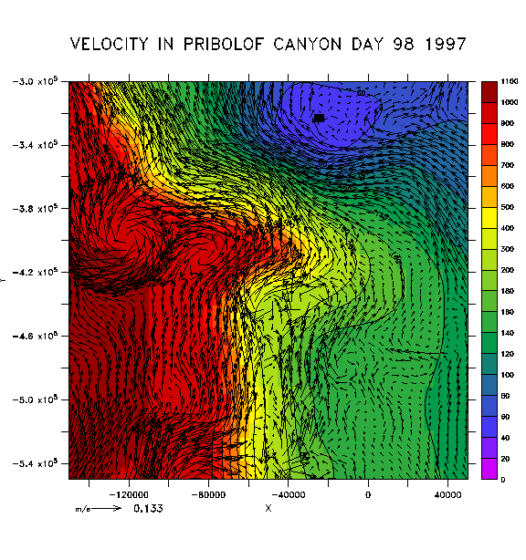
Here's a close-up of the velocity field near the Pribolof Islands in mid-May 1997, and here's an extreme close-up of the velocity field near Pribolof Canyon in mid-May 1997

(this illustrates the full, 4km horizontal resolution of the model)


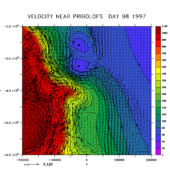
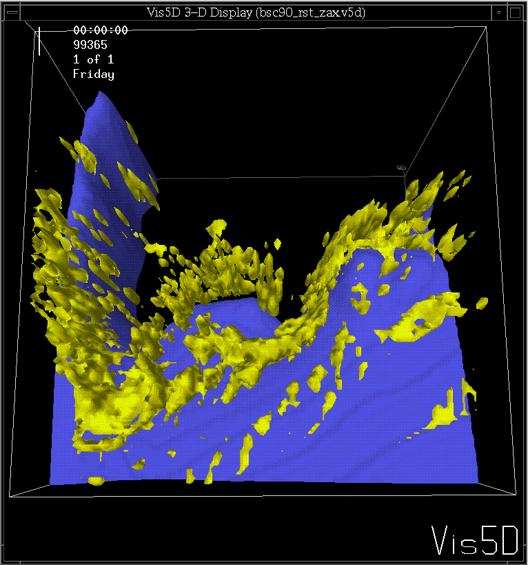
4) Strongest mixing occurs at the shelf break and along the 100 meter isobath. Here is a 3-D view of the Bering Sea shelf, looking over the edge of the shelf break into the basin. Regions of high viscosity (and diffusivity) are colored yellow:


5) A cold pool on the shelf exists in both years:
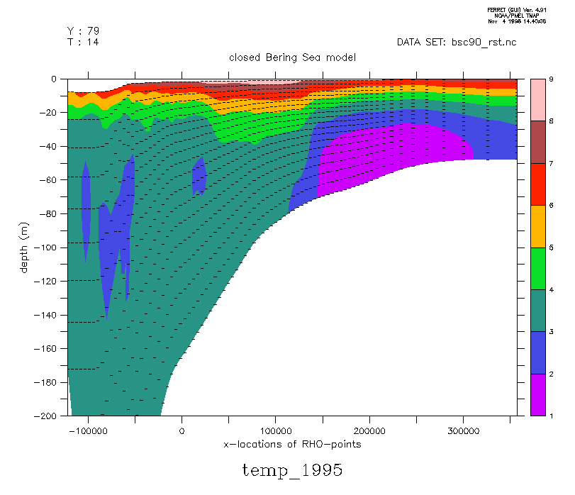
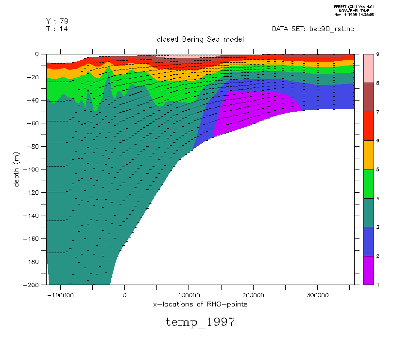
Compare a cross-shelf section of temperature in mid-May 1995, with a cross-shelf section of temperature in mid-May 1997.


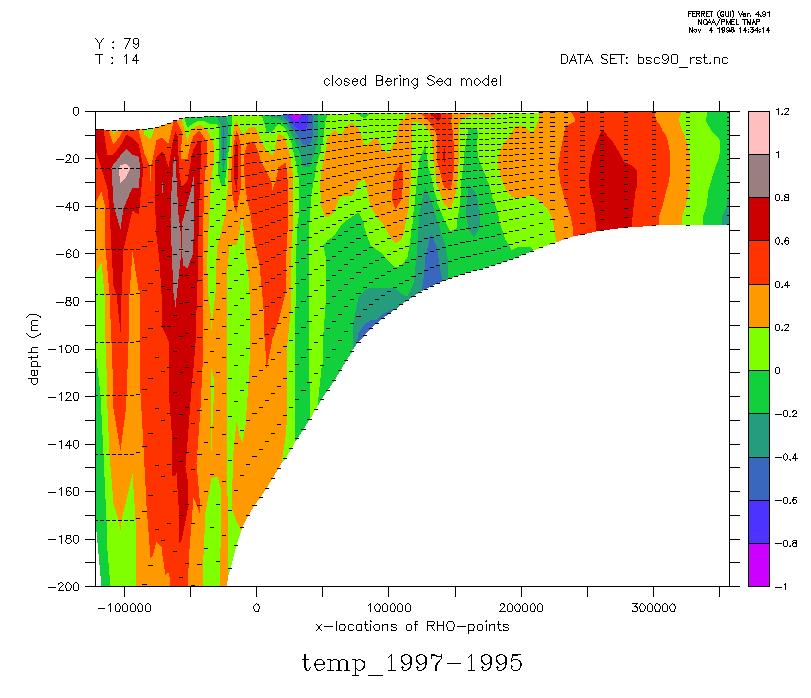
6) Bottom temperatues on the outer shelf are colder in spring 1997 than in spring 1995. Here are the 1997 minus 1995 temperatures across the shelf in mid-May: