Cascadia Margin Methane Seeps
An unknown amount of methane is fluxing through continental margins, and up to ~5000 gigatons of carbon are stored in icy methane hydrate deposits within their sediment. Sources of this methane include biogenic production, disassociation of the methane hydrate layers, and deep thermogenic sources. Methane is recognized as important greenhouse gases and thus the methane geochemical cycle is important to climate modeling. Only recently has sonar technology been capable of locating and mapping these submarine methane sources over large areas of the seafloor. The Cascadia Margin is of particular interest because the methane is stored within the accretionary wedge of an active subduction zone. A baseline characterization of methane seeps along the Cascadia Margin is critical to assess methane input into the ocean, and is timely because the continued rise in ocean temperatures could potentially increase the rate of release of methane from the hydrate layers into the water column and possibly into the atmosphere.
 |
 |
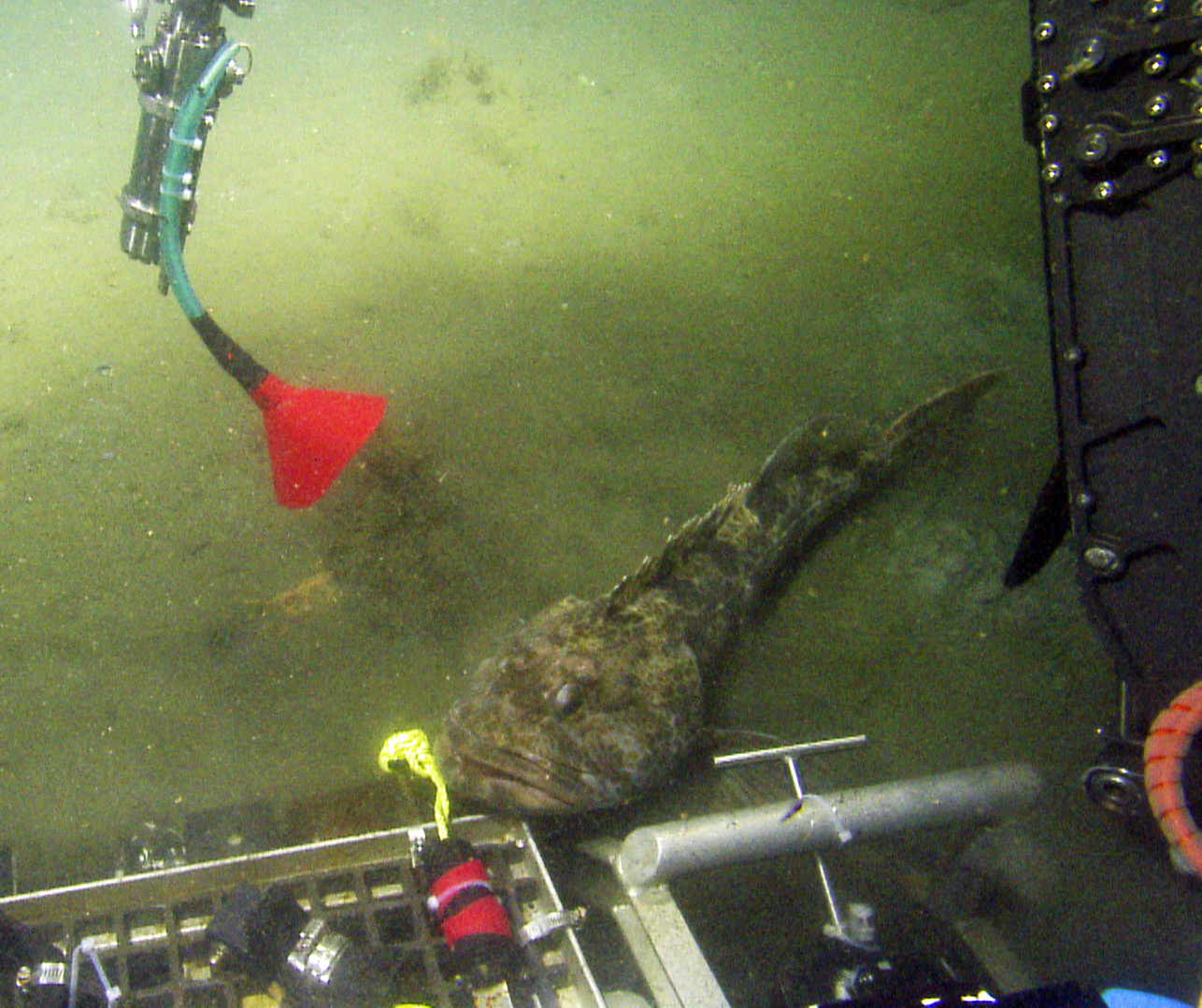 |
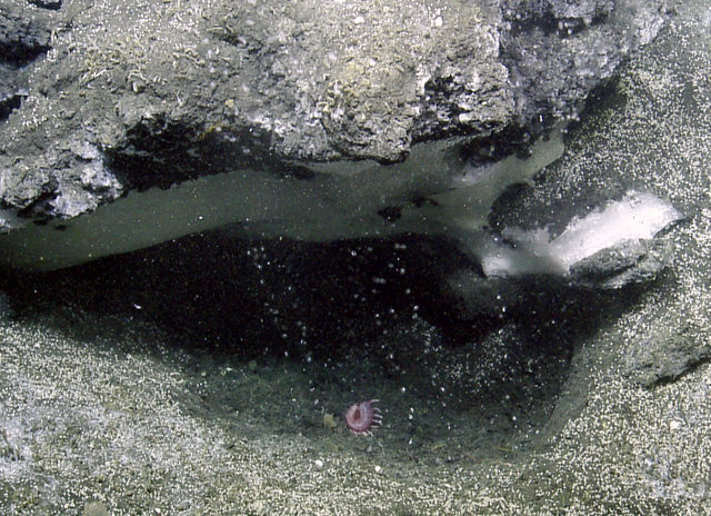
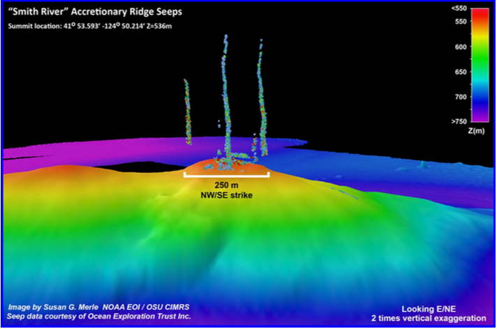
| Exposed methane hydrate (frozen methane) and methane gas bubbles found on the seafloor near Astoria Canyon. | Methane gas bubble streams in 3D view over the seafloor at Smith River. | Lingcod fish swimming through the methane bubbles while sampling gas with red funnel at Nehalem Bank. |
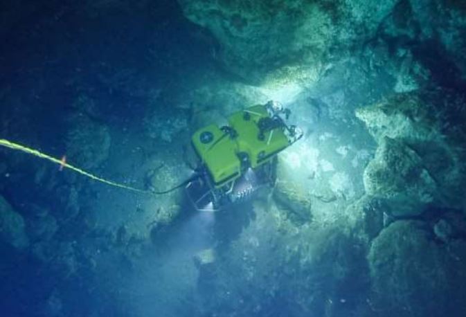 |
| ROV Hercules exploring a massive carbonate outcrop. (NA128 Cruise Report) |
2021 E/V Nautilus Expedition
Extensive mapping of methane seeps and sampling on the Cascadia Margin:
A multi-disciplinary team of researchers set off to further explore and characterize the Cascadia Margin methane seeps on Ocean Exploration Trust's E/V Nautilus with ROV Hercules and ROV Argus on board. The expedition left Astoria, OR on 22 July 2021 and arrived back on land in Port Angeles, WA on 5 August 2021 after being deferred from expedition season 2020. This project was conducted within the partnership between NOAA Pacific Marine Environmental Laboratory (NOAA PMEL) and NOAA Ocean Exploration. It builds on two previous ROV expeditions to the Cascadia Margin on the E/V Nautilus, NA072 in 2016 and NA095 in 2018, respectively.
View more about the expedition on the Nautilus Live web site: HERE.
The 2021 Cruise Report is available: PDF
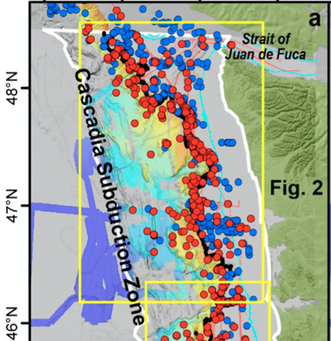 |
| Figure of methane seep sites from Merle et al. (2021). |
2021 Merle et al. paper published in Frontiers in Earth Science
New results:
A paper titled "Distribution of Methane Plumes on Cascadia Margin and Implications for the Landward Limit of Methane Hydrate Stability" is published in the journal Frontiers in Earth Science. A link to the paper is HERE. The paper citation is:
Merle SG, Embley RW, Johnson HP, Lau T-K, Phrampus BJ, Raineault NA and Gee LJ (2021) Distribution of Methane Plumes on Cascadia Margin and Implications for the Landward Limit of Methane Hydrate Stability. Front. Earth Sci. 9:531714. doi: 10.3389/feart.2021.531714
The main Supplementary Materials file is available for download here as a: PDF file.
Supplemental Data Tables from the paper are available to download here as an:
Excel (xlsx) file.
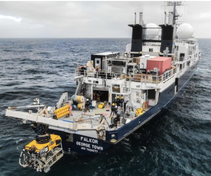 |
| R/V Falkor and ROV SuBastian at sea on the Cascadia Margin. Photo by Shelton Du Preez/SOI |
2019 R/V Falkor Expedition
Continued exploration and sampling with the USGS on the Cascadia Margin:
EOI scientist Tamara Baumberger sailed aboard R/V Falkor with the ROV SuBastian on board from June 12-July 3, 2019, with colleagues from the USGS, GEOMAR, BGS, and UNC, to continue exploration and research on the methane seeps offshore Oregon and Washington. They made ROV dives to collect samples, deploy and recover experiments, and observe the benthic biological communities at the seeps.
View more about the expedition on the Schmidt Ocean Institute cruise web site: HERE.
The ROV dive video from the expedition is available on line: HERE
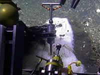 |
| Sampling methane hydrate with newly developed tool for NOAA PMEL's use on ROVs. |
2018 E/V Nautilus Expedition
Extensive mapping of methane seeps and sampling on the Cascadia Margin:
EOI scientists aboard E/V Nautilus June 12-29, 2018 used multibeam sonar and a remotely operated vehicle to more fully document and characterize the undersea methane sites from Northern California to Washington. This year, EOI researchers embarked again on the Nautilus to continue exploring for methane seep sites. During the day a remotely operated vehicle (ROV) collected samples of gas, methane hydrate, seep water, fauna and rocks at these sites. Analyzing these samples in conjunction with a more complete inventory of sites will help scientists understand the origin of the seeping methane and its impact on the ocean environment.
View more about the expedition on the Nautilus Live web site: HERE.
The 2018 Cruise Report is available: PDF | Word (docx)
2018 Hercules dive logs available: Excel (xlsx)
2016 E/V Nautilus Expedition
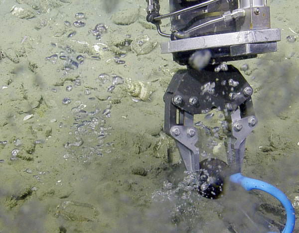 |
| Methane gas released when ROV temperature probe punctures the sediment at Coquille site. |
Discovery of 4x's the number of known methane seeps off the coast:
An exploration effort in June 2016 along the Cascadia margin (offshore Washington, Oregon, and N. California) was conducted on the Ocean Exploration Trust Inc. ship E/V Nautilus, with NOAA-PMEL and Oregon State University CIMRS scientists aboard. The expedition was funded by OET and the NOAA Ocean Exploration Research (OER) Program. The expedition used the latest midwater sonar technology to map out methane bubble streams and made dives with a remotely operated vehicle at selected sites to sample the methane bubbles. The results from this expedition are a game changer - more than 900 new methane sources were discovered in water depths from 105 to 2045 m, more than four times the number previously known. This large number of seeps from just this limited survey indicates that a substantial revision of the methane flux is needed and that cold seeps and the extensive carbonate hard grounds associated with them are an important ecosystem that needs to be factored into future management decisions concerning essential fish habitat. One exciting discovery was finding an exposure of methane hydrate and gas bubbles streaming out of the seafloor in Astoria canyon at a depth of 850 m. The hydrate, a mixed water/methane ice phase, is present over extensive areas of continental margins, but has only rarely been observed exposed at the seafloor along the Cascadia margin.
View the 2016 expedition cruise report is available here (PDF).
Read more about the methane seeps and the 2016 expedition in Oceanography Magazine: Water column and cold seep exploration of the Cascadia Margin.