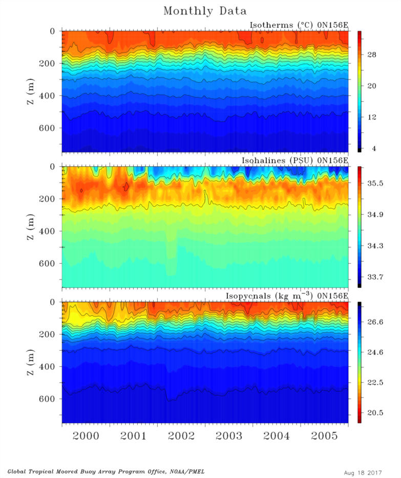
Time-Depth area-fill plots which show temperature, salinity, density, and ocean currents use data which have been gridded to standard depths which are appropriate to resolve the vertical ocean structure, e.g., the Thermocline. The particular depths used are indicated in most plots on the left edge of the plot by the small arrows.
Missing daily data are first linearly interpolated in time when the nearest non-missing data are fewer than 7 days apart.
Missing daily data are then linearly interpolated in depth in a very limited way by testing the profile to be sure the distance interpolated across is not too large, i.e., twice the standard depth difference.
Missing surface values may be filled using nearest shallow subsurface data at the same time, if the depth difference is less than 50 meters, which assumes a mixed layer depth of more than 50 meters.
In a very few cases, data at the bottom of the profile are linearly extrapolated from nearby shallower temperatures when the slope at the nearest non-missing data temperature can be reliably estimated, and when the distance extrapolated is small.
Data for 5-Day, Monthly, and Quarterly plots are computed from daily data by filtering daily data in time using a triangle filter, which approximates well a Hanning filter, in terms of small side lobes. Triangle full-widths are 5-days, 29-days, and 93 days respectively.
Note that high resolution data have not been processed in the same way for displays by interpolating to standard depths or across short gaps in time, so time-depth plots of these data will often show gaps at the locations of missing data.
Also note that when you click the red Deliver button to deliver subsurface data, the data which are delivered have not been interpolated or filled the way the displayed data have. Delivered 5-Day, monthly, and quarterly data are averages, rather than the triangle filtered data used in displays.