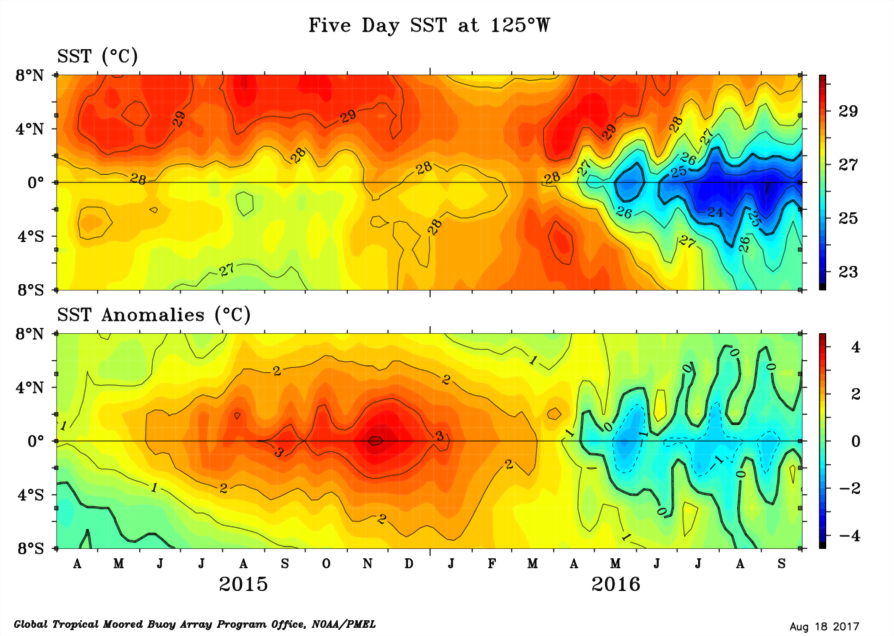
All of the fields displayed as latitude-time sections are fields of gridded 5-day or monthly means. The same gridding routine is used for all fields.
First, 5-day or monthly mean values are computed at the TAO/TRITON buoy locations.
Second, anomalies are computed from these by subtracting climatological averages from the data means after bilinearly interpolating the climatology field in latitude and longitude to the nominal TAO/TRITON array coordinates. In the case of 5-day fields, the climatology is also interpolated linearly in time to the data times.
Third, the anomalies are linearly interpolated, first in latitude where gaps are smaller than 7 degrees, second in time where gaps are smaller than 6 time intervals, and finally in longitude.
Fourth, the anomalies are smoothed, zonally, meridionally, and in time. After smoothing in latitude and longitude, the anomalies are masked using the original data distribution to strictly limit extrapolation from the smoothing filters. Extrapolation of 5 degrees in longitude and 1 degree in latitude is allowed by the masking.
Finally, these gridded, smoothed, and masked data are added to the climatologoy to produce the mean field.
The original locations of data at the beginning and ending of the time series are shown by the little boxes on the horizontal axes.