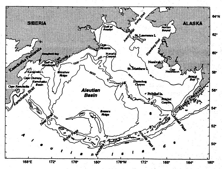
Fig. 1. Geography and place names of the Bering Sea. The location of the seven mooring sites discussed in the text are indicated by bold numerals. Depth contours are in meters.
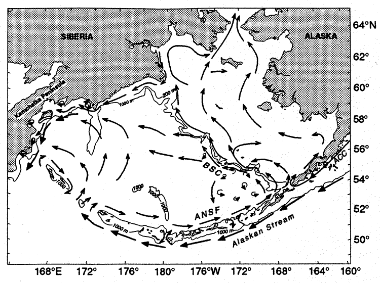
Fig. 2. Schematic of mean circulation in the upper 40 m of water column over the basin and shelf (after Stabeno and Reed 1994, Schumacher and Stabeno 1998). The arrows with solid heads represent currents with mean speeds typically >50 cm/s. The Alaskan Stream, Kamchatka Current, Bering Slope Current, and Aleutian North Slope Current are each indicated. The triangles with numbers indicate the location of the seven deep moorings (water depth >1,000 m) discussed in the paper. The 100-m flow and 1,000-m isobath are indicated.
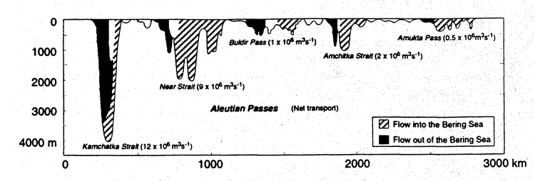
Fig. 3. A cross section of the passes of the Aleutians. Suspected or measured transports are given for each of the main passes. The hatched regions indicate northward flow and the dotted regions indicate southward flow. Unshaded regions indicate areas where either the flow is variable or unknown.

Fig. 4. (a) Vertical sections of temperature (°C) and (b) salinity
(psu) in Amukta Pass in August 23, 1994, during a period of strong inflow (net
1.0 × 10 m
m /s)
of Alaskan Stream water into the Bering Sea. (c) Vertical sections of temperature
(°C) and (d) salinity (psu) during a period of weak (net flow 0.1 ×
10 m/s)
outflow from the Bering Sea.
/s)
of Alaskan Stream water into the Bering Sea. (c) Vertical sections of temperature
(°C) and (d) salinity (psu) during a period of weak (net flow 0.1 ×
10 m/s)
outflow from the Bering Sea.
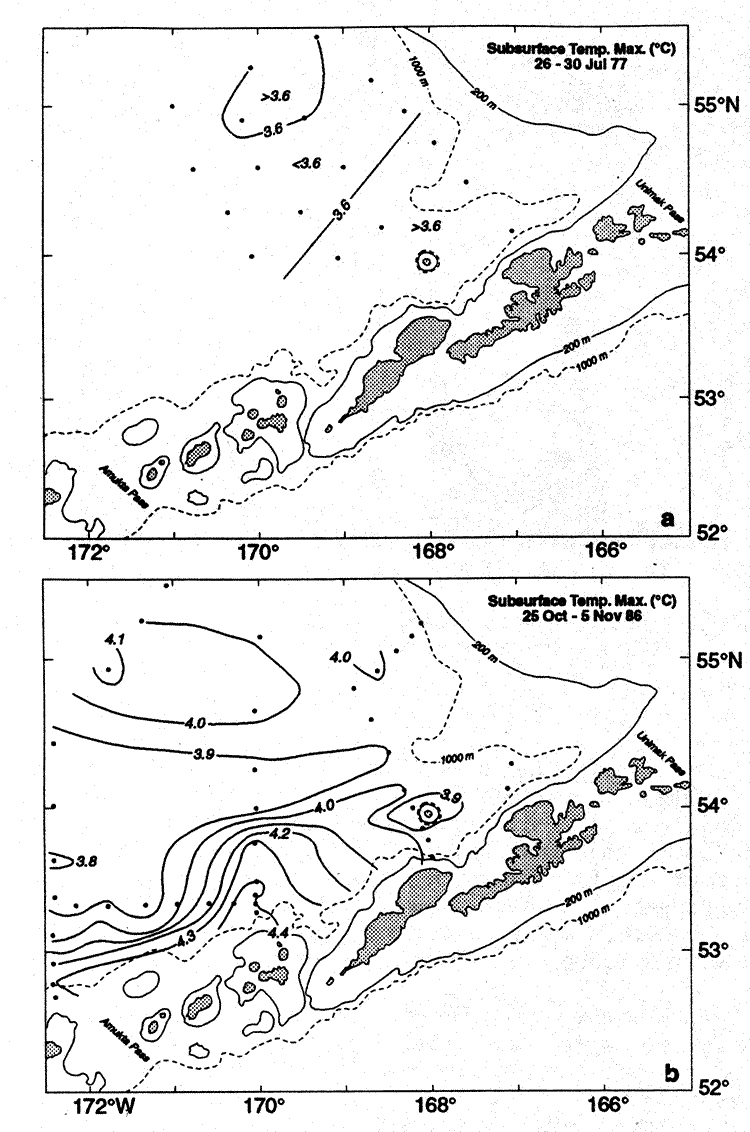
Fig. 5. (a) Distribution of temperature (°C) at the subsurface maximum during a period when the temperature was at a minimum. (b) Distribution of the temperature of the subsurface maximum when substantial areas were >4.0°C. (This figure is adapted from Figs. 3 and 5 in Reed 1995).
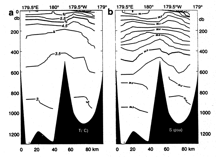
Fig 6. Vertical sections of (a) temperature (°C) and (b) salinity (psu)
along 51°30 N in Amchitka Pass on September
15, 1992.
N in Amchitka Pass on September
15, 1992.
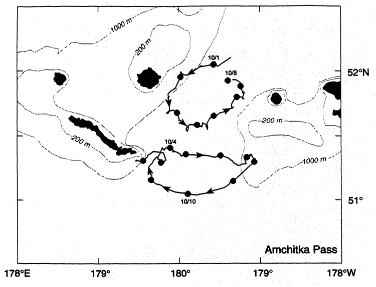
Fig. 7. Trajectories from satellite-tracked drifting buoys deployed in the vicinity of Amchitka Pass in September 1992. Each drifter had a holey sock drogue at 40 m depth. Daily positions are indicated by circles on the trajectories. The southern drifter remained in the eddy for 25 days, making 2.5 circuits. The northern drifter made four circuits of the eddy. Mean rotational speed was 30 cm/s in both eddies.
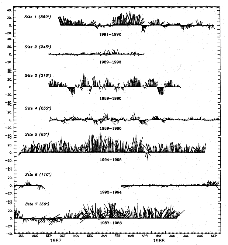
Fig. 8. Daily currents measured at seven locations indicated in Fig. 2. A low pass filter (35-hour Lancoz squared) was applied to each series and the series were then rotated to their net direction (indicated in parentheses). The depth of each instrument was between 250 and 350 m. Site locations are shown in Fig. 1.
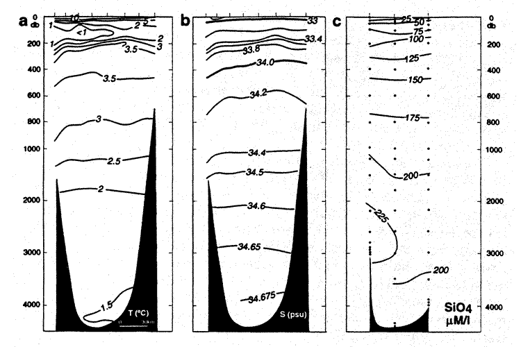
Fig. 9. Vertical sections of (a) temperature, (b) salinity, and (c) silica (mM/L) across Kamchatka Strait on August 13–14 , 1991. Modified from Reed et al. (1993).
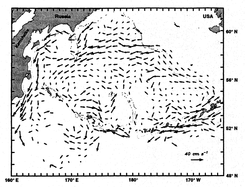
Fig. 10. Velocity at 40 m derived from satellite-tracked drifters. The method used was the same as described in Stabeno and Reed (1994).
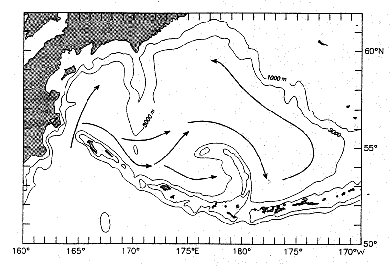
Fig. 11. The deep flow in the Bering Sea basin below 3,000 m. This pattern is inferred from water properties as described in the text.
Return to Abstract