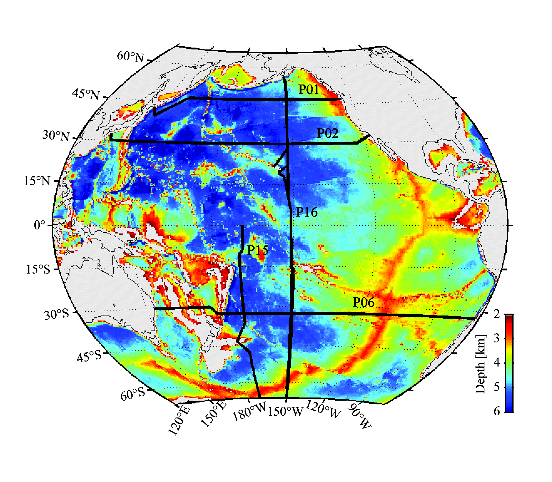
Figure 1. Locations of hydrographic sections (thick black lines) with WOCE designators P01 (47°N), P02 (30°N), P06 (32°S), P16 (150°W), and P15 (170°W). Designator labels are located above zonal sections and to the right of meridional sections. Bathymetry is color shaded from 6 km (blue) to 2 km (red) with shallower depths in gray (see color bar) and coastlines drawn as thin black lines.
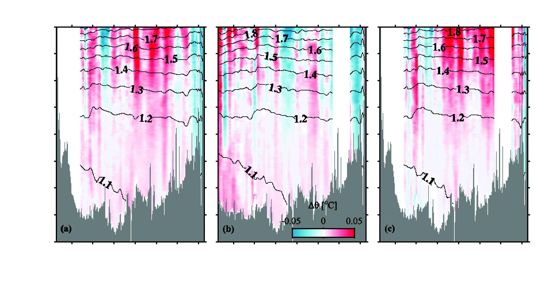
Figure 2. Sections of potential temperature difference (AO, °C) for P16N (nominally along 152°W) between Hawaii and Kodiak Island, color shaded as a function of latitude and pressure. (a) 2006–1984, (b) 2006–1991, and (c) 1991–84. Red areas indicate warming and blue areas indicate cooling, with color saturation at ±0.05°C. Mean potential temperatures from all the data (black lines) are contoured. Portions of the sections with either large data gaps [from 48.3°–52.4°N in (b) and (c)] or where section longitudes diverged at a given latitude [south of 27°N in (a) and (c)] are blanked out.
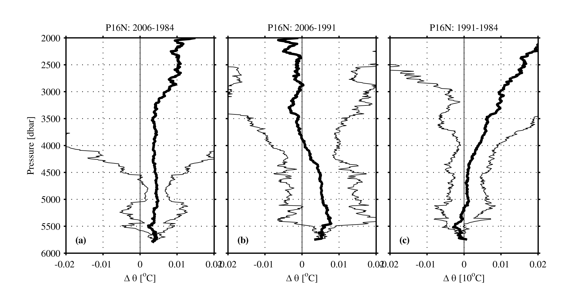
Figure. 3. Section-mean differences of potential temperature differences (AO, °C, thick lines) for P16N (nominally along 152°W) between 27°N/Hawaii and Kodiak Island with 95% confidence limits (thin lines). (a) 2006–1984, (b) 2006–1991, and (c) 1991–84.
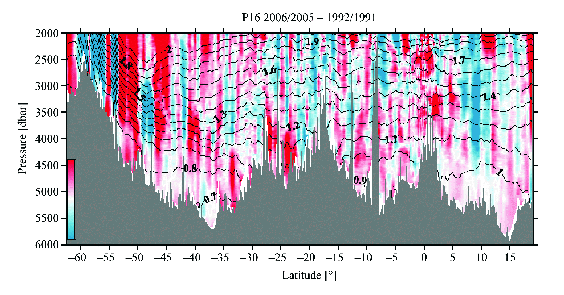
Figure 4. Section of potential temperature difference (AO, °C) for P16S/C (nominally along 150°W south of Hawaii) color shaded as a function of latitude and pressure using 2005/06–1991/92 data. Details are the same as in Figure 2.
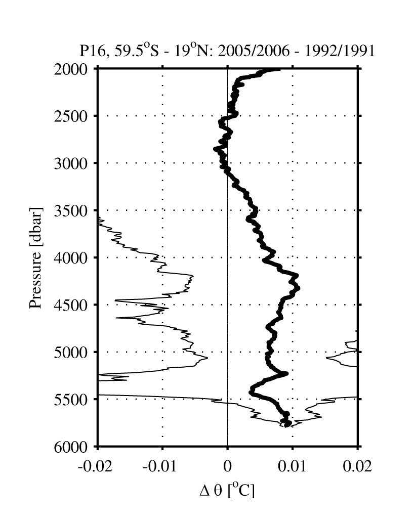
Figure 5. Section-mean potential temperature differences (AO, °C, thick lines) for P16S/C (nominally along 150°W) between the Pacific–Antarctic Ridge (near 59.5°S) and Hawaii (near 19°N) with 95% confidence limits (thin lines) using 2005/06–1991/92 data.
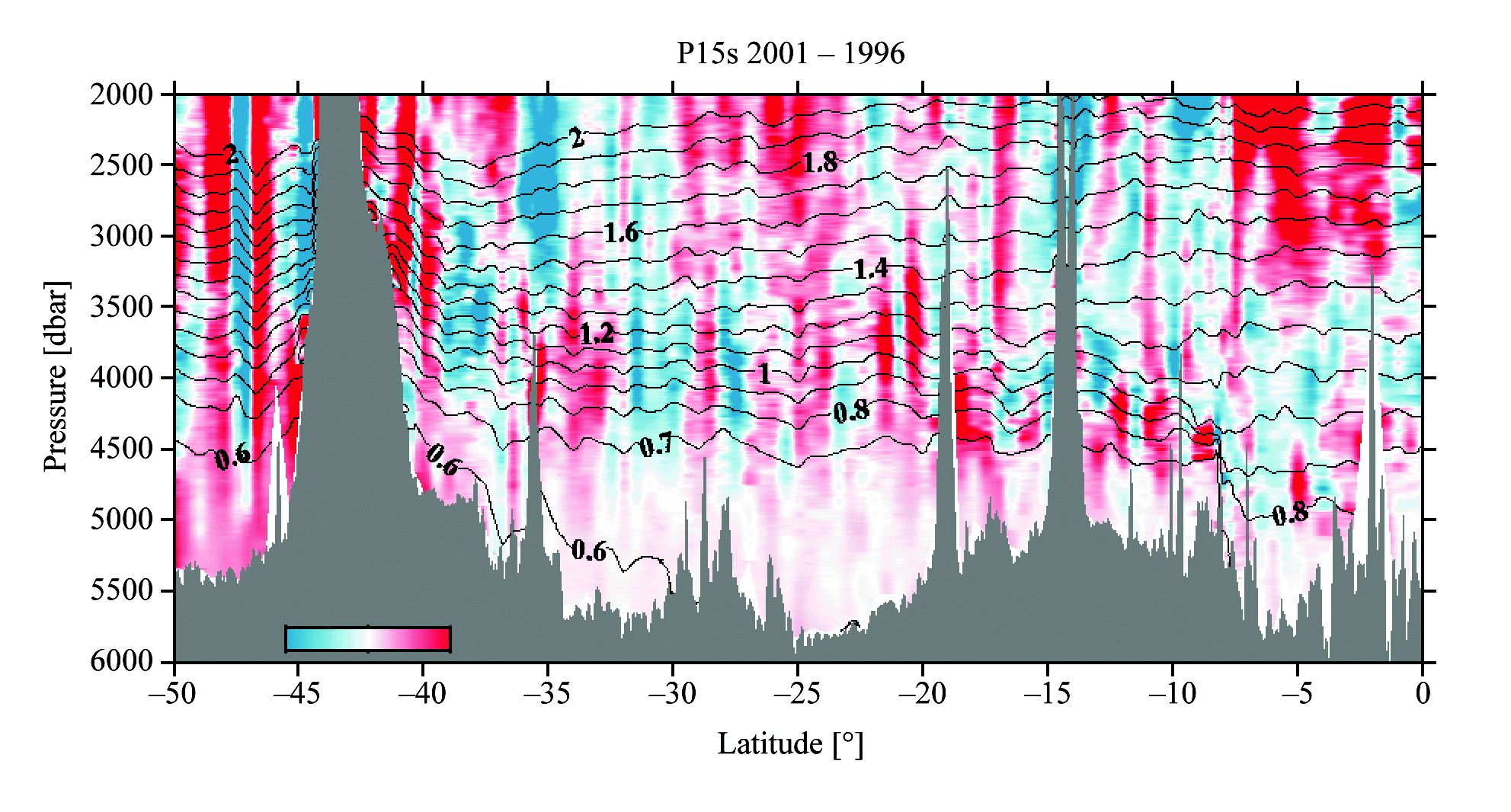
Figure 6. Section of potential temperature difference (AO, °C) for P15S (nominally along 170°W, south of the equator) color shaded as a function of latitude and pressure using 2001–1996 data. Details are the same as in Figure 2.
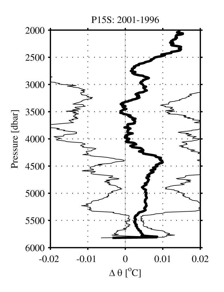
Figure 7. Section-mean potential temperature differences (AO, °C, thick lines) for P15S (nominally along 170°W, south of the equator) with 95% confidence limits (thin lines) using 2001–1996 data.
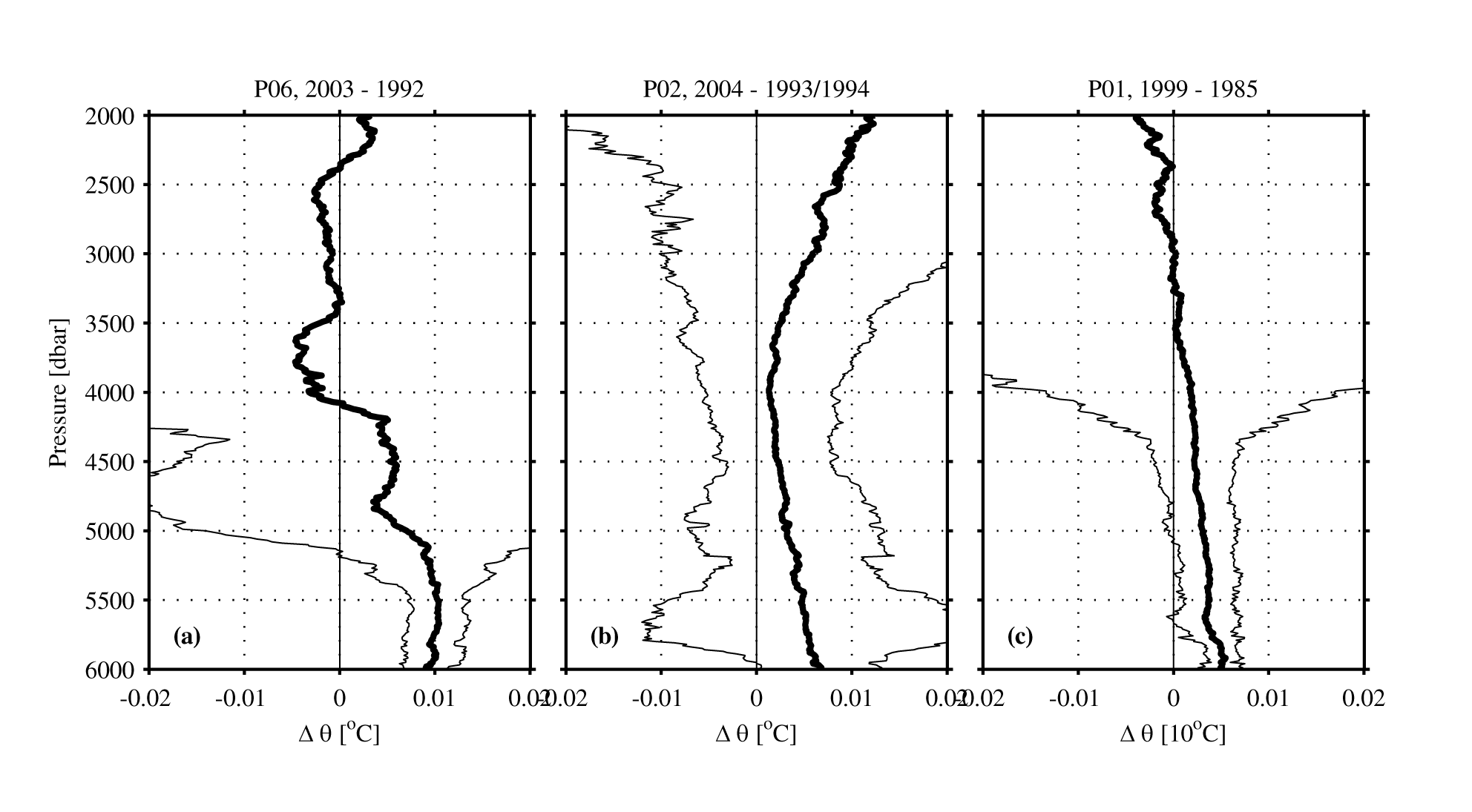
Figure 8. Section-mean potential temperature differences (AO, °C, thick lines) for (a) section P06 (nominally along 32°S) with 95% confidence limits (thin lines) using 2003–1992 data, (b) section P02 (nominally along 30°N) with 95% confidence limits (thin lines) using 2004–1993/94 data, and (c) section P01 (nominally along 47°N) with 95% confidence limits (thin lines) using 1999–85 data.

Figure 9. (a) Percentage of the earth’s surface area (0.510 × 10¹⁵ m2) occupied by the World Ocean as a function of depth. (b) Percentage of the World Ocean volume (1.33 × 10¹⁸ m3) below any given depth. Estimates are based on the bathymetry fields of Smith and Sandwell (1997).
Return to References or go back to Abstract