U.S. Dept. of Commerce / NOAA / OAR / PMEL / Publications
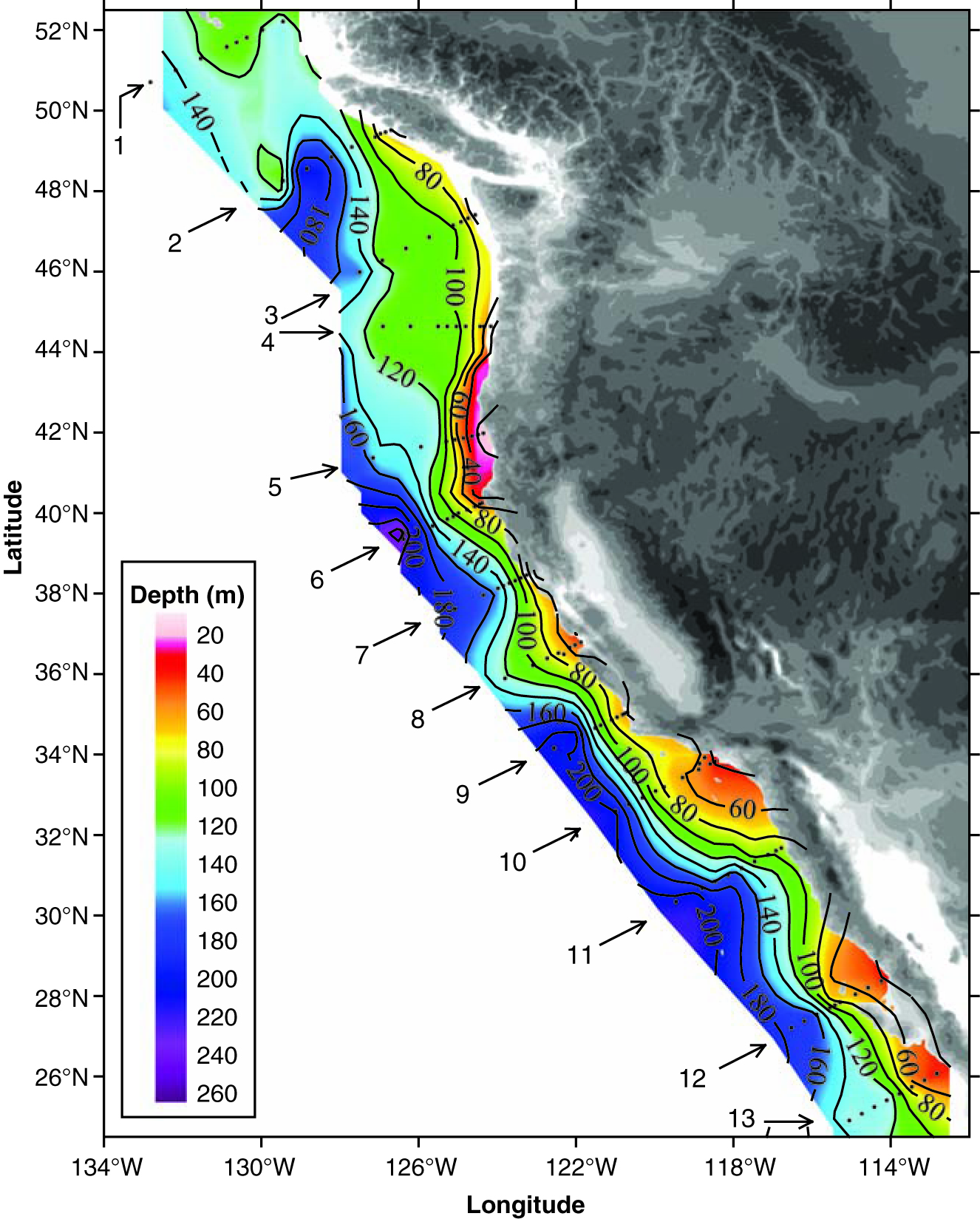
The absorption of atmospheric carbon dioxide (CO2) into the ocean lowers the pH of the waters. This so-called ocean acidification could have important consequences for marine ecosystems. To better understand the extent of this ocean acidification in coastal waters, we conducted hydrographic surveys along the continental shelf of western North America from central Canada to northern Mexico. We observed seawater that is undersaturated with respect to aragonite upwelling onto large portions of the continental shelf, reaching depths of ~40 to 120 meters along most transect lines and all the way to the surface on one transect off northern California. Although seasonal upwelling of the undersaturated waters onto the shelf is a natural phenomenon in this region, the ocean uptake of anthropogenic CO2 has increased the areal extent of the affected area.
Fig. 1. Distribution of the depths of the undersaturated water (aragonite saturation < 1.0; pH < 7.75) on the continental shelf of western North America from Queen Charlotte Sound, Canada, to San Gregorio Baja California Sur, Mexico. On transect line 5, the corrosive water reaches all the way to the surface in the inshore waters near the coast. The black dots represent station locations.
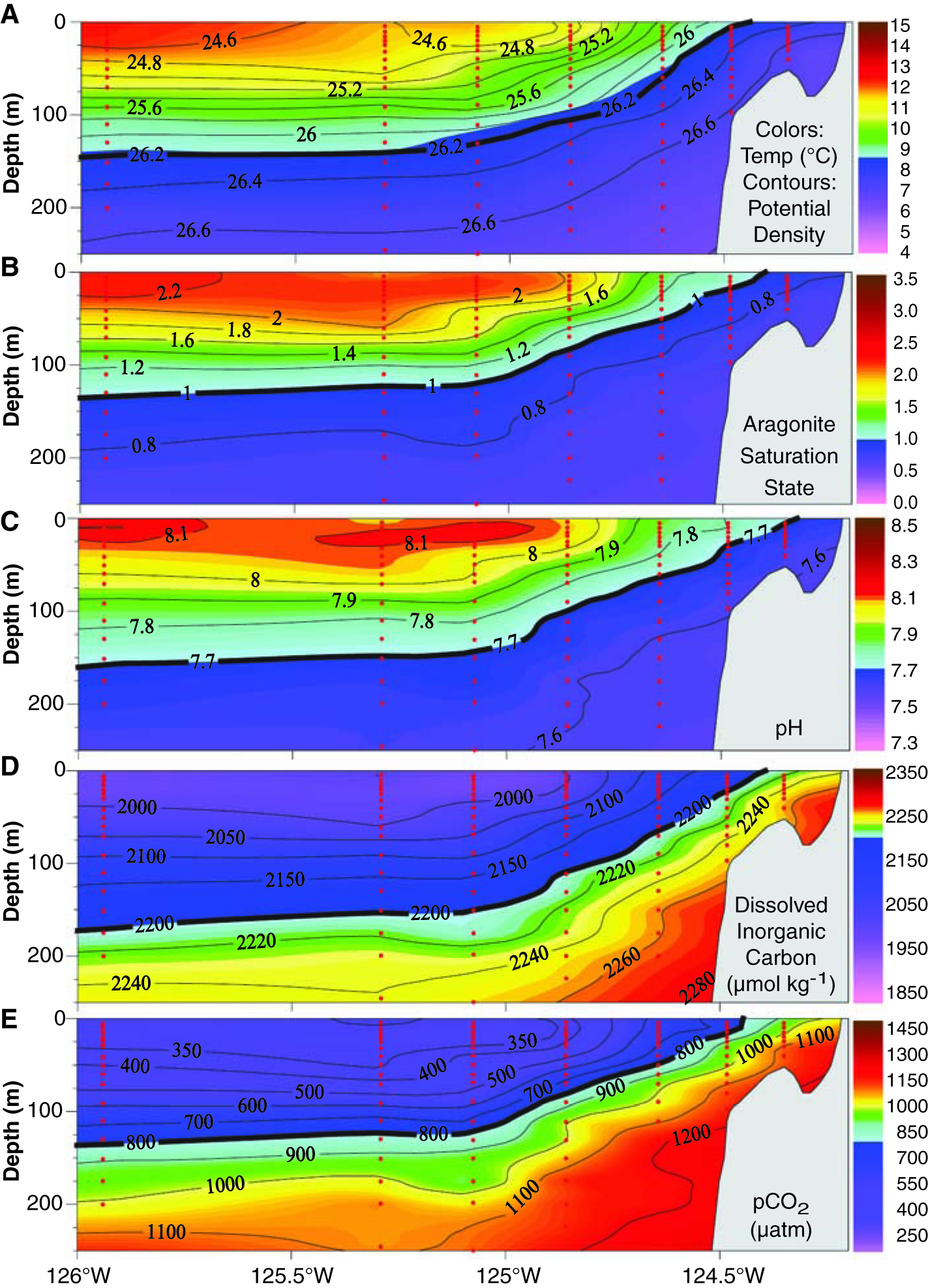
Fig. 2. Vertical sections of (A) temperature, (B) aragonite saturation, (C) pH, (D) DIC, and (E) pCO2 on transect line 5 off Pt. St. George, California. The potential density surfaces are superimposed on the temperature section. The 26.2 potential density surface delineates the location of the first instance in which the undersaturated water is upwelled from depths of 150 to 200 m onto the shelf and outcropping at the surface near the coast. The red dots represent sample locations.
Return to Abstract