U.S. Dept. of Commerce / NOAA / OAR / PMEL / Publications
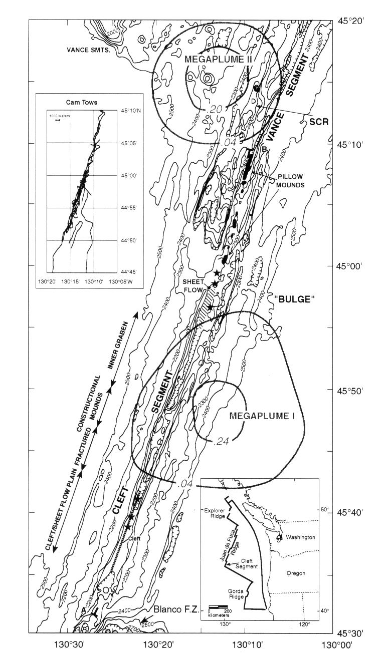
Figure 1. Simplified Sea Beam map of portion of area of Plate 1 showing features discussed in text. Contour interval is 100 m except for the axial valley, where it is 20 m. Temperature anomaly contours of megaplumes are from Baker et al. [1989]. Solid line from 44°35'N to 44°42'N is location of cleft [after U.S. Geological Survey Juan de Fuca Study Group, 1986]. Locations of new pillow mounds and young sheet flows are indicated. Stars show location of high-temperature vents. SCR is Split Cone Ridge. Index map at lower right shows location of mapped area. Inset at upper left shows locations of NOAA towed camera tracks made between 1987 and 1991. A-B shows location of along-axis bathymetric profile shown on Figure 2.
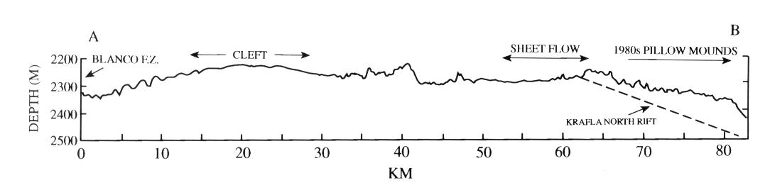
Figure 2. Along-axis bathymetric profile of Cleft segment (A-B) constructed from 100-m grid. Location shown in Figure 1. Dashed line shows gradient of portion of north rift zone of the Krafla central volcano, Iceland.
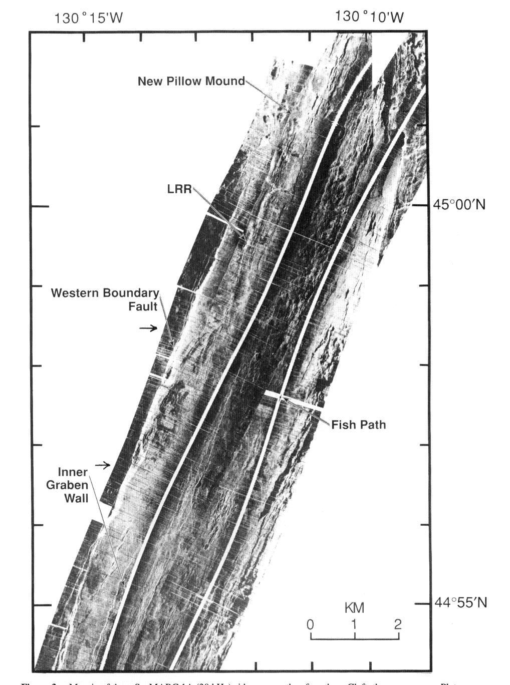
Figure 3a. Mosaic of three SeaMARC 1A (30 kHz) sidescan swaths of northern Cleft, the same area as Plate 2 and Figure 3b (opposite). White ribbons are center beam of sidescan. White is high reflectivity, and black is low reflectivity or shadows. Each swath is 1 km on each side with 1048 pixels across total swath. See Figure 3b for full names of abbreviations. Approximate latitudinal limits of sidescan swaths shown in Figure 4 are indicated by arrows.
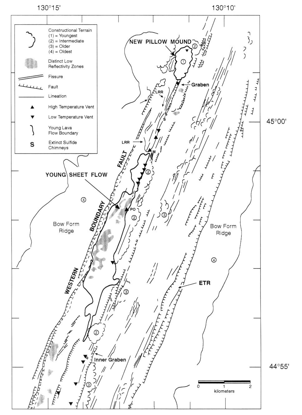
Figure 3b. Interpretative map of sidescan in Figure 3a for northern Cleft segment. Roughly the same area as Plate 2 and Figure 3a. Features outside of Cleft axial valley based on Sea Beam map (Plate 2). Bold line is outline of young sheet flow (YSF). PO is Pipe Organ Vent, M is Monolith Vent, ETR is Eastern Trough, and LRR is Lava Rise Ridge. S indicates location of extinct sulfide chimney fields located north or south of area covered by Figure 5.
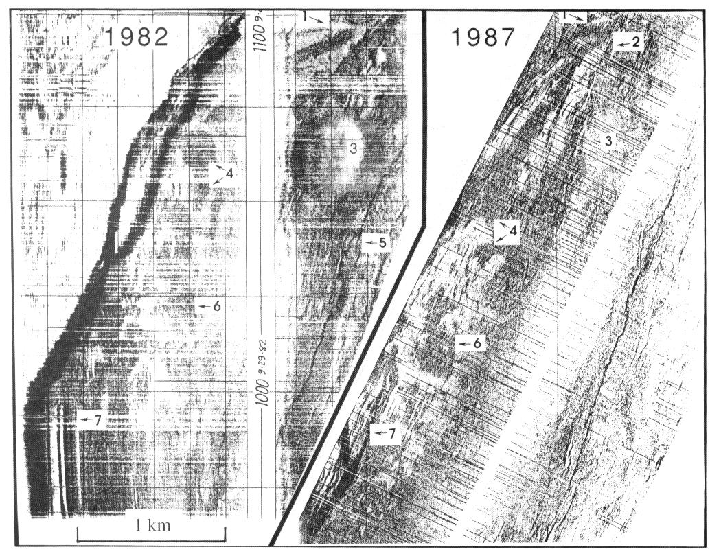
Figure 4. Comparison of 1982 and 1987 SeaMARC sidescan showing similar patterns of backscatter associated with sheet flow. Similar backscatter patterns are identified by number. The low backscatter (white) zones are areas of flat, lineated sheet flows. Note that the 1982 analogue record (no digital data available) is distorted by a large course change.
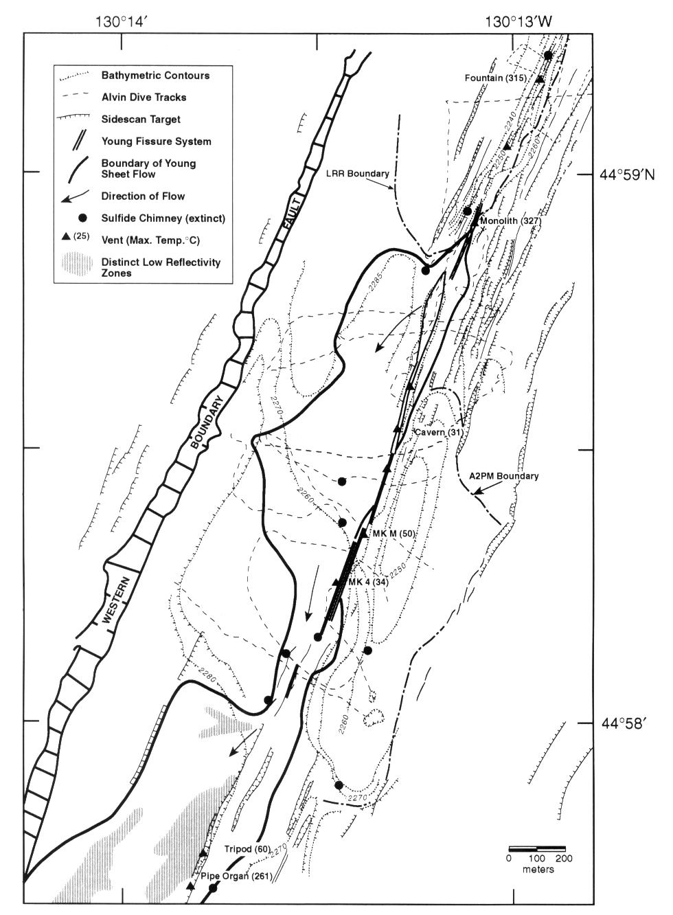
Figure 5a. Geology and bathymetry of northern part of sheet flow. Bathymetry is based on Alvin and towed camera pressure depth and altitude data. LRR is Lava Rise Ridge, A2PM is age 2 pillow mounds (age 1 is YSF and NPM). Most of the structural information is based on SeaMARC I sidescan imagery (Figure 5b, opposite). Western boundary fault is 80 to 100 m in relief.
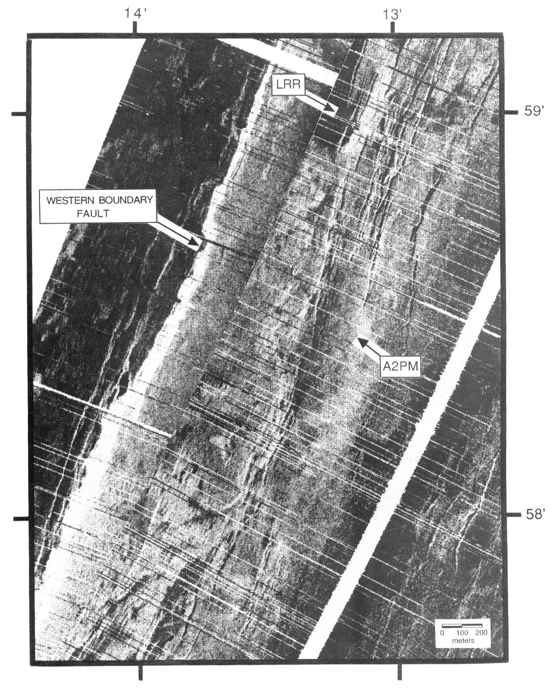
Figure 5b. Sidescan mosaic of same area as Figure 5a (opposite).
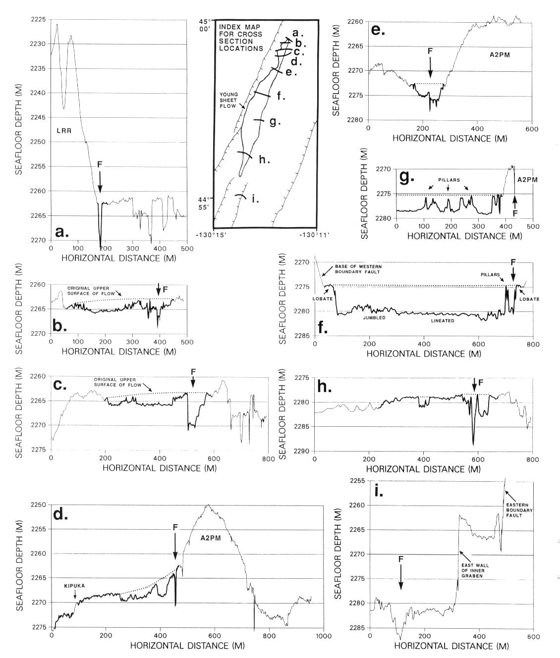
Figure 6. Cross sections of north Cleft segment using Alvin and towed camera microbathymetry. Bold thick line on cross sections show extent of YSF. F and arrow shows location of hydrothermal activity and/or most recently active fissure. A2PM is age 2 pillow mound. Locations of cross sections for Figures 8 and 9 in inset. Letters on inset map refer to following cross sections: (a) Camera tow 198914, (b) Alvin dive 2429, (c) Alvin dive 2269, (d) Alvin dive 2269, (e) Alvin dive 2267, (f) Alvin dive 2431, (g) Alvin dive 2444, (h) camera tow 19874, and (i) camera tow 19875.
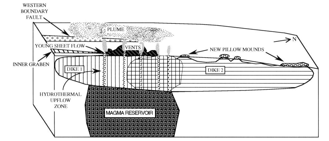
Figure 7. Cartoon of preferred model for Cleft 1980s intrusion/eruption episode(s) based on geologic and hydrothermal observations discussed in this paper. Sketch covers along-axis section from approximately 44°53'N to 45°10'N.
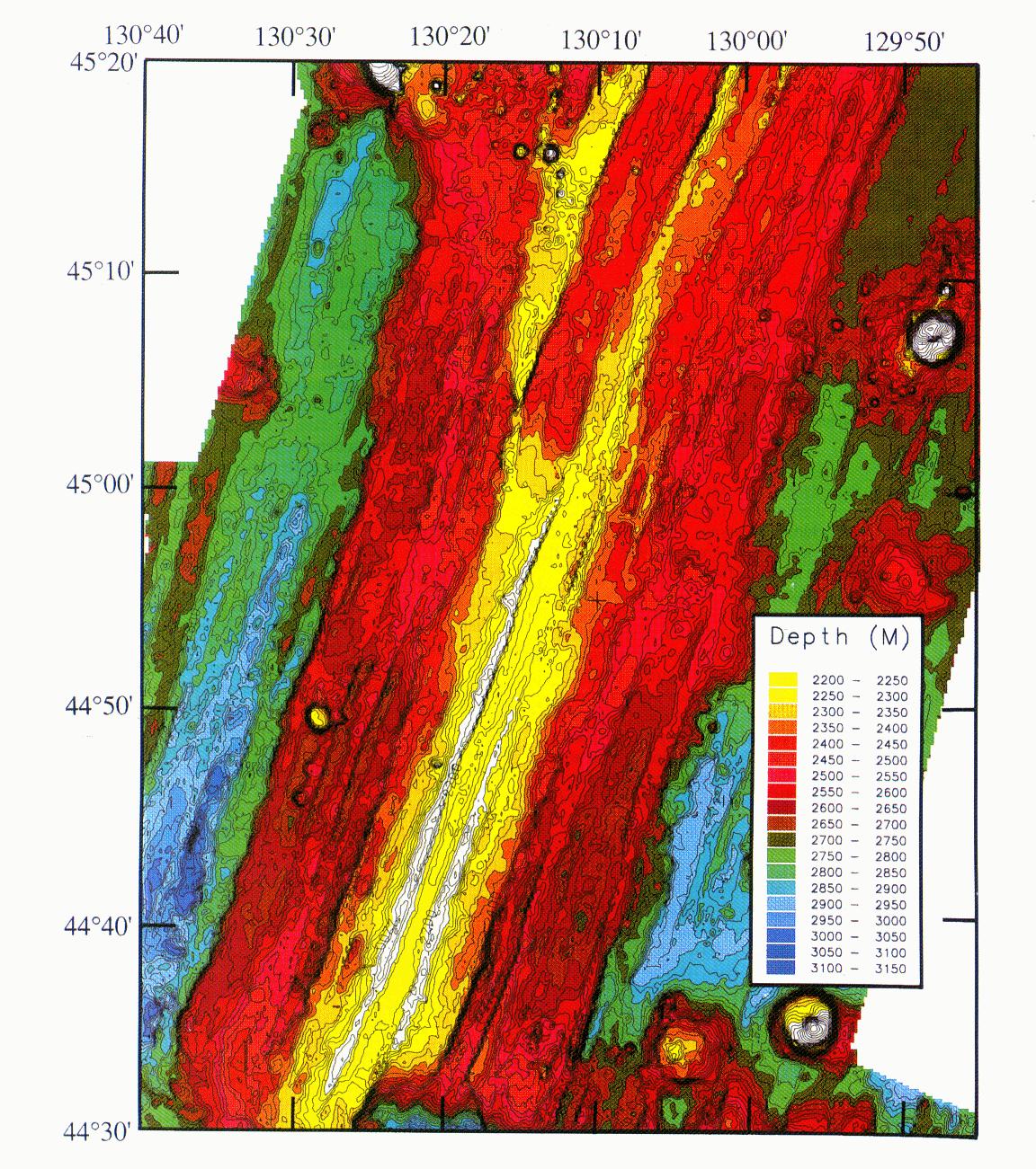
Plate 1. (Opposite) Sea Beam bathymetric map of southern Juan de Fuca Ridge. Track line spacing approximately 1.8 km to produce nearly 100% coverage. Contour interval is 20 m, color interval is 50 m. Grid spacing is 100 m.
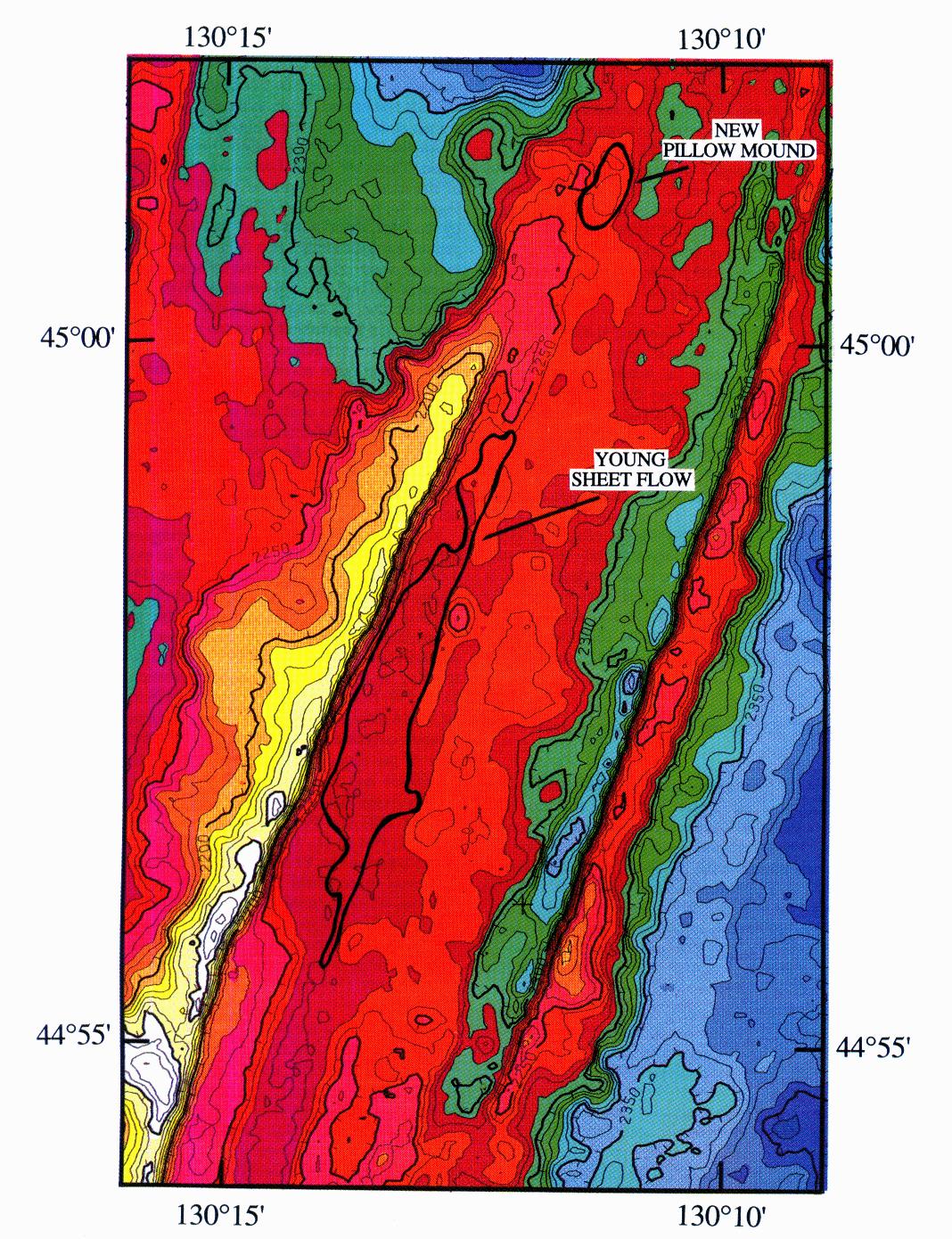
Plate 2. Sea Beam bathymetry of northern Cleft segment. Contour interval is 5 m and color interval is 20 m. Raw Sea Beam depth is corrected to Alvin depths for this area (15 m subtracted from raw Sea Beam data). Bold line is outline of young sheet flow (YSF).
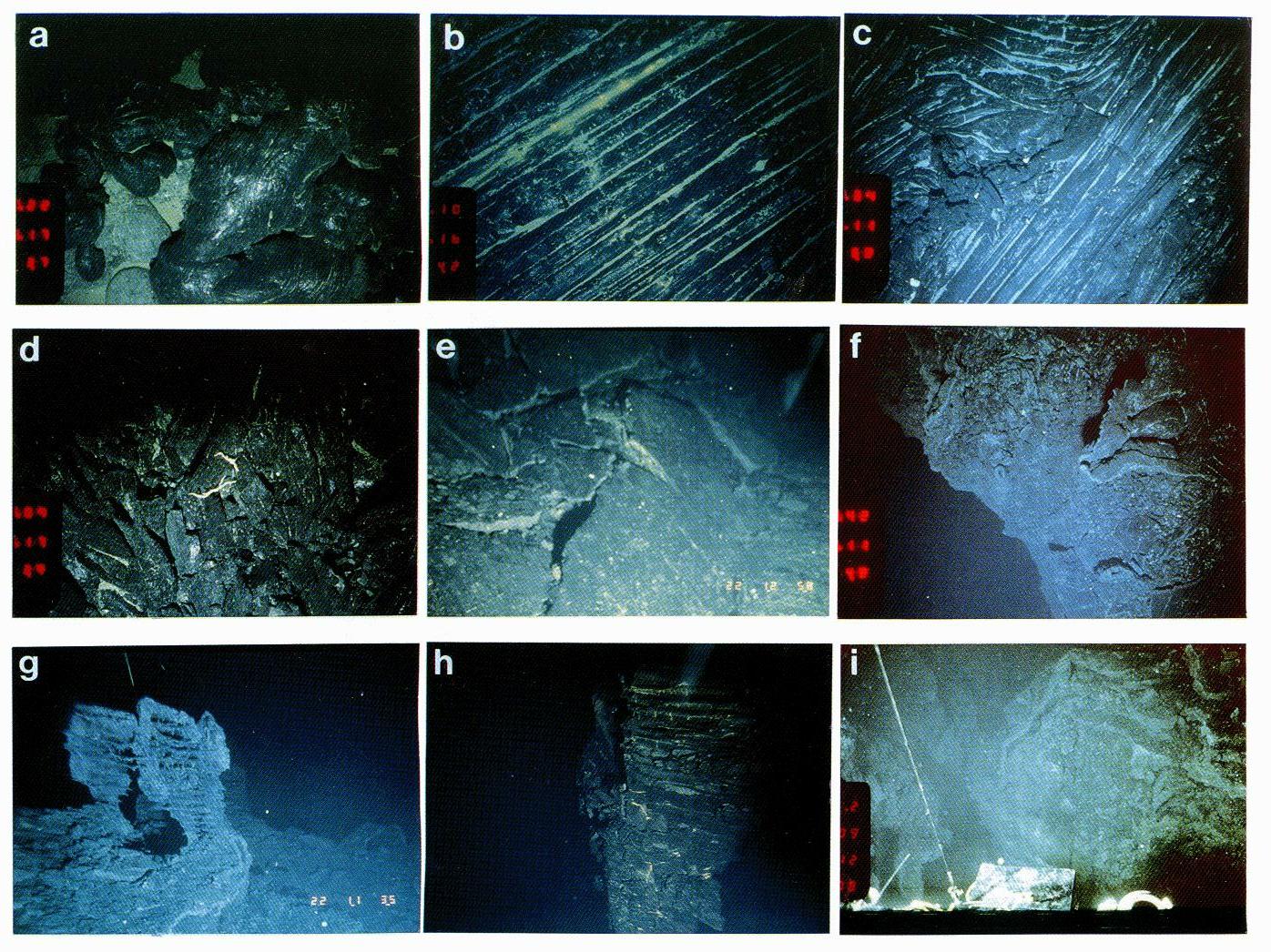
Plate 3. Photographs of northern Cleft geologic features. ALVBC, Alvin bow camera; ALVHH, Alvin hand-held camera; TC, towed camera (approximate scale across bottom of photo). (a) (TC) Contact of young sheet flow with older lobate flows (4 m). (b) (TC) Lineated sheet flow with low-temperature hydrothermal deposits (4 m). (c) (TC) Transition from young lineated sheet flow to ropy and jumbled flows (5 m). (d) (TC) Young Jumbled flow (4 m). (e) (ALVHH) Pushup structure in young sheet flow (3 m). (f) (TC) Looking down on young fissure with remains of collapsed and drained-back lobate flow at edge (5 m). (g) (ALVHH) Lava spires with multiple "bath-tub ring" shelves at western edge of fissure (3 m). (h) (ALVHH) Spire with shelves in southern portion of sheet flow (3 m). (i) (ALVBC) Looking along primary fissure (within a few hundred meters of Plate 3f) showing lava drainback sheets (5 m).
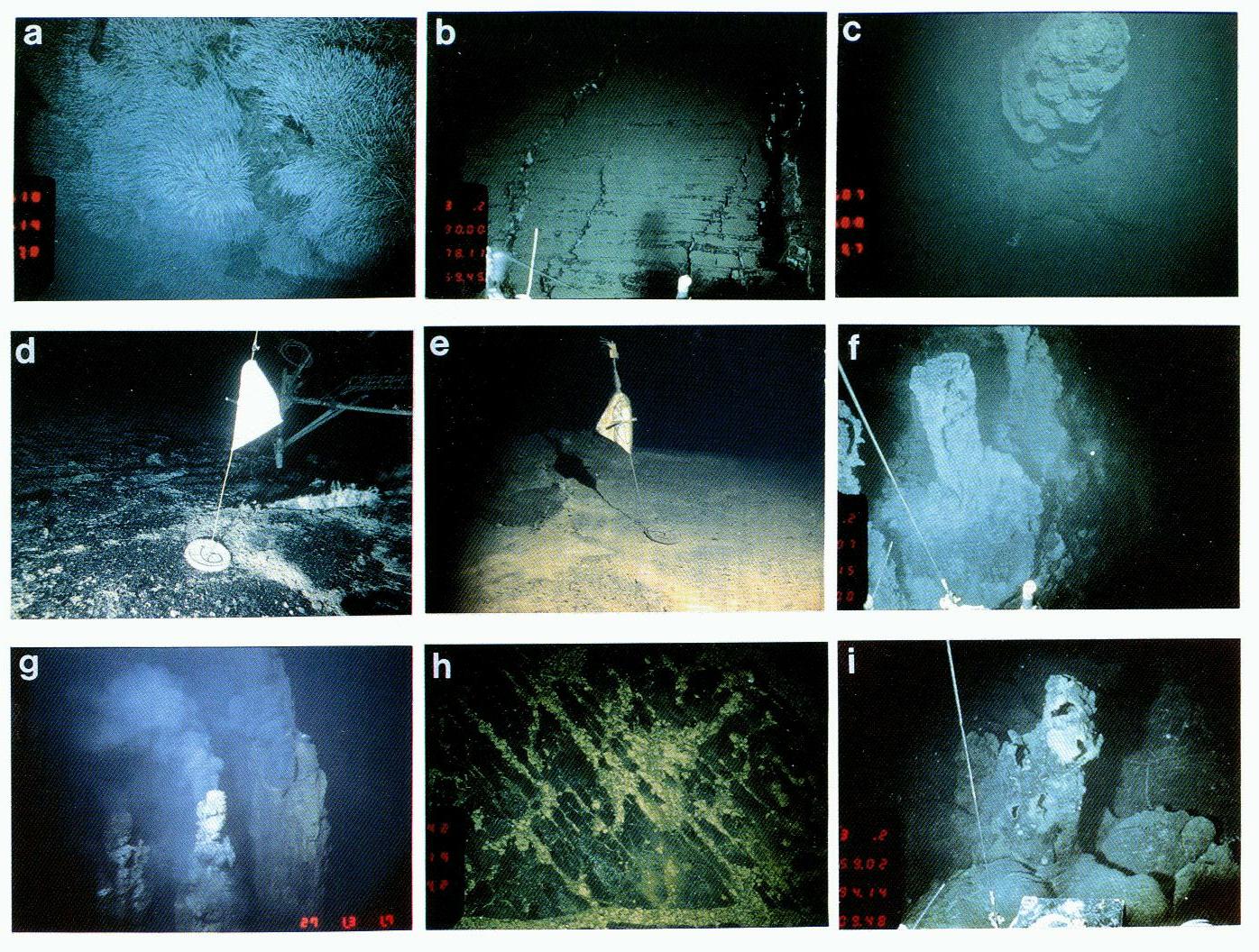
Plate 4. Photographs of vents at north Cleft site. Same abbreviations as Plate 3. (a) (TC) Luxuriant Vestimentiferan "bushes" at base of inner graben at 44°55'N site (8 m). (b) (ALVBC) Recent fissures (possibly small graben) at inner graben site (5 m). (c) (TC) Inactive sulfide chimney (~56 m high) located about 100 m east of line of most active venting (Plate 4). A few (apparently) alive Vestimentiferan were found at the base of the chimney during a subsequent Alvin dive. Sulfide samples taken here are composed mostly of pyrite and silica (6 m). (d) (ALVHH) Marker 6 at Tripod site, photo taken in September 1988. Note bare basalt and bacterial mats along fracture. (e) (ALVHH) Marker 6 at Tripod, photo taken in September 1991. Note extensive coating of iron-silica precipitate over previously bare basalt. This depositional event took place sometime between September 1988 and September 1990 (an Alvin dive in 1990 observed but did not obtain useable photographs) (34 m). (f) (ALVBC) Bacterial mats coating spires at edge of primary fissure. (g) (ALVHH) Organ pipe high-temperature vent. Tops of 56 m chimneys. (h) (TC) Extensive hydrothermal precipitate on young lineated sheet flows. (i) (ALVBC) Old sulfide chimney at contact between young sheet flow and older lobate flow. Chimney is hollow. Black coating is either lava spatter or manganese.
Return to abstract or go to entire text