U.S. Dept. of Commerce / NOAA / OAR / PMEL / Publications
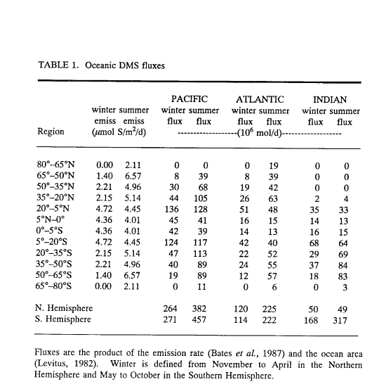
Table 1. Oceanic DMS fluxes
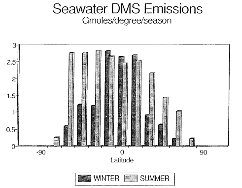
Fig. 1. Biogenic emissions of oceanic DMS to the atmosphere corresponding to the regions shown in Table 1. The equatorial regions have been combined (5°N to 5°S). The data have been plotted per degree of latitude to demonstrate the large source strength in the temperate latitudes of the Southern Hemisphere.
Table 2. Terrestrial sulfur fluxes
Fig. 2. Biogenic emissions of terrestrial sulfur compounds to the atmosphere. The data have been plotted per degree of latitude to demonstrate the uneven distribution between the northern and southern hemispheres.
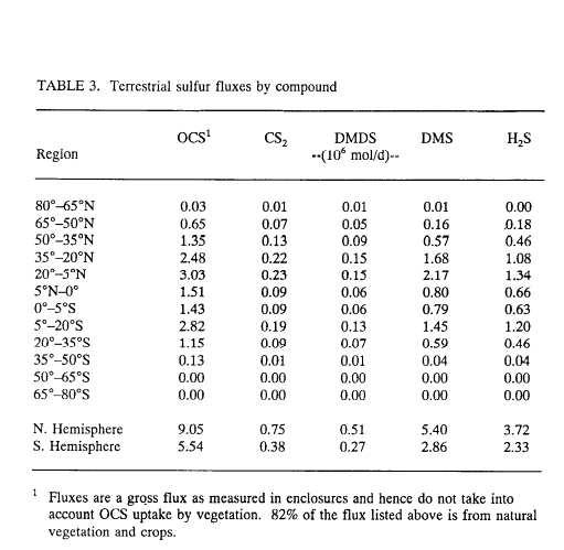
Table 3. Terrestrial sulfur fluxes by compound
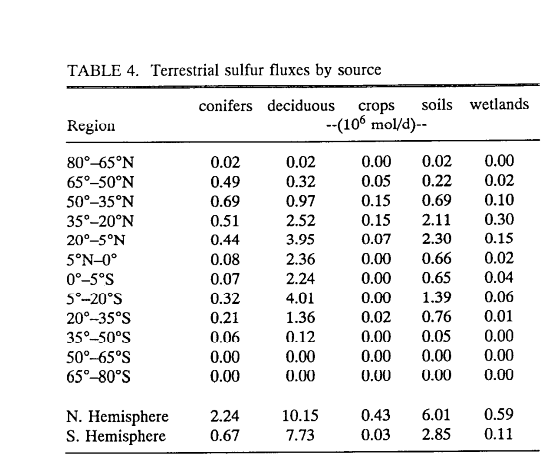
Table 4. Terrestrial sulfur fluxes by source
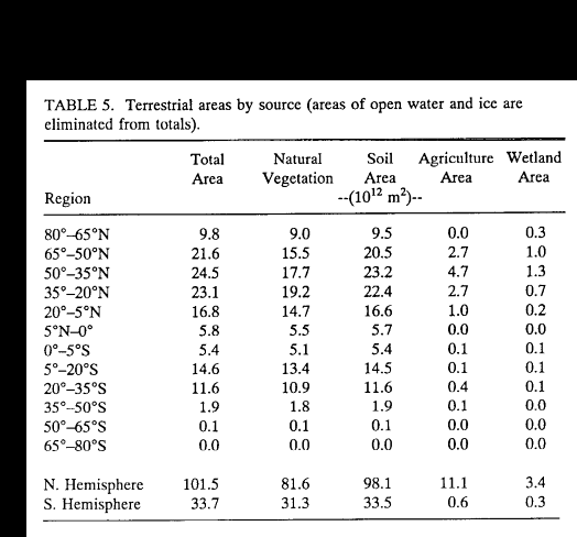
Table 5. Terrestrial areas by source (areas of open water and ice are eliminated from totals)
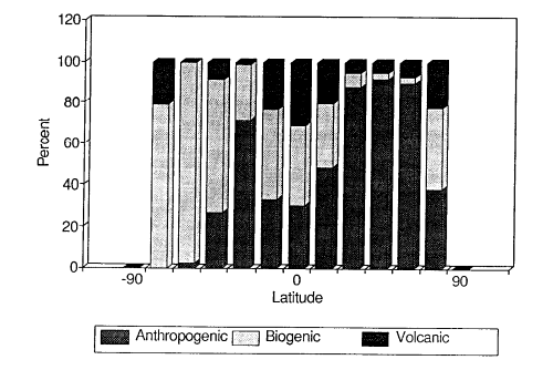
Fig. 3. Global emissions of anthropogenic (includes biomass burning), biogenic (marine and terrestrial), and volcanic sulfur.
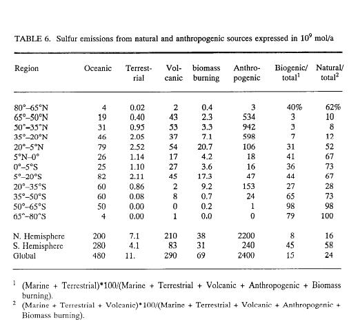
Table 6. Sulfur emissions from natural and anthropogenic sources expressed in 10 mol/a
mol/a