Hi,
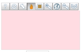
The public map server we use for the map tiles for the LAS
map widget is not returning images at ths time.
If you are running a public LAS and notice that your mini
map has pink rectangles instead of map images you can change
to a different server. I just changed all of our public
servers to:
<meta content="http://www.cmar.csiro.au/geoserver/ows"
name="WMS-SERVER" id="wms-server" />
<meta content="ea-be:World_Bright-Earth-e-Atlas-basemap" name="WMS-LAYER" id="wms-layer" />
<meta content="ea-be:World_Bright-Earth-e-Atlas-basemap" name="WMS-LAYER" id="wms-layer" />
You can make this change simply by editing the UI.vm file
in the root of your deployed LAS server and replacing the
existing which likely look like this:
<meta content="http://vmap0.tiles.osgeo.org/wms/vmap0"
name="WMS-SERVER" id="wms-server" />
<meta content="basic" name="WMS-LAYER" id="wms-layer" />
<meta content="basic" name="WMS-LAYER" id="wms-layer" />
with the above.
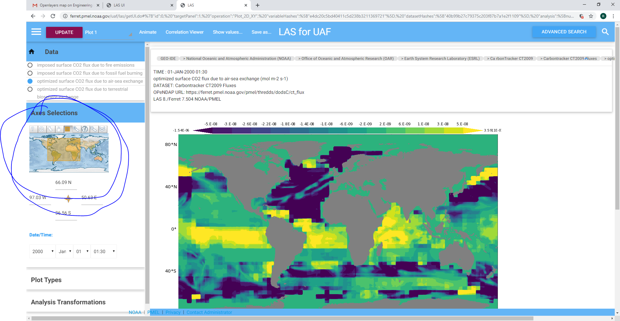
The result of the change looks like:
I recommend you make this change at least for the time
being. A list of possible alternative servers is in a comment
at the top of the file.
Roland
--
The policy of the DOC and NOAA
requires me to inform you that the opinions in
this email are mine and do not necessarily
represent the opinion or policy of the Department
of Commerce or the National Oceanic and
Atmospheric Administration.