|
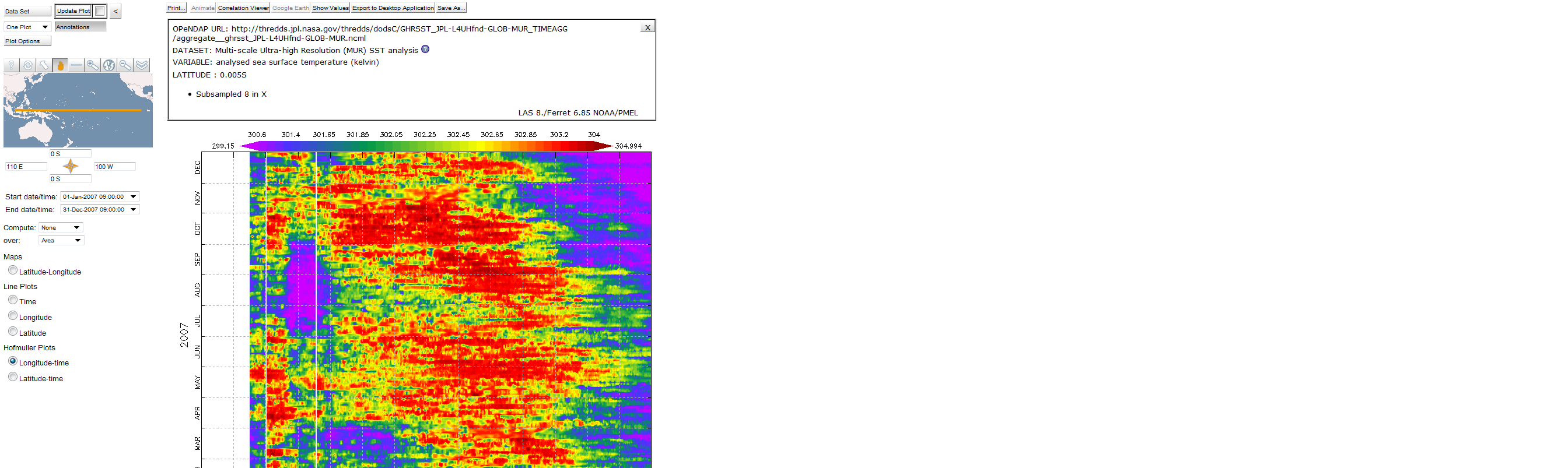
Hi Kacie, As a test, try making a short time selection and smaller range in longitude to see if you can get a result. In LAS we handle large grids like this by asking for a decimated version when the request is really large. A several-hundred by several-hundred pixel image can't show that fine a grid anyway so we make a smaller request, striding the data request so it's a more reasonable size to be shipping around. I have put the MUR dataset into a test server running LAS v8 and I can get an XT plot for a year's worth of it. See the attached screenshot. However for the entire time range the data that is returned from the NetCDF library reading the datset is all zero's. Likewise I can make time series plots that are 6 or 8 months long, but requests for more data results in error messages from the NetCDF library reading the data. Going back to the html view of the dataset, I can get coordinates successfully. Ask for lat 8000:1:8000, lon 32000:1:32000, time 0:10:2791 and the coordinates are returned correctly. Try: http://thredds.jpl.nasa.gov/thredds/dodsC/GHRSST_JPL-L4UHfnd-GLOB-MUR_TIMEAGG/aggregate__ghrsst_JPL-L4UHfnd-GLOB-MUR.ncml.ascii?lat[8000:1:8000],lon[32000:1:32000],time[0:10:3791],analysed_sst[0:10:3791] But, try to get analysed_sst at those same index ranges, and we get an error. That's this constrained url: http://thredds.jpl.nasa.gov/thredds/dodsC/GHRSST_JPL-L4UHfnd-GLOB-MUR_TIMEAGG/aggregate__ghrsst_JPL-L4UHfnd-GLOB-MUR.ncml.ascii?analysed_sst[0:10:3791][8000:1:8000][32000:1:32000] The software behind the url access to the datset is not the same netCDF library that Ferret, running within LAS is using to read this opendap data but it seems to me this is an indication that both pieces of software are having trouble accessing the dataset along the time dimension. Ansley On 4/19/2013 1:55 PM, Shelton, Kacie E
(398C) wrote:
|
Attachment:
MUR.png
Description: PNG image