|
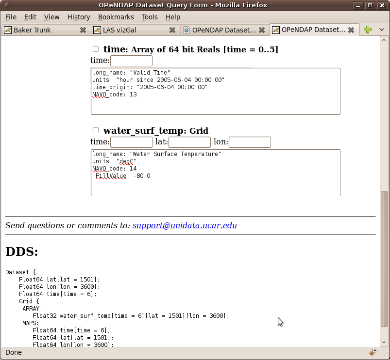
Penny, This data set http://mynasadata.larc.nasa.gov/thredds/dodsC/mcsst_daily.html shows a variable which is 4D (Float32 water_surf_temp[stime = 183][time = 1][lat = 1501][lon = 3600];) when really what I think you are trying to achieve is to create a new variable via aggregation which is 3D that looks like this (Float32 water_surf_temp[time = 183][lat = 1501][lon = 3600];). In order to do this aggregation you probably created a new time variable and used it a the time dimension of the existing variable in the join existing since each file has exactly the same values in the time variable since the origin is different for each file. I think you can fix this problem by changing your aggregation to look something like this: <dataset name="penny_sst" ID="PENNY_SST" urlPath="penny/sst.nc"> <serviceName>gridded</serviceName> <netcdf xmlns="http://www.unidata.ucar.edu/namespaces/netcdf/ncml-2.2"> <aggregation dimName="time" type="joinExisting"> <netcdf location="file:/home/rhs/Users/Oots/mcsst_k10_20050601.nc" coordValue="0."/> <netcdf location="file:/home/rhs/Users/Oots/mcsst_k10_20050602.nc" coordValue="24."/> <netcdf location="file:/home/rhs/Users/Oots/mcsst_k10_20050603.nc" coordValue="48."/> <netcdf location="file:/home/rhs/Users/Oots/mcsst_k10_20050604.nc" coordValue="72."/> <netcdf location="file:/home/rhs/Users/Oots/mcsst_k10_20050605.nc" coordValue="120."/> <netcdf location="file:/home/rhs/Users/Oots/mcsst_k10_20050606.nc" coordValue="144."/> </aggregation> </netcdf> </dataset> Then you'll get a nice 3D data variable like the one shown in the screen snap of the resulting data access form. I'm pretty sure there might still be some problems with your F-TDS installation, but let's start by fixing this aggregation. Roland On 10/08/2010 04:37 PM, Roland Schweitzer wrote: Penny, |
Attachment:
dataform.png
Description: PNG image