Dear Ferreters,
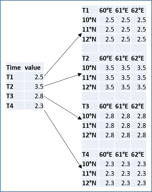
I have a time series measurements for one point in a text file. I want to fill the same TS value to an area containing multiple points (lat/lon) and convert to a spatial-time series data in .nc format. See the attachment.
or I have a grid file (.nc) with multiple time steps and I want to replace all values by a single value in each time step.
How can I do it?
-- Dr. Karnan Chinnadurai, Scientist
Biological Oceanography Division
CSIR- National Institute of Oceanography
Dona Paula, Goa, India.
Contact: 0832 2450 515.
Mobile No. +91 9633032345; +91 9941811608